
| Main Page | Diary | Leaves | Stats |

607. Bear Mountain (03/01/08)
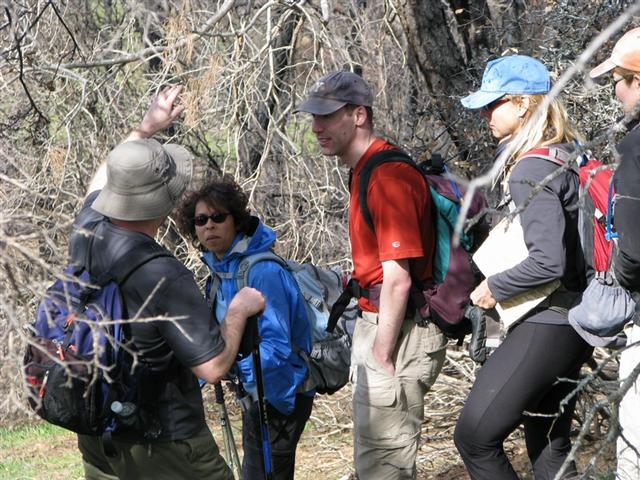
Hikers (14): David, Diane, Eric F, Eugene M, George, Harvey, Helen, Linda L, Paul, Peter, Ross, Sabine, Sarah, Steve
Distance: 25 miles
Rating: 6 difficulty, 8 beauty
Park info: Henry Coe State Park near Morgan Hill
Write-up by George and Peter
7:30am. Cold. Henry Coe Park. Those should have been enough clues to warn us away. We were also warned in the hike notice of off-trail bushwhacking and plenty of creek crossings, and then we were told we were dumb to have signed up – by the hike leader! What a way to spend a Saturday.
1-2-3-INCH!
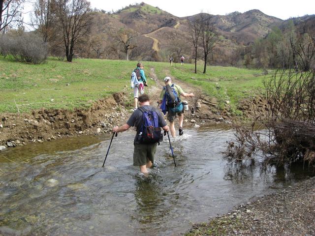
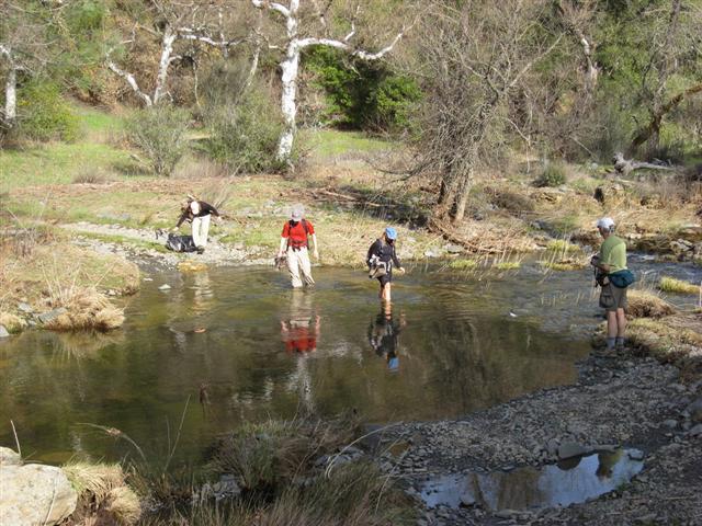
14 dummies started out on the Corral Trail, a nice easy stroll to Poverty Flat Rd. Then the plummet into the chasm. The first creek crossing at Poverty Flat was definitely boots off as the water was about 6-8 inches deep and cold. As everyone sat there trying to pull socks onto damp feet Peter showed up and stomped through the creek and kept on going – his boots barely getting wet from the heat generated by the speed of his passage.
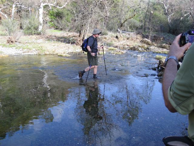
The climb to Jackass Pass warmed us up and it was looking to be a beautiful day. On the downhill section of Blue Ridge Rd there were thousands of Shooting Stars, and every time we said it Peter looked up into the sky. At the bottom of Blue Ridge Rd we started on a new trail for INCH – Bear Mtn Rd. It paralleled the East Fork of Coyote Creek for about a mile, then we had our next creek crossing, and this is where the real fun began.
A number of people brought sandals or tennis shoes for the creek crossings, but others planned to take their boots off at each creek crossing. The only problem is we had about a dozen creek crossings over the next 1.5 miles. People with sandals or tennis shoes kept them on between creek crossings and zipped through the 1.5 miles while the others struggled along the sides of the creek canyon or took boots off and on and off and on and off and on ……
Peter, Harvey and I were doing the creek crossing together when Eugene caught up with us – he had decided to keep his boots on and walk in the water. The water was quite cool, and by the time we were about midpoint in the creek it was feeling cold enough to hurt so we hustled across each time.
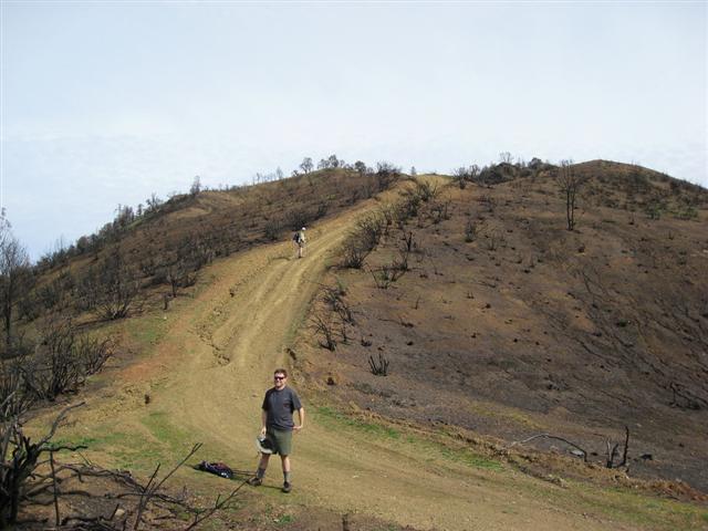
The beginning of the climb to Bear Mtn came into view and surpassed our wildest dreams (nightmares). A steep dirt road up a burned out hillside. Lovely. But it was the steepness that got Ross excited – oh boy a new hill to conquer! Before the climb it was boots back on for everyone for one last time (on the way out).
We quickly gained altitude and had great views into the creek canyon back the way we had come, as well as the ridges rising farther up the creek canyon to the north. After the bulk of the climb we settled into a pattern similar to the Interior Route of the Mississippi Lake hike – up and down up and down, over and over again.
Just behind a gate, as predicted by Peter, was a trail marker for the trail out to Bear Mtn Peak – which was shown on the map as the second peak of the hike. More on that later.
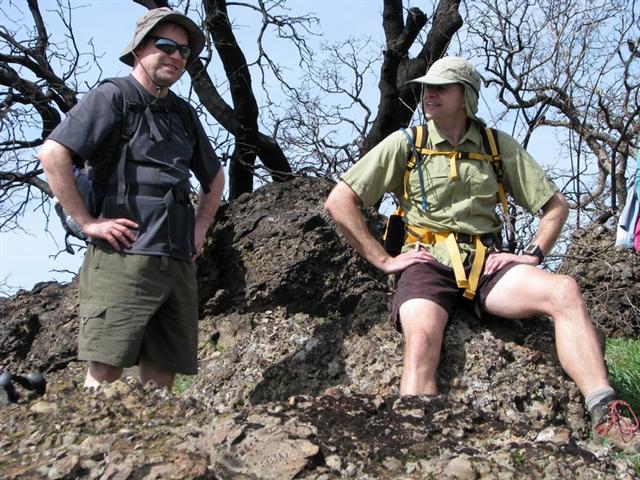
We continued east and in no time we were at the summit of Bear Mtn, or were we? Just a bunch of blackened chaparral bushes on a dirt bump. But there were metal medallion makers at the top, so it was the summit. Peter insisted that we go another 100 yards – downhill – to the junction with County Line Rd, and then come back up before we could break for lunch.
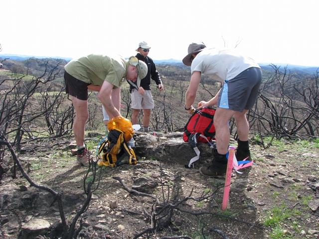
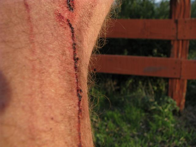
Great views all around, some views of green hills, some of dirt hills with blackened brush. Steve showed up shortly after because he had gone out to Bear Mtn Peak first in order to get to a cache that was part of a contest, and he was determined to beat another guy who was in Coe that day, and was also in the contest. While going out there he managed to get a real nasty long gash on the back of his leg, but he got there first, and that is all that matters. (BTW – Steve won the caching contest.)
We hadn’t seen a lot of the other hikers for a while now and were puzzled. Even with boots off and on 12 times, they should have caught up with us or come into sight. It was time to double-back on Bear Mtn Rd to hike out to Bear Mtn Peak. The trail out to Bear Mtn Peak is not heavily used, and takes a little bit of bushwhacking to follow. The final ascent is quite steep and slippery due to heavy leaf deposits. On the way up we bumped into the rest of the hikers, and a debate began.
The map showed clearly in highlighted arrows that Bear Mtn was first, but the table of instructions clearly showed that Bear Mtn Peak was first. Oops! Oh well, we all ended up going to both peaks. And Steve and Eugene repeated one or both of the peaks. We also found out that Ross and Sabine and a few others had gone down the Shafer Corral Trail to the East Fork, and had to climb back up to Poverty Flat Rd again before getting to Blue Ridge Rd. and that was why we hadn’t seen them in a while.
The top of Bear Mtn Peak was not burned, at least not much, so it was a more pleasant spot to enjoy the views. After a short rest and snack it was time to go! It was all downhill from here, so to speak, or at least until we got back to Blue Ridge Rd., or immediately as we repeated the up and down up and down of Bear Mtn Rd. Ross and Harvey and I would jog on the downhills segments, and Peter would catch us on the uphill segments. On the last big downhill segment we left Peter behind, and then Ross and Harvey left me behind as I jogged, and they ran downhill.
It was time to put the water sandals back on, and I was with Harvey and Sarah. We repeated all the creek crossings, then did the Blue Ridge Rd climb, and the Jackass Pass Climb. At the top of Jackass Pass I decided to go to the top of Jackass Peak – never been there. Nothing special on top, but I got a great flower shot. By the time I got down to Poverty Flat there were a lot of people accumulating at the final creek crossing of the hike. Amazing that after so many miles and mix-ups and problems that so many people ended up at this spot at about the same time. INCH has a rhythm of some kind I guess.
It was a fun time, people chatting, putting boots back on. And here comes Peter, steamrolling across the creek and starting the uphill climb before the rest of us had our boots on again, and that was the last time I saw him until I got to the parking lot. It was a tough uphill climb, and both David and I were about out of steam when we got to the top. It was great to hit the Corral Trail, just a short level walk to the parking lot.
At first I thought everyone had already left for home, only a few of us were in the parking lot. Then we realized the gang was in the covered picnic area. Most everyone was bundled up due to the cool temps, and many were trying to catch any bit of sun they could find. Helen gathered people around her and created an oven made of human bodies in order to keep warm.
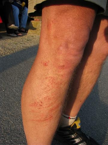
Pictures were taken of Ross’ and Steve’s leg wounds, but I forgot to take a picture of the nice bump on Steve’s head. He and Ross and a couple of other people decided to take the Middle Ridge Trail back. Steve ducked under a low branch only to meet up with another low branch. He tried a head-butt to break the branch off, but it didn’t work.
After the usual tall tales and food and drink everyone hustled off to their cars to warm up on the drive home. A few minutes out of the parking lot there was a view of a spectacular sunset, so I had to make one last stop for the shot. New trails, new peaks, a caching contest won, lots of clean feet – a great hike overall. Note – many people remarked how good their feet felt on this hike – repeated cold water soakings must be the reason, and the aching hot tired feet were missing at the end of this Coe hike.
For more pix, check out George and Harvey's albums.
![]()
![]()
Pages maintained by Steve Walstra,
Peter Saviz, and
Russell Gee.
©2026 Intrepid Northern California Hikers