
| Main Page | Diary | Leaves | Stats |

422. Steve's Superhike (11/20/04)
Hikers (7): Edita, George, Joe, Nancy, Ramesh, Ross, Steve
Distance: 22 miles
Rating: 5 difficulty, 8 beauty
Write-up by Steve -- Pictures by George R
It was time for a hard hike, so I scheduled "Steve's SuperHike", a 22 mile trek around the South Skyline Region OSPs, including 8 Open Space Preserves and a County Park. This was the actually the first level 5 hike we ever created, back in 1999, and I still had the notes describing all the details.
Despite my light threats, a newbie (Ramesh) showed up for the hike. Even more unusual, I had to turn down two other people who independently requested to come on the hike without even being on the mailing list. Who wants to come on a 22 mile hike in winter!? Plenty, it seems, as we had seven total on the hike.
The problem with a long hike in the winter is that the days are short. The bonus, however, is that the air is cool, so the hikes are much easier. The hike was scheduled with an early (8 am) start, and everyone showed up early (yeah!). . .except Edita and Joe, who managed to catch us before we set off. Nonetheless, we were on our way by 8:15.
1-2-3 INCH!
The plan was a 2.5 mph pace, which would get us done just before 5 pm, near sunset. This meant no time for breaks. After zipping around Los Trancos and over to Montebello, we made to the top of Black Mountain in Rancho San Antonio. In the notes I had mentioned we would wave our hands in the air at the three "major" peaks in the area, and damned if this fine group didn't do just that! We touched all the USGS markers, too!
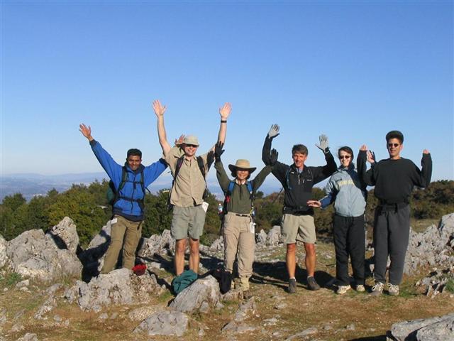
It was downright chilly for most of the day, to the point of being uncomfortable for parts of the hike (except for Ramesh, who was dressed for Everest). When we got up to Table Mountain, we had some time to wait for Nancy and Ramesh. George was not satisfied that we were really on the top of Table Mountain, so he used the time to scout for the peak. After some searching, he declared that, indeed, the surface was flat like a table, and we were pretty much at the top. We waved our hands in the air again, and Ross declared that we were setting a pace of nearly 3.75 mph! Yep, we were smoking, but it was still early in the hike.
The only difficult section of the hike starts a little after Table Mountain up toward around Saratoga Gap. This is also about the only time we were in the sun (it was noted that we only have shady hikes in winter, and sunny hikes in summer). Once that was over, it was becoming clear that getting back before sunset wouldn't be a problem after all, but we still pressed on at a quick clip.
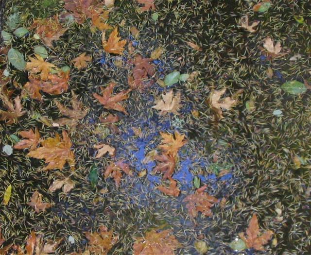
Crossing Skyline Blvd marks the midpoint in the hike, after which the long section through Long Ridge begins. There are some nice sections along Peters Creek, which George took the time to photograph while still keeping the pace.
It was about this time that everyone started busting out their lunches and eating them on the go. We could have stopped, but by now the whole idea of doing the hike quickly had set in. However, Nancy wasn't a total convert, and demanded a break near the Christmas Tree farm in Skyline Ridge OSP (which, incidentally, George has used for his X-mas trees for many moons). I promised her and Ramesh a break at Horseshoe Lake, which was only 0.3 miles away. . .if we took the direct flat route. However, since Nancy never looks at a map, it was no problem taking the 0.6 mile ridge-climbing route (which was also the official route), much to the delight of everyone else. We stopped for the 10 minute break at the lake, but Nancy only needed 8, and we were off again! No rest for the wicked.
Next stop was Alpine Pond, only a couple miles away. The lead group waited for a long time for Nancy and Ramesh to appear, which wasn't boding well for the rest of the hike. However, it did give us time to check out the crazy David C Daniels Natural Center, the least-known Nature Center in the Bay Area. Actually, this probably isn't true, as we weren't the only visitors there, but it certainly isn't somewhere you'd expect to see a nature center. I enjoyed the interactive exhibits, which were designed for children about a quarter of my age.
Nancy and Ramesh weren't lost as we had been starting to fear, though, and we set off to the secret tunnel leading Russian Ridge. This tunnel is so secret that I always take the wrong trail to get to it, and this time was no exception.
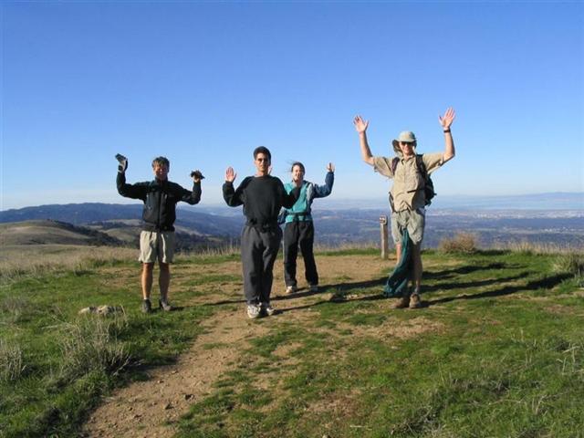
There was less than 4 miles left in the hike (although Joe wasn't believing this). After 18 miles, 4 miles seems like nothing. We motored on up to the Borel Hill peak, only to discover that Ramesh and Nancy were no longer motoring, but were still going at a fast pace compared to the rest of the park's patrons. We waited in the cold, windy conditions--with fantastic views across the bay--only to have Nancy skirt the peak entirely, arguing that it wasn't marked on her map. This map, by the way, was highlighted for Her Highness by George and, either way, the hike notes said we'd go to the peak. Oy! Ramesh was a much better sport, and came up to the top, where we all waved our arms in the air for the last time.
The rest of the trip through Coal Creek was pretty uneventful (although it was sort of cool to see the coal veins in the ground). We were all back by 3:30pm, way before sunset. Amazingly, we had easily averaged 3 mph for the entire trip--the weather makes all the difference. Maybe we should try a 25 mile hike on the winter solstice next time?
Here are all of George's pictures from the hike.
Milestones:
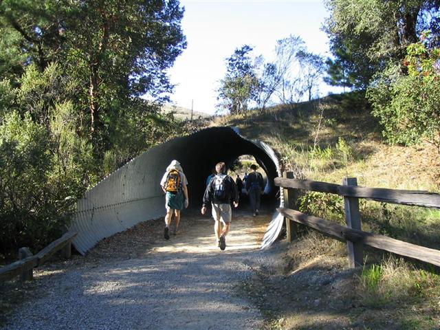
The secret tunnel revealed!
This was followed by an "M", a "C", and an "A"
Ramesh's 1st leaf
![]()
![]()
Pages maintained by Steve Walstra,
Peter Saviz, and
Russell Gee.
©2026 Intrepid Northern California Hikers