
| Main Page | Diary | Leaves | Stats |

1181. Pablo Point (06/22/19)
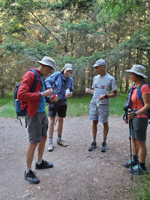
Hikers (6): Dan L, Jeff, Mihail, Sarbinder, Steve, Yipeng
Distance: 43 miles
Rating: 6 difficulty, 9 beauty
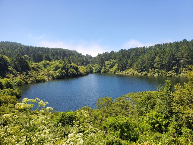
Park info: Point Reyes National Seashore near Olema
Write-up by Steve and Dan L -- Pictures by Everyone
8kft of elevation gain. Half went the extra distance to Bass Lake. The other half came in by headlamp. Go figure?
Dan's write-up at bottom!
There are hikes and there are INCH hikes. INCH rates their hikes on a scale of 1 to 6, (there have been 7s though). The bigger the number, the harder the hike. INCH stands for Intrepid Northern California Hikers but perhaps the name should be changed to CNCH or Crazy Northern California Hikers.
I’m not much of a burger eater these days, but a useful analog to INCH hikes is the Burger King Menu. An INCH 1 is a Hamburger, a 2, a Double Cheeseburger, a 3, a Whopper Junior, a 4, a Whopper, a 5, a Double Whopper, and a 6 is a Triple Stacker King.
Yesterday, Steve, one of three fearless INCH hike leaders served up a Triple Stacker King of a hike, with extra bacon.
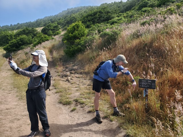
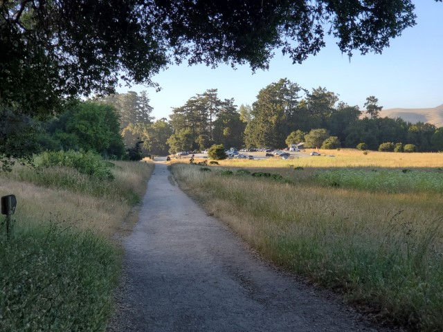
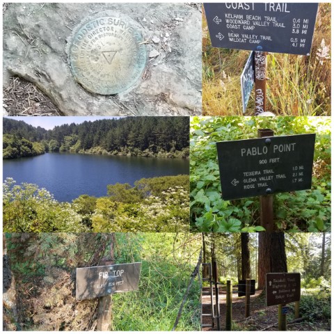
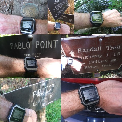
The hike began at 6:59 AM at the Bear Valley Visitor’s Center at the Point Reyes National Seashore. Mihail Mihaylov, Jeff Fisher, Yipeng, Steve and I (sans Sarbinder who would show up later) did the customary INCH cheer and took off up the Woodpecker Trail. The race, if you can call it that, was on, as we branched onto to the Morgan Trail and then onto the Horse Trail for an uphill climb to the Z-Ranch Trail and onto to the Summit Trail, which took us to the top of Mt Wittenberg where I snapped the first of six requisite photos, or proof that I did the complete hike.
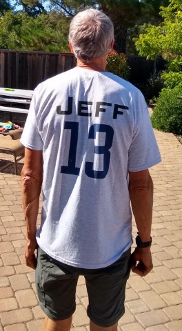
As I arrived at the summit, Steve and Mihail were waiting, not for me, but for Jeff, with a small flask of tequila and shot glasses. This is Jeff’s 300th INCH hike so a celebration is in order. 300 hikes, I can barely imagine that against my (now) 11 hikes. Being that my hike count is below the 100 required to participate in an INCH toast (or so I’m told), I let the INCH “adults”, Jeff, Steve, Mihail, and Yiping get good and drunk while I took off.
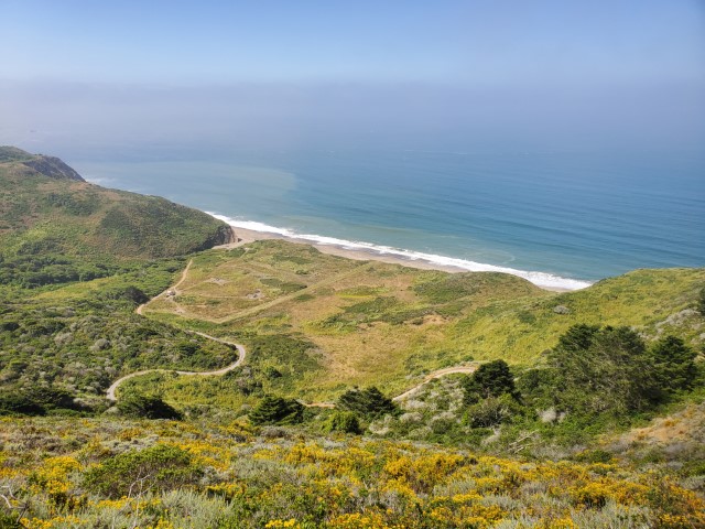
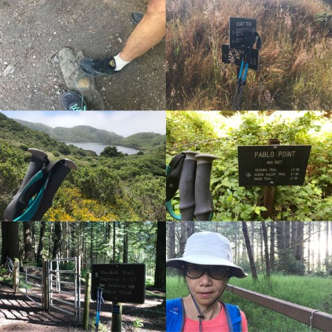
From the summit, I headed down to the Wittenberg Trail and onto the Sky Trail, where I snapped another photo where the Sky meets the Coast, and then onto the Coast trail for the next uphill climb. At that point, I had taken the lead but after hiking past the old Arch Rock and beginning the climb up, any sense that I might keep the lead vanished as Sarbinder, who came out of nowhere, appeared behind me. I let him pass and soon after, let Steve and Mihail pass. It seemed they bounded up the trail like gazelles and were out of sight before I could think goodbye. When I pulled into Wildcat Camp and watered up and out, I was alone but not for long, as Jeff and then Yipeng showed up a short time later.
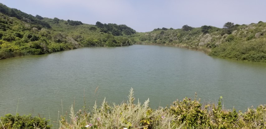
As the hike continued, Jeff and I hiked together while Yipeng took off. At around Pelican Lake I had to stop and patch up a nagging blister on my right heel. New shoes and the extra lift caused by inserts for Plantar Fasciitis had done the trick; my heel was near raw. As I raced to catch up I ran into the usual weekend crowd of Alamere Falls revelers and though that maybe I should hire one of them to carry a sign for me stating “Make way for the Real Hikers”, but thought better of it. After all, we’re all hikers on this Lonely Planet.
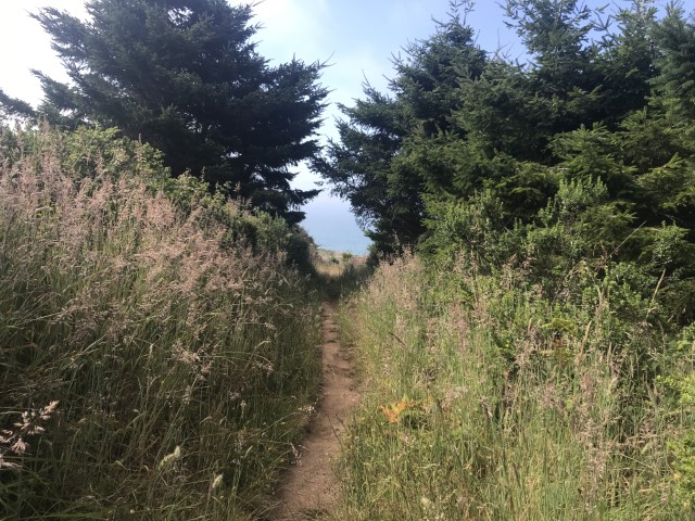
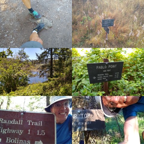
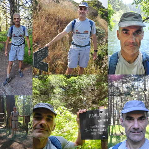
In time I caught up with Jeff and we breezed by the Palomarin Trailhead and up Mesa Road to the Ridge Trail, where we caught up with Yipeng. The climb up the Ridge Trail, is well, a climb and I was hoping it would finish soon. It did after about three miles when we hit the Teixeira Trail (yea, try and pronounce it). It took us to the Pablo Point Trail and then to Pablo Point, the whole point of the hike, which will go down in infinity as INCH 1181 - Pablo Point. Period.
As Jeff, Yipeng and I sat down for lunch, 24 miles into the hike, I wondered what’s the point of hiking up to Pablo Point?” There’s no spectacular ocean view, no roadside attractions, no five star restaurant, just a sign telling us that Pablo Point is 900 ft away, and a meadow full of grass. There’s no there, there. I think that just might be the point, if there is one.
By the time we were back on the Teixiera Trail, my watch had logged 25.88 miles. I consoled myself with the thought “I’ve done 16 mile hikes before, the rest of the hike will be a breeze”. I should have know better as that diabolical hike master, master hiker Steve, had planned the hike. Steve doesn’t do easy, at least when I’ve hiked with him. As Yipeng and I ran down the Teixiera Trail and then slowed to a normal pace on the Olema Valley Trail, the trees that had protected us from the warm sun vanished.
As we crossed Hwy 1 and climbed up the McCurdy Trail I remembered how I had hiked up it about four years ago. That day was hot and by the time I got to the top I was ready to drop. Yesterday was better but at the top of the McCurdy I stopped three times, probably to reassure myself I could make it to the top of the trail, no, to laugh at Yipeng’s comment “It's only two miles long”.
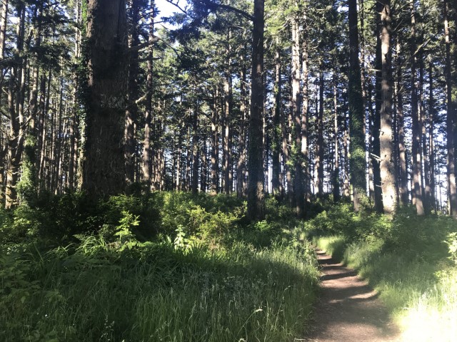
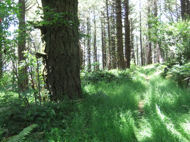
Note to self: you need to train with more steep climbing in the heat….. or maybe you need to avoid steep climbs in the heat. I did manage though and soldiered on to the Bolinas Ridge Trail which luckily, is beautiful shaded Redwoods at least until the Randall Trail, which luckily, I got to head down.
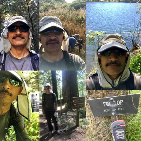
Crossing Hwy 1, I headed onto the Randall Spur Trail and then I was onto the Olema Valley Trail once more, until the Bolema Trail which took me to the Ridge Trail and the climb up to the Stewart Trail for a photo Op of the sign for the Firtop Summit, another requisite photo.
As I branched off at the Greenpicker Trail, I saw Jeff coming off the Ridge Trail and mentioned he had to go up the Stewart to get a pic of the Fir Top sign. The Greenpicker took me to the Glen Camp Loop and Glen Camp where I filled my water bladder at close to 40 miles in. Lucky me as I had gone bone dry coming down the loop.
Back on the Glen Camp Loop, I hiked down to the Glen Trail and onto the Bear Valley Trail for the final stretch. All I can say about that trail is that I’m not a big fan. Sure it’s a beautiful sylvan setting with babbling streams and cool air, but every time I’ve been down it, it’s been the end of a long hike, and it never seems to end. It did end though, after 44.17 miles, and 14:24 hours and 8,293 ft of elevation gain. If there had been one around, I might have eaten a Burger King “Triple Stacker King”, all 1,370 calories and all. Make that with extra bacon and cheese.
Milestones:
Jeff's 3rd forest
Sarbinder's 210th leaf
Yipeng's 160th leaf
![]()
![]()
Pages maintained by Steve Walstra,
Peter Saviz, and
Russell Gee.
©2026 Intrepid Northern California Hikers