
| Main Page | Diary | Leaves | Stats |

400. Ohlone Wilderness Trail (06/12/04)
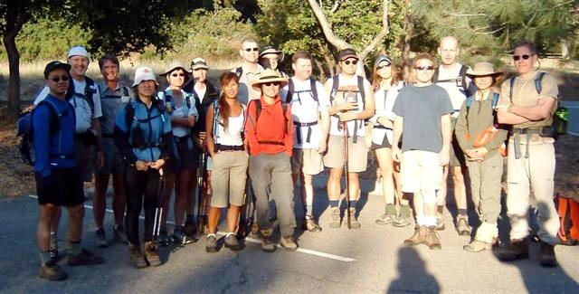
Hikers (15): Cal, George, Gwynneth, Janice, Launa, Nancy, Padraig, Peter, Ross, Russ, Steve, Steve Hu, Tania, Walter, Wennie
Distance: 28 miles
Rating: 7 difficulty, 7 beauty
Park info: Ohlone Regional Wilderness from Del Valle to Mission Peak
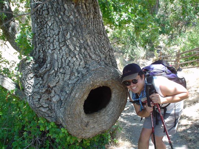
Write-up by Steve -- Pictures by Sue G and Janice
It had been six years since our last visit to the Ohlone Trail. Since then, our ranks have swelled, with many new INCHers interested in our ultimate challenge. To re-create the misery, it was scheduled for the date nearest the six-year anniversary. I did my best to dissuade everyone by recounting horror stories, listing the 8000 feet of elevation gain, and requiring previous level-5 experience. The coup de grâce was arranging the carpool at 5:30 am. Nothing worked--16 people signed up for the hike.
Nineteen people (including three drivers) made it to the Mission Peak parking lot (where the hike would finish) within five minutes of the official time--most were early. It was a good thing we met so early, as the lot was completely filled by early-morning joggers by the time we loaded up the three shuttle vehicles.
Chester, Sue G, and Elaine very kindly drove us to the start of the hike in Del Valle, with the help of Cal's van and Ross's minivan. Elaine brought some tasty INCH brownies to the meeting place, which raised spirits all around. These brownies were a bribe, she said, to make sure she'd get to be a driver. . .Needless to say, the competition bowed out without a counter-offer. In other car-pooling news, Chester was tapped for the job thanks to Carissa, but it turned out that Carissa couldn't do the hike due to a biking accident the previous day. Big nasty bruises confirmed her story. Nonetheless, Carissa and the drivers would later hike all the way to the Rose Flat. All were given an invisible tree ( ) for their kindness and effort.
1-2-3 INCH
What can you say about the Ohlone Trail--it's 28 miles and 8000 ft of elevation gain spread out over two long climbs. Almost everyone had been training for the hike, and we had done several long hikes prior to this (including one that turned out to be unintentionally longer), so most people didn't expect to have trouble with the distance. The main problem would be the huge elevation gains and the heat. Unlike our first visit, though, the second problem was non-existent: the weather was great. It was never too hot, and there was often a cool breeze. All my hype, it seemed, was for naught! Or was it? We started with 15 people (having lost Carissa before the hike started)--how many would make it all the way?
My personal plan was to get the hike done as soon as possible and enjoy the "Hike #400" BBQ at the other end. By the time I finished filling out the sign-in log a mile into the hike, Ross had caught up and was waiting. It wasn't long until he slowly pulled away on the steep uphill. Not to be thwarted, I jogged a bit after reaching the ridge, but never saw him. That's when I realized he must be running. Bastard! I figured the rest of the hike would be in solitude.
After passing Schlieper Rock on the opposite side of Williams Gulch, I was in high spirits. The majority of the first half of elevation gain was over. Reached Rose Peak at 9:33 am, making the 9.5 miles in 2 hours and 48 minutes. This was a pace of 3.4 mph for the steepest part of the trail. I was invincible!
After refilling my water bottles, I hiked down the other side of Rose Peak. That's when I saw Padraig coming around on the bypass trail. He had completely skipped Rose Peak (no surprise since it isn't on the Ohlone Trail route). I intended to stay ahead, but immediately ran into a big group of loitering (and aggressive) cows. I walked a long semi-circular arc around them and came up on the other side. Just then, Padraig came upon the same group and started whistling at them to clear the trail in front of him. That, of course, meant they had nowhere to run but toward me. . .and so they did. The guy was going to get me trampled!
Now would be a good time to mention a positive quality of the Ohlone Wilderness trail: it is extremely well marked. This was touted in the hike notice, because the Ohlone map is so fantastic. Each trail intersection is numbered on the map (and the numbers are printed on the trail markers). Having done the hike before without problem, I didn't even bring a walkie-talkie. As I would hear later, several people did manage to get a little lost, but only two got really lost: the guy who said it was "well marked" and the other guy who almost killed him with cows.
Unsuccessful in his effort to flatten me, Padraig caught up and vowed that we'd catch Ross. I told him that was impossible, because Ross was running, but we quickened our pace anyway. The next part is a little hazy. We were talking, talking, climbing a locked gate, talking, talking, climbing another locked gate, and then suddenly we were in a residential area. After some head scratching and map consulting, we still had no idea where we went wrong nor where we were. I could identify Mission Peak in the distance, so we turned around and took an off-shoot road back in the general direction (after climbing yet another gate).
We soon after ran into another herd of cows, which caused us to hike off the fireroad. Padraig and I took slightly different routes which put us on opposite hills separated by a deep valley. Padraig had taken the better route--I could see him reaching the fire road again. I didn't want to go down into the valley and up the other side, so tried to hike around another hill, thinking it would come around to the fireroad. This was not the case, and so Padraig and I were now independently lost.
For the next hour and a half, I continued to hike up, down, and around unknown hills. To save energy, I started to hike at the bottom of a steep creek bed, which I was thinking might eventually turn into (or at least lead to) the creek that runs right to the Sunol HQ. This idea was reinforced when I came across a spring bubbling out of the side of the hill. Very cool, except now that there was water, which nurtured all sorts of barbed and stinging foliage along the steep embankments of the creek. After fighting it for a while, I abandoned the route and hiked up a slope to a parallel cow path. This was a vastly superior route in terms of speed, although every once in a while the thin trail would give way, sending me diving for stable ground. . .I don't know how the cows do it.
Time passed and I saw a paved road. . .on the other side of the creek. . .which was now pretty far below. After a few more hills and no trails in sight, I decided to go straight down the hill, across the creek, and up to the road. This was its own hair-raising experience, but it was nice to reach terra asphalta. The map showed I was still lost--there was no road running along the creek I had been hoping for--but at least the hike would progress faster. Ten minutes later, I saw a trailhead sign! Yes! What did it say? "Upper McGuire Peaks Trail" What in the hell!?!? This trailhead is over 2 trail miles north of the HQ (and Ohlone Trail). Still, it was great to no longer be lost, and I knew I'd get back before night fall.
On the way to Sunol HQ, I stopped by the High Valley Camp area (the place with the old barn and picnic area) to wash myself off and change socks (my socks had reached a critical density of thorns and other poking objects). Refreshed, hydrated, fed, and on-course, I hiked into the Sunol HQ and--surprise!--ran into Steve Hu. I told him I'd been bushwacking for 1.5 hours and he said, "Are you going to Mission Peak?" Of course! And off I went, thinking that maybe I wouldn't be the last one back after all.
Only Ross's name was on the Sunol sign-in log. While this is an easy log to miss (it's in front of the equestrian parking area instead of next to the trailhead gate), I was surprised that no one else had signed it. Weird. The 4.5 mile hike from Sunol to the base of Mission Peak is constantly uphill, but it is nicely shaded and gentle. Once the shade disappeared, the barren Mission Peak became visible.
Hiking to the top of Mission Peak isn't required since it isn't on the Ohlone Trail. I considered skipping it, having already done enough "bonus" hiking, but it's one of those things that a "man has to do." As I signed the log at the border (which again only had Ross's name), I saw what appeared to be Padraig behind me in the distance. He had found his way out, too! Whew--I was thinking Janice might kill me if I lost him. I hooked around the back of the mountain to make the hike to peak into a loop instead of an up-and-back route. As I was going up I could see that the Padraig-figure had turned to follow my route. Well, if that was him, I figured I better pick up the pace again. I was starting to think that maybe we were in the middle of the pack now since it seemed unlikely that everyone would miss both sign-in logs between Sunol and Mission Peak.
It's only 700 ft over about two miles from the sign-in post to the peak, but that was more effort than I've spent on Mission Peak in a long while. My calves were burning, but I was smiling big as I touched the marker on the peak. The remaining three miles would be all downhill. . .
. . brutal, brutal downhill! With only a mile or so left, I was entirely tapped out. I couldn't gut out the last bit and just sat down on the side of the trail, dug out a Cliff Bar, and rested. Eventually Padraig came around the corner. I was ready to go after him, but he also plopped down. We swapped stories--he had also ended up going cross country after determining that the fireroad wasn't heading in the right direction, and had found himself at Upper McGuire peak (and took the more painful route back via Flag Hill). Eventually we got up and headed on down. We reached the end at 4:04 pm, 9 hours and 19 minutes from the start.
Much to my surprise, the only person who had made it back so far was Ross. He had gotten there nearly two hours before us, and was kicking back in a chair, having already taken a nap. Carrisa and Chester were there, too, and had acquired prime cookout area right on the edge of the parking lot. Excellent! Many bewildered folks drove by that day, checking out our makeshift picnic area.
Since it turned out to be useful data from the first hike, I tracked the arrival times for everyone as they came in (see the chart at the bottom). Gwynneth and Tania came in fifteen minutes after us (having skipped Mission Peak), and were followed half an hour later by Peter, George, and Steve Hu. Steve Hu, with a bum knee, still went up to Mission Peak, which inspired (or guilted) George to do the same. That's the spirit! On the other side of the spectrum, Peter skipped it, saying "I've seen Mission Peak plenty of times." The Man!
Nancy, Wennie, Walter, and Janice came in twenty minutes later en masse, and Russ, Launa, and Cal would round out the finishers an hour later (with bonus points to Launa for doing Mission Peak). 100% completion for our only Level 7 hike!
We all enjoyed the massive BBQ (big thanks to Chester and Carissa for the critical supplies, and everyone else for bringing stuff to share). Although we agreed that it wasn't twice as hard as some sixes we have done, it was still pretty tough and a seven by definition (as discussed in our first visit). I don't know if it was the weather or the BBQ, but unlike our first visit six years ago, it seems reasonable that we would actually do this one again. . .and next time I'm not talking to Padraig!
| Name | Hike Time | Rose | Mission |
|---|---|---|---|
| Ross | 7:25 | X | X |
| Steve† | 9:19 | X | X |
| Padraig† | 9:19 | X | |
| Gwynneth | 9:32 | ||
| Tania | 9:38 | ||
| Peter | 10:11 | X | |
| George R | 10:16 | X | X |
| Steve Hu | 10:16 | X | |
| Nancy | 10:38 | X | |
| Wennie | 10:38 | X | |
| Walter | 10:38 | X | |
| Janice | 10:38 | X | |
| Russ | 11:33 | X | |
| Launa | 11:34 | X | X |
| Cal | 11:34 | X |
For future hikers, it sounded like there were some confusing signs around the Star's Rest camp (Backpack Area) between #20 and #19, which could result in doing an extra loop. Padraig and I bypassed that entirely, somehow losing the trail at either #24 or #21 (and not getting back on the trail until #13). Don't repeat that mistake.
![]()
![]()
Pages maintained by Steve Walstra,
Peter Saviz, and
Russell Gee.
©2026 Intrepid Northern California Hikers