
| Main Page | Diary | Leaves | Stats |

549. Chalk Mountain (01/27/07)
Hikers (17): Edita, George, Harvey, Janice, JP, Kristen, Lisa B, Nani, Padraig, Paul, Ramesh, Ross, Sabine, Sarah, Sparky, Steve, Tom
Distance: 18 miles
Rating: 4 difficulty, 9 beauty
Park info: Big Basin State Park near Santa Cruz
Write-up by Steve -- Pictures by George
The weather report had said 10% chance of showers all week, but jumped to 40% on Friday night and 60% Saturday morning. It looked more like 100% as the carpool cars went down Hwy 17 in a steady rain.
As luck would have it, the rain stopped by the time we got to the trailhead. Linda L and David canceled early (maybe because of the weather), while Julia, Frank, Fred, and Helen all flaked. Fred kindly updated his hike response saying the rain in Los Gatos inspired him to turn around. That's pretty lame, but not as lame as the other three.  !
!
We hiked up the Big Basin access road for a half mile to reach the trailhead. George had asked the ranger earlier why they don't allow people to park up there. Apparently day hikers often take all the spots, thus preventing overnighters (who pay for the privilege) to find a spot. Makes sense.
1-2-3 INCH
This was a new hike, proposed by JP and advocated by George (and Sparky). Peter was supposed to lead it, but bailed at the last minute, so I got the honor. That was OK, because I've wanted to hike to Chalk Mountain for a long time. Lots of other people were apparently interested, as 16 people showed up despite the chance of rain. Peter outsourced the map production to George (thanks George), so everyone had fancy color maps.
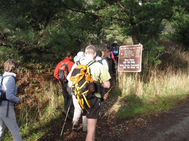
The route starts at the "hiker only" trailhead that purists take at the end of the Skyline to the Sea Trail (shameless people take the signed "handicap only" route instead). Along the newt-covered hiker trail is the Clark Connection Trail, which switchbacks 850ft up to the Westridge Trail. This fine "ridge" trail climbs another 700ft, taking many opportunities to dive down and then head right back up again. Keeps you guessing all the way to the top.
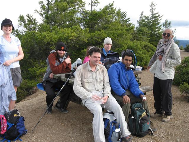
Near the top of Chalk Mountain sits a famous outhouse, complete with a crescent-moon window on the door and an excellent view from the landing. It's worthy of a visit itself, and Peter would have really enjoyed it. Away from the outhouse, there is a convenient picnic table (out of sight, so it's useful to know it exists). The front runners, who got there around 2 hours from the start, enjoyed an early lunch. As usual, Edita and Sabine got cold and couldn't/wouldn't wait. This led most of the front-runners to leave (except JP, who was busy cooking and eating a hot lunch). Part of the second group was already checking out the area as we rounded the corner.
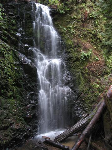
The front pack reassembled a few miles later at Anderson Landing Road (where a second lunch occurred), and then went down to see the four famous falls of Big Basin. At Sunset Camp, we heeded George and JP's advice to look for the correct trail near the outhouse, and successfully bypassed the more tempting paths to the camping area. Golden, Cascade, and Silver Falls came and went, and we chilled (literally) at Berry Creek for a while (eating yet more food) and discussed which of the falls was the best.
We also talked about the next section. The official route was to take Skyline to the Sea all the way back, but I had decided to try the Howard King Trail to McCrary Ridge ("Ironman route" in the notice). Ross, Sabine, and Harvey took that route as well. Lisa B started to go, but thought better of the ~3 mile longer route with a 1100 ft gain. That's too bad, because it was a great trail, with lots of variety and a good kick getting up to the ridge, and great views from the ridge.
Long story short, the alternate route worked out well as a fast-hiker "delay", allowing people from both groups to finish around the same time. The total alternate route was 22 miles with a respectable 5751 ft of elevation gain according to Harvey's GPS tracking. Harvey and Edita blew by when I stopped to remove some stones from my shoes on the long downhill portion. At the bottom of McCrary Ridge I ran into JP and Kristen, who were the last of the second group. Perfect timing.
Caught the next group of people at the park gate (i.e. the very end of the hike). Nani was just ahead, and quickly pointed out that he had beaten me back, as had just about everyone else (and that getting to the end of the hike is the truest metric of hiking prowess). I figured everyone had missed the Hiker Trail on the way back (because the sign is parallel to the trail for some reason), but it sounded like everyone took the "harder" route back--good job!
It was a great hike, and JP had lots of suggestions for crazy variations starting from the parks north of Big Basin--definitely some food for thought. Note to self: next time we do Chalk, let's try it from Año Nuevo.
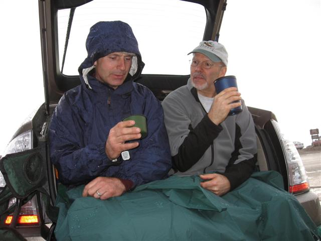
Most people hung out for a little while and shared snacks (thanks everyone). Then it started to drizzle, which turned to rain. We reveled in our luck at completing the hike in a dry window, and hid under umbrellas and vehicle overhangs. But as the rain continued, most of the cars left (George and Janice/Padraig were the last hold-outs for better weather). On the way back to San Jose, it was pouring, but INCH was high and dry.
But wait, there's more! A few people reported that Sparky felt too tired at the top of Chalk Mountain and took Henry Creek Trail back (shaving a few miles off the hike). She wrote the next day that she ran into two lost hikers on that "absolutely beautiful" trail. After setting them straight, she had to cross rain-swollen Berry Creek on a wet log and scramble up a hill to regain the trail. Soon after, she heard some distressed sounds from her lost hikers--one had ended up in the water (unintentionally) and the other had tried unsuccessfully to cross on the log. So Sparky went back down and helped them across, including wading into the creek a bit. The non-profit community work never stops.
All George's pictures.
![]()
![]()
Pages maintained by Steve Walstra,
Peter Saviz, and
Russell Gee.
©2026 Intrepid Northern California Hikers