
| Main Page | Diary | Leaves | Stats |

555. Mt. Diablo (West) (03/10/07)
Hikers (19): Alexandra, Bharati, Carissa, Carla D, David, Diane, George, Harvey, Helen, John N, JP, Kristen, Linda L, Paul, Ramesh, Rudi, Sabine, Sarah, Steve
Distance: 17 miles
Rating: 4 difficulty, 9 beauty
Park info: Mt. Diablo State Park near Walnut Creek
Write-up by Steve -- Pictures by George
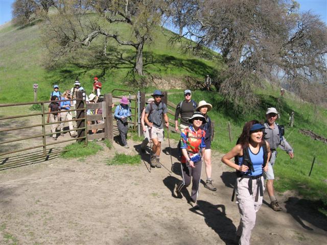
19 people showed up for hike #555, including four newbies who laughed at the level 5 rating. Would Mt. Diablo teach them a lesson, or would the old-timers be the ones to learn a lesson? Read on!
Soon after exiting on Ygnacio Valley Road, the Intel carpool took a right on Walnut Blvd instead of Walnut Ave. Why are there two roads within a two miles of each other named Walnut? Because it is Walnut Creek! Still, some nut diversity would be helpful. To make matters worse, Walnut Blvd goes to the back of Shell Ridge, thus encouraging one to keep going since the obvious open space keeps getting closer. As we turned around, Barbara zoomed right past. . .
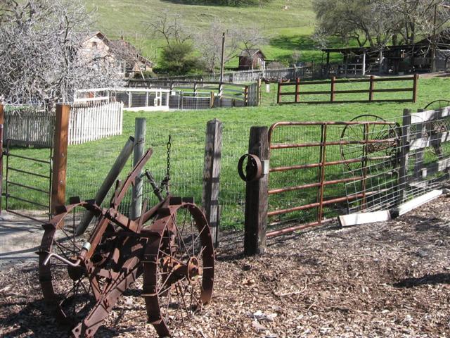
With the detour, we (and Barbara) were a few minutes late, so we rushed to get ready and set off from the picturesque Borges Ranch.
1, 2, 3. . .INCH!
The good news was that it was only in the lower 70s, unlike our previous visit three years ago. At the first intersection, George hung a left. I said, "What the hell?", but he was adamant that he knew the route and half the group--all of whom had nice, clear, detailed maps suggesting otherwise--went right along despite my protestation. George would later argue that the route he took was what we took on our last visit, not to mention that his crappy Diablo map didn't have the trail we took this time. . .but why didn't the rest of the people (1) consult their maps or (2) respect my authoritah? Oh well.
The good INCHers took the logical route, which put us 0.3 miles ahead of the other guys as we entered Castle Rock Regional Recreation Area (and its cool signature ridge). At the first turn onto Sunset Junction, I had a vision that Sabine (who was the next person behind me) would miss the turn. So I stood just out of sight and watched as she and John N walked right on by. There was even a sidelong glance at the trail marker, like some vestigial reaction from a long-lost navigational ability. And then Diane M followed those two. . .so I called out to them and waited until the rest of the train also took the turn. We collected again at the top of Sunset junction, where Barbara wondered aloud (1) why there were no wild flowers and (2) why George's group had not caught up.
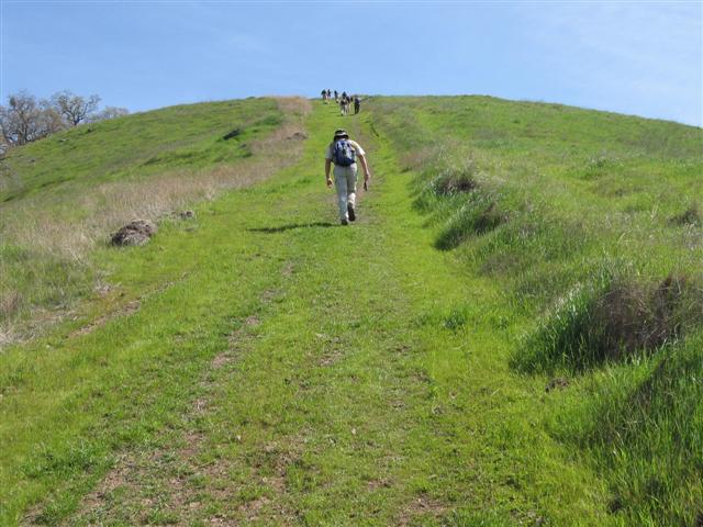
Not too much later, we reached the point where the trail crosses North Gate Road. The trail here shoots straight up the hill, and at the very top, one can just see a second hill with a trail right up it as well. Crazy! I still remember it from the first visit and it looked every bit as daunting this time. As the front group started up, George's traitorous flock caught up to the rear of the loyalists. Reunited at last.
After the two hills, the trail levels out where it intersects with (your) Mother's Trail. I took the well-signed trail, waited in the shade for a while until I saw Sabine come over the hill, and continued on (with my highly-visible yellow backpack). As you would guess, Sabine missed this turn as well, and Harvey followed her, and Ramesh followed him. . .by this time, I was waiting higher on the trail and realized they weren't coming. I started waving at people cresting the hill, figuring that someone might see me and take the turn (or look at their map). It all worked out, and the discovery was relayed down from person to person to oblivious Sabine and her followers. Sarah was the first person up on Mother's Trail, so she was apparently the one who broke the trend.
After another climb we were on Burma Road. Near the high point on the trail, it comes around a turn and offers a particularly nice angle on Eagle Peak. This is near Deer Flat and intersects after a 100 yards with our normal return route down Mitchell Canyon Road. I stopped here for another shepherding break, hoping to avert the unlikely situation that someone might instinctively take the trail down. People slowly came by, several telling me how I must have gotten lost, must have skipped Sunset Junction, and all sorts of George-based lies. SYG, Eugene was right! So when George finally showed up, I gave him a stern lecture.
That off my chest and everyone accounted for (except Barbara, who turned back early due to low flower-density), we headed up through Juniper Campground, the lower parking lot, and the wooded trail-through-the-middle-of-the-road-and-time. It was perfect on top for a change--nice temperature and very little wind. We commandeered a large block of real estate on the crowded Diablo lookout deck and enjoyed a late lunch. Most of the old-timers remembered to go inside and touch the peak.
A few miles later I was pleased (!) to find the front-runners waiting at the junction where we had to deviate into some unmarked trails. This almost made up for the previous transgression, and we really did need to stick together for the next section. Once everyone showed up, we were off. Could the hike actually work this time? Dare to dream!
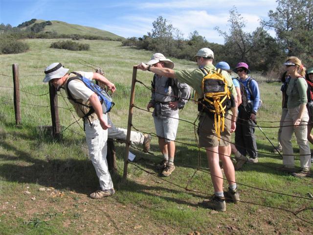
We encountered our first fence, which no longer sported any signs suggesting it should not be crossed (well, except for the existence of the fence in the first place), so we formed an orderly line and one-by-one squeezed through. From there, we followed the old jeep roads in accordance to the waypoints laid down ahead of time. Some of the old roads were pretty faint, but they were all there. Cows rule this section of the park.
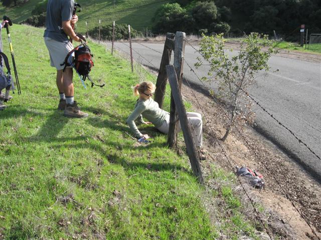
This time around, Google Earth had helped with reconnaissance, which led to a route that nearly eliminated the cross country hiking. . .and it mostly worked. The only hitch was that we had to do a little limbo under a second fence (a limbo that could have been avoided going through a gate earlier, which I had staunchly refused to do because I believed we were farther away from the crossing point). The little legal park corridor, which I had forgotten to mark in my GPS, was easy to spot because it was the only gate along the way which just said "Please Close Gate" instead of "Stay Out".
We assembled on the inside of the gate on a wide field, but were missing Ramesh and three out of four of the newbies--not a good sign! Someone said they had heard the group might take the road back to the park, which brought back memories of our previous visit. As usual, Helen started asking which way to go because she wasn't going to wait for anyone. Luckily, no one knew where to go for sure, so it wasn't too hard to keep the order. Still, I was ultimately compelled to go track down the stray group, who turned out to be not too far away. Apparently they ran into someone on the property who told them to turn around and take the road.
The legal corridor was a muddy trail that ended near a creek. One branch of the trail led across the creek into a huge horse stable complex while the other led to a sign that said "Keep out". We abided the sign and headed for the creek. Since the horses cross here, the creek was wide and ankle-deep. Everyone scouted crossing routes, with the most popular being a downstream concrete dam that provided a reasonable passage. Sarah wasn't having any of that and just went right through the water.
On the other side, the only non-horse in the place was a woman chatting on her cell phone while washing a horse. We found an exit which deposited us in the Castle Rock parking lot, as planned. On the other side of this exit was a sign that it said "Private Property, Absolutely No One Allowed". Luckily, there was no such sign on the creek side, and now we were in compliance, so all was good.
Ah, Castle Rock--almost done with the hike! Success! Now we had the detailed map again to lead us to the parking lot. Only about a mile left. At the first unmarked junction, I took us left and down the trail. After a bit, Rudi said, "Hey Steve, are we supposed to be along the road?" and I said, "Sure!" but quickly realized what he meant. We were supposed to be parallel to the road, but higher! Rather than turn around, I figured we would just loop back long the ridge--wouldn't be much longer. And, since no one else was looking at his or her map, that's what most people did (although a few turned around and took the original route, which was reported to be quite steep).
After three quarters of a mile, we were at the junction where George and crew had come down that morning. We could take this easy route back to Borges Ranch. So I asked Helen, who was the first person to the intersection, which route (easy or hard) we should take. She opted for the harder route, and so we headed up to and along Shell Ridge, which was quite nice. Before I left, though, I waited for John N, who was pretty tired by this stage in the hike. I told him we had about a mile and a half left (much to his dismay!), but that he could cut it a bit shorter by taking the easy route. He wasn't having it (mostly because he didn't want to dig out his map and had parked at the north end of the park where this route would deposit us), and so we headed up the ridge. At this point, I didn't realize it would be quite as steep as it was, but it wasn't too bad overall. Everyone enjoyed the views of the equestrian center, noting that we seemed to be going back to where we started. . .
And so we made it to the Borges Ranch Trail and the parking lots. By the time the last couple people came in (David and Bharati) we were well into the eating and drinking. Eventually, people started wondering what happened to John. I assured everyone that he had parked in the top lot, and could very well be on his way home without us knowing. This wasn't too convincing, but no one knew what sort of car he drove. The mystery was solved, however, when he drove his van into our lot to join in the festivities. Hooray! Everyone survived--much better than last time. Most everyone agreed that we needed to downgrade the hike to a four--it's hard at the start, but even with the bonus elevation at the end, it was still very reasonable, and only slightly harder than other Diablo routes (in the cooler winter air).
More pictures from George, including incriminating shots of everyone going through the first fence. That guy is clever.
Milestones:
Highest point in Contra Costa county
Alexandra's 1st leaf
Bharati's 1st leaf
Carla D's 1st leaf
John N's 1st leaf
![]()
![]()
Pages maintained by Steve Walstra,
Peter Saviz, and
Russell Gee.
©2026 Intrepid Northern California Hikers