
| Main Page | Diary | Leaves | Stats |

652. Three Russian Peaks (01/10/09)
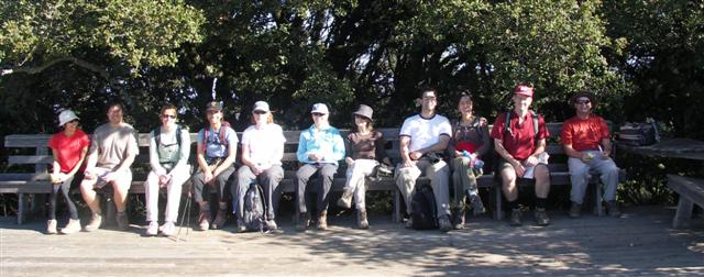
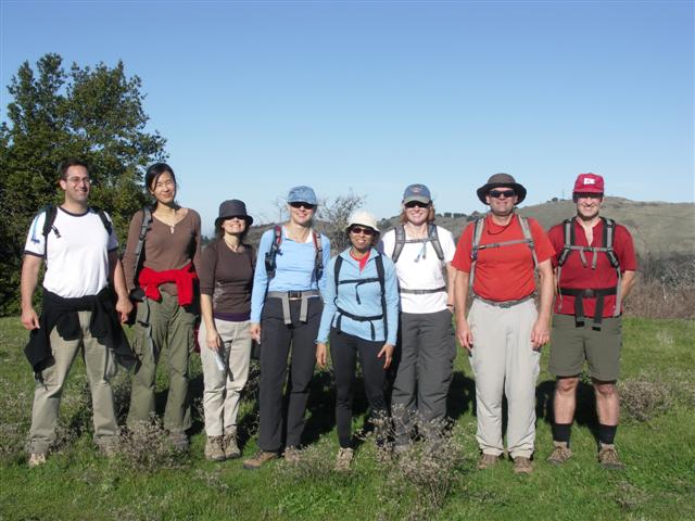
Hikers (12): David, Diane, Hima, Jinglan, Kim M, Lynda, Nick S, Paul, Russ, Sabine, Stacy, Steve
Distance: 18 miles
Rating: 3 difficulty, 9 beauty
Park info: Russian Ridge Open Space Preserve near Palo Alto
Write-up by Steve -- Pictures by Steve
This was a rare limited-invitation hike in hopes of keeping the numbers down. Twelve people signed up, despite the notice having almost no information. That's the spirit!
1-2-3 INCH!
There are three named peaks in Russian Ridge: Borel Hill, Mt. Melville, and the other one that hasn't been added yet. After hiking out of Skyline, we all enjoyed the secret tunnel, and conquered Borel Hill in no time. Actually, the tunnel wasn't 100%--Jinglan and Nick took the wrong turn and walked over the tunnel. Of course, it wouldn't be a secret tunnel if it were easy to find. . .
With Borel down, we were off to Mt. Melville. Along the way, we passed the mysterious deck we'd seen in the past. For some reason, there is a huge deck just sitting along the trail (near a windmill). Why is it there? For INCH to take a rest (just kidding!). But. . .well. . .maybe take a picture, anyway.
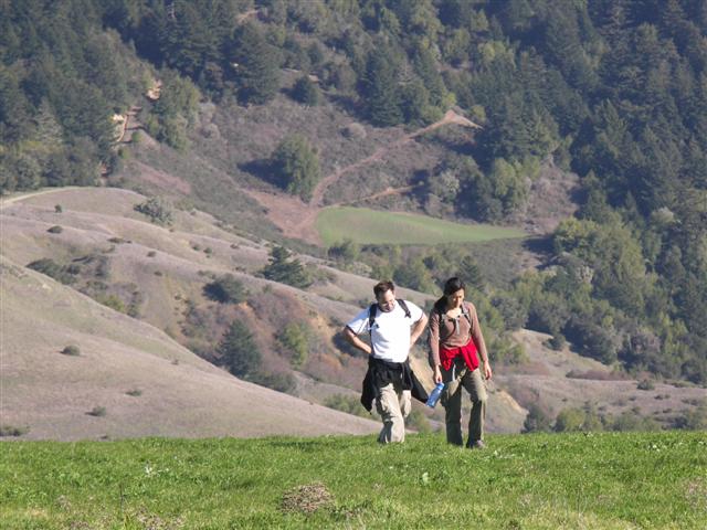
I had consulted a Topo map and discovered that the peak of Mt. Melville was on the next hill over from the housing area we had visited on our last trip. With that in mind, I zipped by the housing structure and over to the adjacent hill as quickly as possible. As I was coming up the next hill, I heard a dog yapping, perhaps in response to similar yapping from the group behind me (Sabine et al.). This tiny white dog (as well as I could see it) scared everyone else off. Maybe it had razor-sharp teeth?
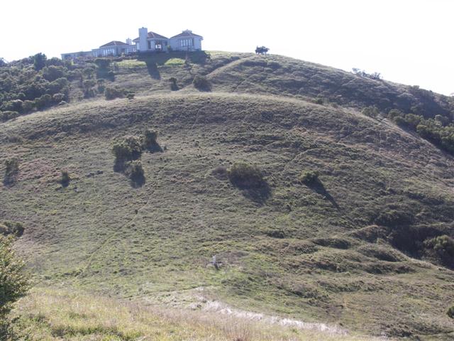
When I got back to the other hill, one of the residents was outside. We chatted for a while, and I learned the following interesting facts: (1) the residents there are not allowed to hike over to Mt. Melville {and, um, maybe I shouldn't have either} and (2) they pay rent to the OSP. It turns out the house came with the land when it was bought by the OSP. A closer look at the house shows maybe three or four connected units up there. Last time we were there it looked a bit run-down, but this time it looked quite nice (see picture). The guy attributed it to a fresh coat of paint as no major renovations have occurred. Not a bad place to live, except for all the damn hikers.
Next we were off to the other side of the park along the Mindego Trail. As we were hiking along the ridgeline, it became clear that we'd be exceeding the 14-mile estimate. I'm not sure where the extra distance came from (relative to the map-given distances), but no big deal--it was an easy hike so far. We waited along the trail to regroup (and had a round of vodka shots to pass the time) before setting off for our next goal. Surprisingly, Hima balked with some crazy excuse about not wanting to risk her pending citizenship on any off-trail excursion. Russ trumped her by not going for no particular reason. While there is some wisdom in not screwing with the INS, Russ garnered a  for shamefully baling, mostly because he knew what the hike was all about before getting into it. The rest of us, including one fearless non-citizen, were off!
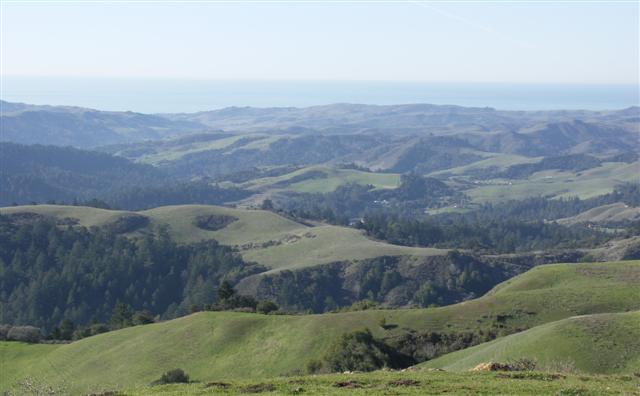
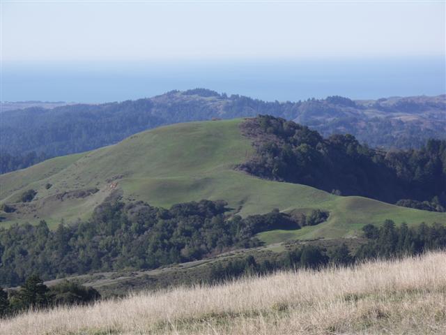
After a steep route up, we were greeted by fantastic views, with green hills all the way to the ocean. Jinglan and Nick didn't look so thrilled when they got there, but that was mostly because they didn't get the vodka shots at the start. We remedied that the hard way--I couldn't find the shot glass so they drank right from the bottle. Hard core!
After a few pictures, we headed back down. The return route featured a lot more uphill than expected. Once back into Skyline OSP, I discovered the trail I highlighted on the map did not connect "as drawn" (which involved hiking on the opposite side of Alpine Lake after exiting the secret tunnel). Oh well--next time. Soon after, Diane and I missed the road that was the route back to the parking area. When coming back, we ran into David and Sabine, who had previously been ahead. Turned out that they dutifully looped back around Alpine Lake to satisfy the map requirements. Great job!
On the way back, there was a general consensus that this was way tougher than a level two. Back at the parking lot, we enjoyed some of Sabine's post-hike snacks while waiting for the last two people to return. Lynda, trapped in the carpool, had been commenting all day about the un-INCH-like breaks. She finally said why: she had a date that night! Clearly she hadn't read through some of our old write-ups, which have sad stories of unrequited love due to late-running hikes. We did the only thing we could do--abandoned Jinglan and Nick's triumphant return and raced back to the carpool. {They survived}
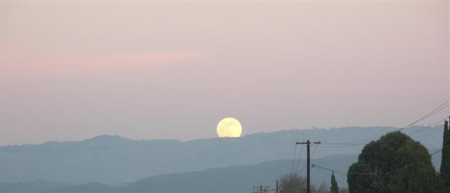
Prologue: The late hike resulted in catching the moonrise just south of Monument Peak as we left the Intel carpool point. Snapped a picture while waiting for a stop light.
Milestones:
Diane's 90th leaf
![]()
![]()
Pages maintained by Steve Walstra,
Peter Saviz, and
Russell Gee.
©2026 Intrepid Northern California Hikers