
| Main Page | Diary | Leaves | Stats |

32. Cone Benchmark (04/26/25)
Hikers (5): Bill M, Christina, Hong, Mihail, Steve
Distance: 17 miles
Rating: 5 difficulty, 8 beauty
Park info: Henry Coe State Park near Gilroy
Write-up by Steve -- Pictures by Jarda, Kendra and Steve
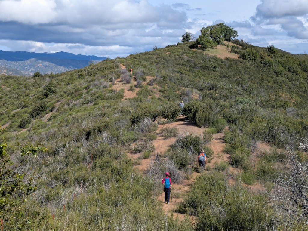
While it had drizzled a bit during the night, the day started bright and mostly clear. Everyone was ready to go on time. We made quick work of the rest of Bear Mountain Peak Trail, including the no-longer-obvious route down the side of the ridge. This was the third time I've been here and each track is a little different.
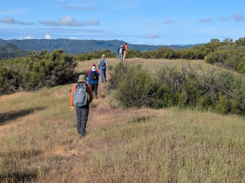
The planned route was to take a long abandoned road to the saddle next to the peak. The road is on old topographic maps and I'd taken it before, so I knew it worked (a theme for today). Since it was going to be a long hike, however, I took a vote on whether to just take the steep route to the peak. The vote was unanimous to take the shorter route.
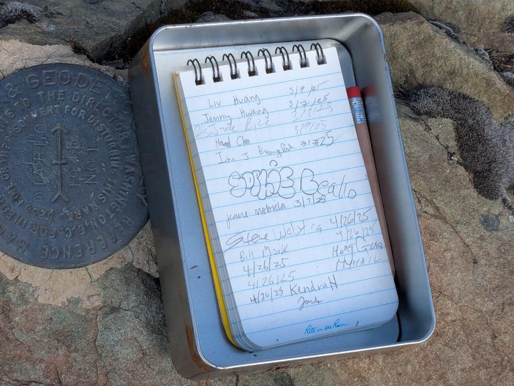
As we signed the register, Christina was perplexed by the fact that the register had been placed by me three years prior, as if that invalidated its authenticity. Being a government employee, she'd apparently imagined there was a central registry organization in each county that develops and tracks such things.
Next up was Bear Mountain proper (Diablo benchmark). This is a vastly more popular peak than nearby Bear Mountain Peak.
I mentioned that we'd take an old road from Bear Mountain down to the new road that heads to Chaparral Trail. This would ostensibly provide plausible deniability for walking through the in-holding since we'd be unlikely to encounter any negative signage. I knew it would work since I'd taken that old road on a prior hike, although it is very hard to pick up at the start. I stated all this in the hike note, but people were skeptical as I pushed into the bushes. . .
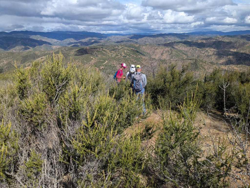
Jarda and Kendra decided to bail at Bear Mountain summit. Jarda claimed he didn't want to risk his impending US citizenship on getting caught trespassing. Others did not believe this area was even closed ("Why would Chaparral Trail exist otherwise?" they pondered). Well, the reality might lie somewhere in the middle. It used to be closed, but does not seem to be too strict after multiple fires went through the area. Indeed, on the Chaparral-Trail side of the area, there was a welcoming sign.
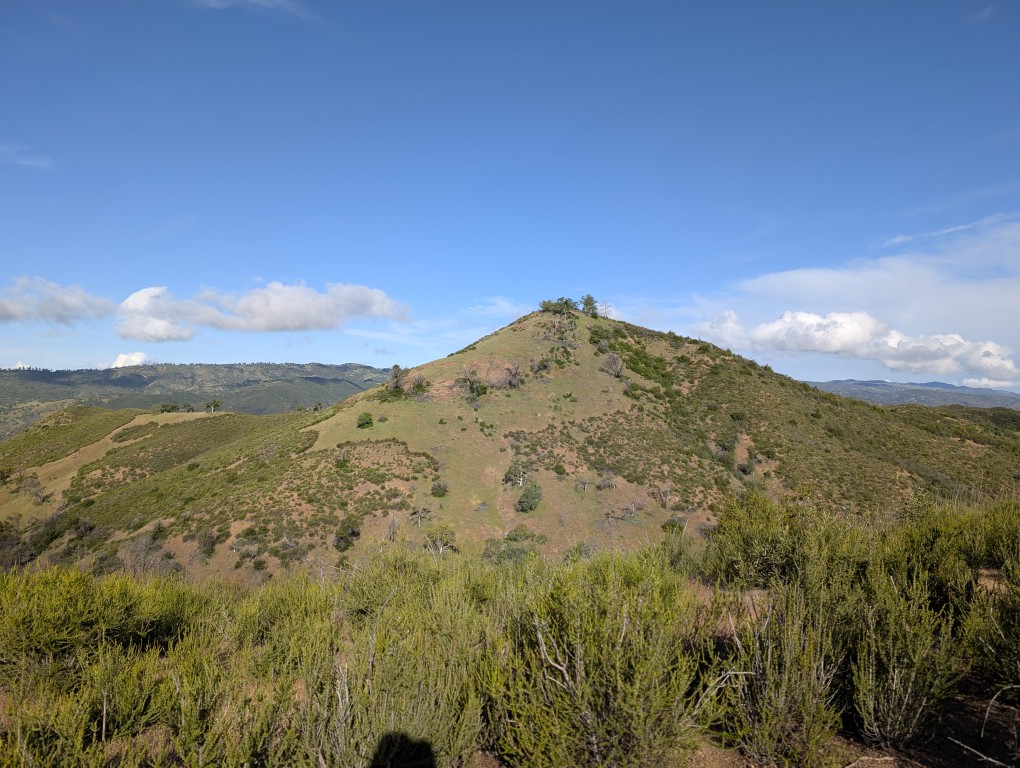
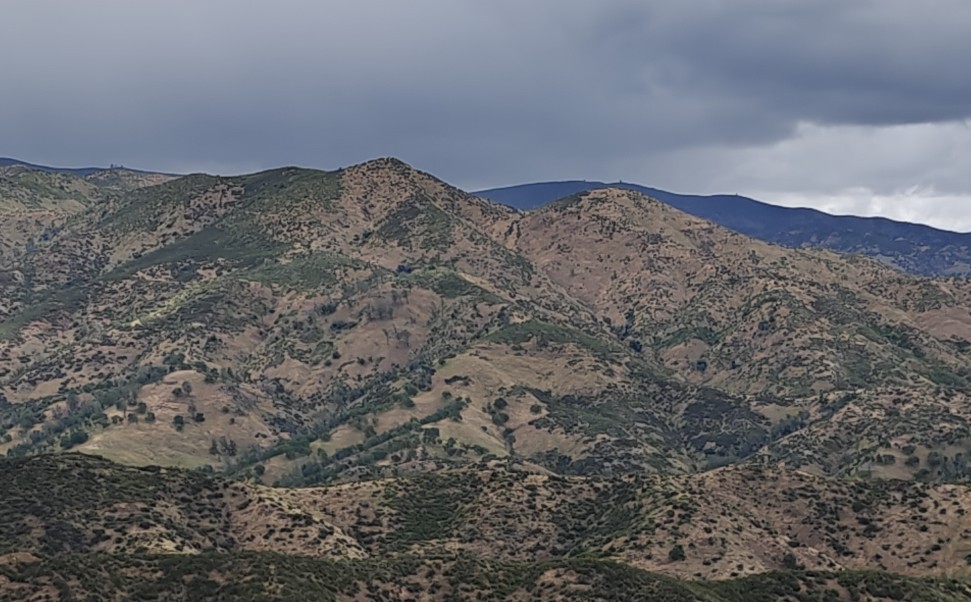
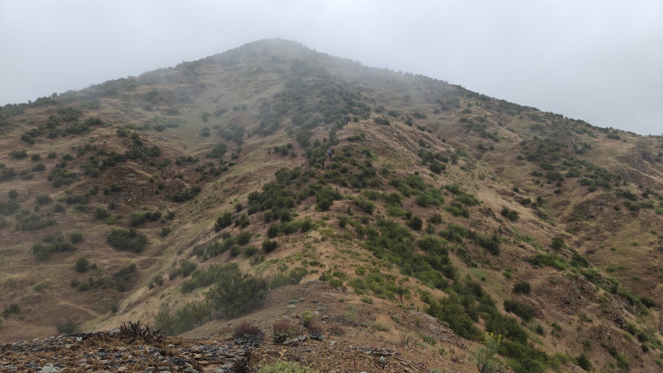
As we headed down the trail, it started to hail (or graupel). Since it was bouncing off me, I didn't put on a jacket, unlike everyone else. Later it would rain, and I still didn't put on a jacket because I was already wet. Soon I saw Cone Peak looming in the distance. I didn't point it out to anyone because I guessed it would be a little demoralizing.
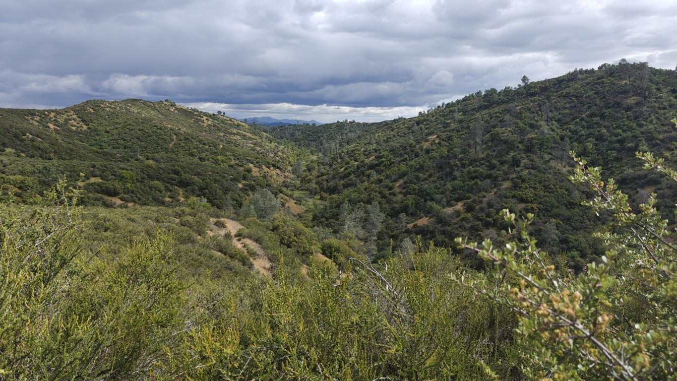
We regrouped at Red Creek at the bottom of Chaparral Trail and then headed up Robison Creek Trail. This immediately passed the very first "Camp Awesome"--my first overnight BCW camp in 2016. Unlike that time--when I failed to reach Cone BM--this time would be much easier.
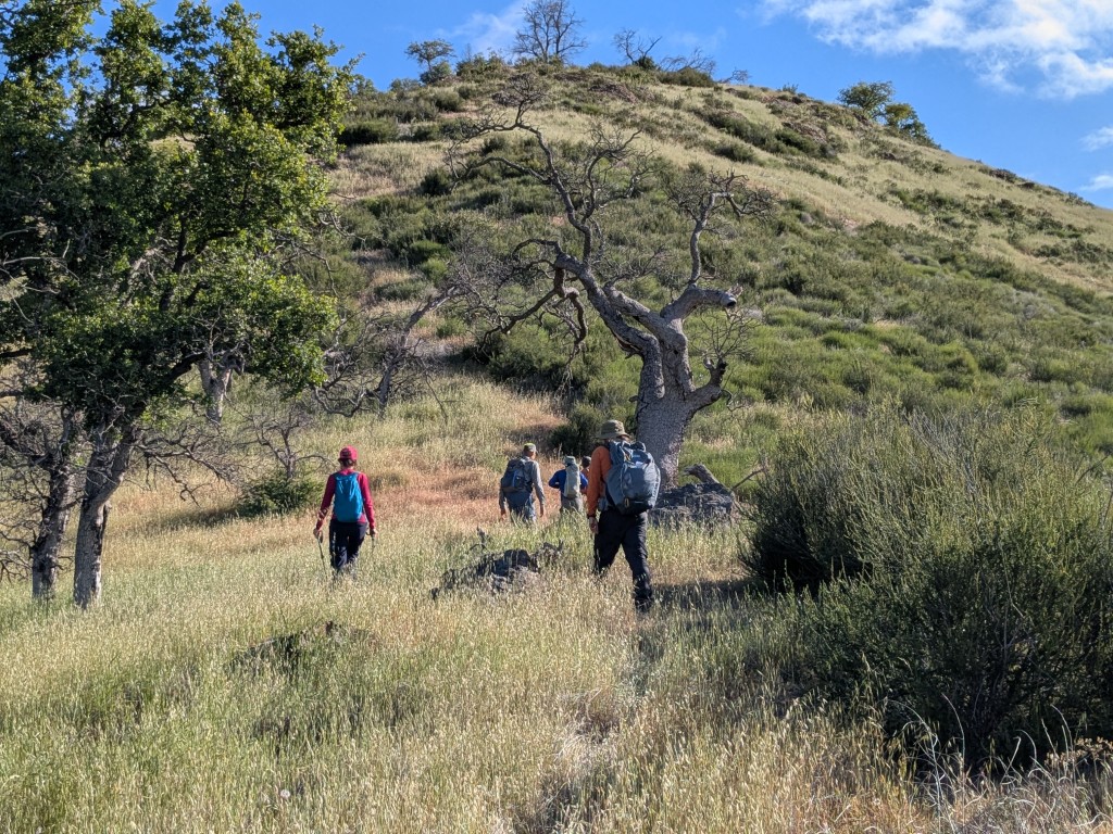
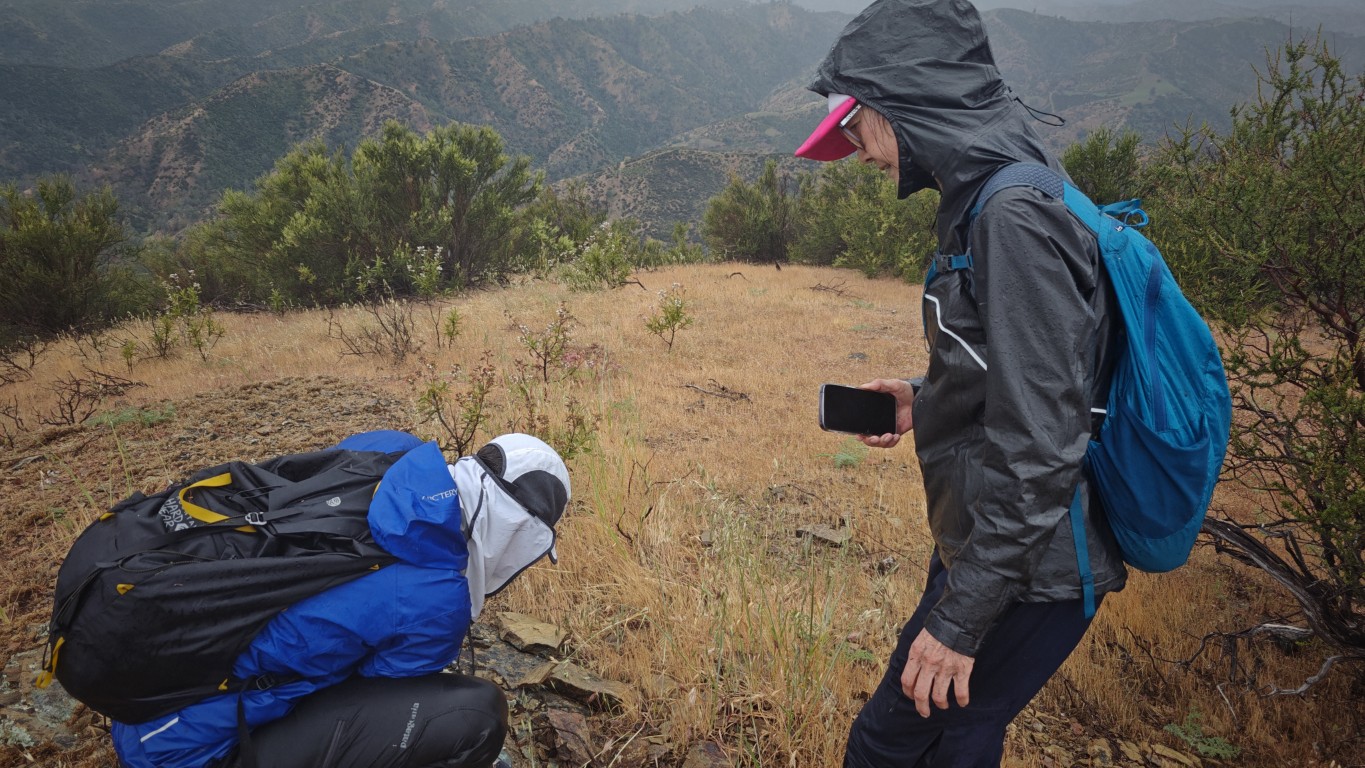
We eventually reached a point where an unnamed road departs from the more popular route. It was here when I pointed out the remaining route to the summit. I've never seen a sadder-looking Bulgarian. Mihail was not loving being cold and wet and seeing the peak looming far in the distance. Fortunately, everyone else was game, so we headed off.
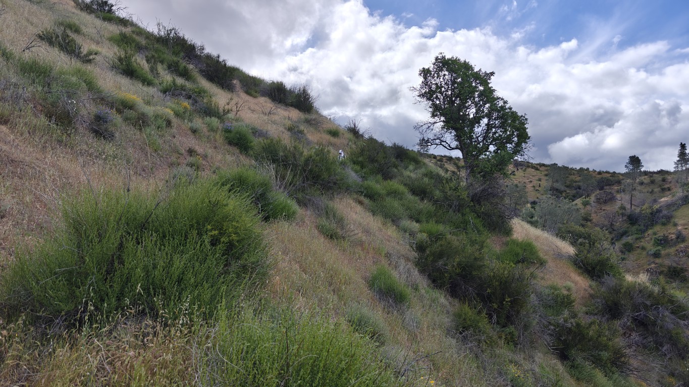
I had spotted a new route that was a continuation of the same old road we were taking. While it doesn't show up on any maps, old satellite photos confirmed it had been there a long time. It worked out nicely and made the hike slightly easier and less bush-whacky, although it did require going around a small reservoir (NE of the one on topo maps) that somehow managed to avoid fires, so was especially overgrown. There was a water hazard on one side and a falling hazard on the other, but once past that, it was smooth sailing to a small saddle and then steeply up to the summit.
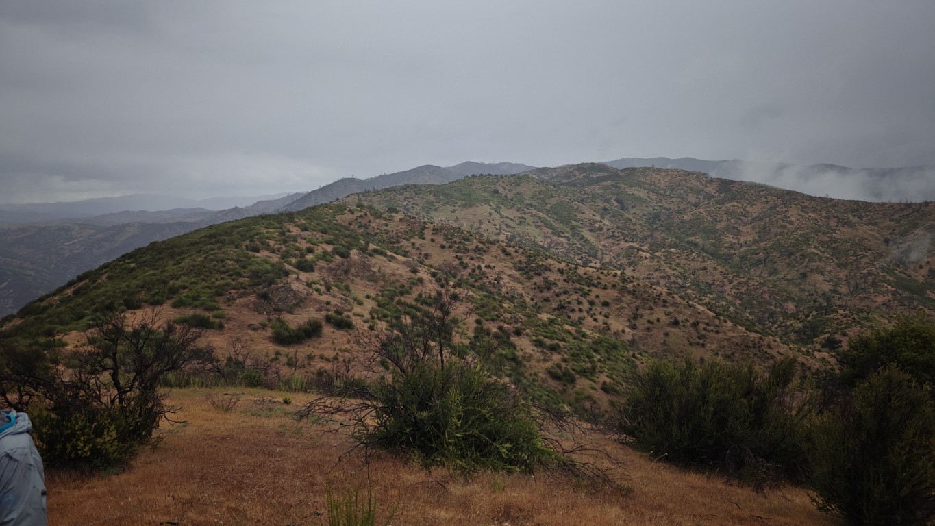
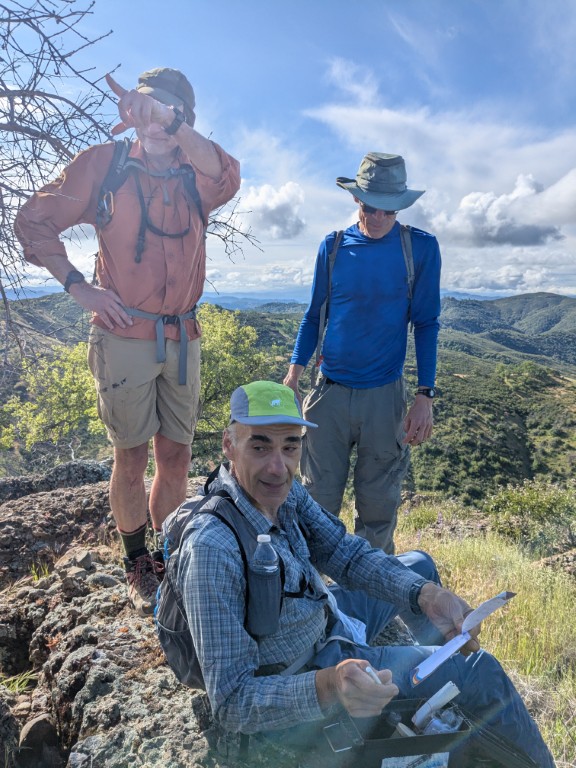
Ten minutes after we were on the summit, the clouds rolled in, removing any views. That also made it cooler, so everyone was happy to go down. I finally donned my rain jacket.
We headed back the way we came and eventually reached Red Creek again. The original plan was to make a loop, but everyone was happy--yet again--to shorten the hike by taking Chaparral Trail back the way we came. We ran into another group at Red Creek who were looking at their Coe map and planning to take Chaparral Trail. The guy said "See you later" and I thought "The hell you will!".
Upward we headed, this time taking the correct route the whole way. We'd gone off-trail for a small section on the way down. Later, at the junction to Bear Spring Trail, Mihail and I sat down and waited for everyone. Mostly I wanted to encourage everyone to take this slightly harder route back since we'd already shortened it a tad. I was also feeling a little spent and a lot cold.
As we reassembled, everyone was game for the Bear Mountain Spring route. Bill M pointed out there was an unnamed trail connecting Bear Spring Trail to Bear Mountain Peak Trail (and thus Camp Awesome). Turns out everyone took that route back, which saved a little distance.
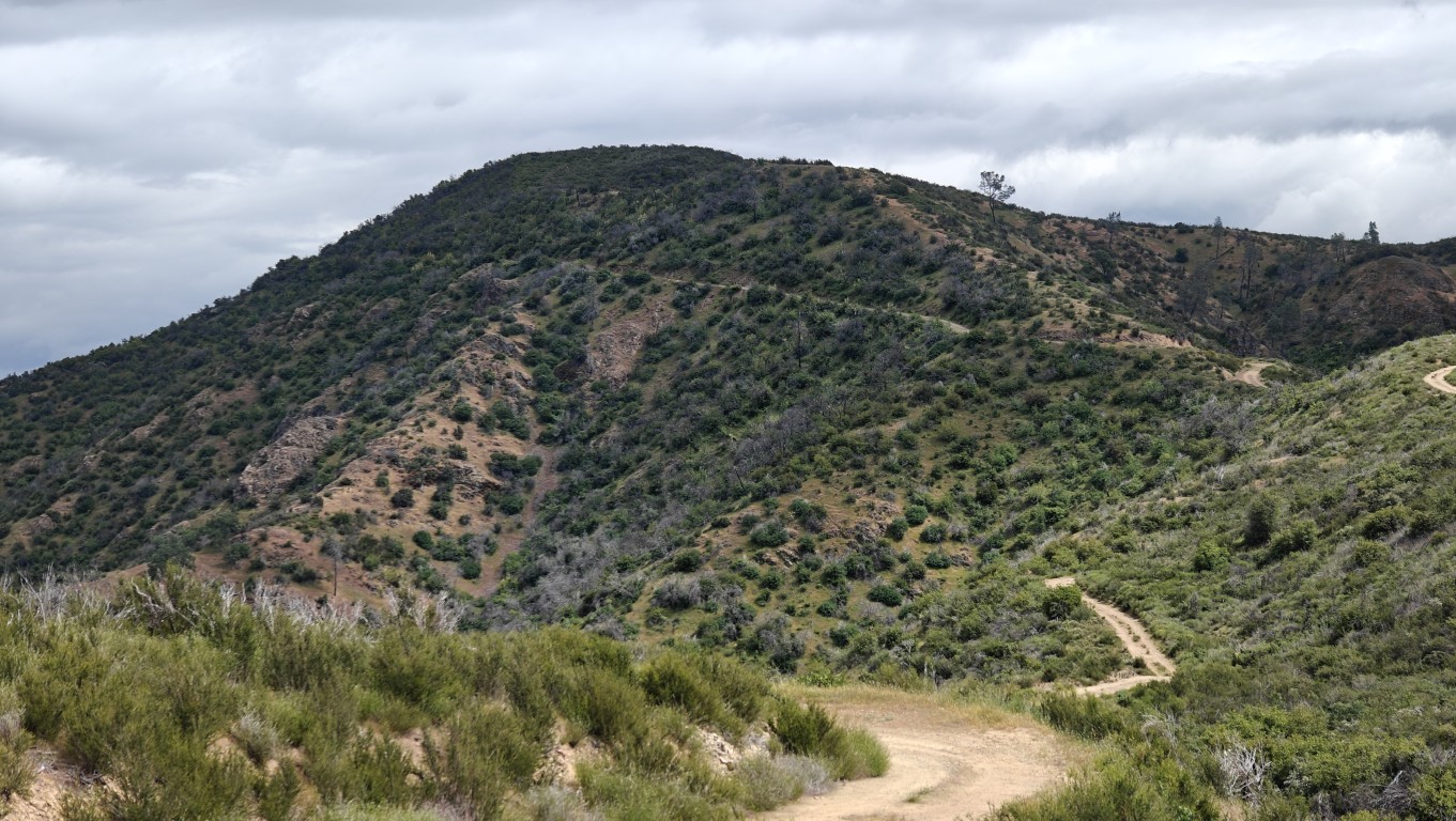
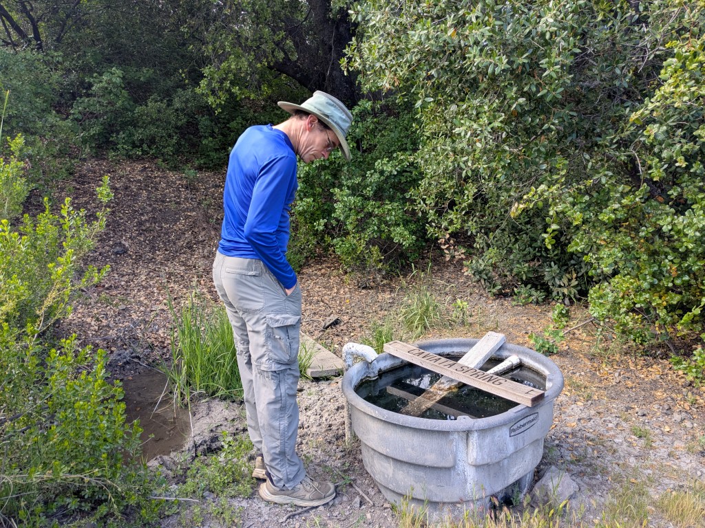
After motoring up the trail to the highpoint of the ridge (pic above), I felt a bonk coming on. I pulled out the remaining food from my pack and started to eat it on the trail heading down to the Bear Spring. Then I decided it would be wise to just stop and eat it. Then I thought I might as well lie down and eat it. Everyone soon passed me. I eventually got back up and walked the short distance to the bottom (Mississippi Creek), where the group was refilling their water from a circular tank downstream from the "true" Bear Spring.
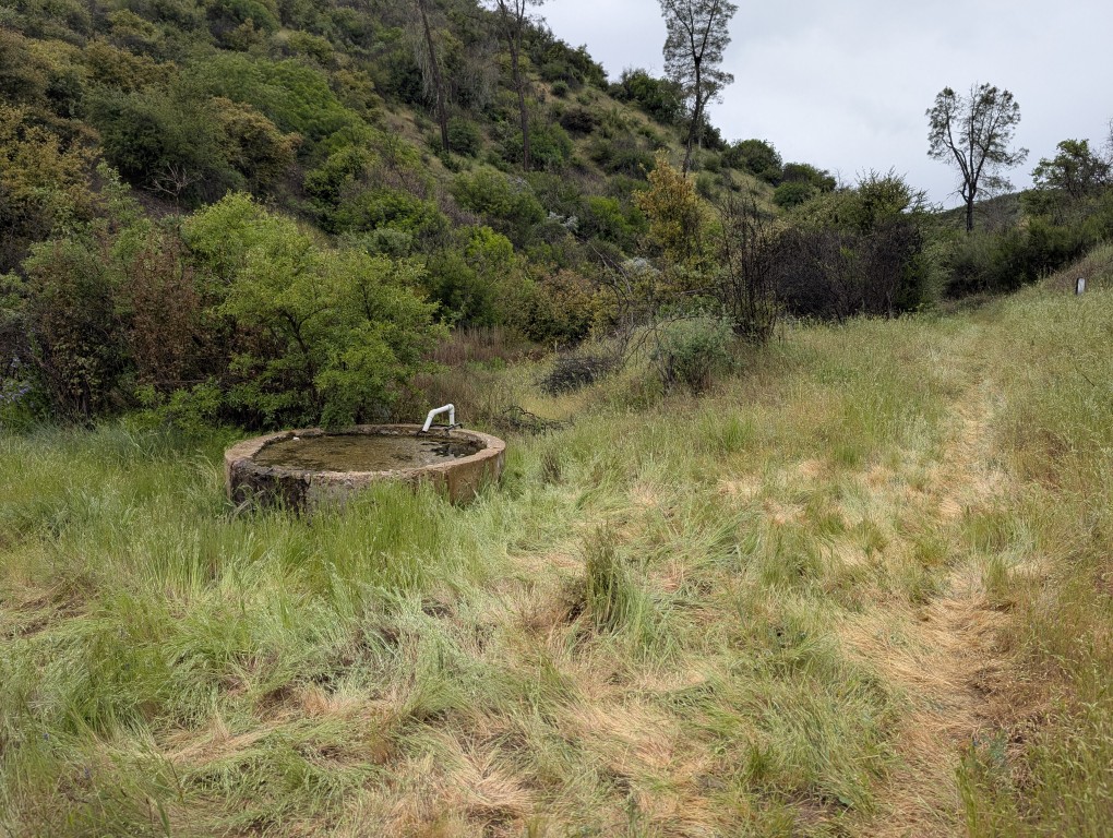
Everyone was soon gone except for Mihail, who was last in the water queue. Once he was done, I filled my entire 3L bladder from the slow stream, hoping it would be sufficient for cooking that night and breakfast the next morning since I was no longer planning to get water near camp. During that time, the group we'd met earlier passed. Now I had a goal: pass them again! That turned out to be easy, as the calories from the earlier pause became available during the water break. Passed them just before branching off to the right to take the old road back to camp. Even caught up to Mihail before camp. Have to admit that I was quite relieved when I spotted my bright orange tent in the distance.
Jarda and Kendra were already back from their hike, which covered the same route we had taken back as well, so everyone was accounted for. We even had a short post-hike party before getting rained out.
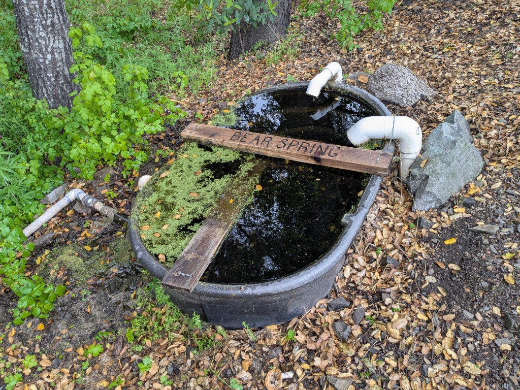
Bonus: Springs of Coe
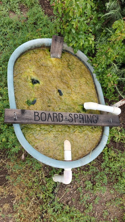
Incidentally, based on the time stamp, I was already on the way back from Board Spring by the time Jarda and company were rolling out of Camp Awesome.
![]()
![]()
Pages maintained by Steve Walstra
©2026