
| Main Page | Diary | Leaves | Stats |

1021. Grant's Pyramid (02/13/16)
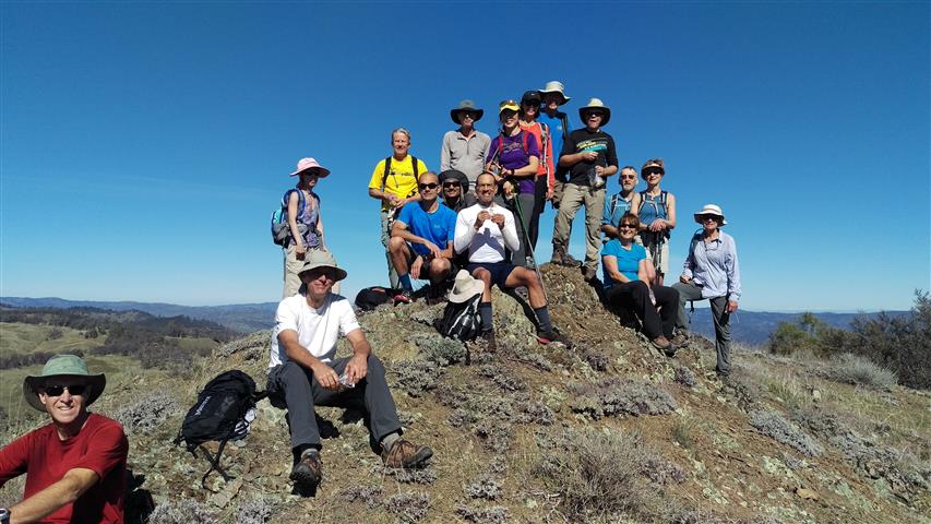
Hikers (17): Alan, Brad, Chris P, Giulia, Jane, Jeff, Jim, John, Kirk, Mihail, Milon, Sarah, Sarbinder, Steve, Vicki, Yipeng, Yvon
Distance: 16 miles
Rating: 4 difficulty, 9 beauty
Park info: Grant Ranch County Park near Mt. Hamilton
Write-up by Steve -- Pictures by Alan, Kathryn, Sarbinder and Steve
As people were assembling in the parking lot, I overheard Peter E whisper to Kathryn, "Hey sexy mama, after this hike, I've got a swollen Valentine's Day treat for you." Not missing a beat, Kathryn said, "When I'm done with it, it'll be black and blue". So it wasn't too surprising when the two horndogs decided to turn back after only 1.8 miles. What happened? Well, you'll have to read on.
Because this hike involved a short off-trail excursion, I limited the attendance to people who had done two long hikes this year. Two additional people with reasonable credentials lobbied to attend, so in the end, we had 19 people start. In order to finish the hike before sunset, we started at Twin Gates, which removed a bit of elevation gain and mileage. But there was plenty of elevation gain added in the process of making it a loop, so it worked out just fine at around 5k ft.
1-2-3 INCH!
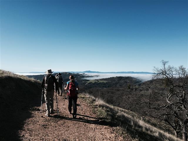
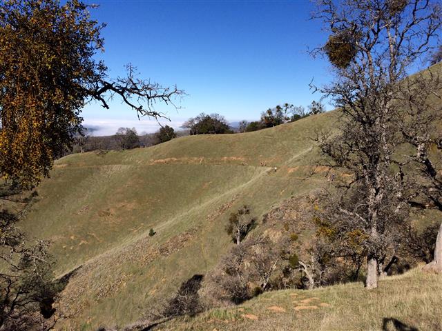
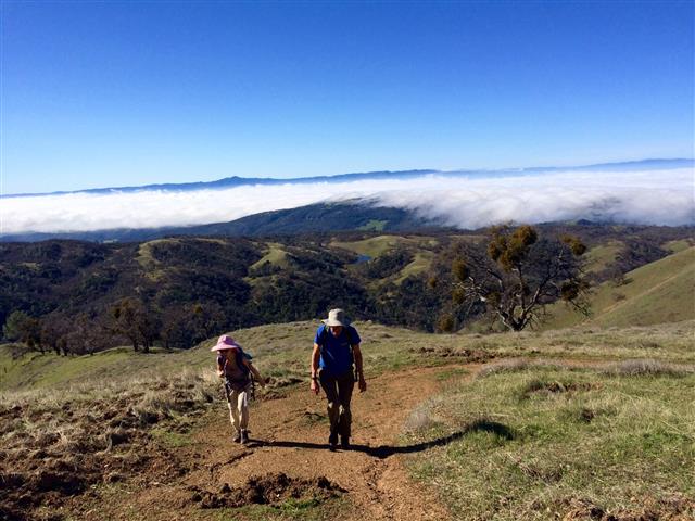
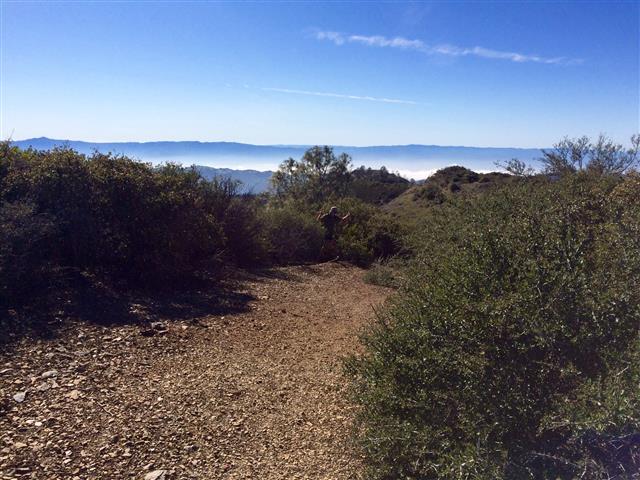
On the drive up, the road was socked in fog, but once we cleared the ridge, it was sunny. We could see that fog hanging around the Valley until well after noon, but it was quite warm hiking up the hills. Never know what you are going to get in February.
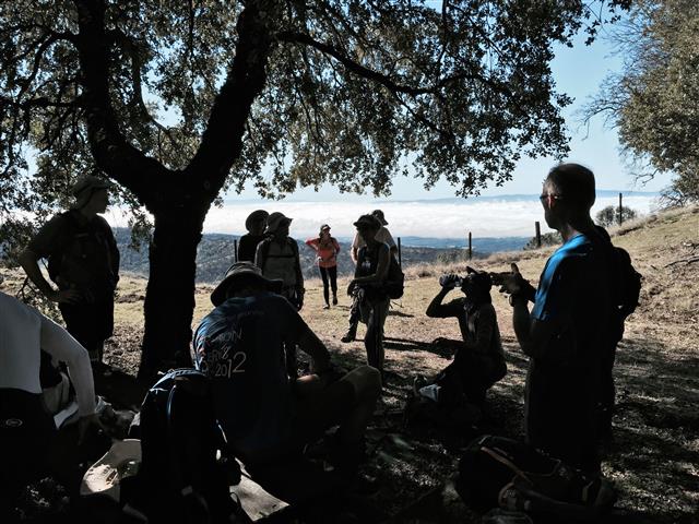
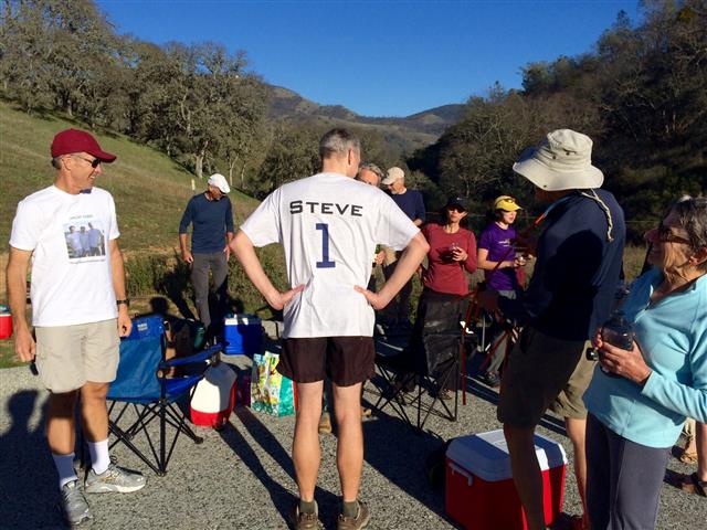
Much to my delight, Sarbinder knew it was my 800th hike, and brought some tequila (Thanks!). So we took a break at a picnic table to celebrate and regroup. We managed to down the entire bottle, with John helpfully volunteering to finish the last bit to lighten the load.
Soon we were atop Grant's Mistress. . .
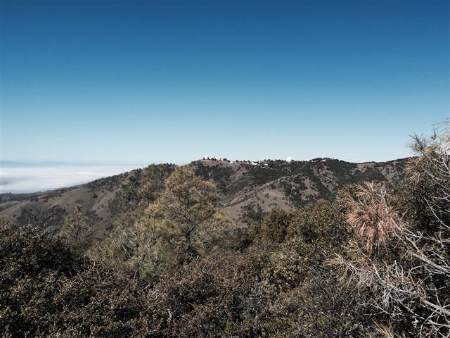
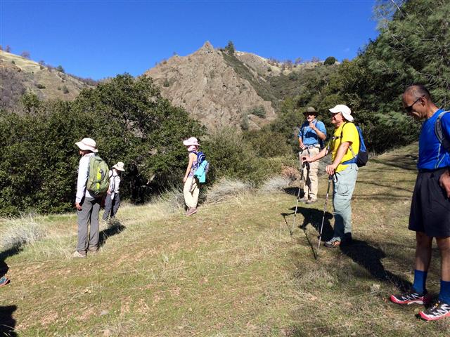
But we had more to do! Two years prior, Yipeng, Jeff, Moe, and I had done an extra loop at the end of Grant's Mistress. This time we made a much larger loop to visit Grant's Pyramid. The new route involved a short stretch of cross-country, which went more smoothly than expected. It wasn't long until we were back on trail, and then atop the second peak for the day.
From there things got more interesting. Google-Earth-based recon successfully identified a plausible route, and we were able to go up, then down, down, down toward the base of Grant's Mistress. Lots of cool rocks and nice streams were encountered, and the roads became increasingly disused. It was hard to keep everyone together, though. Jane would bolt off, and various people would chase after her, none of them knowing where they were going. But at the same time, a few people were starting to drag, so we took a few breaks.
We eventually reached the route some of us had done two years prior, which connected to a steep bulldozed trail that mostly, but not entirely, reached the ridge we had started on. I warned that it was "up, up, up from here". . .and it was all that and more. Since that old bulldozer didn't quite make it to the top, people tended to take various routes through the bushes near the end, resulting in INCHers popping out randomly along the ridge. That sort of made it fun, because until you reached the road, you had no idea how close you were. Everyone was equally happy when they arrived, because pushing through the bushes after a long uphill was tiring work.
From there, we headed mostly downhill. There was a small alternate route on the way back, which I'd asked the front-runners to wait for (pointing out the "wall" at which to stop as we were going up in the morning). Amazingly, everyone was there when I arrived. . .but there was no convincing everyone to wait until everyone else arrived. But that was fine--everyone still got to take the alternate route. Jeff and I waited quite a while for Vicki, Chris P, and Kirk. Turned out Kirk was flagging, and they were keeping him company.
No worries--it was all downhill from there, followed by two creek crossings. Ha. That's a lie, because just like every other visit to this fine park, there is a steep uphill to get back up to the ridge. I mentioned this to Yipeng when I passed her, and she said she had no recollection of going downhill at the start of the hike. I'm pretty sure her memory was jogged not too much later. Mihail and I trudged up together and were happy to finally catch sight of the parking lot at the end. We noticed Sarbinder wasn't there--turned out he had taken a wrong turn after the creek, but didn't get too lost, and showed up not much later.
Much to everyone's surprise, Kathryn and Peter were still in the parking lot, apparently too spent from 3.6 miles of hiking and four hours of God-knows-what. We soon discovered that everything I had heard at the start of the hike came true.
Everyone sat around eating and drinking, and Sarah presented a shirt to commemorate my 800th hike. Thanks Sohpie-via-Sarah! In my haste to try on the shirt, I manged to bind my button-cuffed wrists together with my inside-out shirt, leaving me flailing around trying to unbutton my cuffs through the shirt, exposed to the harsh elements and harsher INCHers. . .but it all worked out eventually. I decided not to post that picture.
Milestones:
Alan's 120th leaf
Jeff's 240th leaf
Sarah's 320th leaf
Steve's 8th forest
![]()
![]()
Pages maintained by Steve Walstra,
Peter Saviz, and
Russell Gee.
©2026 Intrepid Northern California Hikers