
| Main Page | Diary | Leaves | Stats |

1148. Pyramid Peak (09/15/18)
Hikers (15): Giulia, Hong, Hyo, Jarda, Jeff, Jim, Kathryn, Kendra, Leslie, Mihail, Milon, Shuli, Steve, Tiffany, Vicki
Distance: 13 miles
Rating: 4 difficulty, 9 beauty
Park info: Desolation Wilderness in Tahoe
Write-up by Steve -- Pictures by Steve, Hong, Kathryn, Vicki, Tiffany, Jim, Mihail, Sandy F and Shuli
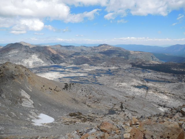
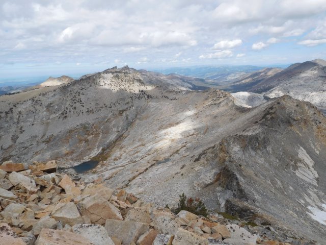
About once a year, we head off to Lake Tahoe to hike in higher elevations than we can get in the Bay Area. Although we've been many times, there are plenty of peaks left to bag. This time around, we were heading for Pyramid Peak, the highest point in Desolation Wilderness. There was an option to do a traverse over to Mt. Price if we summitted fast enough. . .
Everyone was at the trailhead when it was time to start hiking (although not all were ready). This included people who had stayed in the area the night before as well as people who drove up from the Bay Area in the early morning. Sabine, unfortunately, had forgotten her boots, so had to drive 30 minutes back to get them, meaning she was going to get a late start. Maybe she'll be able to catch up. . .
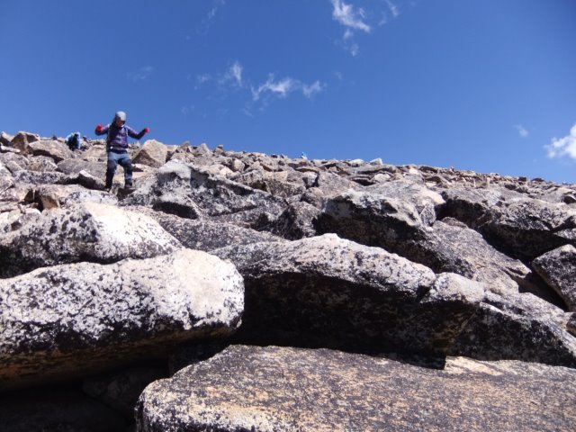
1-2-3 INCH!
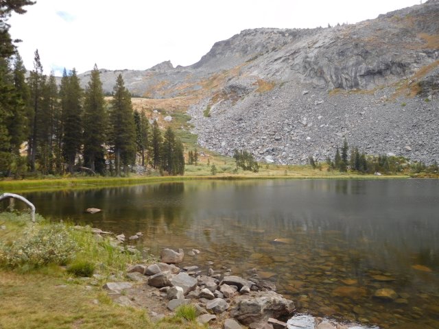
I'd purposely not provided maps since we'd have to stick together after Lake Sylvia. The front-runners were quick to get to the lake along the easy Lyons Creek Trail. I pointed out the route to Mihail and Jim, who could not believe that route existed. Mihail looked at a gentler-appearing route off to the left and said "what about that?". I said that wasn't the route, and maybe it cliffed-out higher up, but he was welcome to try.
As we were idling, I mentioned I'd like to demonstrate the route existed so as to remove any doubt before we all headed up. Jim volunteered to wait, so I said "I'll go up there to see if it works. If it doesn't, I'll come back. If it does, then wait until Sandy F shows up." Then I headed off on the obvious use trail. . .
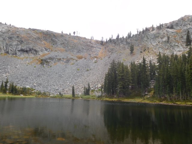
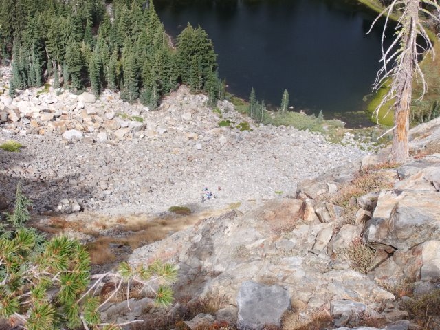
Ten minutes later, I was 2/3rds of the way up. The "right way" route worked fine, as expected, and the closer one gets, the less imposing it appears. I stood on the rocky chute, waiting for the group to show up, assuming the two below had seen my "confirmation" of the route.
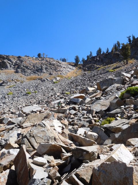
Many minutes later, a group of INCHers appeared at the bottom of the chute. I waved, and then headed up. I looked back a bit later and noticed they were sitting down. . .so knew it was going to take a while. When I got to the top, I hiked up to nearby Peak 8662 to pass the time.
The peak was higher and farther away than it looked, and by the time I returned, lots of INCHers were sitting around at the top of the gap. Right then, Tiffany appeared from the chute, and turned out to be the last person. That's when I found out Jim had gone AWOL, and the only reason the group come up the chute was because newbie Hyo knew the route! (Thanks Hyo!) I was pissed, because now I didn't know where half the group was. In fact, I soon learned that Jeff and Leslie were behind this group, so they didn't get any clue about which route to take. I wasn't too worried about Jeff, but the hike was clearly FUBAR.
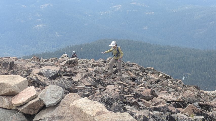
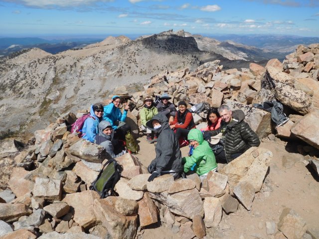
From here, a pretty good use trail made its way up to Pyramid Peak--much better than expected. While the trail was easy to lose, it was generally easy to re-discover. Everyone slowly made their way up. The weather had been predicted to be cold and windy, but thus far it had just been overcast (with a tiny amount of sleet [and not hail, as Milon would teach me later]). But cold and wind greeted us on the last two hundred feet to the top. Fortunately, there were multiple rock shelters at the summit, allowing groups of hikes to hunker down.
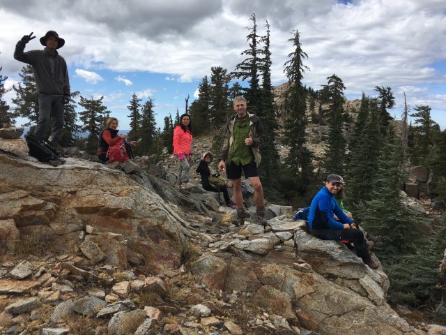
As I approached one of the shelters, I saw Mihail, Jim, Shuli, Giulia, and Milon had made it. Was glad to see it! Then Mihail gestured at his watch (as in, "you're slow"). When I got within speaking distance, I laid into Jim for dereliction of duty!  ! And after that cathartic moment, all was well again.
As the story went, apparently Shuli, seeing a trail in front of her, did not stop at the lake. Why? Because "Shuli". So Jim went after her, and Mihail was happy not to go up the chute, so followed. . .and several people followed them. . .and it could have turned out badly, but luckily it worked out. In fact, Jeff and Leslie showed up a little later, having taken the correct route, so everyone was there except Sabine and Sandy (not to be confused with Sabine's Sandy).
I was pretty sure Sandy was going to turn back because of the scree-filled route (he said later it wasn't the scree; it was the boulder hopping), and Sabine, well, seemed less likely if she hadn't caught up with (or sight of) Jeff and Leslie.
Hyo was disappointed we weren't continuing on to Mt. Price, but it had taken nearly four hours for the last people to get to the summit, eating into the daylight margin. So I told him he was welcome to go for it, but several of us had taken a look at the first downward section (which is really the crux of the traverse) and it was not particularly appealing. What did seem appealing was to get down earlier and have a beer, then hike to Mt. Price another time!
Coming down off the summit was a little faster. As with the uphill, it was generally easy to find the most commonly used route. . .but it was also easy to lose it. This time everyone took the same route back.
As the last people reached the lake, I was surprised to see Sandy. He'd been off exploring around the area, and happened to see the front-runners coming down the chute. So by the time he hiked from his distant perch, we crossed paths at the lake. At this point, the only missing INCHer was Sabine. . .who incidentally was Vicki's carpool.
The flattish hike down Lyon's Canyon took forever, and it was now quite warm (both because it was later in the day and 3000 ft lower), resulting in much shedding of clothing. When we got to the bottom, we found Sabine. She had tried to find a route up, then hiked around the lakes, and later feared she might be behind everyone and rushed back. . .only to wait around. So all 17 people at the parking lot in the morning were accounted for. 17 people, 16 leaves, 15 of them green. . .Good hike!
Milestones:
Hyo's 1st leaf
Leslie's 1st leaf
![]()
![]()
Pages maintained by Steve Walstra,
Peter Saviz, and
Russell Gee.
©2026 Intrepid Northern California Hikers