
| Main Page | Diary | Leaves | Stats |

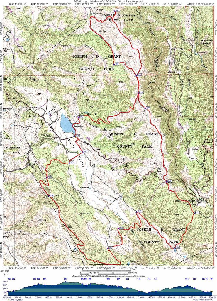
372. Grant Park Big Loop (02/14/04)
Hikers (6): Janice, Nancy, Padraig, Ross, Sparky, Steve
Distance: 20 miles
Rating: 5 difficulty, 9 beauty
Park info: Grant Ranch County Park in East San Jose
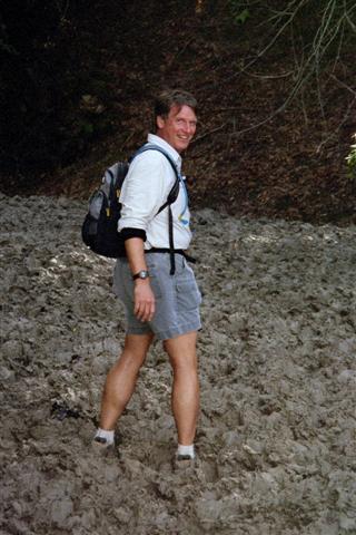
Write-up by Steve -- Pictures by Janice
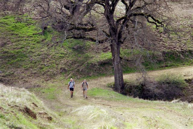
With Valentine upon us, it was time for the lonely hearts to take solace in the hills. I planned a new 20 mile loop of Grant Park, figuring I'd be the only one on it (particularly since many of the regulars were in Death Valley). Surprisingly, three other sad souls and a happy couple showed up to join the club.
1-2-3 INCH
Nancy, Padraig, and Janice had big plans that night, and had to be back by 6pm. Janice decided that we'd have no problem because we'd average 3 mph on the hike. That sounded rather aggressive, but we had a good group of people, so who knows? Plus, I had lovingly drawn out the hike in Topo and downloaded all the waypoints into my GPS unit. Thus, we couldn't get too lost for long. Plus, as Ross pointed out, you can usually see Grant Lake, so you always know where to go if things fall apart. . .
That being said, despite the park map and topo map both suggesting otherwise, I believed the first trail sign I saw and took a quick right. This took us to the fabulous McCreery Lake, the smaller brother of Grant Lake. That was great, but it wasn't where we intended to go, so we just headed off-trail (straight up a hill) to where we ultimately wanted to be. This was Sparky's idea, and a good one, but we were already panting heavily by the time we found the trail, and we had gone a total of one mile. 19 more to go. We waited for Nancy to catch up (it was pretty steep), and I reminded her that she had big plans that night (3 mph!).
After a few miles of hiking we reached the Line Shack, which is being mysteriously rebuilt. The maps at the park (and all the signs) still call it "Line Shack", but the on-line map now calls it "Deer Camp". Although we did see some deer later, they weren't hanging out in their camp this particular morning. Not far from the Shack, I decided to go off-trail again and trudged up the side of the hill leading to Antler Point--we had a schedule to keep! Although we all got there well before noon, we still enjoyed lunch at this highest point in the park (2995 ft). The good news was that the next section of the hike was mostly downhill. The bad news was we still had 15 miles to go. "One quarter done!" said the ever-optimistic Padraig.
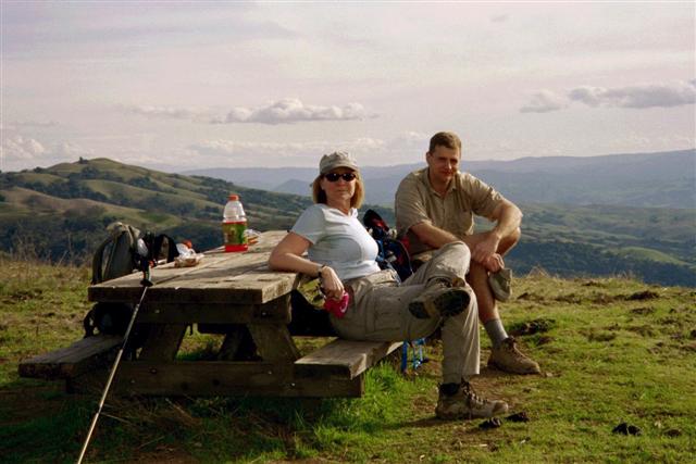
After winding through a few herds of cows (including a few who were baying menacingly at us), we reached the high point on the west side of the park. Two couples were already there, apparently having a picnic on the sole table. They saw Ross, Padraig, and I milling about and invited us to take seats since they were leaving. I jokingly said I'd like one of their beers more than a seat, and one of the women said, "No beer left, but I have this bottle of wine if you want it?" Score! Now I could drink my Valentine's Day into oblivion (OK, not really, because it was one of those single-serving sort of bottles). We took the table and had a picnic of our own. This was the 17.5 mile mark. Surprisingly, we weren't much below Janice's 3 mph pace.
By the time we got back to the cars, Nancy was all smiles, as we had gotten back WAY earlier than her deadline. In fact, as I was driving off, she was still happily sitting in her trunk, kicking back and enjoying all the time she had left. All said and done, we were tired, but on this relatively cool day, it was a low level 5. If we were to return in the summer, I bet this would be a deadly 5.
One sad note: Padraig really wanted to see some wild boar, but we never ran across any. I have seen them in this park more than any other, and the grounds are torn up all over the place from their presence. The people we met at the top suggested coming out around 5 or 6am--one of the women lived on a nearby ranch, so presumably she knows her pigs.
![]()
![]()
Pages maintained by Steve Walstra,
Peter Saviz, and
Russell Gee.
©2026 Intrepid Northern California Hikers