
| Main Page | Diary | Leaves | Stats |

589. Priest Rock Trail (11/04/07)
Hikers (27): Ana, Arlene, Clive, David, Diane, George, Greta, Harvey, Helen, Hima, Iyad, Janice, Judy, Kate, Linda L, Mikael, Nani, Padraig, Paul, Peter, Peter Es, Rudi, Russ, Sarah, Sparky, Steve, Tom B
Distance: 8 miles
Rating: 3 difficulty, 9 beauty
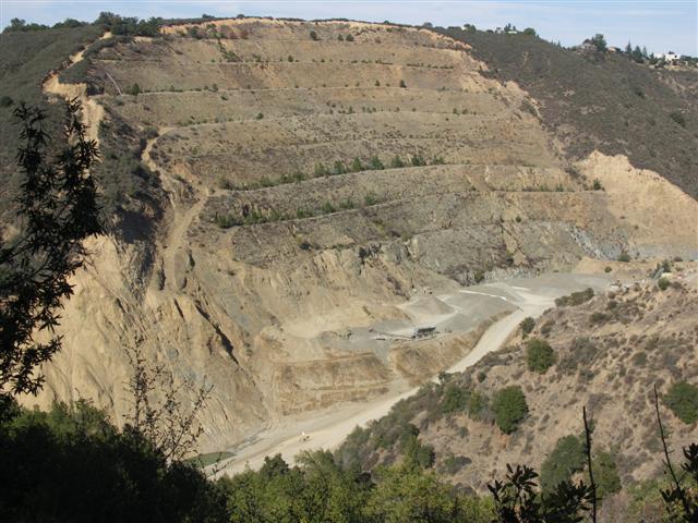
Park info: Sierra Azul Open Space Preserve near Los Gatos
Write-up by Peter and George -- Pictures by Steve
It was just one week after the grueling hike in Death Valley, and there was a big game on that afternoon, so I decided to choose something short and sweet for a Sunday morning hike. As expected, there was a pretty big turnout, and everyone was raring to go, so without further ado …
1, 2, 3, … INCH!
… and we were off! Most of the group decided to climb over the gate at the foot of the trail, but some of the savvy old veterans (Sparky, Dave, and myself) chose to go around. This put us near the back of the pack, but Dave and I soon made our way up near the front. I don’t know if was that I’d become used to doing harder hikes or was motivated to get back early, but whatever the reason, I found myself going at a much faster pace than usual. Pretty soon, I found myself out in front of the pack, trailing only Steve, who was off somewhere geo-caching. Before I get too cocky, I should also note that some of our faster hikers, such as Ross and Sabine, were not on this hike.
I was hiking by myself for most of the trail, so I don’t have much interesting to say – no juicy gossip, no funny anecdotes. At around the halfway point, where the trail passes under the power lines, I looked back over to the left and saw a nice view of the valley, but there was no time to stop and enjoy it – gotta keep moving. I kept pounding my way up the hill. The last quarter-mile uphill was a bitch, as usual, but it was good to get it over with. I made it to the top in 1:08. Steve’s GPS showed the distance as 3.84 miles, so that put my pace at 3.4 mph – not bad (for me), considering it was all uphill. Maybe I should leave the poles at home more often.
The rest of the motley crew began to appear shortly. Most did not question the INCH tradition of touching the sign at the intersection to designate having gone all the way to the top, except for Nani and Hima, who steadfastly refused. Must be an Indian thing. The Death Valley crew recreated a memorable highlight from their trip and posed for a photo with George’s bottles of urine samples (ask him all about it), and then it was time to hit the road.
The official hike was just to the top of the hill and back, but some of the hardcore members could not fathom doing such a short hike, and so they went off and did extra trail. Steve did a longer loop, and George, Harvey, and Helen went to Mt. Umunhum. George’s write-up is below. As for me, I went home to sit on the couch, eat fatty snacks and drink cold beer, and watch the game. Unfortunately the damn Patriots won, but other than that, it was a good day.
George’s write-up:
Just wanted to give you some of the details of this hike. Note - a nice addition/change to the Priest Rock hike would be to continue over to Mt. El Sombroso, then take the Limekiln trail back down three miles to where it intersects with the Priest Rock Trail. It adds a few miles, adds a non-trivial amount of climbing - several steep ups-and-downs on the way to Sombroso. And Limekiln is a much gentler downhill than the initial drop from Priest Rock.
The extra up and down climbing over to Mt. El Sombroso added about 1000 feet I think, I'd have to verify it again, but it was a surprising amount. After the drop down from El Sombroso and the long flat winding canyon trail we started up Barlow Road heading up the western flank of Mt Um. It circles around to the northwest corner, and that is where you catch Guadalupe Creek.
Almost immediately we saw a very steep slippery dirt trail heading up away from the creek, and of course like an idiot I thought it must be the trail. Never been up anything quite that slippery and steep. Helen was digging in with her hands to get enough purchase to move uphill. Piles of scree made up of very small pieces were continually sliding down as we ascended. It wasn't long before we realized it was a dead-end and had to go back down. I have a video of Harvey skiing down.
Like the directions said, we stayed in the creek bed. It was dry, so just a matter of walking on rocks. Much easier than Kelly Cabin Canyon, not hard at all. In two places we had to do minor climbing, or go up the hillside to get around something, but nothing bad. As the directions said we kept bearing left at any forks. Finally the creek started heading west and we knew we were getting closer. Up above we could start to see a rocky slope above. BTW - it was very cool in the creek canyon on the way up and down.
We seemed to hit a natural spot to jump out of the creek and just climb the mountain. I chose to go left on grassy bushy slopes as opposed to the right side which went up rocky gravelly dirt slopes that looked dangerous. It turns out most people go up the rock/dirt slopes. I preferred the safer footing of grass and brush. However, at one point we hit a wall of brush that required serious bushwhacking and using my body as a ram to get through. It was rough. I thought on the way back we might try the creek itself, but there seems to be a big drop right at the top and that is why people go off either side. On the way back I decided to crash through the brush rather than go down that rocky dirt slope.
Helen stopped where the heavy bushwhacking started. Harvey and I got through it and back into the creek again. It turns out the creek literally winds its way up to the concrete block building. The reading I had done talked about having to circle the top following the fence line until you find a hole in the fence. Nope, we went straight up the creek and hit the fence, and there was a hole. Very easy to find. It was obvious where to go at that point, just head for the building.
The trip down the creek was much quicker, but still hard on the legs, knees and feet. Finally back on the trail we used Tecnu just in case. We ran out of light just as we finished running most of the way downhill on Limekiln Trail. When we turned left onto Priest Rock Trail it was time for the headlamps. Good thing all three of us had lights. However, Helen stepped on a rock while looking for the mythical Dan and managed to twist her ankle pretty good.
Back at the road, the rangers cruised by Rudi, and wanted to know who had ticketed his car. It was Greta's card, and when the saw the decorations they seemed to like it and went away and didn't bother Rudi anymore. I took pictures of Greta's handiwork in the dark. Rudi and I stopped at In-N-Out of course, so I'm fine now.
Final stats: 22 miles, 6755 foot gain, 7:35 moving time, 1:58 stopped time, 3.1 mph moving average. Felt like a level 6 to me when you include the hike up the creek, crashing through brush near the top, and the final bit of scree to attain the summit.
Milestones:
Ana's 1st leaf
Peter Es's 1st leaf
Sarah's 20th leaf
![]()
![]()
Pages maintained by Steve Walstra,
Peter Saviz, and
Russell Gee.
©2026 Intrepid Northern California Hikers