
| Main Page | Diary | Leaves | Stats |

755. Garland Ranch (12/11/10)
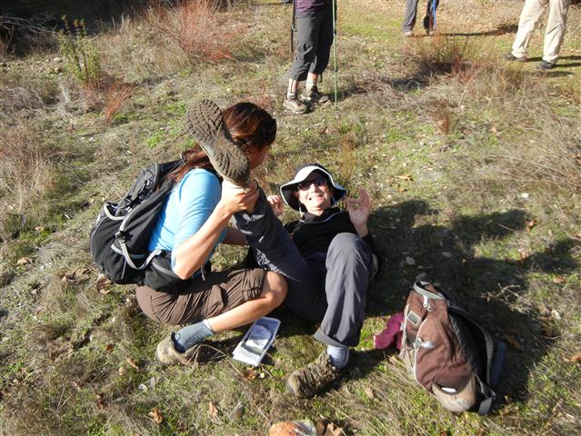
Hikers (23): Angelika, Diane, Gavin, Iris, Jeff, John, Karl, Kirk, Mike, Paul, Peter M, Robert, Ross, Rudi, Sarah, Shuli, Sophie, Steve, Susan, Thomas, Tiffany, Wendy, Yipeng
Distance: 21 miles
Rating: 5 difficulty, 9 beauty
Park info: Garland Ranch in Carmel Valley
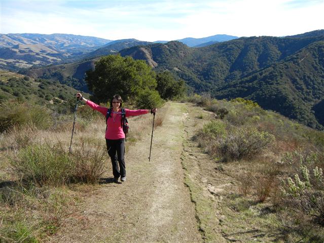
Write-up by Steve -- Pictures by Karl
For my 600th hike, I wanted something new. Many moons ago, ex-INCHer Nani had recommended Garland Ranch. At first glance, the park looked too small for the long drive. Over the years, I'd run across it again, check it out, and table it. When I ran across this park again recently, I took another look. Checking around online, I saw lots of people commenting "tough hike" and "so steep", but what do they know? When I overlaid the park map on Google Earth, it really did look steep. . .still, just in case, I decided to string together all the steepest sections just in case it turned out to be unexpectedly weak (like Fremont Peak). Before sending out the notice, I upped it from a "4" to a "4.25" because I was starting to believe it might actually be hard. Despite my attempt to scare people off, 22 people showed up.
1, 2, 3 INCH!
The bridge to the main entrance was washed out, so we had to do a slight detour to start the hike. There were lots of little trails at the beginning, but the Garland map has a convenient blow-up of this area, which I included in our map. We threaded our way through this section and were soon on the main trails. Maple Canyon to Sage to Sky and up to awesomely named Snively's Ridge. This was the first climb of the day, and I thought it was just fine. Diane mentioned it was steep, but I thought she was being sarcastic since she was passing me as she said it.
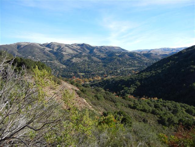
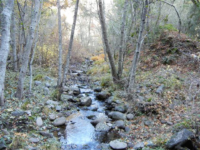
There was a brand new junction sign at Snively's Ridge, and we hooked a left there. I heard Jeff thought we had gone off to the tower (Pinyon Peak). Apparently Shuli went with, as would be the theme for the day. Going the correct way was down, down, down the ridge to Garzas Canyon. We could see a steep trail heading up the next ridge, starting far below us--this park was looking good! Soon we were at the Redwood Canyon junction, where we followed a creek for a bit. A few creek crossings later, we headed up a gentle canyon filled with redwoods, as advertised. Great park.
After enjoying the shady redwoods for a bit, the trail crosses over to the main East Ridge, which we took upward for the second big climb of the day. I started picking up geocaches along this route and the front runners all passed on by. Eventually we headed down Cougar Ridge and, again, in the distance, was another good-looking climb in the Kahn Ranch addition (don't believe all the comments about "need a permit for Kahn Ranch"--that only applies if you lamely drive there).
Was very happy to see water on tap down at the Kahn entrance. It was only slightly warm, but I was feeling thirsty and was already conserving water. I filled up on water and topped off my 3L camelback. As I was finishing, it occurred to me how much smarter it would be to finish the Hitchcock Loop first and fill up on the way out, but. . .what the hell, I was already done. The climbing was almost over, right?
There were plenty of caches in this part of the park too. I knew I was hiking OK because I was able to keep up with the pack while logging caches along the way. Near the top of this third (and thankfully mostly shaded) climb, I encountered most of the front pack of INCHers sitting down having a nice lunch (only Ross, Diane, and Kirk were missing). Being a courteous hike leader, I grunted or something and kept going--many more caches to do and was barely going fast enough to get out before sunset.
While heading downhill, I enjoyed the inscription on one of the many benches in the park. It said "Getting old isn't for sissies" commemorating Dick Merrill's 70th birthday. Further down the trail I ran into Paul, then Iris, then Jeff, and finally Shuli, all going the wrong direction. Paul had accidentally gone the wrong way--Jeff, Iris, and Shuli purposely went the wrong way in order to head-off Gavin in the other direction. Both Shuli and Iris used this reason as if it were perfectly logical for them. Gavin has that effect on women, as I saw other kind ladies of INCH fattening him up back at the start of Hitchcock Loop (in the correct direction).
After a quick stop at Fern Falls which, despite reports otherwise, had water falling (or trickling, anyway), it was up Cougar Ridge for the fourth steep climb of the day. For whatever reason, despite being in the middle of a cold, I was zooming up the trail now. The slope, temperature, and shade were all just right. When I hit the junction for Vasquez, I knew (or thought, anyway) the hike was almost over. I caught a glimpse in the far distance of someone, so picked up the pace a bit. Down I went to the River Trail, where I discovered the glimpse was Kirk.
I would learn later that this is roughly where Tiffany decided to wade across the river and catch a ride back to the start! Hmmmm. I smell Black Leaf. . .but since it was advertised it as a 4 but turned out to be a 5, I decided to be merciful. Would also learn later--happily--that Thomas and Angelika had turned back. By this time in the hike, I was really worried about them getting back. . .but I digress!
Eventually caught up to Kirk as we sidestepped several equestrians. Neither of us was particularly chatty, so I passed him quietly while going up Garzas Canyon. I stopped at the Terrace Trail junction to check my map. Kirk came up, paused briefly, and headed down the wrong trail without a word. I finally broke the silence and talked him into going the correct way. Why do we make these maps?
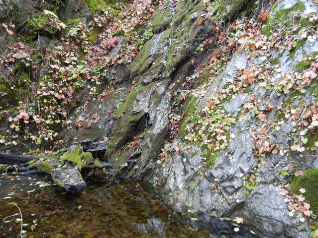
Garzas Canyon was the fifth climb of the day. It's nothing like the other four, but it's not zero either, and was happy when it started going down to La Mesa. From there I took the waterfall trail down to the second waterfall of the day, which was even drier than the first. Still, it was a nice-looking steep-walled rock area (I would hear later it was cool-looking in the dark, too). The sun was starting to set, so I started digging arrows everywhere. When I got to the visitor center, I even made a set of arrows that went to the washed out bridge. . .D'oh!. . .Had to retrace my steps, erase the errant arrows, and try again.
Back at the parking lot, I was surprised to see Tiffany and Sarah. Tiffany's shameful story has been told already. Sarah said she started cramping in Kahn Ranch so chose to hike back on the paved roads rather than climb Cougar Trail. . .but at least she made it back on her own two feet. Well, that's pretty lame too, but I guess in both cases, it was better than calling search and rescue. Not much later, Kirk came in, after which it was officially night.
I was glad to have carpooled in my own car this time, so didn't have to wait to have access to clean clothes. Better yet, my carpool partner was Iris, who had made hot soup. Along with everyone else's food, we were able to chow down while waiting for the troops to roll in. Every fifteen minutes or so, a headlamp or two would be spotted and a few people would come in. It was actually great to see so many light sources--INCHers are prepared!
Everyone made it back in high spirits. It was actually a great new park and a worthy 600th. Next time, maybe we'll take an easier route and start earlier. . .Just kidding.
Milestones:
Diane's 190th leaf
Karl's 60th leaf
Shuli's 20th leaf
Sophie's 1st leaf
Steve's 6th forest
Susan's 20th leaf
Yipeng's 20th leaf
![]()
![]()
Pages maintained by Steve Walstra,
Peter Saviz, and
Russell Gee.
©2026 Intrepid Northern California Hikers