
| Main Page | Diary | Leaves | Stats |

939. Relay and Rose Peak Loop (07/26/14)
Hikers (7): Brad, Carol, Chinyet, Hailong, Mikael, Sabine, Steve
Distance: 18 miles
Rating: 5 difficulty, 10 beauty
Park info: Mt. Rose Wilderness in Lake Tahoe
Write-up by Steve -- Pictures by Eric L, Carol SC and Steve
Many people had been requesting a Tahoe hike, and I had some high altitude hiking to do the next week, so some so seemed like the perfect time to visit some 10k ft Tahoe peaks. While looking for somewhere new to hike, I noticed Mt. Rose, which is also a Nevada county high point. Better yet, after some more sleuthing at the Garmin Connect website, I found there was a use trail that would let us make the hike into mostly a loop.
1-2-3 INCH!
We technically had something like 13 people signed up, if including Mikael's family. But by the end, we only had 7 people complete the hike, and only five of them did it "properly" (as per the map). This is because Mikael started late, Carol Sc showed up late (some story about a leaky bladder), and Sarah and Tiffany bailed half-way.
Well, the good news was that the mystery route to circle behind Relay Peak totally worked, and the trail was in good repair. The bad news was that there was no way the latecomers would find the right route, as the trails weren't marked in the slightest.
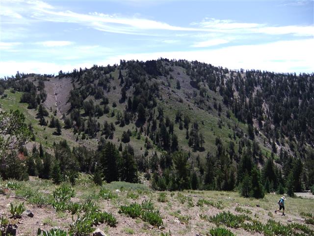
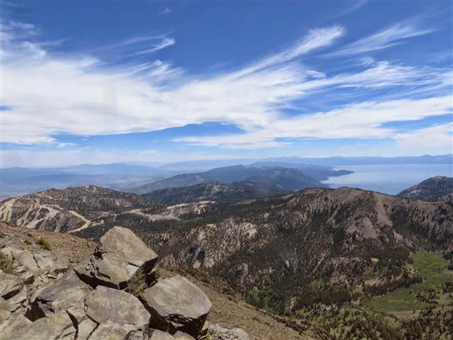
The unofficial trail had the best view of Lake Tahoe just before we reached the TRT. It was also quite a steep trail, which left a gap between the front and back hikers. We waited at the junction for a long time until spotting Tiffany. It was the last time most of us would see her.
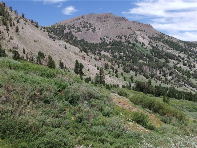
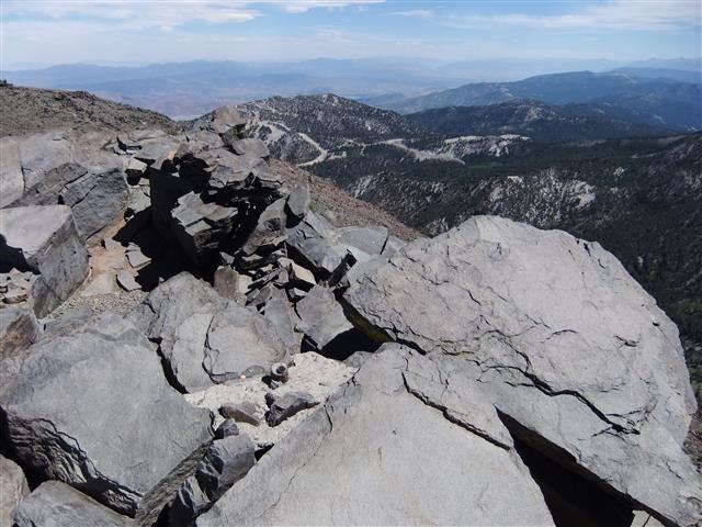
Not too much later, we are atop Relay Peak, named after the microwave relay tower that is in the saddle between Relay Peak and Mt. Houghton. Mt. Houghton, it turns out, is the fifth highest peak in the Tahoe Basin, so I had written on the map that anyone ahead of me had to hike to Mt. Houghton, which I read had a use trial leading to the summit (with only an additional 300 ft of elevation gain).
After a little geocaching, I frantically tried to catch up with the front of the pack to make sure they wouldn't overshoot the route to Mt. Houghton. But there they were, eagerly waiting at exactly the right location. Brad had coyly dropped behind me so he could skip the "optional" summit, but he also didn't know where we were for sure, so when I said "come this way", he came along. Not too much later, he realized he was going on the optional path and claimed I tricked him. Who doesn't want to bag a summit?
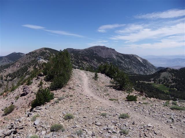
Much to my surprise, the trail to the summit was fairly well built. . .and marked with TRT flags. About a third of the way there, we ran into a group of people who were helping to build that very trail. They said we'd need to take the old use trail for the rest of the way, and pointed the way. There were still flags where the new trail was going to go, but it was easier to follow the old trail, even though it was steeper. Soon we were on the summit.
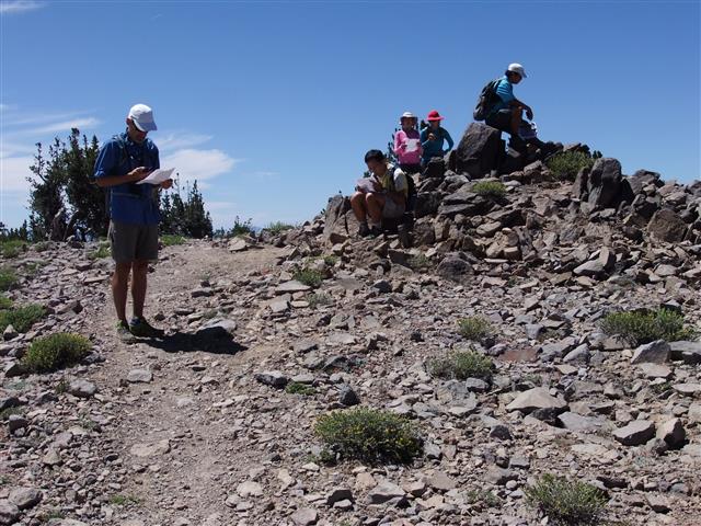
I went along the ridge to another prominent point just to make sure I could claim the summit, and then headed on back to catch everyone. Back at the junction, I was surprised to see everyone talking to Carol Sc, who had found her own route to Relay, and happened to cross our path. All the data suggested she did all the altitude gain/pain, so she got the leaf.
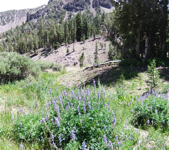
Down, down, down we went into the valley between Mt. Houghton and Mt. Rose. There were many springs and creeks in the area (and a nice waterfall), providing water for many blankets of flowers. We would learn later that Sarah and Tiffany bailed here due to lack of water. . .and the fact that it was turning into a hard hike.
Unlike the start of the day, there were tons of people going up and coming down the Mt. Rose trail. I was the last one to the summit and definitely not breaking any records (but I was geocaching), and ran into Mikael coming down. He said he was going finish the hike in reverse after dropping off his kids at the waterfall. I thought this would be impossible considering (1) it had taken him this long to get to Mt. Rose compared to us doing Relay, Houghton, and Rose and (2) he'd have to find that use trail back. Well, he sent me his track afterwards and, indeed, he found the right trail (for the most part) and got picked up by his family at the bottom (instead of hiking back to the start) late in the day. Close enough in this case, so he got a leaf, too. Must be the thin air making me soft.
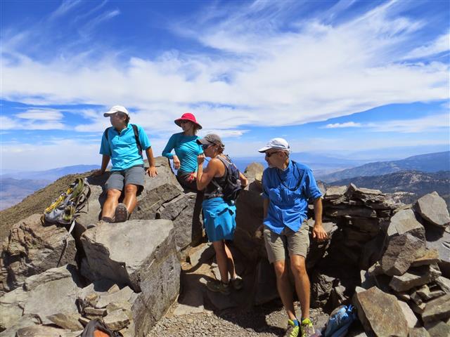
There was a mob of young kids at the true summit the entire time we were there. Once the INCH contingent disbanded, I went off to do a geocache in the other direction and, upon my return, the peak was clear. So I tagged the true summit and headed back down. As it turned out, there was still a little elevation gain at the end to get around Tamarack Peak. I was really getting tired of hiking at this point, and was dismayed when the GPS reminded me that it was still a mile to the car (as the crow flies). Glad to be done.
Well, it was definitely an unexpectedly hard hike (relative to my initial rating). Turned out to be in the high 4k ft of elevation gain, which Hailong pointed out was well above my low-balled 3k ft estimate in the morning. Still, 18 miles with 4.8k ft of elevation is hardly worthy of a 5, and yet I was beat. And everyone else was beat. So I called it a 5.
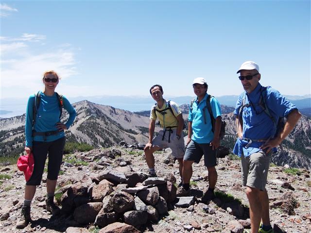
5 out of 7 people did Mt. Houghton, giving us the third (Rose), fifth (Houghton), and sixth (Relay) highest peaks in the Tahoe Basin. Five years ago INCH did the first (Freel) and second (Job's Sister) highest peaks. Guess we need to go to Tahoe one more time to hike Job's Peak (#4 on the list).
Later that night, no one would believe that the pass (where we parked) is called Mount Rose Summit. It is!
Milestones:
Highest point in Washoe, NV county
Carol's 10th leaf
Sabine's 210th leaf
![]()
![]()
Pages maintained by Steve Walstra,
Peter Saviz, and
Russell Gee.
©2026 Intrepid Northern California Hikers