
| Main Page | Diary | Leaves | Stats |

1108. BART2BART 2 (11/11/17)
Hikers (12): Alan, Bjorn, Chinyet, Hailong, Jim, Manfred, Sarbinder, Shuli, Sophie, Steve, Susan S, Theresa
Distance: 25 miles
Rating: 4 difficulty, 7 beauty
Park info: Tilden Regional Park
Write-up by Steve -- Pictures by Everyone
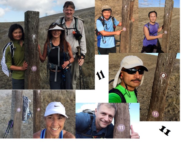
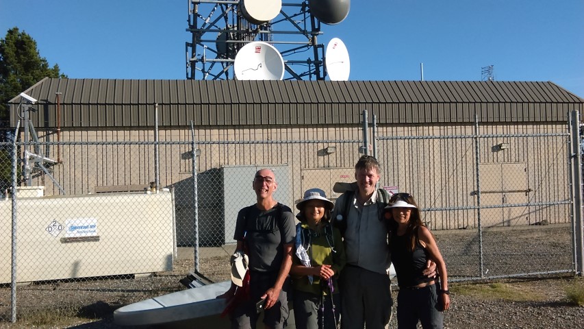
BART to BART hikes are fun, and it seems like there should be plenty of variants. However, most of the BART stations end up with long approaches through neighborhoods and unclear ways to get from those neighborhoods into the parks. A few weeks ago I noticed that Orinda BART has a perfectly good trail nearby--a trail that we'd passed previously while doing the East Bay Skyline Trail. Just when I was going to schedule a new B2B hike, I noticed the crucial trail was temporarily closed. But no problem, it would be open the next time my hike was up. That date was 11/11--Chinese Singles Day! I'm the American poster child for 光棍. To celebrate, I asked everyone to take a picture at post #11 in Briones.
Well, the days are short in November, so had to get an early start. I didn't expect a big turn out for a (listed) 24 mile hike with a tight deadline. Not only was this true, but people started signing off as the date approached. Oh no! We've become Meetup!
I started the day a few minutes before 7am at the new BART station in Warm Springs (a.k.a. South Fremont). I was worried about being late, so ended up getting there one train early. Because of that, I ended up in Lafayette one train early as well, which was already earlier than necessary. Alan was on the same train, but he'd gotten on at the previous stop (Orinda). I told him which side of the BART station the hike started from, and promptly went the other way to explore downtown Lafayette (and find some coffee to keep busy since it was still early).
That adventure was successful, so I walked back to the BART station, where I saw several INCHers inside. They were all surprised as I walked into the BART station, with Chinyet commenting how rich I was. I didn't catch on to their "shock" because I figured the ticketing system would be able to tell (based on the time stamp) if I just walked through the station. But, nope, they were right! I couldn't exit, because my BART card didn't have enough money on it. But, since the heavens smile on INCH, the local BART attendant had heard all the commotion when I stupidly walked in, and refunded my ticket. Lesson learned for free!
1-2-3 INCH
We started slightly late, but were still missing Jim and Shuli. Tough luck! But they saw us as we were leaving, and managed to catch up before we made any surprise turns on the atypical residential access route we took. It wasn't too long until we were steeply climbing an unmarked (on the Briones map) trail to reach the Lafayette Trail. At this point, I could still see Chinyet, Hailong, and Sarbinder. Bjorn was just ahead of me. But that was the last time I'd see them before the end of the hike, except for one remote view of Bjorn as I was coming down from Briones Peak (because you can see pretty far).
The route was pretty simple at the start: take the entirety of the Briones Crest Trail. But there was an alternate "shorter, but steeper" trek at one point up to Flat Top peak, which some of the front-runners took (not sure about the people in the rear). I stopped by Briones Peak, which is a short detour. Turns out Sarbinder went there as well, and took a nearly identical picture.
From there, it was a long, undulating ridge route. Along the way was post #11, where everyone needed to take a picture. I received (in timestamp order): Chinyet, Sarbinder, Hailong, Steve, Susan S, Sophie, Shuli, Theresa, Manfred, Jim (implied). Alan was with Sophie and camera issues. Bjorn is apparently oblivious to the goal, but saw him on the right path.
I'd never gone down the final segment of Briones Crest Trail, so was happy to touch some new trail. The drawback of going that way is that you miss Briones Park's parking lot, and associated water. It was a cool day, so the water wasn't a problem.
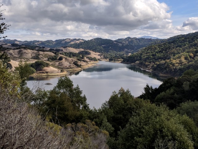
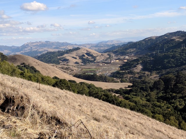
From there, we took the short way around Briones Reservoir. Someone complained that this section is boringly flat. That's true, but I can only say that the route around the other side is equally flat over twice as long. Along the way was the second optional "shorter but steeper" route. I found it, and promptly took it the wrong way up to the road, making more elevation than intended. I didn't see any footprints along the (correct) route, so might have been the only one who caught this "closed" section of road. All in all, didn't save any time, but it did go higher for a slightly better view of the reservoir.
Eventually one reaches the edge of the reservoir and heads down along the spillway. The route is not very well traveled, but there isn't anywhere else to go. You get the "is this right?" feeling, but never the "this is wrong" feeling. At some point, it becomes an obvious old fireroad and everything falls into place.
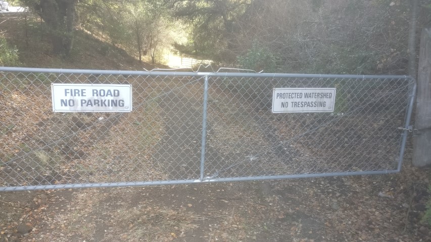
That fireroad crosses a paved road, and leads to an obvious gate with an EBMUD sign. Soon, the "trail" takes a turn and passes some picnic tables. . .but that's not really the trail, it's the much more used access road(the picnic tables are really misleading). They need to erect a small sign here, as we have someone miss this junction every time. Anyway, I had picked up some sticks to leave an arrow at the key location, but when I got there, I found Sarbinder had already made a big arrow there. Great! Left a second arrow. INCH will not get lost today!
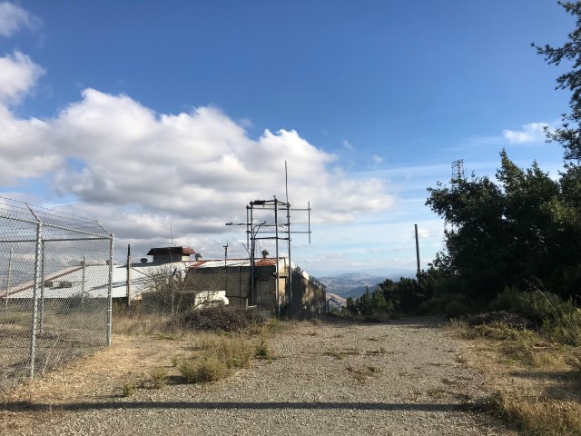
Eventually one reaches "Old San Pablo" trail, which takes you to Inspiration Trail and into Tilden Regional Park. This was the location for the final "shorter but steeper" option. From that intersection, I walked down San Pablo Dam Road .15 miles to reach a gate and a steep dirt road that heads up to Inspiration Point in a rather direct manner. But all in all, it wasn't too bad on this cool day. Soon, I was under the parking lot at Inspiration Point, which, despite passing nearby a dozen times, I'd never visited. It was inspiring.
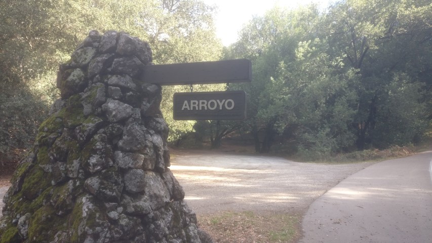
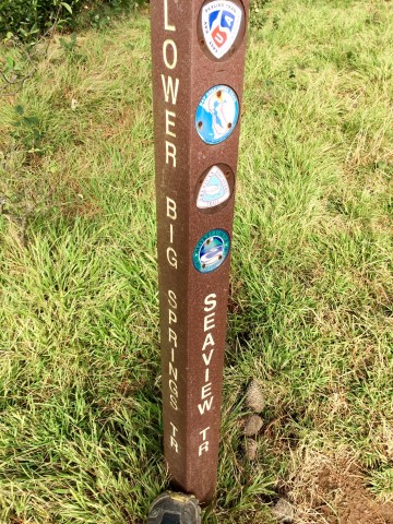
From here, the route gets a little trickier, going down Curran Trail a little, then up Seaview, and down Big Springs and Quarry Trails. After that, it was a very short walk on the road to the Arroyo picnic area. There were no cars there, and it's marked Big Springs on the map, but the giant sign says Arroyo.
Vollmer and Arroyo trail start from here, and yet it's doubtful either one gets much visitation from this trailhead since there are more convenient (i.e. easier) trailhead elsewhere. I could not help but think this would be a great place to have a picnic (and a hike). . .if I did that sort of thing. Whatever the case, the Arroyo Trail goes along an arroyo almost all the way to the top. It is unrelenting in its ascent, which was great.
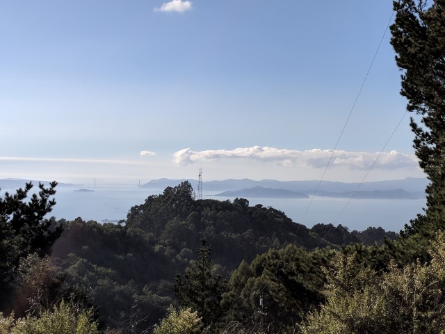
Reconnected with the Seaview Trail for a short bit and then headed up to Vollmer Peak where I ran into. . .Arlene, Kevin, and Nagendra! They'd started from Bear Creak area, skipping Briones Regional Park, but getting the rest of the hike in. Good job! No Leaf! Despite Sarah saying otherwise, the summit of Vollmer Peak has some great views, but you have to seek them out. It's mostly covered in trees and towers--several groups of them, actually. The highest point seems to be between two independent fence lines protecting various pieces of property. So you can walk to it, but your view is "fence" in all directions. But on the periphery, views are good.
Took some pictures and headed back down Vollmer Peak Trail and finally out of Tilden Park (leaving arrows where I could) and onto the East Bay Skyline Trail that heads through EBMUD. I'd been here several times, and was happy to finally take the new-to-INCH De Laveaga Trail down to Orinda. Almost done!
There is a "surprise" uphill on the way down, but the first third of the route is quite nice. I visited several geocaches along the way. The second third of the trail has been "upgraded" to hard rock because a fairly large landslide took out a power tower, so they upgraded all the towers in the area (which presumably required heavy vehicles, which lead to the road improvement). That pounding route was hard on the feet after 22 miles or so. . .
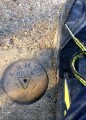
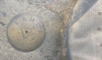
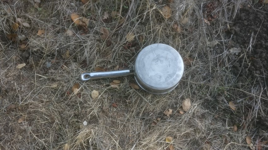
I was happy to reach the third section of the De Laveaga Trail, which had a sign warning about Orinda vandalism issues. Since this was not on the hard-rock road, it was a pleasant descent. But I was wrong to ignore the signs--this is where I discovered Orinda's terrible secret!
After that dangerous run-in, I was soon crossing the street to take the pedestrian overpass (and later underpass) to the BART station intersection, and eventually to the real destination: Fourth Bore Taproom, which is a reference to the Caldecott Tunnel. I had almost caught up to Arlene/Kevin/Nagendra just before crossing the street (they didn't cross).
At the Fourth Bore, the front-runners had already secured a table outside. I went to the restroom to change into a full set of new clothes that I'd lugged the whole way. I felt clean and happy to hang out for a while, knowing I still had an hour of train ride left at the end.
As I returned from the clothes change, who should walk in but Mike! He'd skipped the hike, but had recommended this location (indeed, it was the unanimous recommendation from East Bay folks. . .perhaps because it's the only game in town). We liberated a second outdoor table to get ready for more INCHers coming in. Ten minutes later, it was noted that Arlene's crew still hadn't shown up (a surprise since Kevin had also suggested this place). We eventually guessed they had to drive back to their cars, which was later proven to be the case. Mike commented that the road to the Bear Creek was miserably windy.
Long story short, everyone but Alan made a showing at the Fourth Bore, plus five non-hikers (Rainer being the fifth). So the party was bigger than the hike, and we ended up with about a third of the outdoor seating. We hung out quite a while, finally being driven away by the live music (which, incidentally, wasn't that bad--certainly better than the service!).
On the BART ride back, I had the pleasure of listening to two drug dealers discussing their business. It was really interesting!
Milestones:
Sophie's 250th leaf
![]()
![]()
Pages maintained by Steve Walstra,
Peter Saviz, and
Russell Gee.
©2026 Intrepid Northern California Hikers