
| Main Page | Diary | Leaves | Stats |

1137. Magnificent 7 Challenge (06/16/18)
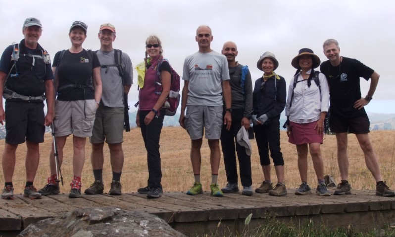
Hikers (9): David, Iris, Kristy, Mihail, Ross, Sarah, Sarbinder, Sparky, Steve
Distance: 19 miles
Rating: 2 difficulty, 8 beauty
Write-up by Steve -- Pictures by Steve and Iris
Santa Clara County Parks designed another Magnificent 7 Challenge for 2018. It looked easier than 2017. So easy, in fact, that I figured an entire hiking club could do it in a day.
I had planned it earlier in the year, when the days were shorter, so the timeline was tight. But every time it was my turn to lead a hike, the weather forecast was rain around the time of the hike. That would be unfortunate for the kind people who were driving. However, I did want to do it before the temperatures became too warm. . .
When Peter bailed out on his hike at the last minute, and the weather looked reasonably cool, I sent out The Challenge. 12 people signed up, although Sandy (the 10th) said he was going to go it alone, because he was afraid he'd hold up the show. Two more canceled the day before with similar concerns based on the rough schedule I proposed (for start and end times at each park). . .Could the rest of us do it all in a day? Such a challenge is limited by the slowest hiker, but INCH's slowest hiker is no snail.
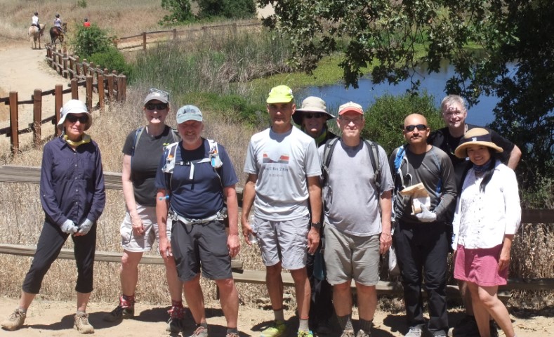
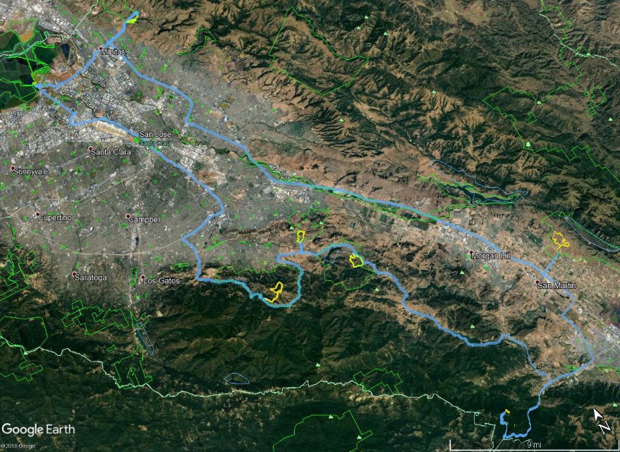
We met up for car-pooling just outside Alviso Slough, which would be the last hike of the day. Sparky was chatting up the ranger, so I walked over to break it up so the ranger could open the gate. But it turned out the Alviso gates are on a timer, so the ranger was waiting just like us. Once it opened at 8am on the dot, a few people moved their cars inside the park (street parking was still OK). We mostly left on schedule around 8:10am. Helen was driving a car [thanks to Helen for taking care of 1/3 of hikers!], so Sparky and I split the rest of the people. I had original envisioned a bigger turnout (with a two week warning), and was scared of a long carvan at the entrance points. That wouldn't be a problem now.
We got to the first park, Ed Levin, pretty quickly. Sparky took a wrong turn so showed up a bit late. Sandy was already there. David took his sweet time getting ready--the sense of urgency had yet to be developed.
1-2-3 INCH
We did a very quick and weak cheer. Didn't want anyone to expend too much energy early since we had six more to go.
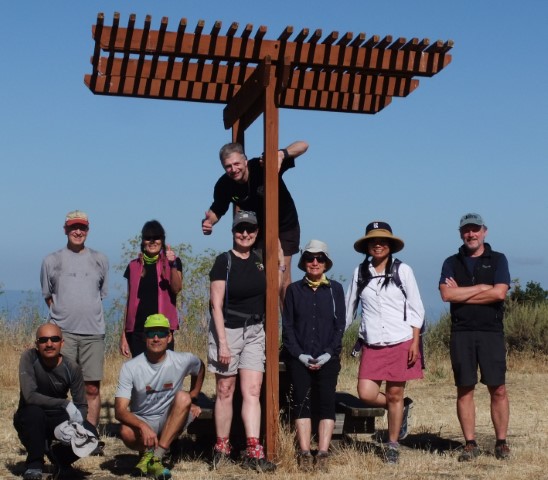
The path to the photo point was straightforward, and went through a section of Ed Levin that INCH had never visited (because it's in the opposite direction of Monument Peak). As was the theme for the day, we took the longer leg of the route to get to the picture point, giving plenty of time to set up the camera before everyone got there, and more likelihood we'd return to the cars around the same time.
It was a quick trip back to the car, with almost as much elevation gain as on the way up. Sarbinder pointed out that one section was as steep as Mt. Sizer's Shortcut Trail. . .except about 1.4 miles shorter.
We hopped in our cars and were off to the second location. Just kidding. Again, the sense of urgency had yet to develop. . .but everyone left ahead of the planned schedule, so things were looking good.
It was an estimated 45-minute drive down to Coyote Lake. Apparently everyone drank a lot of water along the way and felt the need to queue up at the restroom before we started. That being said, it was Ross who was the last to stroll in for our subdued cheer. . .
1-2-3 INCH
We've hiked in this area a few times, so there were no new trails. We waited at a confusing junction for the slow pokes to catch up. Looking back, I could see Kristy and David chatting away in the distant caboose position {my theory being that talking slows people down}, but they showed up slightly ahead of Iris at the junction, so couldn't get too riled up.
From there, it was a quick descent to a bridge over a muddy spring that represented the picture point.
Somewhere along this route, Sandy (who started just behind us) got slightly lost and would ultimately lose too much time to finish the penultimate park (Quicksilver). No leaf for him, but it was a solid decoupled attempt.
Despite the seemingly slow pace, we were still ahead of schedule at the end, and did a slightly better job on the transition. Off to Mt. Madonna summit!
As our cars climbed up the road to Mt. Madonna, we found the summit socked in clouds. On the plus side, the road wasn't busy, which had been a concern since it is a potential route to get to the coast/beach on a warm weekend. On the (very minimal) downside, it was unexpectedly chilly in the parking area. Fortunately, most people had a jacket of some sort. We waited for a few minutes until Sparky showed up. No rush--this was a quick hike.
1-2-3 INCH
It was beneficial to have all the junctions on a GPS, because the signage at some intersections was designed for the nature-trail map rather than the "Magnificent 7" map. We passed within eye-sight of the picture point twice while hiking the longer section part of the official loop.
This was certainly the most visually interesting of the picture locations. I set up a camera on a stone wall, zoomed in, then jumped down to get in the picture. For reference, last year's photo point in this park was the most ambiguous of the seven, and the hike was almost 5X longer.
We could see the white deer pen (which is/was an attraction in this park) on the way out, but not any deer. Not sure if they are still there, because it was too foggy to see far. From here, it was an estimated 45 minute drive to Calero along the full length of the scenic Uvas Road (and past Uvas Reservoir). Sparky was behind our car, and I'm guessing Helen's car might have gone to 101/Bailey, as it was already there when we arrived.
Another slow start due to the siren's call of restrooms, but we were still ahead of schedule. Another rapid, though vapid, cheer. . .
1-2-3 INCH
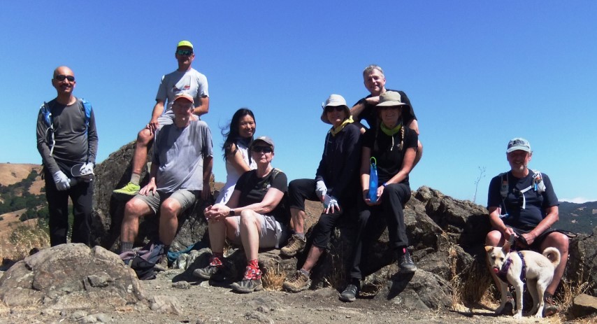
Calero is one of the better parks in the Santa Clara County system because it features plenty of fine hills, although the park is working hard to switchback the heck out of them. The prescribed route was fairly gentle already, coming in under 400ft of elevation gain in the short three miles. Unlike Madonna, Calero was blazing hot, which was making us worry about the later Quicksilver section, which was expected to be the hardest of the seven hikes.
After a long, sun-drenched stretch, the front runners waited in the shade at the junction of Figueroa and Peña for everyone to catch up. This coincided with three equestrians coming down another trail to our junction. We let them pass but. . .turns out our hiking pace was faster than the horses, so ended up catching them. They stopped for a minute to give us the lead. Whew--no one likes eating horse dust. They'd catch us at the picture point later (see below in the background).
We took pictures in the exact picture location, but one picture had people looking quizzical, and the other cropped out Ross. We took a third (below) just to the left of tree-sheltered picnic table with better lighting.
The picture spot was very close to the end of the hike, so we finished soon after. It was an estimated 15 minutes to Santa Teresa, and people were in the cars pretty quickly. The whole "game" aspect was finally catching on.
1-2-3 INCH
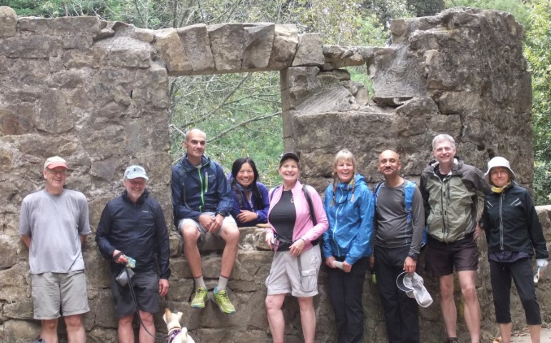
INCH has never started from this remote entrance to Santa Teresa, but we've hiked these trails in the distant past from the center of the park. The last time we started a hike in Santa Teresa was 2007, although we did visit it the the end of the (one time) Bay Area Ridge Trail route from Lexington to Santa Teresa in 2012. I remember that hike well, because it was supposed to be supported, but Chinyet and I reached the food stations before they had set up. . .Point being, with the exception of myself and Sparky, no one on this hike had done these trails with INCH, so that's fun.
It was still a bit warm, but a few breezes kept things reasonable. We again took the long leg of the route to the picture point. It was a long, gentle rise to get to the pile of rocks for the picture.
We could see the top of a nearby IBM building--part of the trail is an easement on IBM property. Iris was dismayed to notice, from the same vantage point, that we had to go down and then up to get back to the cars. That being said, the whole hike was less than 500ft of gain over a scant 2.6 miles.
This time, the cars filled up and departed quickly (once everyone got back) and we were on our way to what was expected to be the hardest hike of the day: Quicksilver. This was the first time I've ever driven to Quicksilver via Hicks Road from the south (out of New Almaden). It was sort weird to reach the four-way intersection (which includes Mt. Umunhum Road to the summit) coming from the "wrong" direction.
1-2-3 INCH!
This cheer we did loudly (hence the !), because it was the last challenge of the day. We already knew the hike was around 5 miles (as opposed to the 3.6 miles still listed on the map).
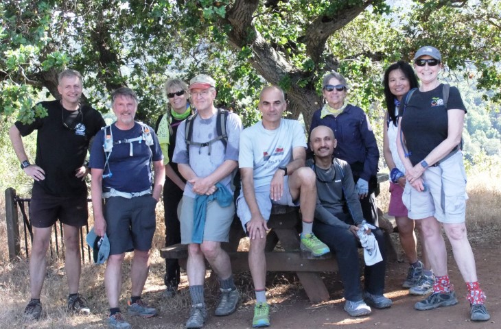
The bright sun was offset by a cool breeze, making the hike easy. We knocked out the 1.2 mile spur trail quickly and regrouped at the Mine Hill site where we learned about how they melted the cinnabar and collected the evaporated mercury. Later, at Alviso Slough (our last hike), we learned the old port there shipped out that very same mercury.
We continued uphill to reach the overlook that marked the picture point. This was the same place Sarbinder did his 151st shot less than a year ago.
We took a group picture and were happy to know it was mostly downhill from there. Despite being the most elevation gain for the day at around 850ft, no one found this to be particularly hard, despite coming near the end of a long day.
Hooray! All we had to do was drive to Alviso and do the easiest hike of the seven. For whatever reason, my carpool got to Alviso well before everyone else, despite leaving several minutes after Helen. Hmmmm. Maybe they stopped for coffee? We partook of the facilities then sat around until everyone showed up. From there, it was a quick hike to the picture point, where we were able to solicit a visitor to take our picture. (We hadn't had that opportunity all day)
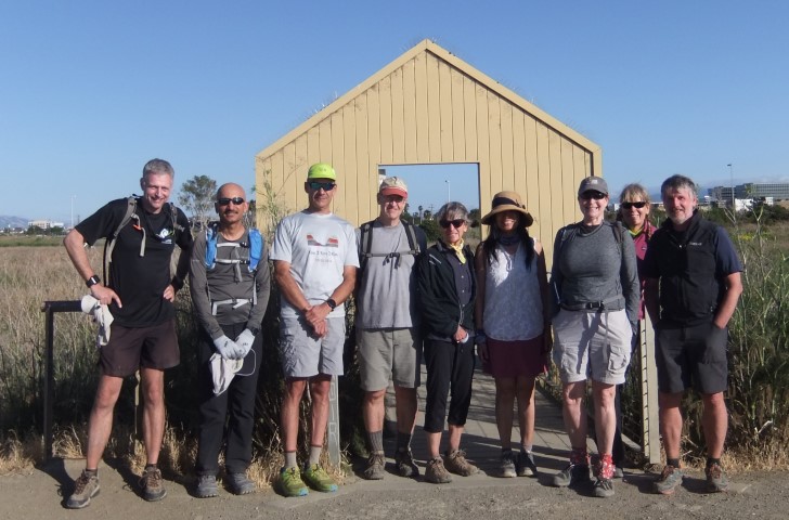
A tenth of a mile later, we were done at 6:25pm. So, from leaving Alviso in the morning at ~8:10am to finishing in Alviso at 6:25pm, we'd taken about 10 hours and 15 minutes. Of that, 19 miles of hiking took about 6 hours (for the front people) and 121 miles of driving took about 4 hours and 15 minutes, including transitions and waiting for the final hikers to get back to the cars.
We finished two hours before sunset, so had plenty of time to discuss the Challenge afterwards at a great post-party in the Alviso picnic area--thanks to everyone for bringing food/drinks {because, for this Challenge, I hadn't expected anyone to bring anything!}. Last year's challenge was 11 miles longer and 2.5k ft of elevation more difficult. Doing it solo, with optimal transitions and above-average speed, took almost 12 hours and required an alpine start. It would have been hard to pull that off with a group of people. Was it easier this year by design, or just random chance? We'll have to see what they do next year.
Thanks Santa Clara County Parks for a fun challenge!
Milestones:
Sarah's 390th leaf
![]()
![]()
Pages maintained by Steve Walstra,
Peter Saviz, and
Russell Gee.
©2026 Intrepid Northern California Hikers