
| Main Page | Diary | Leaves | Stats |

1227. Ramage Peak Trail (08/15/20)
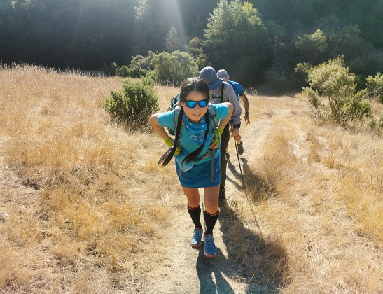
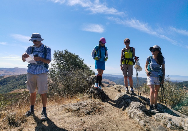
Hikers (15): Bjorn, Brad, Dong, George, Giulia, Helen, Iris F, Manfred, Mihail, Peter, Robert, Sandy F, Sarah, Sophie, Susan S
Distance: 19 miles
Rating: 4 difficulty, 8 beauty
Park info: East Bay Municipal Utility District near San Ramon
Write-up by Peter -- Pictures by Dong, George, Robert, Peter, and Adam
We knew it was going to be hot, but decided to go ahead anyway. Five people (George, Helen, Robert, Sandy, Sarah) were smart and started at the crack of dawn. Others were even smarter and declined the hike. Ten people who should have known better met up in the Chabot Staging Area at 8am. The last person -- who probably lives the closest to the trailhead but shall remain nameless -- showed up a little before 8:30 and we hit the trail.
1, 2, 3 ... INCH!
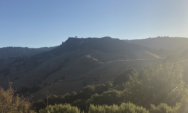
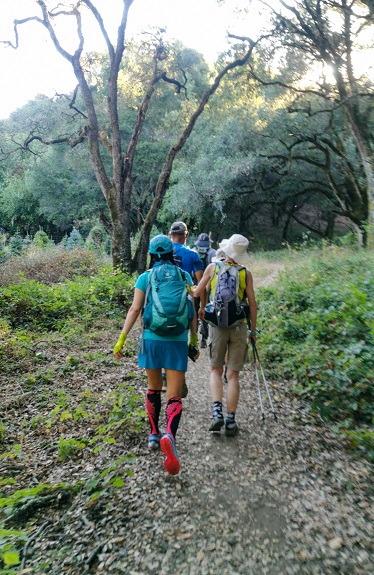
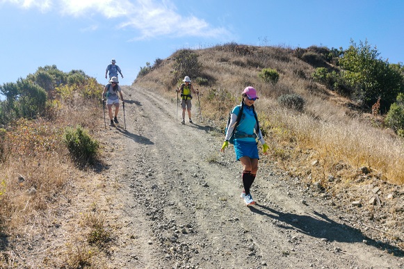
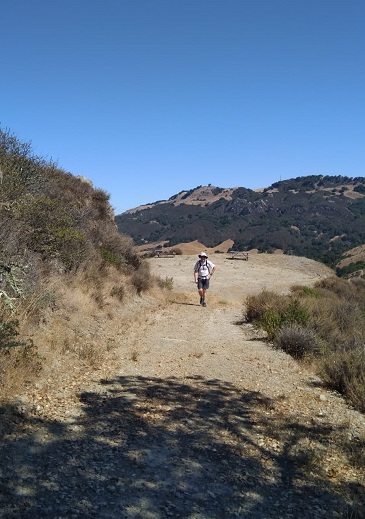
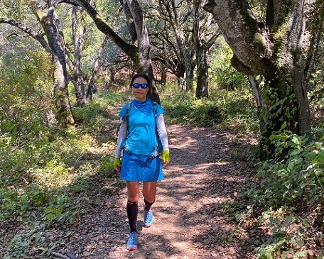
We normally go to Ramage Peak from Las Trampas. For a change of pace, Sophie had suggested we go there from the west side. The trails are definitely prettier on this side. The first few miles were very pleasant, going through the woods and crossing several (dry) streams -- note to self: come back and do this hike in the spring.
As expected, I was in the rear of the main group and was hiking solo most of the day. I had packed 4 liters, but was starting to think it wasn't enough. Hmmmm. My original plan was to go all the way to the end of the Ramage Peak Trail (RPT), then do a different trail on the way back, via Kaiser Creek, Riley Ridge, and Miller Road, to make it more of a loop. A couple of miles before I got to Ramage Peak, I came across George who was already on his way back. He told me that the Kaiser Creek Road was closed off, so he had just turned around. I figured most of the group would likely ignore that and go ahead anyway. I wasn't sure what my plan was -- it really depended on my pace and how much water I had left. I would have to call some audibles.
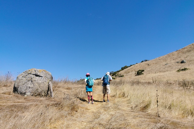
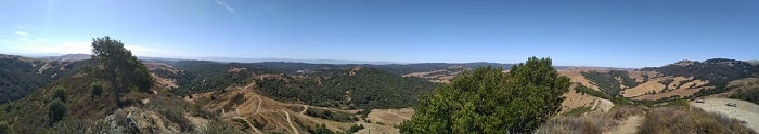
I caught up with Sandy at the top of Riley Ridge. As always, he was smiling and in good spirits. I love that guy! Ramage Peak was in view. So far, so good. From here, it was about a mile to the peak, all along wide fire road. I noted there had been a lot of trail maintenance in this section since our last visit. I distinctly remember fighting my way through the thistles last time when approaching the peak from the south.
Robert was resting under a shady tree a few steps below the peak. I went up to the top, touched the peak, and turned back down to join him for a nice break. I also noted that most of the poison oak had been cleared off the peak. There had definitely been a lot of cleanup work done -- thanks! Robert said he was done, and was going to head back. Not a bad idea, but I decided to press on.
It was 11:30 when I packed up to head out. I took stock of my water supply. I decided I would hike for about another hour and then turn around and go back. This basically meant I would continue on the RPT, down the gulch and back up the other side, and then turn around. As I headed down the trail, I could see some of the INCHers doing the reverse route on the Two Dog Road and Mihail taking the back road back to the peak. WTF! All hell had broken loose! I should have spent less time looking around and being concerned with others and more time focusing on where I was going because I took a major spill and twisted my knee coming down the steep peak trail. Ouch! That wasn't going to help my speed on the way back ...
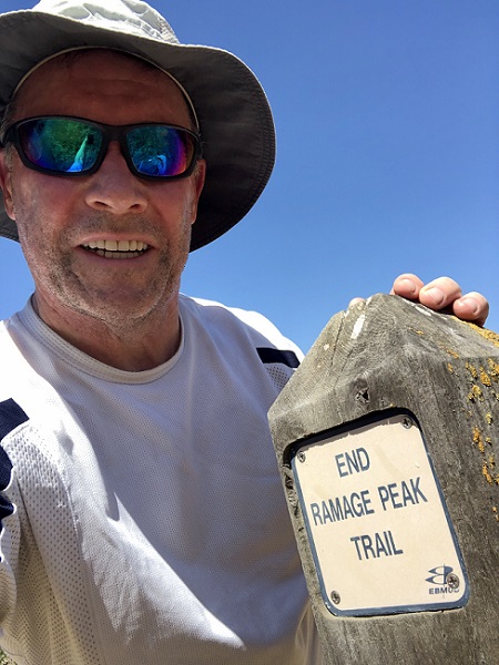
I reached the sign for the end of the RPT at 12:15; it had taken me 3:45 hiking time. If I turned around now and took the same route back, I'd get back around 4 o'clock. Of course, I would be slower on the way back, but I wouldn't be going all the way up to the peak, so it would be a wash. But it was getting damn hot ... I don't do well in hot weather.
I headed back down into the gulch and up the other side, picking up Manfred's lost sunhat along the way. I stopped and rested under a tree at the foot of the peak trail. If I was to make it back, I'd have to set intermediate goals (spoken like a true manager). Riley Ridge intersection was about a mile away, but all along hot exposed fire road with elevation gain. The good thing was that I knew there would be good shade after that, and it would be mostly downhill.
I trudged back in slow motion, one step at a time ... I was starting to feel light headed. A light breeze picked up, but it was not enough. I threw off my backpack and sat down in the dirt by the side of the road, panting. If there was a ranger coming along, I would have gladly taken the Ride of Shame. No such luck. I'd have to push through.
My next stop was about 30 minutes later. I was looking for a good place to rest, but couldn't find anything so I threw myself down in a pile of poison oak with a swarm of gnats buzzing around my head. I didn't care any more. Who knew hiking the East Bay hills in mid-August would be a bad idea???
I finally reluctantly scraped myself off the ground and kept going ... around 3 o'clock I found a nice shady tree and decided this would be it. I sat against the tree and looked up at the sky while I took my last few sips of warm water. I was out of water now. I guessed I was about halfway back, maybe slightly more. I figured the best options were either to wait a few hours for it to cool down before continuing, or just plan on spending the night here. I closed my eyes and fell asleep for a few minutes.
The sound of something rustling in the bushes woke me up. I had sufficiently recovered so I could keep going. I knew the RPT had a lot of ups and downs on the way back, as opposed to the Miller Road which I could see down below that was basically flat, but I resisted the temptation to drop down. I would take the harder route back or die trying.
I had to take a major break every 20 minutes or so. All told, I think I took six of them on the way back, each time throwing off my backpack and either lying in the dirt or resting up against a tree or a signpost. The happiest moment of my life was when I finally saw the Christmas tree farm near the end of the trail. I was going to make it!
When I finally stumbled out shortly before 5pm, only Brad, Sophie, and Manfred were still there. Everyone else was long gone. I learned that I was not the only one who suffered. Sophie had major leg cramps. Manfred had only taken 1.5L and (said afterwards) he lost 8.4 lbs on the hike. Brad had been picked up by the police while trespassing, but managed to talk his way out of a ticket. As I sat there recovering, Sandy strolled in, still smiling. That's the right attitude!
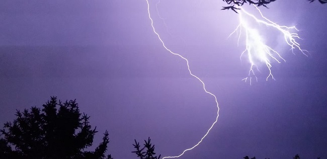
As I sat there recovering, we talked about the Pineapple Express and remarked on the strange weather and cloud formations that day. A few hours later, there was major thunder and lightning and tropical rainstorms -- very unusual for the Bay Area. I was glad I made it out and didn't spend the night in the woods!
Epilog: Sadly, those lightning strikes set off a series of forest fires in the area. As of this writing a week later, the fires are still raging. Big Basin HQ (where INCH started) has been wiped out, and Henry Coe has sustained a lot of damage in the backcountry area up to Mississippi Lake / Bear Mountain. 2020 is the crappiest year ever. Hopefully, the fires will be contained soon.
Milestones:
Manfred's 50th leaf
Peter's 590th leaf
Sophie's 330th leaf
![]()
![]()
Pages maintained by Steve Walstra,
Peter Saviz, and
Russell Gee.
©2026 Intrepid Northern California Hikers