
| Main Page | Diary | Leaves | Stats |

1247. Pinnacles Middle Loop (05/01/21)
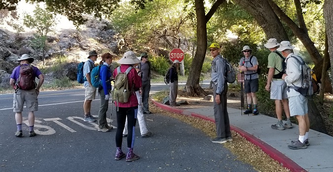
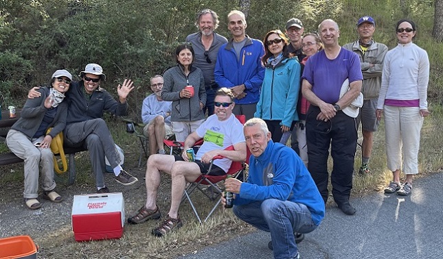
Hikers (18): Bill M, Brad, Christina, Crystal, David A, George, Giulia, Hong, Kendra, Manfred, Mihail, Mike He, Milon, Peter, Qi, Rudi, Sophie, Stacy
Distance: 17 miles
Rating: 5 difficulty, 9 beauty
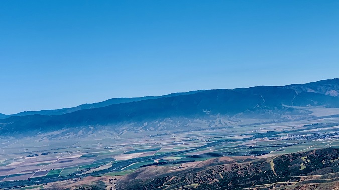
Park info: Pinnacles National Monument south of Hollister
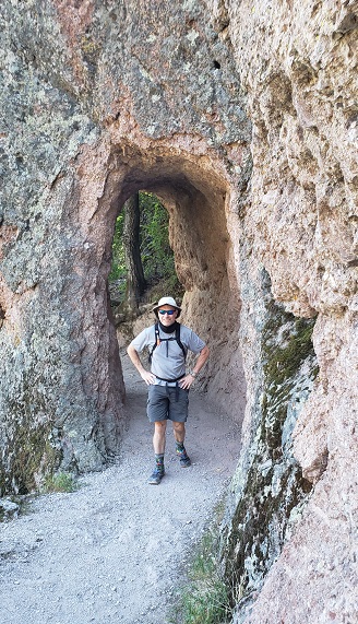
Write-up by Peter -- Pictures by David A, George, Hong, Manfred, Qi, and Sophie
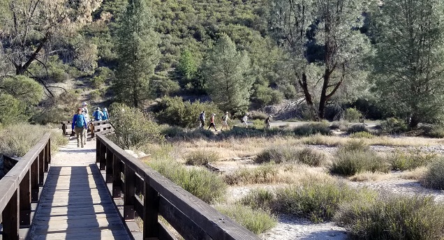
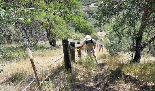
We hit the hike in the right time window -- late enough in the spring so that the SWT creek was easy to navigate, but before the insane summer heat started. I fell behind the main group and stayed back with Mike to make sure he was able to find the starting point of the climb up The Fence.

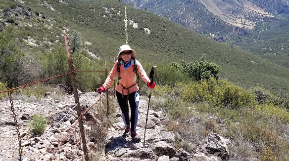
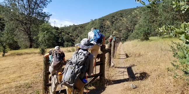
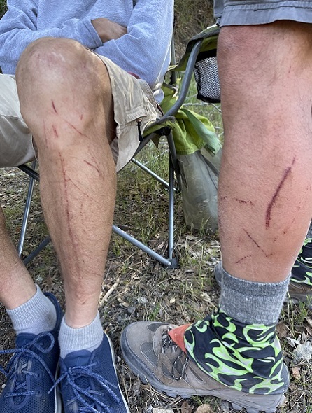
As expected, the trail was more overgrown than usual due to less use in the past year. Most of the scratches going up The Fence usually come from the scrub brush, not The Fence itself. My left side was getting scratched up pretty good, so I hopped back over The Fence at the top of Hill 4 (about 1/2 mile sooner than usual) to even out the scratches on my left and right sides. Share the pain! After the hike, George would tell me that he prefers to get scratched up on one side so that he has one good side to sleep on. To each his own!
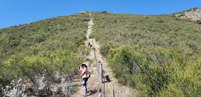
After veering away from The Fence, I spent a lot of time bush-whacking and going in circles to find the use trail leading towards South Chalone Peak. At one point I was completely stuck in the brush, so I had to take off my backpack and crawl under some bushes to get into the clear while hoping that I wouldn't get stabbed in the eye. I was about to give up and just head back to The Fence when I saw the second metal post that marked the trail to the top. Finally!
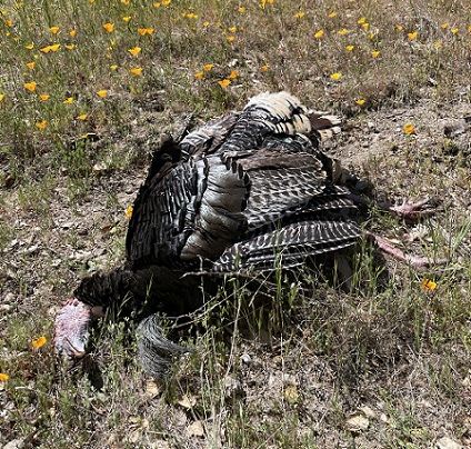
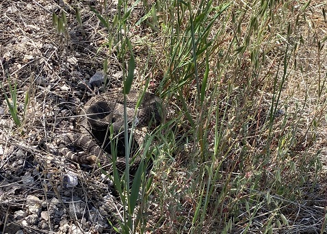
As I made it over the top and began to head down the real trail, I was able to pick up the pace. It felt great to not be getting my flesh ripped anymore! I was looking up and taking a swig of water while ambling along, when suddenly I heard a loud chhh-chhh-chhh-chhh sound. I glanced down and saw my foot was right above a rattlesnake! If it had not made the warning sound, I would have stepped on it for sure. I took a step back, but since I was on a slope, I slipped and fell down, and now I was face to face with the damn snake! I froze in fear -- I think I literally peed in my pants. It was about a yard from my face, coiled up and ready to strike. I kept as still as I could, and slowly brought my hand up to try to protect my face in case it struck. It was still rattling like crazy. My heart was pounding. The standoff continued for an eternity, but it finally backed off. It moved off trail and under a bush, but I knew it was still around. I waited for a while to give it more time to move away. When I thought the coast was clear, I continued on the trail and immediately heard the rattle again! Chhh-chhh-chhh-chhh!!! I didn't stop to look and just ran as fast as I could, hoping it wouldn't catch me. Made it!
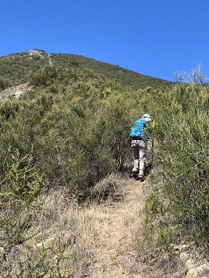
I thought The Fence was tough, but the snake was worse! My nerves rattled (pun intended), I continued on. I wanted to rest, but I saw Rudi and Milon taking a break up ahead on the trail that leads up to North Chalone Peak, so I kept going to join them. It felt good to not be hiking alone any more. We caught up with Brad, David, and George at the peak. David's first words to me were, "Did you see the rattlesnakes?". Turns out there were two of them on that section of the trail! Snakes alive!
After about a half-hour break, we began to head down. We could see someone coming up the trail, so we waited to see if it was Mike. It turned out it was Mihail, who had done a side trip to Mt. Defiance, just to make things more challenging (the Pig Fence is not enough for him!). He was quite hoarse, and looked pretty beat up, which almost never happens. The good news was that he had seen Mike at the top of Hill 4, so we had good confidence that Mike would make it out (assuming he didn't get taken out by a snake).
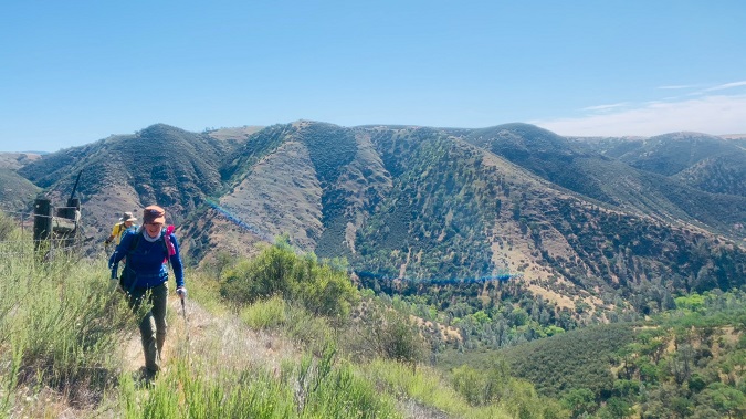
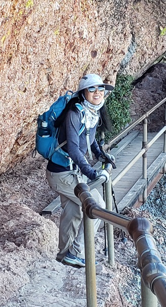
I had told the group at North Peak that I was not going to call an audible and skip the High Peaks, so now I was compelled to do it myself. Damn! At the reservoir, Milon told me he was heading back to the car, so I asked him to take my poles (thanks!). I hate carrying the poles while trying to navigate the handrails and tight spots along the peaks.
 |
 |
 |
 |
Overall, it was probably a Level 4.5 hike, but I'm rounding up. As far as I know, 15 people did the full hike, and 3 cut out the High Peaks portion due to a combination of injuries and fatigue (they still get a leaf for doing the toughest part of the hike). Mihail ended up doing around 20 miles and just under 7000 feet elevation on the day. Nice!
Well, the joke was one me this time, as I decided to do a completely different hike. As such, I left San Jose about the time the official hike started. . .and when I rolled up to the entrance, I was surprised both by the long line and the $30 entrance fee (!!). This is for a park which provides exactly zero additional features for hikers compared to 20 years ago. And everyone who showed up at the official time paid nothing. Peter had mentioned it would be free, but apparently it was only free if you got there before the entrance was manned.
The good news, abstractly, was that the park was so packed that the interior parking areas were closed, so they were ushering people into the camp ground area right after the entrance. My plan was to hike from there anyway since it provided a few new trails.
It was a fun hike up to Mt. Defiance. Was not successful in finding the initial route, but once a bit higher, there was only one way to go. Was delighted at the summit to see the world's greatest acronym in stick form. Mihail had bagged it earlier!
Started a route down the other side to try to visit Little Pinnacles summit, a location only a peakbagger would know. After a half mile, decided the stupid route I was on would only get stupider, so turned back. . .which was also stupid because it required a lot of uphill.
After so much delay, I decided to keep going to the parking lot where I imagined INCHers with cold beers. Instead, I saw more people. Filled up my dwindling water supply to the max and headed uphill. Soon I ran into INCHers coming down. Damn--I should have just waited. Oh well. This route let me explore the last of the trails in Pinnacles I'd never taken.
Milestones:
Christina's 140th leaf
Manfred's 60th leaf
![]()
![]()
Pages maintained by Steve Walstra,
Peter Saviz, and
Russell Gee.
©2026 Intrepid Northern California Hikers