
| Main Page | Diary | Leaves | Stats |

667. Mt. Robison (04/25/09)
Hikers (14): Brian C, David, Devin, Diane, Eugene M, George, Helen, Jed, Jeff, John, Ross, Sarah, Steve, Tiffany
Distance: 24 miles
Rating: 5 difficulty, 9 beauty
Park info: Henry Coe State Park near Hollister
Write-up by Steve -- Pictures by Steve and George
Great hike for Backcountry Weekend, and unlike last time, they opened the gates on time and we were all hiking an hour later.
1-2-3 INCH!
The weather was cool and breezy, so the group moved quickly. It didn't hurt that the hike is mostly flat for the first several miles. There is no sign for Mt. Robison Trail, but I had a waypoint for the start of the trail. There is also a helpful stone arrow and a cairn at the intersection, but you have to be looking for them. Since we were all fairly close together when we got there, everyone got the message except poor Praveen, who passed below us as we were hiking up. He kept going for miles until turning around.
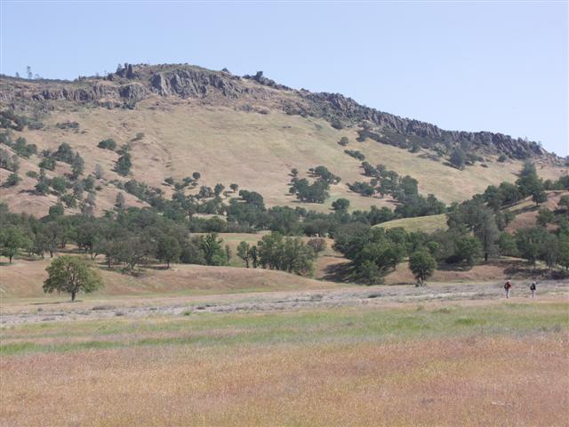
What passes for a trail is a steep old fire road that does not get much love during the year. Even on the popular Backcountry Weekend, we only saw four people on the whole mountain. Some people (mostly Eugene M) were getting nervous that the sketchy route we were taking wasn't even the right one, but I assured everyone it was good (based on a couple of waypoints along the route). At the very least it was a route to somewhere. . .
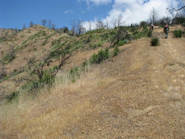
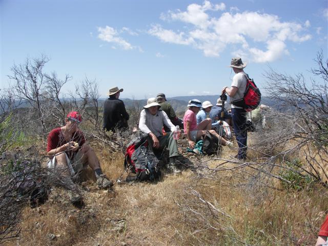
There were several false summits before the top, but eventually the last peak was in sight. Everyone made it just after noon--perfect for lunch.
We were well ahead of schedule for the return trip. George, Brian C, and (unwisely) Devin decided to try a different trail back, with the goal of picking up a longer return trail just a bit below the peak. They didn't find the trail and ended up going cross country down to Paradise Lake.
There is a section where Oristima Creek Trail goes around a big hill while Oristima Creek Road goes around the other side. We took the trail on the way out, so I took the road on the way back for variety's sake. Was surprised to see George just ahead (coming off of Oristima Creek Trail, presumably) as Eugene and I got to Oristima Corral. As it turned out, the cross-country route, although painful, was shorter, so they got back around the same time as the front-runners. That was good for Devin, because he was in one of the car pools, and would have been out of luck if he hadn't gotten back in time. In the end, everyone who needed to be back (i.e. not camping) made it back with an hour to spare. One or two slackers got a ride from the corral back to the cars, but it was part of the back country fee. . .
Ten of us (including Sabine and Sandy, who did an alternate hike) went out to the traditional Backcountry Weekend dinner location in Casa de Fruta. That hit the spot after a long day!
![]()
![]()
Pages maintained by Steve Walstra,
Peter Saviz, and
Russell Gee.
©2026 Intrepid Northern California Hikers