
| Main Page | Diary | Leaves | Stats |

791. Skyline National Recreation Trail Alternative (08/13/11)
Hikers (7): David, Diane, George, Sarah, Sophie, Steve, Susan
Distance: 34 miles
Rating: 5 difficulty, 9 beauty
Park info: East Bay Regional Parks near Richmond
Write-up by Steve -- Pictures by Susan S and Steve
Big thanks to Iris and Chris M for the 5:45am shuttle!
It was time for a "real" hike. We rarely hike the East Bay parks along the Skyline Trail because they are individually too small. The only way to do them is in a nice, long string along the Skyline National Skyline Recreation Trail. But that hike is a hassle to arrange, and the trail is a bit boring at the beginning and end. To "fix" this, I re-routed the official route. Only 10 out of 34 miles were the same, and those miles were almost entirely on the connecting trails between the parks. That made the new route a little more complicated than "follow the blue Skyline markers". A spreadsheet and a digitally highlighted reference route were provided to clarify things to the intrepid seven INCHers who signed up.
1, 2, 3. . .INCH!
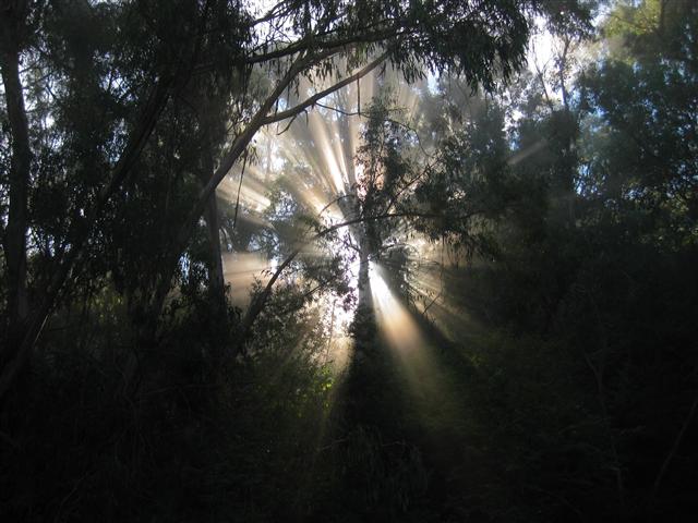
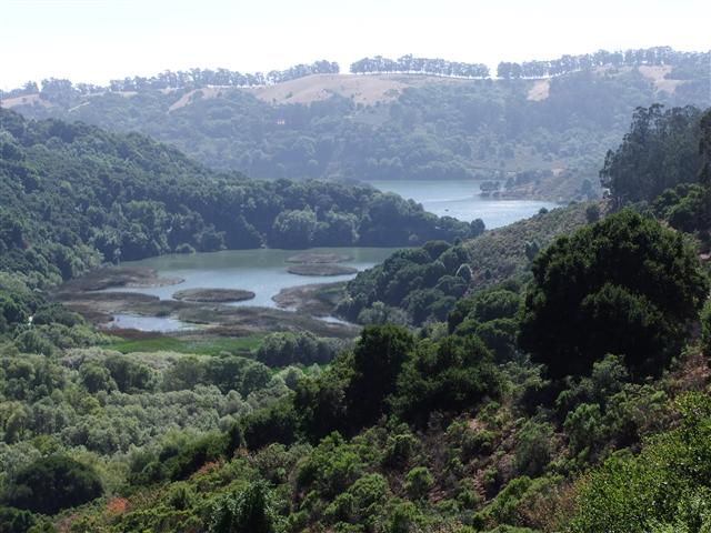
The new route definitely added a lot of diversity to the scenery. All those junctions also gave the brain something to do (besides enjoy the scenery) during the long day. For a little more adventure, I added a location every five or six miles to snap a picture. David bought a camera for the event. That's dedication!
| Pictures: Wildcat Peak | Vollmer Peak | Huckleberry Gate | Redwood Peak | Marciel Gate | Lake Chabot Bridge |
The new route had less pavement and more shade, which made things nicer. This was also the first time I've seen Lake Chabot, despite doing the Skyline route twice in the past. Reasonable temperatures with occasional breezes helped keep it under a level 6. Many people lamented the tiny--225 ft!--hill near the end of the hike. Every molehill feels like a mountain after 33 miles.
Except for a small piece of Tilden with mysterious icon-only junction signs (where George almost got us back on track, but the group over-ruled for an extra 0.1 mile loop) and a later junction where all the trail names had fallen out (Baccharis Trail in Redwood), the signs were all in good condition and the route was easy to find. That's good, because no one wants to add more distance to the hike. . .although some did.
We had a three-hour spread between first and last, which is about par for the course. Unlike previous visits, we had such a small group that there was no sustained party afterwards. Between Diane leaving (and a guest appearance from Ross, who was biking nearby) and George/Susan's arriving, I was forced to drink alone in front of the "no alcoholic beverages sign". Very sad--I had to have a second bottle to console myself.
Everyone made it back alive on INCH's third-longest hike in fifteen years. David get's the award for "most improved" time compared to the two-mile shorter last visit.
Hike started at 6:30 am.
| Hikers | Finish (pm) | Hike Time |
|---|---|---|
| Steve | 4:12 | 9:42 |
| Diane | 4:29 | 9:59 |
| George & Susan S | 5:21 | 10:51 |
| Sarah & David | 6:04 | 11:34 |
| Sophie C | 7:12 | 12:42 |
![]()
![]()
Pages maintained by Steve Walstra,
Peter Saviz, and
Russell Gee.
©2026 Intrepid Northern California Hikers