
| Main Page | Diary | Leaves | Stats |

838. Kickham Willson Loop (07/07/12)
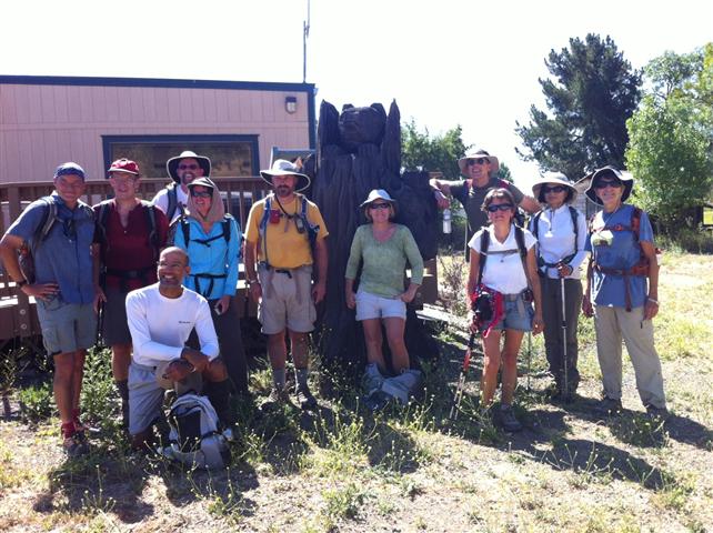
Hikers (19): Angelika, Chris, David, Helen, Iris, Janice, Jeff, Karl, Kathryn, Kirk, Paul, Peter E, Robert, Russell, Sarah, Shuli, Sophie, Stacy, Steve
Distance: 17 miles
Rating: 4 difficulty, 8 beauty
Park info: Henry Coe State Park near Morgan Hill
Write-up by Steve -- Pictures by Karl, Angelika, Helen and Steve
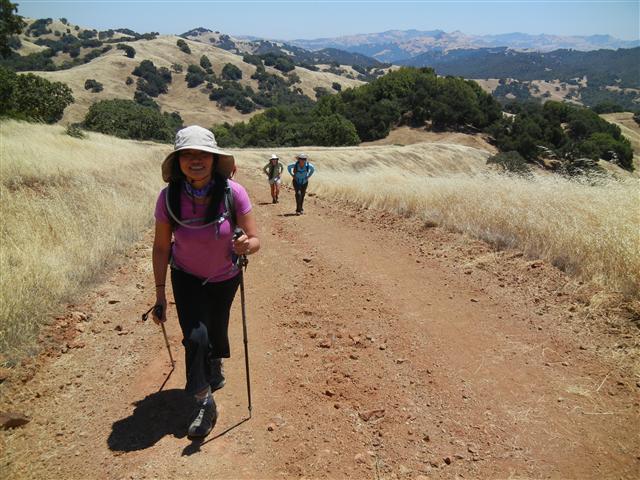
The 3.5k elevation gain suggests an easy hike. And it was pretty easy. . .except for the 90+ temperatures. Lots of long breaks in the shade for just about everyone--INCH's most leisurely-paced hike in years.
1-2-3 INCH!
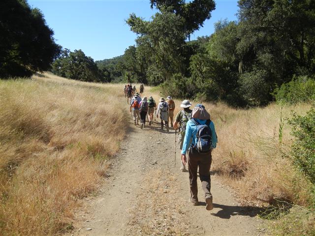
We started an hour early to beat the heat, but there was no avoiding the high temperatures. Even the first flat leg to Kickham Ranch was sweat-inducing. The only interesting aspect of this piece, which others noticed as well, is that coming back on Hunting Hollow Road at the end of a hike seems to take forever, but walking the entire length of Hunting Hollow to Kickham Ranch took no time at all. It helped that all the creek crossings were bone dry.
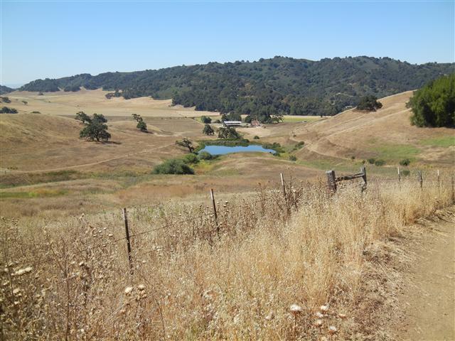
I found out about Kickham Ranch from a geocache placed near the (closed) entrance gate. Noticed Kickham Ranch again on the latest Coe map and figured it would make for a good hike on a hot day, mostly because we'd be able to head up to the intervening Phegley Ridge via the least steep route (Wagon Road). The area looks like a visitor center, complete with picnic tables, plenty of parking, and informational displays about Kickham Ranch. But because it is perpetually closed to traffic, no one goes there. Sort of like Dowdy Ranch, but a lot easier to reach.
Angelika and Thomas hiked in early (much to my chagrin), and had a chance to talk to the ranger who confirmed it was OK to visit. Saw the ranger leaving as I was walking parallel to the ranch to snag the aforementioned geocache. The loop to visit the cache and return to the ranch was over half a mile, so by the time I got to there, everyone was gone. Well, that wasn't totally true--Robert came up late, so showed up at the Kickham complex while I was scoping out the place.
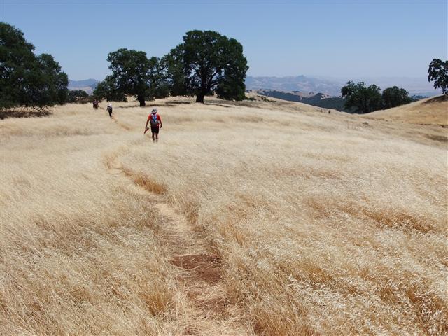
By the time I left Kickham, I was way behind everyone. It was hot and there was a long continuous uphill to Vasquez peak. After a while, I was surprised to pass Janice, who was surprised to see me (because I wilt in the heat). Soon after I saw Russell and Chris M (separately) taking breaks in the shade. This would be a theme throughout the hike.
Eventually reached Long Dam Trail and finally the Vasquez Peak ridge line. I fully expected (1) no one would know where the peak was and (2) everyone would be long gone. I was right and wrong.
There was a sizable group hanging out exactly on Vasquez Peak, which had a nice circle of stones denoting its location. There were five or six people behind me, and lots of people at the peak, but several were missing. It turned out that all of the "missing" had continued on to Rock Springs Peak. That was great, because I explicitly said in the hike notice that the "front runners" would go there (and expected to be one of them). Of course, most if not all did not do this on purpose--they were just following Jeff.
Side comment #1: Jeff actually went to the "real" Rock Springs Peak. See discussion here. Don't say INCH never did any investigative research!
Side comment #2: When I got to Vasquez, I immediately headed for the shade of a nearby tree. When Paul and David came up behind me, they did the same. Couldn't understand why everyone else was happily sitting in the sun. It was hot! How do people dissipate heat so easily?
Eventually we were off. Iris had left ahead of most people, but I later passed her eating lunch under the shade of a big tree. Like I said, it was a theme for this hike.
I had only brought 3 liters of water, but was happily drinking my water with the knowledge that there was a convenient spigot at Willson Ranch. Well, not totally convenient because it's downhill to visit. . .and even less convenient when I discovered it was no longer there. My smile turned upside down as I trudged back up the hill to the source of the spring, which was a big pool of algae-filled water with various things swimming around. All was not lost, though, as someone had crafted a bleach bottle into a water scoop. I used that to douse myself with water--it was nice. Dripping wet, I headed back up the final uphill to Willson Peak, passing several people who asked how I managed to be behind them again. Not much later I stopped to retrieve a geocache behind a big tree. . .where I sat down in the shade for a while and evaporated quietly.
By the time I could see Willson Peak, I was out of water. Could see the intrepid hikers turning up to tag the summit. Passed Helen as I was coming down from the peak--she didn't seem totally enthusiastic about this final spur. Nonetheless, glad to see everyone knocking out the last highlight of the route.
From here, it was almost all downhill to the cars. It felt way longer than expected, though. Afterwards, everyone was commenting about how long the hike down the newly-routed Jim Donnelly trail took. Was it just our sun-addled imagination? Nope.
Jim Donnelly Trail Re-route
We had a nice post-hike party (complete with a 4th of July flag-themed fruit concoction from Iris). No one was in a big rush to leave because everyone was a little beat by the heat. There was a large time gap between the first and last hikers, as evidenced by the applause we provided when the last people rolled in. The hike was statistically a cakewalk, but the temperatures really upped the bar, so ended up calling it a four. Thomas said the external temperature was in the mid 90s in the shade (in the parking lot), and Robert had over 100F in his car. There wasn't a cloud in the sky all day.
Milestones:
Sarah's 190th leaf
![]()
![]()
Pages maintained by Steve Walstra,
Peter Saviz, and
Russell Gee.
©2026 Intrepid Northern California Hikers