
| Main Page | Diary | Leaves | Stats |

934. Pablo Point (06/21/14)
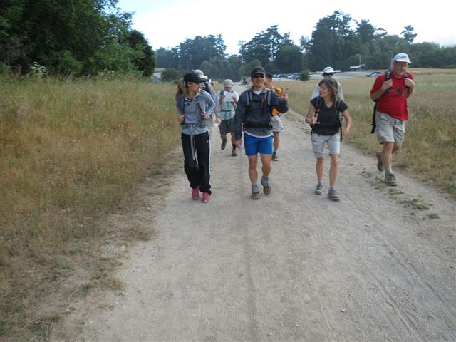
Hikers (11): Brad, Chinyet, David, George, Hailong, Nick, Sarah Z, Sarbinder, Sophie, Steve, Thai
Distance: 42 miles
Rating: 6 difficulty, 9 beauty
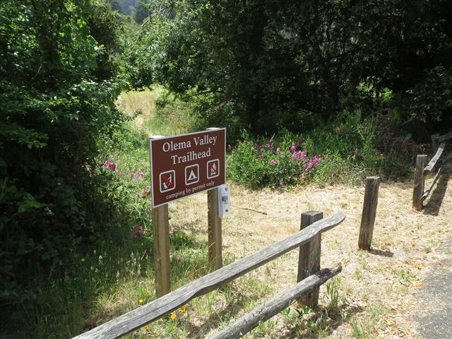
Park info: Point Reyes National Seashore near Olema
Write-up by Steve -- Pictures by Everyone
With this year's summer solstice on a Saturday, I figured it was a good time for the longest hike of the year. With the sun setting after 8:30pm and "civil dusk" until 9:10pm, there was plenty of time for a 40 miler.
It's good to be rested for a hike, so set the start the hike at 7am. Enjoyed the comments from the people who weren't doing the hike: "I'd rather start in the dark than finish in the dark" and "Late start for a long hike!". With a 7am start, one has 14 hours of light to finish a 40 mile hike. That's a 2.85 mph pace. If one can cut out the four-course lunch and spa treatments along the way, it's entirely doable. . .for those silly enough to try.
11 people were ready to go at 7am (well, 7:08am by the time the cheer was loudly performed). While preparing the night before, it occurred to me that doing Mt. Wittenberg at the end of the hike was overly cruel. So in the morning, I called an audible, and started the hike with Wittenberg. This also added 0.8 miles to make sure we went over the 40 mile mark. The drawback, of course, is that everyone had to carry a full load of water up and down the peak. Many hours later, at the end of the hike, everyone agreed this was the right way to go (except David, who may be undecided).
The summit (Mt. Wittenberg pics) was the last time we'd all see each other for the day (although there was some overlap later at the 1 mile out-and-back at Pablo Point). The next segment was the flat Rift Trail, which turned out to be a cow haven. There was only one apparent route to take, but it was hard to tell if it was the route or just some use trail connecting to a farm road. As I reached the other side of the field, though, I saw the official exit sign. . .and several cows right next to the exit gate, making it hard to exit this section (maybe they were wisely waiting to bolt out the second we opened the gate!). As I stepped around the recently-laid cow-mines, the nearest cow stood up and startled me as it helpfully got out of the way of the gate. Home free! I heard several others had similar experiences, with the cows herding toward the gate, and then having nowhere else to go.
Next stop was Fir Top. The trail starts in a large horse camp. Lots of people and their horses enjoying breakfast like a family. I'm sure there was a centaur in there somewhere. The trail eventually hits the Stewart Road, where I left the first of many arrows. As I started up Stewart, Sarbinder appeared behind me. A couple miles later, while laying down a giant arrow to point to the unmarked (but obvious) Fir Top connector trail (off Greenpicker), Sarbinder was gone. Even after I took pictures at the "summit", I didn't see him. From there, it was down Bolema, along Olema Valley, and up Randall. (Fir Top pics)
On the way up Randall, some guy says, "Get out of the way--fast hiker coming! Are you heading for the coast?" I was sort of surprised, so said something like "I'm heading everywhere--18 miles into a 40 mile hike around Pt. Reyes and Bolinas on the longest day of the year". Was having a hard time thinking because I was focused on hiking and wasn't expecting a chat. "Are you going to make it back before the sun sets?" "Sure, but I have a headlamp just in case!" It wasn't until I got to the top of the ridge that I could consider his question and estimate when I actually would get done. It seemed I could finish at 6pm if I could maintain this pace. . .which seemed unlikely. But after doing a geocache and taking the required picture at the top of the ridge, the GPS still said 4 mph average at the 20-mile half-way point (at the time I thought it was half-way). This location was the highest point on the hike, so it should all be "easy" from here. As I started down, Sarbinder appeared. (Top of Bolinas Ridge pics)
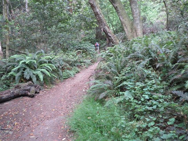
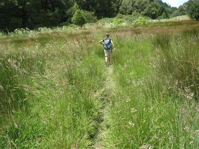
The route off Bolinas Ridge was McCurdy Trail, which clearly gets less love than Randall. It was rocky and unpleasant after 20 miles of hiking, but opened up nicely at the bottom. After crossing Hwy 1, I was back in Olema Valley. I had read many warnings on the NPS website about Olema Valley being prone to seasonal flooding. Was not too worried about that during the current California drought, but it was the grassiest location in the park for sure. The drawback of the formally wet ground was the trail was really potholed, and you couldn't see it well through the grass. Stumbled around a couple times and was glad to see the Teixeira Trail sign, because it went uphill out of this area.
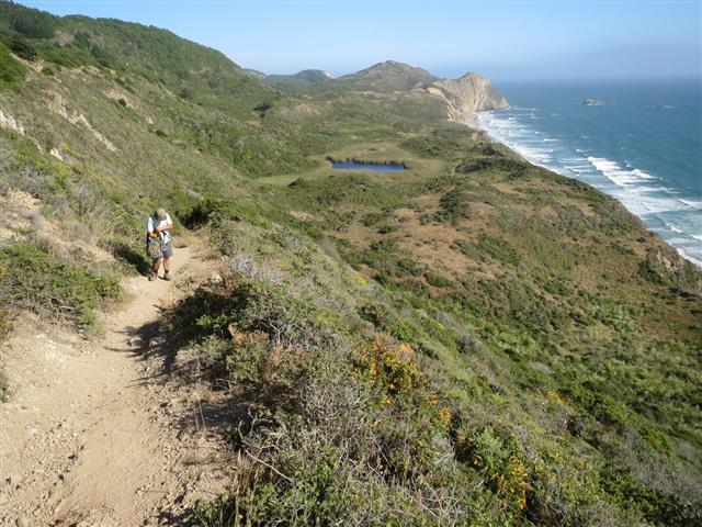
The Teixeira Trail was lush with ferns and other greenery. The trail tends upward to the spur junction to Pablo Point. A mile later, I took the requisite picture at Pablo Point. On the way back up the trail, who is the next person I see? Brad (not Sarbinder!?). Also ran into Hailong, who was uncharacteristically not enjoying the pain. Saw Eric L and Sarah Z standing at the top of a trail segment. Eric L was looking intently at his GPS, so I said "Are you afraid to go downhill?" (implying giving up altitude) and Sarah immediately said "Yes!". I had had the same feeling when coming in, as the route to Pablo Point is clear, but goes up, down, up, and down. In fact, Pablo Pt is 30ft lower than the trailhead from which it begins. And the view from the point? Not much! [Later on the Ridge Trail, if you look over at the ridge that Pablo Point sits upon, you can see that it is a prominent geographic feature in the local area] The official Pablo Point pics.
I was out water just before getting back from Pablo Point, but wasn't sweating it (ha!) because (1) it wasn't hot, (2) the route was heading toward the cooler coast, and (3) water was only a bit over four downhill miles away. Additionally, I had concluded that the stinging nettles from various points along the trail had numbed my legs to the point of making me invulnerable to all hiking pain. The rest of Teixeira Trail and the subsequent Ridge Trail were great. The Ridge Trail was "soft" on the feet, which was welcome.
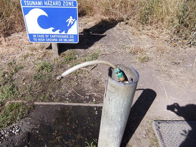
There were supposed to be some trails after the end of the Ridge Trail connecting to the Bird Sanctuary. I couldn't find them, but the map was pretty clear that we could also just walk the road, so that's what I did. I heard some INCHers successfully found the trail(s), some took the route I did, and a few others went the wrong way on the road for a bit. What we all agreed upon later, however, was that the place had no potable water! I walked into the little visitor center and it was empty. There were no water outlets of any kind inside or outside. I went into the restroom, and found a whole sheet of warnings about E. coli being found in the water in 2008. I walked around the general area, but did not see anyone. Didn't want to knock on the office doors or the private residence, so went back to the bathroom and took many generous gulps from the faucet. I figured 2008 E. coli was no match for my 2014 thirst. Look for an update in a week! [No problems!]
At the end of the hike, there were many stories about this area. Several people managed to find employees of the Bird Sanctuary to give them water, proving that persistence pays. One quote I heard was "George was not going to leave without water". David, we would learn the next day, refused to drink the "crappy" water and also didn't hit anyone up, much to his subsequent hydo-detriment.
I set off knowing that six miles away was clean water at Wildcat Campground. I passed a constant stream of college-aged people returning from hiking. They had probably gone five miles at most--I was getting close to 30. I was many people with almost-full water bottles returning to the parking lot, but couldn't think of a slick way to beg. Got to Bass Lake, where the coordinates for the use trail were spot on. A few GPS-less people couldn't find the trail. The lake area was packed, so it seemed like everyone else in the world knew how to get there. Had to cross through several groups of people laying around in the sun in order to get down to the water for the requisite picture. Stayed longer than usual--it's a nice place and the first time I had sat down all day--before heading off to Wildcat Campground. (Bass Lake pictures)
Before Wildcat, I crossed over a bridge from which the sound of delicious burbling water could be heard. Could not resist the siren's call, and went down to a steam to enjoy a few handfuls of it. I figured the giardia would kill the E. coli, just like that old lady who swallowed the fly. When I did reach the very popular Wildcat Camp, I saw the water hose and knew everything was going to be fine.
Was surprised by the uphill out of this area heading to Glen Trail. I thought everything was sort of flat on the coast side of this hike, but no, there was plenty of up-and-down along the way. Just before the hike, Sophie was estimating the elevation gain in the 6k-ft range. I didn't think it would be more than 5k--1k per summit plus another 1k for slop. It turned out to be in the high 7k range, and this last uphill was the end of it. Left arrows at all the various junctions, but heard later that Sarah Z and others took the straighter (and incorrect) route through Glen Camp instead of Glen Trial. That only adds 0.1 miles, so if you had to make a mistake, that was the one to make.
Was supremely happy to reach Bear Valley, even though there was another 3.1 miles left back to the cars. Not only did it look like I'd finish before 7pm (the rough 12-hour mark), but the hike would be a new record of 42 miles! As I stood up after making a tiny arrow at this multi-trail junction, I almost passed-out, complete with ear ringing. No more bending down for arrows! [Incidentally, Eric L and Brad took the wrong turn here and hiked a mile toward the beach]
From there, it was a gentle jaunt up to Divide Meadow and down the other side to the parking lot. I couldn't find any sign proclaiming Divide Meadow, so took a picture in front of the trail that leaves Divide Meadow. Was surprised later to see many people found the official sign. Good job! Where was it!? The official Divide Meadow pictures.
Strolled in to the parking lot at 6:50pm with a big smile. Cleaned up a bit before walking over to Sophie's car to grab a bottle of her anti-E.-coli/giardia medicine, a.k.a. Stone Imperial Stout. She'd kindly provided a key to her car in case she got back to the lot late. Thanks!
It was not too long until people started coming in, many of whom looked entirely not devastated, including more than one jogging in. 42 miles with 7k+ elevation gain--what else can I do? By 7:45, we were only missing three people. The first was Sarbinder. I was sure, after not seeing him back at Pablo Point, that he'd accidentally missed that trail entirely and would go leafless. George, however, said that Sarbinder had missed the turn for Teixeira and headed down Olema Valley for 2 miles in the wrong direction. . .But he still wasn't in, so we still weren't sure what had happened. Second was Nick--he had been worried about getting lost, and his not-get-lost-partner George was sitting in the parking lot. . .Third was David, who no one had data on. Long story short, Nick and Sarbinder showed up (before dark), but David was still missing after dark (but we knew he had a headlamp). I walked down the dark trail at 9:45pm, and tried to leave a note on his truck at 10pm. . .but couldn't find it because he hadn't had a truck for five months. Whoops! But fear not--he survived, and made it out at 10:26pm. 11 INCHers successfully finished INCH's longest official hike.
Start time was 7:08a.
| Name | Hike Finish | Hike time |
|---|---|---|
| Steve | 6:50p | 11:42 |
| Sophie | 7:23p | 12:15 |
| Sarah Z | 7:23p | 12:15 |
| George | 7:27p | 12:19 |
| Thai | 7:29p | 12:21 |
| Hailong | 7:39p | 12:31 |
| Eric L | 7:44p | 12:36 |
| Brad | 7:45p | 12:37 |
| Nick | 8:33p | 13:25 |
| Sarbinder | 9:08p | 14:00 |
| David | 10:26p | 15:18 |
Milestones:
David's 390th leaf
Hailong's 30th leaf
Nick's 60th leaf
Sophie's 140th leaf
Steve's 740th leaf
Thai's 10th leaf
![]()
![]()
Pages maintained by Steve Walstra,
Peter Saviz, and
Russell Gee.
©2026 Intrepid Northern California Hikers