
| Main Page | Diary | Leaves | Stats |

977. Pinyon Peak (03/29/15)
Hikers (13): Adam, Brad, Christina, Giulia, Jane, Jim, Kirk, Milon, Nick, Sarbinder, Shuli, Sophie, Steve
Distance: 15 miles
Rating: 4 difficulty, 9 beauty
Park info: Garland Ranch in Carmel Valley
Write-up by Steve -- Pictures by Sarbinder, Steve and Brad
Garland Ranch is a great place for hiking. Despite being fairly large, we had hit most of the trails (and peaks) by our third visit. In early February I planned a route to a new peak (Pinyon), but had to replan. Turns out we were going to have heavy rain the day before the hike, and the route I had planned involved fording the Carmel River. So rather than have various people float away to to the ocean, I decided to reschedule. It did not rain much in the intervening month (as any Californian knows), so it was time to try again.
1-2-3, INCH!
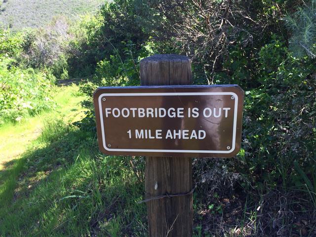
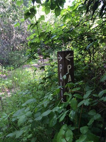
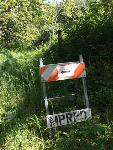
There is actually more backstory to this hike. Since we had hiked so much of the park already, the only new area was on the north side of the park. Of interest was a trail called "Palisades", along with Pinyon Peak. As a bonus, we could go up Snively Ridge the "hard" way, too. While Palisades is on the map, the bridge across the river has been out for many, many years and the rangers (as we heard from Angelia) strongly advised against that route. I had contacted a friend from a Monterey-based hiking group, who said the group had never done Palisades, but that it looked rather "poison oak-y" from the top. . .
Since it is a long drive to Garland, I decided to add a gratuitous elevation gain at the start to make it worthwhile. Abstractly, Garland Ranch has three parts: the north part where the parking and HQ exist, the middle part with East Ridge and Vasquez Knob (outside the park), and the south part called Kahn Ranch. Each section is connected by a single trail, so there is no loop around the park, just loops connected by segments. . .like a human centipede.
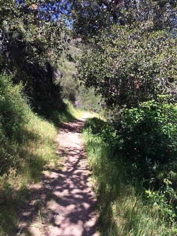
For this hike, we started from the HQ and headed gently up the Waterfall Trail (which was more attractive going this direction) to Garzas Canyon Trail. Garzas Canyon took us up and over the hump and down, down, down to the redwood-filled canyon. From there we did a tricky figure-8 loop that involved Terrace Trail and Veeder Trail--both new to INCH--up to Veeder Pond on East Ridge.
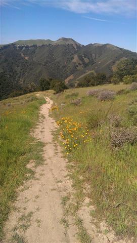
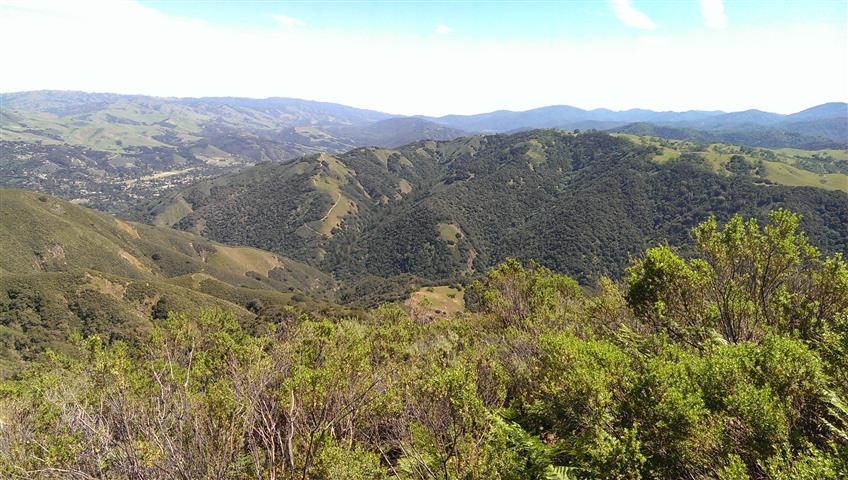
From the summit just after Veeder Pond, we could see our main goal--Pinyon Peak. Wild flowers were in abundance, purple, orange, and some blue. Between East Ridge and Pinyon is a big valley (where the Redwoods were), and a steep climb back up Garzas Canyon, followed immediately by Sniveley's Ridge, the only trail listed as "very Steep 15% grade". While I was heading up that way, some hikers were standing along the trail worried about going down. . .but it really wasn't as bad as expected, and soon I reached the ridgeline where things flattened out.
From here, I left an arrow pointing to the use trail up that heads to the route that ultimately goes to Pinyon. After doing a geocache along that way, I ran into Shuli. A bit farther, I saw Jane O. I chastised her for taking the "wrong" route, but she pointed out that this was what was listed on my map I had sent out before the hike. That was true! I had made "better" maps (with waypoints) for the hike, but everyone had printed out the original maps, which only had the official trails listed.
From there, we had to get over an intervening peak. The whole route is an unmaintained (but fairly popular) use trail. We passed one junction where I decided to take the high route. That wasn't the best choice. Eventually saw Nick ahead of me, so knew I wasn't alone. It was clear that the trail would work, but it was quite steep going down. Shuli didn't like it, so turned back and took the alternate way.
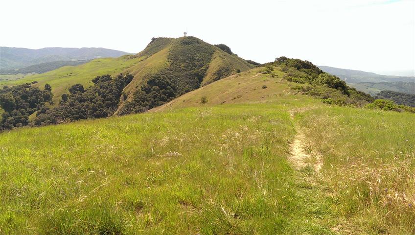
After that, it was just one more steep route to the summit. Just before the tower near the summit was a metal gate under a tree. I stood there for a while and enjoyed the summit-breeze + shade. Sophie passed by. I continued up to the tower and then to the true (flower covered) summit behind it. After taking some pictures, I sat down at the picnic table next to the tower waiting for more people to show up. Nick chowed down on a sandwich, and Jane O did yoga stretches to stay warm. Sarbinder was already gone--we saw him on the way up.
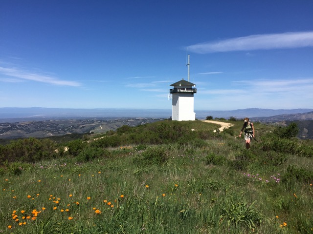
Soon Brad, Giulia, Milon appeared. We waited a bit, then started heading down. We soon ran into Jim I coming up. A bit later we ran into Kirk. As we rejoined the major trail, we saw Christina J and Adam C. So everyone was accounted for except Angelica.
I had expected the Palisades Trail to be unmarked, particularly after seeing a picture of the sign posts in storage. But when we reached the junction, there was indeed a sign and, further along, a second sign. Near the point where one needs to cross the river (or risk trespassing) there was a third sign. So all my fears (and warnings) were for naught. And for all the concerns about poison oak, the majority of it was found en route to Pinyon Peak, not the Palisades Trail. The trail was great, with a lush mossy oak forest near the river.
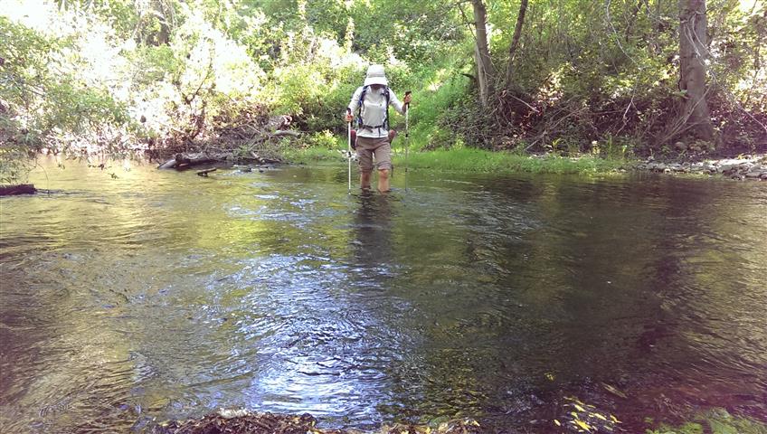
After several geocaches, I was right behind Shuli and Jim at the river crossing. I had brought some flip flops for the crossing because I am the epitome of "tenderfoot". I had managed to lose one of those flip-flops during the hike (I had caught my pack in bushes and trees multiple times). I figured I was still OK with a single "flop", because I'd just make sure I was standing on the protected foot most of the time. I took big steps to get across the river and, in the process, managed to get my only flip-flop stuck in a rock and lose it. Luckily, Jim managed to grab it before it floated to the ocean, and then tossed it to shore. So now I was barefoot, and every step was a painful reminder that I should have brought water shoes. . .Both Jim and Shuli walked across like it was shag carpet.
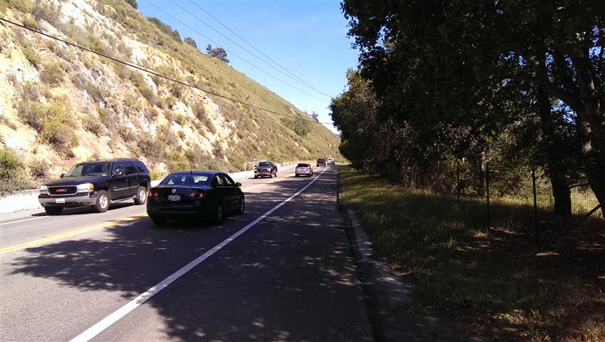
From there, it was just a short walk along Carmel Valley Road. At the end of the trail, someone outlined the trail with rocks to make sure people did not stray into private property. A half mile down the road, there is a dirt road inside the park which one can use (that parallels the road). I had provided the waypoints for this route, but not sure how many people took it. It avoids the final quarter mile of road-walking.
At the end of the hike, as people streamed in, we found that Kirk and Angelica had bypassed the river crossing and trespassed slightly to access a real bridge. I had that same route as a backup in case the river was high, so couldn't black-leaf them. . .but then I learned that Angelica had, as expected, skipped the summit to avoid any potential injury. That's a good bit of leafless wisdom, to be sure.
We had another fine party at the end of the hike. The party was in full swing when I got there, and still going when I left. Can't keep up with these crazy INCHers.
Milestones:
Adam's 30th leaf
Jane's 80th leaf
![]()
![]()
Pages maintained by Steve Walstra,
Peter Saviz, and
Russell Gee.
©2026 Intrepid Northern California Hikers