
| Main Page | Diary | Leaves | Stats |

981. Skyline National Recreation Trail Alternative (04/25/15)
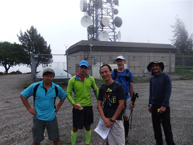
Hikers (13): Chinyet, George, Hailong, Jason F, Jim, Max X, Patrick Be, Sarah Z, Sarbinder, Shuli, Sophie, Steve, Yvon
Distance: 34 miles
Rating: 5 difficulty, 9 beauty
Park info: East Bay Regional Parks near Richmond
Write-up by Steve -- Pictures by Everyone
I enthusiastically scheduled this long hike knowing full well that I would be out of town just before the hike. The good news was that we had enough kind volunteer drivers lined up by Wednesday. The bad news was that I couldn't get the maps out until Friday afternoon. 14 people still signed up.
Shuli was already at the carpool when I got there, and Chinyet showed up just before the 5am meeting time. En route to the shuttle point, one of our shuttle drivers called to warn that she'd missed the turnoff to Redwood Road. That didn't bother me too much because I was fixated on the "empty" gas light on my car. By the time we got to the general location of Proctor Station, it was still pitch black and I had less than 10 miles of gas left according to the range indicator. Perfect!
One of the shuttle cars had its lights on--pointing toward the road--which was very helpful for spotting the elusive parking area. I knew the parking lot had two entrances, so was able to pull in to the second entrance after seeing the lights. A few more people trickled in. Then a three car caravan came by and they all pulled over on the road across from the parking lot--we called them over and now had just about everyone.
As we started packing up the cars, we noticed we had too much room, which meant we must be missing people. We knew Jane O had ditched last minute, and Alan wasn't coming, but it still seemed like too much space. Just then, a car comes zooming by, stops midway between the two entrances (it's still very dark), starts to make a 3-point turn in the middle of the road, but stops at the 90-degree phase because another car was coming down the lane. . .truly an accident waiting to happen. But that all worked out, and the car completed the maneuver and turned into the lot. But the turn was executed a little too early, and the car caught the bottom of a curb, making an unpleasant noise. It was Yvon in a rental car. The car now had a not inconsequential hunk of plastic paneling sticking out an odd angle near the wheel base.
But no time to worry about that--jump in a car and let's get going. And away we went. . .still missing Doug W despite our late start.
Wildcat Canyon Regional Park--as always for this hike--was not open yet when we got there, so we tumbled out of the cars at the entrance gate. Big thanks to Rainer, PG, Iris, and Moselle for shuttling us there in the early morning. That makes everything much nicer. Now we just have to worry about hiking 34 miles back to the cars.
1, 2, 3. . .INCH
The hike was a little different than the previous visit, mostly to visit Grizzly Peak and touch some new trails. There were four "location" for pictures, plus one for the "bonus" peak: Wildcat Peak | Vollmer Peak | Round Top | The Bridge | Bonus Location(s)
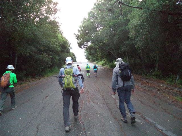
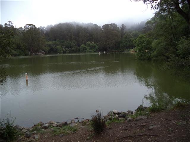
It's a paved walk at the start of Wildcat. We hiked straight down the valley for the first time (i.e. not heading up to the ridge). Once we got to Tilden, we turned straight up the ridge and hiked to Wildcat Peak for pictures. Then it was a tricky route back down to Lake Anza.
The next stop was optional Grizzly Peak. We had separated into groups by now. I knew the way and left some arrows near the route there. Was very happy to see the next two groups of people found it as well. Only people missing were Yvon, Sarah Z, and Jason F--but they'd later visit their own bonus location, so that worked out, too.
Next stop was Vollmer Peak, which required crossing from the south edge of Tilden to the north. Although it goes into the intervening valley, it wasn't as much gratuitous uphill as expected, and everyone was soon snapping photos on the summit.
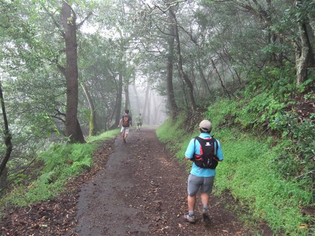
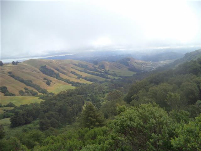
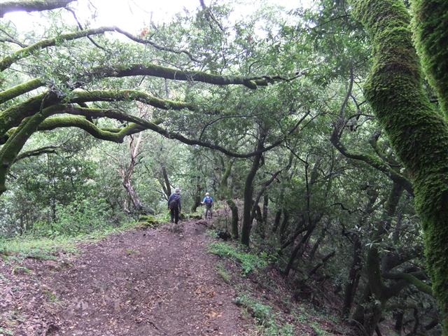
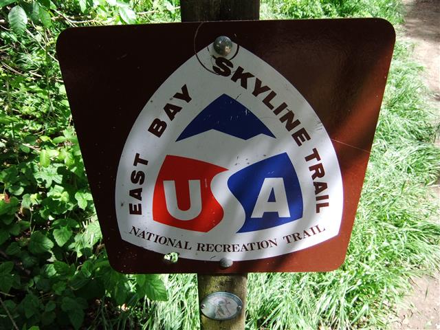
From Vollmer to Round Top is a stretch of "not-park" that is both the Bay Area Ridge Trail and the East Bay Skyline National Recreation Trail. Because it outside the parks, it gets less visitation, but it's in fine shape and quite pretty. You pass right over the Caldecott Tunnel (HWY 24), but wouldn't know it if not for the sound of traffic not too far below you.
In Sibley, the plan was to head north and loop around the summit of Round Top. In four or five visits, we had never visited that main part of the park, instead only venturing along the shortest path to the summit from the Skyline trail. My instincts from previous visits were still strong, so overshot the turn to enter the main section of the park by a quarter mile. I called back the people ahead of me, and herded some more coming in from behind, but in the end, it sounded like 100% of the people took the right route (including those already far ahead), which was great. Incidentally, with this new knowledge, I would say you aren't missing too much no matter which way you go--Sibley is a geologically interesting place, but not the jewel of the park system.
The next part of the hike was through Huckleberry Botanic Regional Preserve which is a jewel of the local park system. Sarah Z, Yvon, and Jason F--we would learn later--noticed I had left a "picture" point on the map from our previous visit. Even though it was off the highlighted route, they went up and snapped pictures. That was awesome, and got them some bonus time in Huckleberry to boot. Well done.
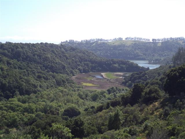
The next stretch of the hike was through Redwood Regional Park. In past trips I'd taken every permutation of ridgeline in the park, so this time we stayed high on the Ridge Trail (where the front runners, and Sophie, had detoured south to the get water and restrooms) until the Prince Trail. There, we headed down and walked along the Stream Trail for the first time. About this time, the front runners--literally Eric, Max, and Hailong were jogging--came by from behind, as they had done several times that day. The Stream Trail is so built-up that it was occasionally hard to tell if you are on the trail or going into a picnic area. Tons of people in the park here, as you can drive up.
Near the edge of the park, we followed the Stream Trail around the creek contour to eventually meet up with Golden Spike. As we discovered last time, this isn't really a trail so much as a sidewalk along the road. The front-runners had taken the shorter Bridle Trail, thinking it was the right path (and while the signs are clear, they aren't positioned where you'd expect them). Anyway, we all met back up the intersection the Bridle Trail and Stream where it becomes Golden Spike. I vow to take Bridle next time, because it's a trail. . .
A bit later, we were entering Anthony Chabot on the MacDonald Trail. This is worst part of the hike for several reasons. Obviously you've already been hiking all day, but also the map scale is much smaller, so you feel like you're almost done, but it is actually it's a big park. There is only one route at the beginning, too, and it's a hard-packed dirt road with lots of sun exposure and a steep start. This time around, the heat wasn't an issue.
I had been looking on Google Earth and noticed a stretch of old road/trail along the top of the ridge that the MacDonald fireroad crosses. So as George, Shuli, and I were walking along, I branched off onto a half-mile segment of this more shaded single-track. It was definitely nicer than the "real" trail. Some bikers came through behind me, so it appears to be well known. I could occasionally see INCHers on the road below, so it's never far from the main route.
The final route was Brandon Trail, up a short (and new to INCH) connector trail (Deer Canyon Trail), and onto Redtail. As with the previous visit, it looks like they have given up restoring the old trail (which apparently had a landslide), resulting in crossing the road twice to take a little bypass route. After that, it was down Towhee, where we could see the ever-shrinking Lake Chabot. At this point, George took off down the trail, and Shuli started gaining speed--I was not enjoying the downhill quite so much.
Took the requisite picture at The Bridge and enjoyed the final little uphill and shaded section--the "uphill" muscles were in good shape, but the "downhill" ones were ready for beer. After that, it was a shaded downhill to the cars. Shuli and I strolled into the parking lot where the first five were already kicking back.
Since everyone either did the extra peak or the unintended side-trip to Huckleberry, I bumped up the distance to 35 miles. ~7k ft of elevation gain was offset by cool temperatures. While there was much lobbying for a "6", when everyone finishes a 34 35 mile hike under 12 hours with big smiles, it's hard to call it a six.
Everyone sent in her/his pictures except Doug W, who we hadn't seen at the start of the hike. Turns out he missed the start and hiked it in reverse (we saw him around mile 20). Thus, even with pictures, the leaf was in jeopardy!
Hike started at 6:31 am.
| Hikers | Finish (pm) | Hike Time |
|---|---|---|
| Chinyet†, Max† | 4:31 | 10:00 |
| Hailong†, George†, Sarbinder† | 4:32 | 10:01 |
| Shuli†, Steve† | 4:42 | 10:11 |
| Sophie†, Sarah Z‡, Yvon‡, Jim I† | 5:25 | 10:54 |
| Patrick Be† | 5:41 | 11:10 |
| Jason F‡ | 5:49 | 11:18 |
† Did the bonus peak
‡ Did random location
Milestones:
George's 370th leaf
Max X's 1st leaf
![]()
![]()
Pages maintained by Steve Walstra,
Peter Saviz, and
Russell Gee.
©2026 Intrepid Northern California Hikers