
| Main Page | Diary | Leaves | Stats |

1139. Lil' Burdell Indian (07/07/18)
Hikers (16): Adam, Christina, Dan, David A, Giulia, Jarda, Jim, Karl, Mihail, Milon, Sarbinder, Shuli, Sophie, Steve, Yannick, Yipeng
Distance: 24 miles
Rating: 4 difficulty, 8 beauty
Park info: Mount Burdell Open Space near Novato
Write-up by Steve -- Pictures by Karl and Jarda
I had planned a longer hike, but at the last minute discovered the original starting location did not open early enough. Luckily, this motivated finding a different trail head that not only allowed us to start earlier, but was free (as in no $), and resulted in a shorter overall hike that still hit all the original peaks. And why did I care about an early start time? Because it was going to be 90+ F. Despite the temperatures, 16 people still signed up.
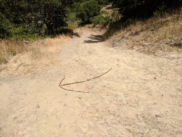
1-2-3 INCH!
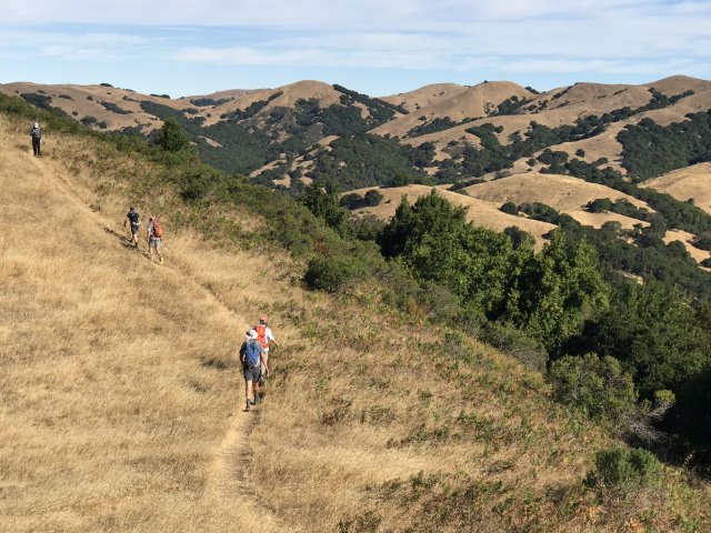
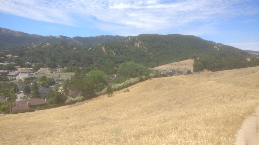
The first stop was the summit of Little Mountain. While relatively close to the start of the hike, and still reasonably early in the day, plenty of sweat was generated hiking up the steep unmarked (yet well traveled and obvious) hike to the summit.
Sarbinder overshot the summit slightly, then came back. I found a cache and waited for the last of the hikers before heading back down. Managed to corral most of the people who had taken a wrong turn on the descent. The route they were following ends up a quarter mile away relative to where we were heading. That being said, it allowed us all to get back together again. Sarbinder took the full wrong route, so I ran into him at the bottom of the hill.
I couldn't keep Sarbinder from running off again, but recommended that if he was in such a big rush, that I'd pay for his and my Slurpee if he wanted to swing by a 7-Eleven after getting to the mid-way point later in the hike (i.e. where we'd re-pass our cars on the way back from Mt. Burdell). This was, of course, a joke.
While heading up the network of trails to Mt. Burdell, I was starting to think people might have missed the turn off from Dwarf Oak Trail (note: no diminutive oaks spotted) to get to Michako Trail. Along Michako, we could see pretty far behind us, and only a few INCHers were in sight.
Took a while for everyone to show up at the summit, and after some amount of friendly interrogation, it turned out that everyone had taken the correct route to the summit. Hooray! Two peaks down, one more to go. . .
The good news was that, despite the expected high temperatures, we'd gotten most of the exposed hike out of the way early. It was warming up, but there were compensatory breezes as we headed back toward Little Mountain. This part was a loop, so there were plenty of new junctions to navigate. I had a few caches to do along the way, so by the time we rejoined the trail we'd taken up, everyone had passed me.
Near the bottom, I cut through San Marin High School to refill my water. Upon arriving back at the cars, I was surprised to see almost everyone still there, refueling and rehydrating (although apparently no one else took advantage of the high school).
More surprisingly, Sarbinder was still there, and presented a partially melted Slurpee! Turns out there actually is a 7-Eleven in the vicinity. And then he was off, never to be seen again. The rest of us hung out a little longer. People had planned for this rare mid-hike break, with lots of fancy foods. I only had a frozen gatoraid waiting, and that was left to quietly melt since I had a delicious Slurpee.
From here, we'd head back up toward the Little Mountain trail, making it the third time we'd pass the junction to the summit (with still one more passing left). I thought the undulating connector trail to Indian Tree would be hard to follow, but it was very well signed.
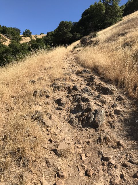
The planned route took a short jog down a dirt road so we could pick up Rent Barn Trail to Deer Camp and make it a loop. This was new to even some of the Marin veterans. That being said, it was still a well traveled route, and all the trails were in great shape. While the temperatures were now warming up, this part of the hike was shaded as planned--love it when things work out!
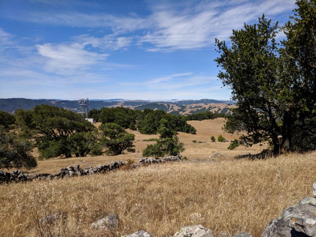
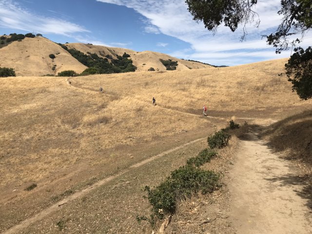
Several junctions later, the front runners were at a gate in front of the local high point.
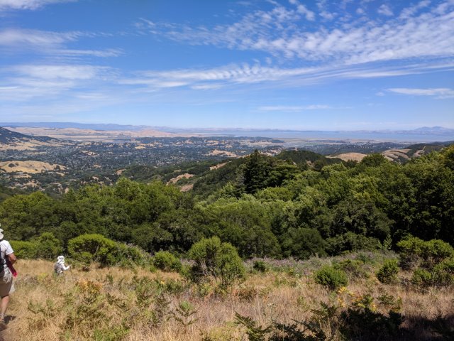
When coming back down, I was pleased to intercept the second wave of INCHers at the gate, enthusiastic to visit the Peak. Not everyone did, but better than expected.
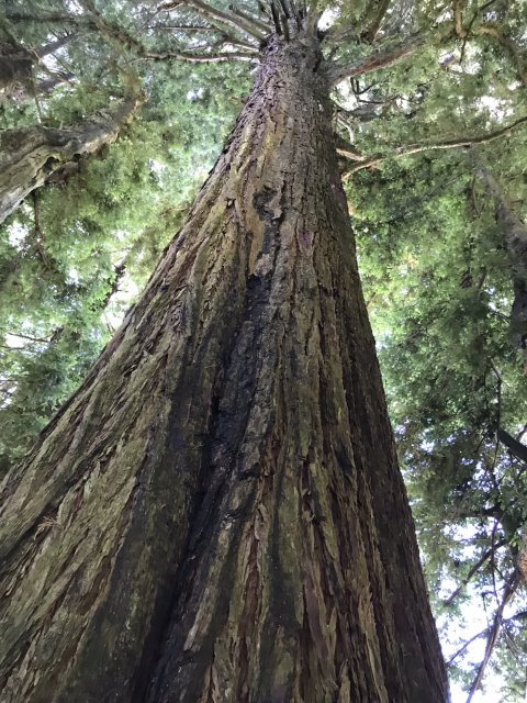
Whether or not you visit the peak, the top of the trail has a path to this very fine tree, which we assume is the namesake Indian Tree.
From there, we took a gentle route down Indian Tree Fire Road.
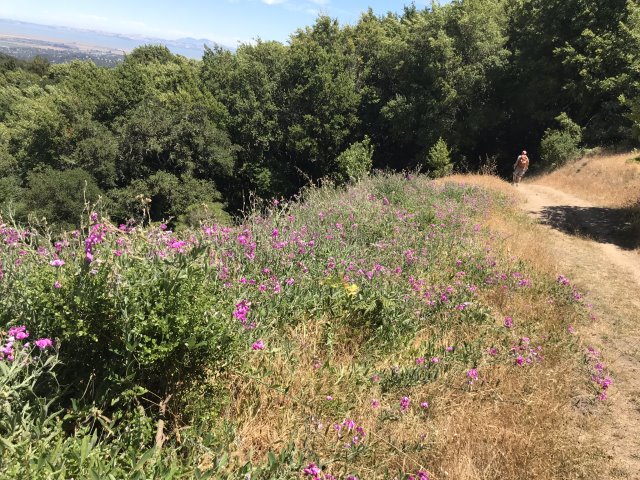
I was afraid people would miss the turn-off to Ship's Mast Trail, which itself was a protracted detour to make a loop out of this hike. That being said, this was some of the nicest forest-covered trail of the hike. And, while I expected it to be mildly downhill, it had a few uphills to keep the pulse going.
Started falling behind the faster crowd while picking up a few geocaches. As we reached the exit of the park, I could see Mihail heading up the "wrong" trail. By wrong, I meant the same one I planned to take, but didn't mark on the map.
When I turned off to take that trail, I mentioned to the large group of people just behind me not to follow. At the end of the hike, Mihail denied deviating from the route we took coming in, but everyone else had seen him too. Well, it was funny--you had to be there. Anyway. . .that route was both steep and exposed to the sun, but soon it topped out.
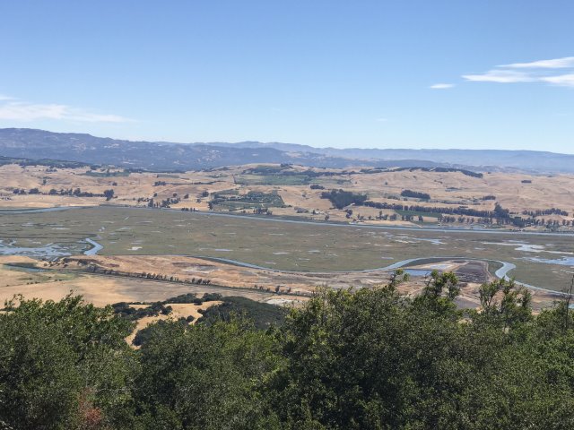
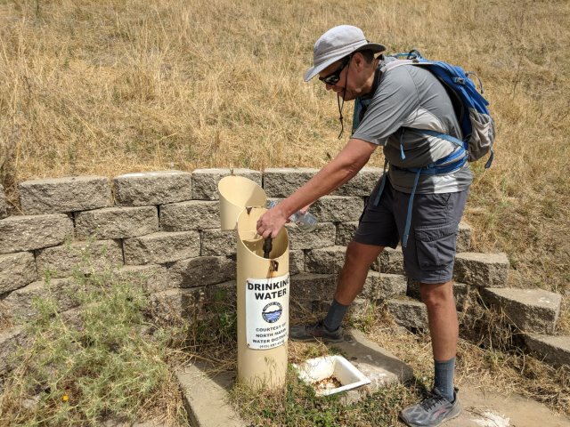
From there, I kept taking the high ridges, which were the original roads before the trail was created. Because of that return route, I missed the sweet Marin Water District water fountain. While everyone was enjoying the cool water on the return, I was hiking by the water tank providing the water pressure for the fountain. We've hiked through many water districts, and this was the best advertising ever.
Milon and I crossed paths as I descended the ridge and intersected the trail. But at this point, I plunged down the road to Stafford Lake (and the golf course) while the trail continued along a more moderate route. So at the other end of the road, I ran into Milon a where the trail crossed a second time. From there, everyone was back on the same trail. I slowly passed a few INCHers along the last miles of the trail. It was now hot and exposed, but the uphill segments were generally short.
Back at the cars, we all agreed that, while hard, we really lucked out on the weather/breezes/shade. The North Bay delivers another fine hike!
We partied for a fairly long time in O'Hair Park, which has some open-to-interpretation rules with regard to exactly where, when, and how-long you might be permitted to consume beverages. We were "forced" to keep the party going because Dan was still missing. We weren't too worried since Dan had been spotted along the short segment of Indian Tree where the route up and down shared a common trail.
One more peak crossed off the San Fran Nifty Ninety.
![]()
![]()
Pages maintained by Steve Walstra,
Peter Saviz, and
Russell Gee.
©2026 Intrepid Northern California Hikers