
| Main Page | Diary | Leaves | Stats |

983. Palisades Loop (05/16/15)
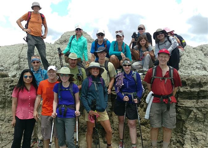
Hikers (22): Arlene, Biz, Brad, Carol, Dan, David, George, Helen, Iris, Jane, Jeff, Jim, Kathryn, Kevin, Milon, Nick, Peter E, Sarah, Sarbinder, Sophie, Steve, Suzie
Distance: 19 miles
Rating: 4 difficulty, 10 beauty
Park info: Robert Louis Stevenson State Park near Calistoga
Write-up by Steve -- Pictures by Biz, Iris and Steve
I had a grand plan. Two months before the hike, I got an invitation to a rare company party in Calistoga. Even more rare, it was on a Saturday. So I figured I'd schedule a hike there the same day and party that night, then stay in Calistoga and do a second hike on Sunday. It all seemed so perfect until I realized I had a Sunday afternoon commitment. . .and later discovered the ridiculous price of hotels in the area for that weekend. But it was too late, as I'd already scheduled the hike. In the end, I took Friday off instead to do the "second" hike first, and stayed in economical Santa Rosa.
This is definitely a great hike. Despite being "far north", 22 people signed up, several of whom had done it before. I got there way early, so went to the restaurant near the trailhead where I ran into Iris, who was ordering a breakfast burrito. That worked out well, because I got to eat a third of that burrito.
1-2-3, INCH!
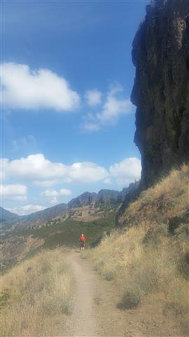
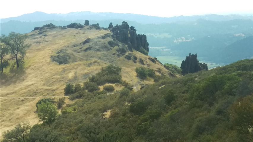
It wasn't too hot, so the long uphill went by quickly. I made a stop along to way to tag the summit of Bald Hill (see picture way below), during which time many people passed below. There was a geocache nearby--below the summit on a treacherous spire--which I spent a long time trying to find for naught.
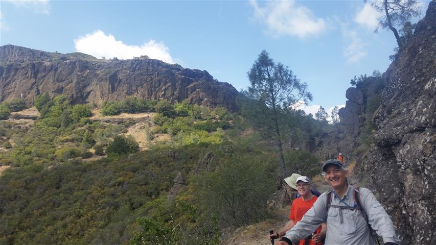
So now I was behind most of the group. Passed Dan right near the junction with The Palisades trail, and then hiked alone for a long time. Caught up with the middle of the pack not too far before Table Rock. A half mile before Table Rock, the trail takes an unexpected turn uphill. There is a trail to nowhere that keeps going straight. I've taken that trail twice before--it's very enticing. This time I noticed the well-designed barrier to prevent people from continuing forward. Others would miss this, including Dan, who had managed to first get lost at The Palisades Trail and, later, at this junction. . .
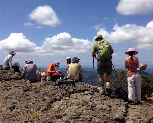
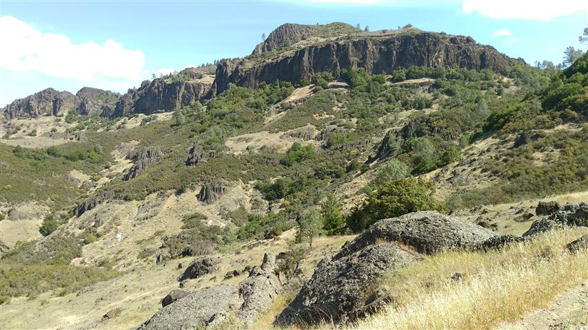
Soon most of us were at Table Rock. Beautiful views were to be had, although not quite as awesome as the prior views heading toward The Palisades. By the time I got there, the front runners had set up shop near the edge. Last time we were there, very few people went out there, so was glad more people got to peer over the edge of "the table". That being said, I was happy to take a break in the middle of "the table". After a while, the fast group came back to where the middle group had staked claim. Jeff and I climbed the nearby highest point on Table Rock while waiting for the rest of the INCHers to arrive.
We waited, and waited, and finally everyone showed up except Dan. We waited a bit longer, but it seemed like I was the last one to see him, which made no sense since there was a full four miles between that point and Table Rock. So if he had fallen off a cliff, well, he wasn't going to get any better if we waited longer. As already mentioned, he had screwed up at the Palisades Junction, and again at the turn for Table Rock, so showed up at Table Rock after we left. And since there was no map for the next section, he wisely turned back. His route back was actually a tad harder, so. . .sucks to be Dan!
Once we found entrance to the route we needed, I keep everyone together until the 0.8 mile point where we crossed a stream. I figured people couldn't get lost from this point for a while, so I cut the front-runners loose. Much to my dismay, it was a good 15 minutes until the back of the pack got there, so there was no chance to catch back up with the front.
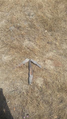
A few miles later, I would see most of the group milling about in a picturesque valley. Someone asked "Is this right?". Well, that caused me to pause and look around, and I immediately noticed cairns to my left. So I headed up that trail and eventually confirmed the correct route. Everyone started trudging back. I left an arrow at the first turn and kept going up and then down, down, down to another wide junction near a camp. This area I remembered, and made another arrow while waiting for everyone. Soon the formally stranded group came in, hung out for a while, and then headed down the trail (Jim scouted out the nearby camp while waiting). Everyone was accounted for except the "back of the back" from the 0.8 mile point {Arlene, Kevin, Iris, and Jeff}. After waiting far too long, I headed back up, up, up, and down, down, down to see what had happened. . .
They had made the same mistake as the others, but Jeff had led them farther into the abyss. I waved them back. Looking at the map now, it would have been a very long day if they had continued that course! This chewed up even more time. . .
From there, it was fairly straightforward to get back to the main Oat Mine Hill route, and back to the cars far below. As with the last visit, I took a cool (unsigned) alternate route back that parallels the main trail. . .and as before, no one was willing to wait, so no one got to experience it. Too bad, 'cause it's a hell of a lot better than the pounding one takes going down Oat Mine Hill (at the cost of a bit of bonus elevation).
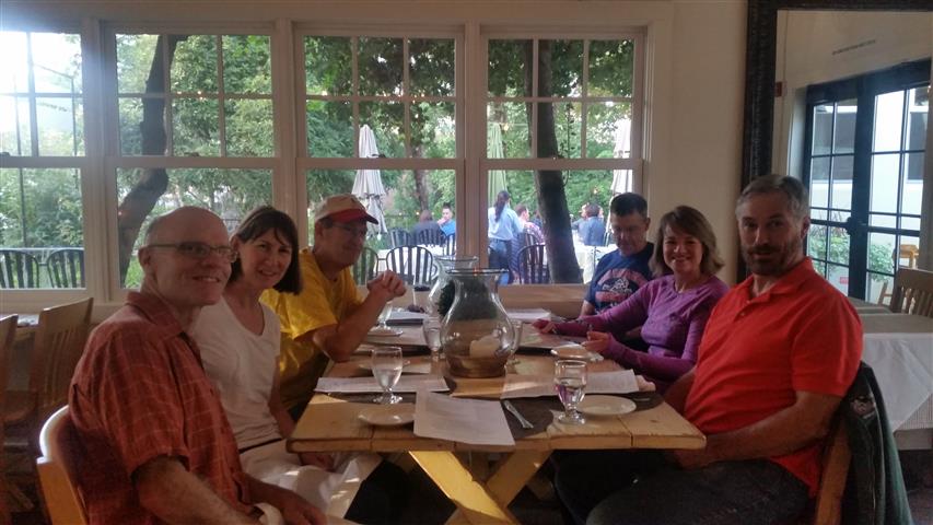
As I was cleaning up to leave, David came down. He was as surprised to see me as I was to see him. We chatted for a bit, guessing that everyone had already left (except the trailing four). I told him I had to get going to Santa Rosa to change for my Calistoga party, which I was now way behind schedule. As I drove around the corner, I saw everyone hadn't left (for Russian River Brewery), and had just settled in the nearest shady spot. Oh well--probably better I hadn't seen them, or I'd be even more late. As pictured above, they would go one to better things--great way to end to a fine hike.
For me, I quickly drove to Santa Rosa, took a shower, put on a suit, and drove back to Calistoga. Thanks to all the hijinks, I was an hour late, but managed to find a way into the "castle" through an emergency exit (there were tons of tourists still walking the grounds taking pictures, so this was no small feat). Eventually asked someone inside where the party was--the place is quite large--and, since I was dressed up, they showed me the way saying "You look like you should be there, but if they kick you out, it's not my fault!". . .Later that evening, when telling folks at the table that I'd done a "big hike", I manage to score a second delicious entree to go with all the wine, so it was a good day all around.
Milestones:
Kevin's 60th leaf
Milon's 20th leaf
![]()
![]()
Pages maintained by Steve Walstra,
Peter Saviz, and
Russell Gee.
©2026 Intrepid Northern California Hikers