
| Main Page | Diary | Leaves | Stats |

1099. Mt. Diablo's Camel Castle (09/09/17)
Hikers (24): Adam, Alan, Carissa, Chester, Chinyet, Christina, Dong, Giulia, Hailong, Heyning, Iris F, Jarda, Jim, Karl, Kathryn, Kendra, Manfred, Mihail, Sarah, Sarbinder, Shuli, Steve, Susan S, Tiffany
Distance: 18 miles
Rating: 4 difficulty, 6 beauty
Park info: Mt. Diablo State Park near Alamo
Write-up by Steve -- Pictures by Chinyet, Jim, Karl, Dong, and Steve
I'd been dodging the heat for the last several hikes, but this weekend looked to be below 90 (just barely). . .so why not visit Mt. Diablo?
25 people showed up, with a few arriving right before the hike should have started. There was a little bit of a delay because Macedo Ranch now charges $6 for parking (previously it was free), resulting in people looking around for $1 bills and filling out the form. Oh well, at least it's a good place for a post-party. (<- that's foreshadowing).
Some signs at the entrance claimed the area was closed for a private event. The event turned out to be the Save Mt. Diablo "Moonlight on the Mountain" charity dinner. High-end "black tie" shuttles were going in and out all day. They were fine with us parking there because we were early--the signs were mostly to prevent people from trying to enter after noon when apparently the shuttles would be the only way in. Save Mt. Diablo must be doing good work, because in over 20 years, Mt. Diablo is still there.
1-2-3 INCH!
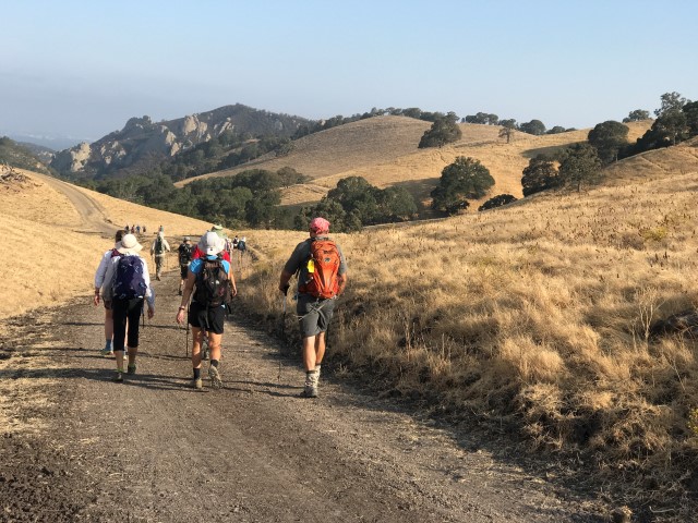
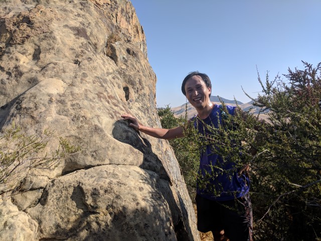
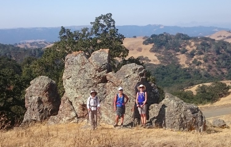
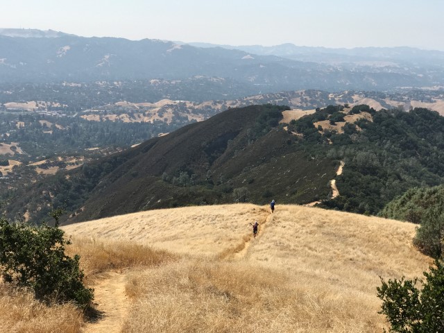
The first target was Castle Rock summit. This is the Castle Rock in Walnut Creek, which when viewed from the namesake park, does have a bit of a castle-like look. But from the ridge line, it wasn't nearly as remarkable. Still, a new peak to bag.
Several people walked a few yards more from the summit to take pictures at the most castle-like rock in the vicinity. Also, several INCHers were apparently stung by bees on the way up Sunset trail. Good way to start a hike!
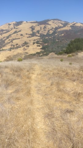
After that, it was down to the road and up to Camelback Trail. This trail is not on some of the newer maps, but it is still signed and easy to follow. A few people still missed it though, and went various way (on the road or along the fireroad in the wrong direction) for a bit until figuring out where the trail was. The trail is definitely overgrown in places, but after INCH beat their way down it, it's probably in slightly better shape.
The end of the trail hits Burma Road, and just after that is the namesake Camel Rock. All this time, I thought the name came from the first two humps of the trail, but no, it's a real Camel-looking rock. Gotta love it--Diablo is full of fun things.
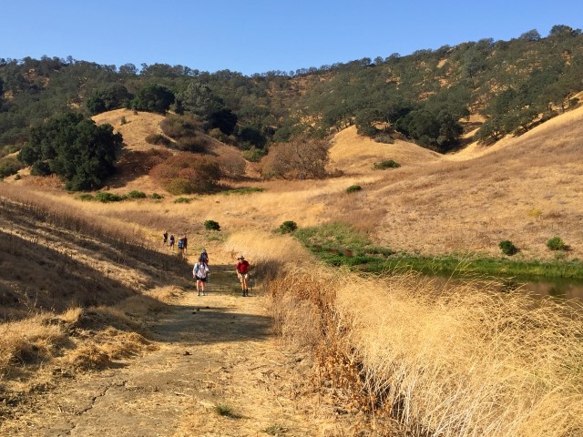
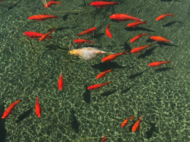
From there, it was up, up, up. There was an optional extension which was gentler, but an extra mile longer and with a little more elevation gain (and new-to-INCH trail). I had run into Iris F at the Burma/Camel Rock intersection, and she took this extension as well. Along the way, I noticed an orange flicker in one of the circular water troughs that are found on this side of the mountain. Mentioned to Iris that it probably had goldfish in it, as I was familiar with another one (that many INCHers passed on the shorter route and took picture of [below]). She went down for pictures and confirmed the fish. So apparently all of them have been "stocked". Anyway, another weird delight of Mt. Diablo.
Later I ran into Manfred, who was taking a picture of a small tarantula. A few minutes later, I could see Alan coming up the shorter route, about to rejoin Burma Road. We were all heading for the intersection with Deer Flat Road, where pretty much everyone goes when coming up from Mitchell Canyon.
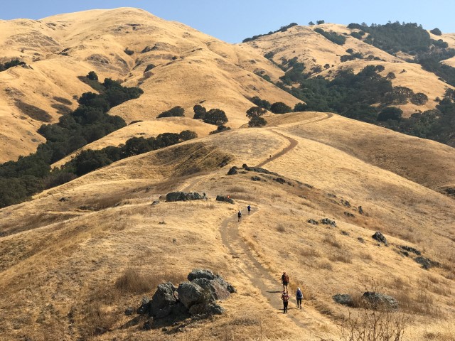
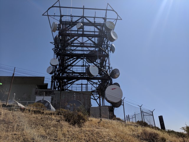
From that junction, we were passing people left and right on the way to the summit. It seemed longer than usual getting to the top, and I stopped at Juniper Campground to spray water on my hat to try to cool things down (Tiffany and Karl, I heard later, took it to the next level with a cold shower). Was ticking off landmarks on the way up: campground, saddle, road-crossing, radar tower, parking lot, Trail Through Time center trail, second radar tower, summit. I could feel a cramp coming on when I took too big of a step up, but it was OK, because I knew I was close.
Touched the summit, then walked back down to the water spigot to re-fill. Few people notice this spigot, which is next to the visitor center lower exit, so end up filling their bottles [slowly] from a nearby water fountain. I'd gone through 2.5L on the ~11 mile trip up, and filled by Camelback to 3L knowing it was mostly downhill from there. From the location I was sitting, I could see a few beat people sitting in the shade in the same place we were sitting 14 years prior in INCH's youth. That hike also went through Castle Rock and has a rich history.
I'd run into Hailong, Sarbinder, and Mihail coming down "Trail Through Time" as I went up, so only Chinyet was still at the summit when I got there. He hung out long enough to see the next wave of INCHers before ditching. Iris F shared some cherry tomatoes, whose fluid content made them more delicious than normal. Waited long enough to see most of the tail end of the INCHers before setting off. While I didn't see everyone, I was confident (p < 0.05) that no one had gotten horribly lost on Camelback Trail or such.
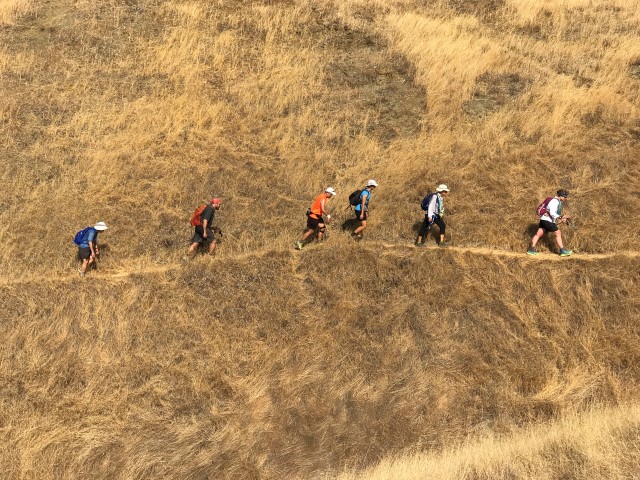
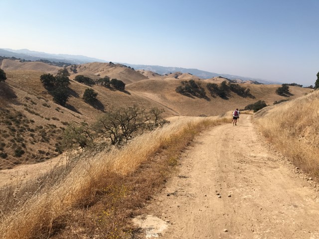
Next stop was Wall Point. It's a long, boring hike down Summit Trail. We eventually went up the Ridge Trail and down to Wall Point Road. I had just caught up with Shuli at this point, who was quite vocal about not enjoying the steep single-track section.
A bit later, we passed Secret Trail, which happened to have a geocache. I found the cache, and while picking it up, I though "Gosh, it's nice and cool in this shade. . .". So I dropped my pack and laid down for a few minutes to sign the geocache log and consult my map (and rest). Ten minutes later, I was off again. During that break, no INCHers passed by.
The route occasionally had a few welcome breezes, but the most dominant feature was the trail radiating heat itself. Wall Point Road has a few uphills, which were a welcome break from the grinding downhills. For sure, this trail is better hiked in the opposite direction, because you face the interesting parts of the route (rock formations). Was happy to see a big arrow at the short use trail to Wall Point. I heard later that Mihail made it--his first official INCH arrow. The grassy summit is no big deal, but it is a named summit, and the last of the four "points" along today's route.
From there, it was mostly downhill to the parking lot. There was one little uphill portion near the end which I'm pretty sure I ascended more quickly than any section of the downhill. I was both happy for the variety and anxious to get the hike over with.
Three people sent in their tracks [17.8mi, 5.0kft; 17.6mi, 4.8ft; 18.6 mi {+1 mile route}, 4.9kft] which confirm we had about 5kft gain. With the heat, a few people were lobbying for a 5, and there was unanimous agreement that this route was harder than the standard Diablo routes. But. . .my subjective judgment was it wasn't a 5 because there were too many happy-looking people.
Speaking of which, the party was going strong when I got there, but we were later informed by a ranger that there is no alcohol allowed in the park. I didn't believe this (as, by default, California state parks do allow alcohol), so furiously looked up the details on-line. Indeed, even the campgrounds at Mt. Diablo are "dry". Who knew? Well, that's OK, because INCH always keeps a few teetotalers on hand to average things out. We did notice that one of the neighbors had a camera that kept swiveling toward our party. . .Chester wanted to moon it, but Carissa (the teetotaler) wasn't having it.
Russell left a note on my car declaring that this was his first Did-Not-Finish. The heat was too much (I agree!). It's generally unwise to hike 18 miles on a hot day.
Milestones:
Highest point in Contra Costa county
Alan's 150th leaf
Kathryn's 180th leaf
![]()
![]()
Pages maintained by Steve Walstra,
Peter Saviz, and
Russell Gee.
©2026 Intrepid Northern California Hikers