
| Main Page | Diary | Leaves | Stats |

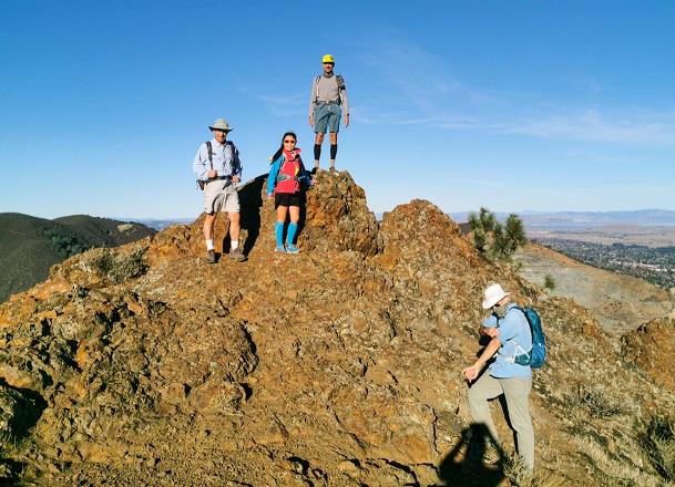
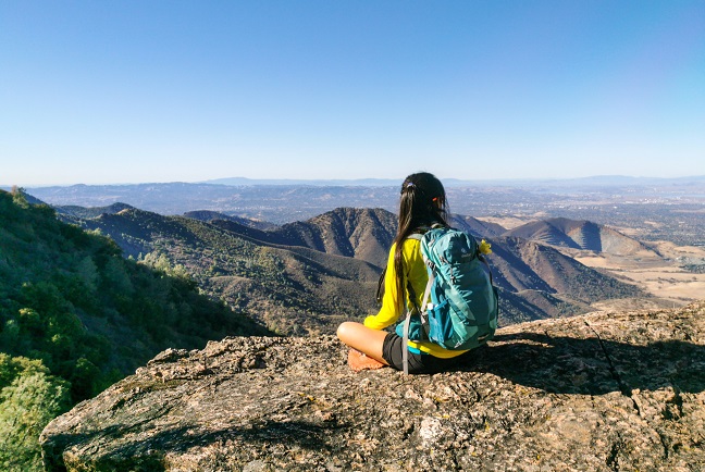
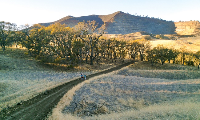
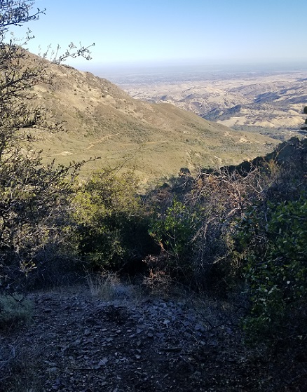
1237. Five Peaks of Diablo (11/27/20)
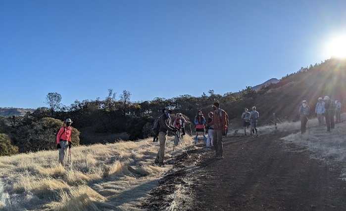
Hikers (32): Adam, Alan, Alan B, Arlene, Bjorn, Brad, Chinyet, Christina, Dan, Dong, Ellen, George, Giulia, Helen, Iris F, Jim, Kathryn, Kevin, Mihail, Milon, Nagendra, Nohemi, Peter, Peter M, Rainer, Rudi, Sandy F, Sarah, Sophie, Steve, Susan S, Yannick
Distance: 16 miles
Rating: 4 difficulty, 9 beauty
Park info: Mt. Diablo State Park near Clayton
Write-up by Peter, Adam, and Steve -- Pictures by Adam, Alan, Chinyet, Dong, Helen, Milon and Sophie
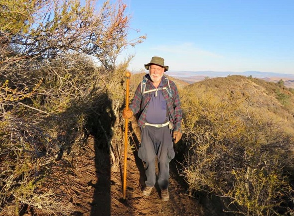
The Black Friday tradition of hiking Diablo was back. Fortunately the weather was much better than on our last trip here just a few weeks ago.
We could not gather at the trailhead thanks to the COVID rules, so we started the hike a little way down the trail ...
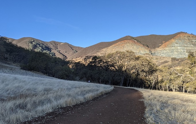
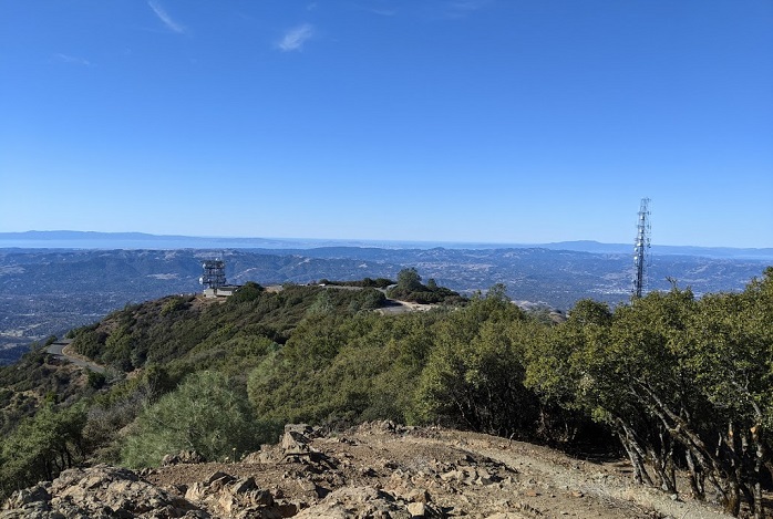
After North Peak, I decided to skip Olympia because (a) I'd been there just a few weeks earlier, and (b) there's nothing too exciting about it other than a nice view of the oil refineries below. So instead I went back down to Prospector's Gap and then took the Bald Ridge Trail back to Murchio Gap, followed by the Meridian Ridge Road back down to the bottom. The route takes you up to the top of the Bald Ridge, with beautiful views on all sides. This and the "secret" Deer Creek Trail are my two favorite trails in the park and I wanted to be sure to hike them both on this gorgeous day.
As Milon and I were having lunch at the summit, we chatted about the steep use trail that goes from Prospector's Gap up to the summit. As it turns out, it was a quite a coincidence ...
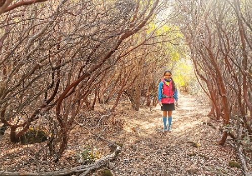
Adam's Notes: Sorry to miss the after party, heard the soup was good. I finally found your Deer Flat Creek trail after years of missing it. It was worth the trouble, if a little hard to follow.
Also "discovered" another new trail thru my own carelessness. I had put the route on my Garmin watch, but instead of the intended minor shortcut from the "pulpit" to North Peak Trail at Devil's Elbow, the routing software had auto-filled down an unofficial trail from Diablo Summit to Prospectors Gap.
I sorta realized I was in trouble after I'd climbed over a railing, alarmed some picnickers at a rock outcrop ("there's no trail down there!"), and crashed thru thorny brush to find myself gazing down an almost vertical wall with the road to north peak far below. Naturally, being an INCHer, I kept going.
I'd misjudged the entrance, but there was a trail of sorts, dropping 750 feet in less than half a mile with some 45% grade sections covered in gravel. Not sure how I got down it without falling. It puts your favorite North Peak access road to shame, as well as the East, Zippe & Olympia trails I took as another alternate later.
On the open-source map I used, I now see this trail is called "Death Slide". I can't argue with that. I'm sure it will find its way into an official INCH hike soon!
Addendum from Steve:
Adam's comment about the "Death Slide" made me dig up some history. The first time "Five Peaks" came up on T-giving was 2007. We first did a Mt. Diablo hike post-Thanksgiving in 1998 on hike #96 to North Peak, but didn't come back again at this time until 2002. After that, it became annual, but with some variety of routes. Who can forget 2005 when there was much drama about a car break-in. Well, you'll have to imagine, because it wasn't written up.
It wasn't until 2007 that "Five Peaks" showed up and, excluding 2008, it became the norm as Peter gave up on conceiving new hikes, except to make "5 Peaks" easier. That happened in 2016--because Peter's knee hurt--and 2018--because the weather was bad. It happened here in 2020 based on Peter's write-up, but since 30 other people did the whole hike (besides Sandy F, I'm guessing), apparently the rules have changed.
Overall there have been 20 Diablo post-Thanksgiving hikes. I've been on 18 of them. So. . .at some point you start to look for new things. On the last T'giving hike, I found a new route to Twin Peaks "behind" a geocache. I doubt it was ever an official trail, but someone with a chainsaw had cleared out a little of it after a past fire. It's unrelentingly steep and exits at a location with an official sign post. That's what the State Park sometimes does when it closes a trail (the sign doesn't reference the trail--it's just "there"). The trail begins early in the hike where the trail to Mitchell Rock makes a hard right--the "Twin Peak" trail makes a hard left.
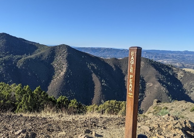
When I reached Twin Peaks, it wasn't clear who was ahead and who was behind. I had huffed, puffed, and slid my way up this shorter route. Didn't see anyone ahead on the way to Eagle Peak. There is a big rock along the way. As one approaches it, another of those mysterious signs that don't mark junctions appears. This is where the original route to Eagle Peak went. I took that as well. It's steeper and shorter. In the summer, this exposed route to Eagle Peak used to be a Level 5.
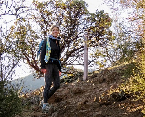
Despite the steepness, the distance saving should have gotten me ahead of everyone. I passed Susan S along the spine from Eagle Peak to Murchio gap, but she had started early. When I broke through the brush at the end of Deer Creek Trail, I soon ran into Chinyet tying his shoe. I chastised him for missing Deer Creek Trail (since he hadn't passed me). He consulted his map and eventually agreed. A bit later I headed up the steep route to Moses Rock Trail. I invited Chinyet up the detour, which has a little more elevation gain, and is a tad shorter. Bjorn, Nohemi, and Susan S were right behind us, I'd hear later, but were not inspired to follow. I can say that the views are better up there, but you pay a price.
When I reached the Diablo summit, I headed up to the top of the building. Chinyet was already there, snapping pictures. After we came down, I said "Don't follow me" as I went over the railing to the short trail toward Ransom Point (I'd taken this route up from Ransom Point on a prior Diablo hike, so knew it was good). That connects to the loop trail around the summit. A slight jog to the right took me to my goal, the "Death Slide". I'd never heard of it, but spotted it on OpenStreets, the same source for Adam's link above. I'd seen the bottom of this trail before, but never a route from the top. Well, it's a crappy trail, as Adam mentioned, and should only be used as a route to the summit, not from the summit.
Was happy to make it to the bottom and proceed to North Peak. That's where I ran into Sarah and Helen coming down. I bagged the peak and then headed down, eventually running into Chinyet coming up. So despite my slow going on the steep trail from the summit, it was still faster than the usual route.
Thought I might catch Sarah and Helen before Olympia, but did not. After touching the now-signless summit, took East and Zippe to continue the "shorter but steeper" theme (also the fewer CoViD-y people theme). I usually take this route anyway because coming down East gives a different view than the rest of the routes we generally take on Diablo. Since I never saw Sarah and Helen, I apparently passed them during this detour.
Chinyet eventually caught me near the bottom of Olympia Trail. When we reached Wasserman Trail, I realized I'd missed my "bonus" route. Bid Chinyet au revoir and backtracked uphill to a gate. . .
This took me to the true start of the Bruce Lee Spring Trail. I've done this maybe six times (from both directions) and this was the second time I've taken it without making a mistake along the unmarked, forking trails. From there, it was back onto official trails and up and over two ridges to get to Back Creek Trail and onward to hot soup!
Finished with a total length of 14.5 miles from car door to car door, which could be shortened to under 14 if that were the goal. Still got all the elevation gain and more. As a side note, the bottom parking lot--where I had been the only car in the morning--was packed. People are definitely opting outside. #optOutside
Milestones:
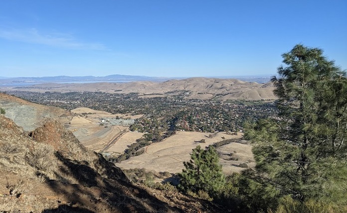
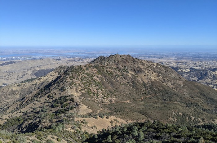
Highest point in Contra Costa county
Ellen's 70th leaf
![]()
![]()
Pages maintained by Steve Walstra,
Peter Saviz, and
Russell Gee.
©2026 Intrepid Northern California Hikers