
| Main Page | Diary | Leaves | Stats |

1152. BART2BART (10/06/18)
Hikers (26): Alan B, Bjorn, Chinyet, Crystal, Dan L, David A, Giulia, Gloria, Jan Pr, Karl, Kathryn, Michele, Mihail, Milon, Nohemi, Peter M, Rainer, Robert, Rudi, Sarah, Sarbinder, Sophie, Steve, Susan S, Vicki, Yipeng
Distance: 22 miles
Rating: 4 difficulty, 8 beauty
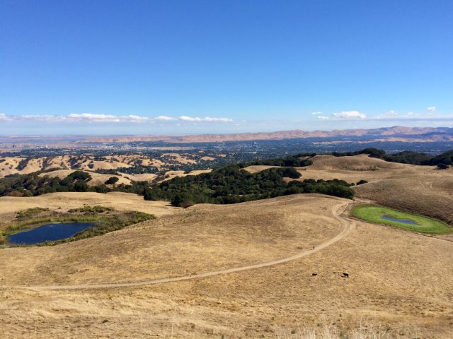
Park info: Tilden Regional Park near Berkeley
Write-up by Steve -- Pictures by Chinyet, Karl, Milon, Steve, Sarbinder and Mihail
The days are getting shorter, but thankfully cooler, so a good time for the open hills of the East Bay. We were starting the hike from the Lafayette BART station, and the start time was designed to align with the BART schedule. I took one train earlier, so while I wasn't surprised to see INCHers getting off the train "early" at Lafayette, I was surprised at the number of people who were there "two trains" earlier.
Everyone got ready and, at the last minute, almost all the "missing" people showed up when the next train arrived.
1-2-3 INCH
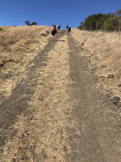
Susan S and Nohemi were off running ahead even as we walked down the street. Unfortunately, they headed uphill one street too early. Unfortunately, that is, for me, because I glanced down at my GPS, saw a waypoint, and followed them. Everyone else went up, too. Later Sarah yelled that we'd taken the wrong road, but I thought she was thinking we'd go up Elizabeth Drive (which is the only official route on the Briones Map). A second person confirmed it wasn't the street I thought it was (Sierra Vista). Damn! I hate screwing up my own hike! So we turned around and took the right road, which was quite steep. . .
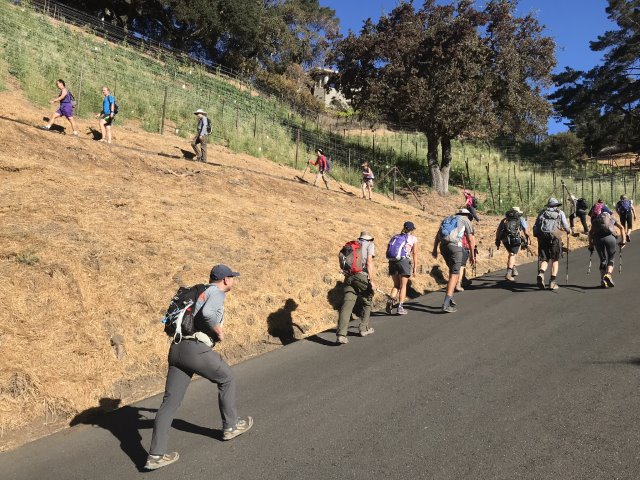
Once we got on to Lafayette Ridge, everyone was free to run off, which some people took literally. It's an undulating ridge, so the (downhill) runners (Susan S and Nohemi) would rush ahead, and then we'd pass them on the uphill, and then they'd be off again. . .luckily it's a wide road, so no worries.
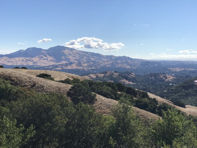
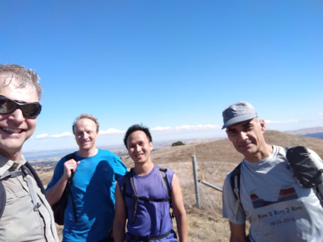
Sarbinder ran ahead (uphill!) at some point and behind him was a group of fairly quick hikers. We tagged Flat Top and then headed to nearby Briones. There is a "back route" to the summit, which I pointed out to everyone who was nearby at the time. After bagging the peak, we ran into David A and Crystal, who didn't take that route, so now headed up to tag the peak.
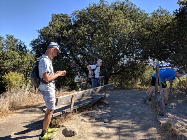
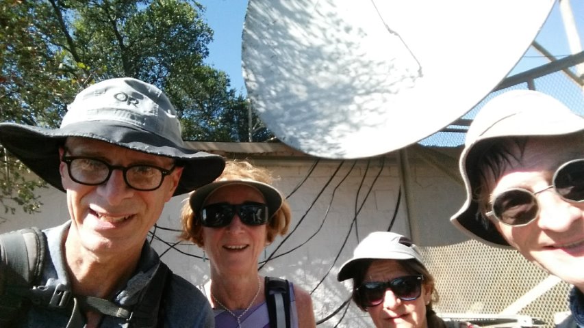
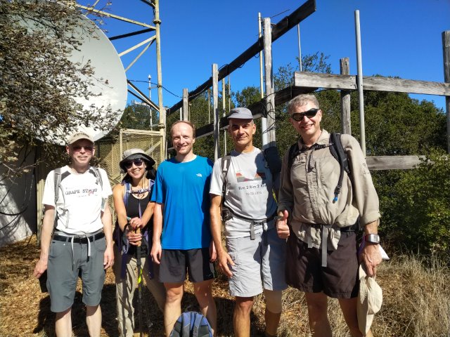
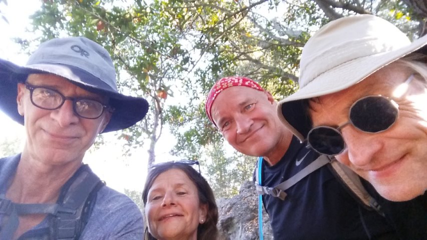
My plan was to go to Mott's Peak, which was part of the extra-intrepid red route on the map. Mihail decided to come with. Chinyet saw us going up and came along with his latest +1 (Jan Pr). I'd find out many hours later that Sarbinder also took the this route, along with the below picture from the close-but-not-quite summit.
Motts Peak was optional, but it was the motivation for this hike. The summit was the last peak needed to complete the Sierra Club San Fran Bay Chapter's "Nifty Ninety day hikes. Sarah had shared the list from her local Sierra Club news letter near the end of 2017, and I only needed 17 peaks to compete it. Half of those could be knocked off in a single visit to San Francisco. Then the list was added to Peakbagger, making it even easier to track. That list also motivated hikes #1111, #1139, and #1142, not to mention me skipping a few INCH hikes to tag distant North Bay peaks.
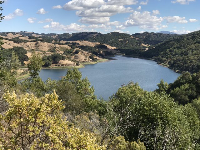
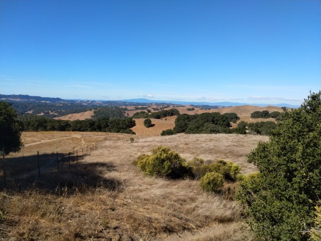
Passed David A and Crystal (who'd skipped Motts earlier) along Briones Briones reservoir. I'd seen them ahead, but now they were stopped. Crystal was pulling out her Camelback which was shooting out a tiny arc of water from a pinhole breach. D'oh!
I took the steeper (but shorter) route at one of the bends around Briones Reservoir (another one of the red routes) which dropped me right behind Chinyet and Jan Pr. I was still dropping arrows every once in a while, so I'd fall behind and then catch up (no small feat with those two). We parted ways at the trail up to Inspiration Point. I took the red route while recommending they go the "proper way". To make up for this, I also took the longer (and red) route around Lake Anza, which was not only longer than expected, but also more popular.
As I walked up the fence line that parallels the "beach" on Lake Anza, I noticed some blue ribbons. Were they Sarah's ribbons marking the way up to the road? It didn't seem likely, but I went up the trail to check. Sure enough, I saw the black rope she'd mentioned. A few minutes later, I was standing on a paved road in Berkeley.
Sarah had put colorful (and helpful) chalk markers at all the turns along the way (thanks!). These, supplemented with GPS coordinates, made it super easy to navigate all the paths. Despite this being the third time I've gone from Tilden to downtown Berkeley, I was still surprised at the amount of uphill after Tilden.
I had seen pictures of people climbing on Cragmont Rock. What I didn't realize was that we were approaching it from the top, so you have to look over the edge of the park to see where the climbers climb. But mostly this detour was to take a different set of paths through Berkeley. Fun!
What I was not surprised about the 3/4 of a mile to the end of the hike, which feels longer than it is. It's not because it's hard (it's dead flat), but rather there are so many milestones along the way (each road crossing is less than a tenth of a mile). So you are forced to be aware of your progress, or lack thereof, relative to when you are walking along a dirt track with no intersections.
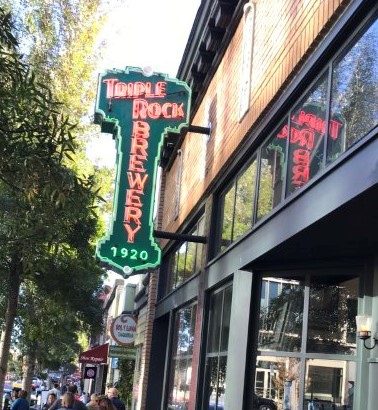
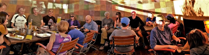
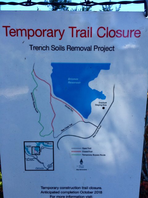
Amazingly, every INCHer except Crystal checked in at Triple Rock, which has to be a new compliance record. And the order that people showed up was unexpected. When I stumbled in, Bjorn and Mihail were already there. After we'd changed, cleaned up, and ordered beer/food, Chinyet and Jan Pr came in. But Sarbinder was AWOL--we figured he'd left long ago. Instead, he showed up soon after, having unintentionally gone the wrong way around Briones, which adds several boring (but picturesque) miles. On the plus side, he got to take a new bypass trail.
INCHers Yenya, Theresa, and Peter E dropped in for the party despite not doing the hike. Dan L showed up at some point, which was a surprise to me since I'd written him off at the start of the hike as a "no show". Turns out he was just slightly late, and saw us walking by as he was getting out of his car. As the last few people trickled in, we noticed Susan S and Nohemi were unaccounted for. They later showed up, haven gotten lost along the way. . .Last in were Rudi and Gloria, who'd taken a wrong turn in the link between Briones Park and Briones Reservoir (mostly thanks to EBMUD's crappy map).
On the BART ride back, I got e-mail from Mike, who'd also stopped by Triple Rock. Turns out he left just before Mihail and Bjorn got there. Oh well, next time!
Milestones:
Jan Pr's 1st leaf
![]()
![]()
Pages maintained by Steve Walstra,
Peter Saviz, and
Russell Gee.
©2026 Intrepid Northern California Hikers