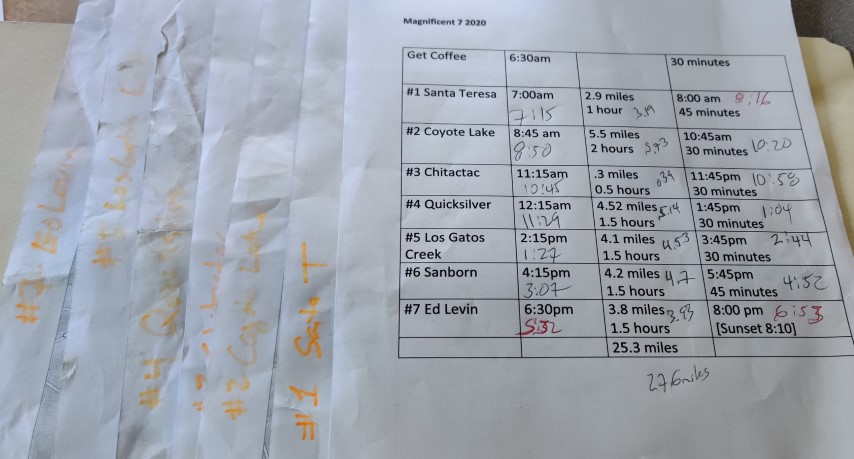
The Plan (post hike)
| Santa Clara County Parks: | 2017 | 2018 | 2019 | 2020 | 2021 | 2022 | 2023 | |||
| San Mateo County Parks: | 2020 | 2021 | 2022 | 2023 | 2024 | 2025 | 2026 |
Another year, another Santa Clara County Parks #PixInParks Challenge. The challenge is to visit seven parks and take a picture at a designated location along the recommended trail in each of those parks.
May is the tail end (hopefully) of the CoViD lockdown {it wasn't!}, so figured now was a good time to try to hit all the parks before the traffic started (both on the roads and on the trails). While not too crowed, the parks were doing good business. Actually, they were doing bad business, as none of the fee-based parks was was collecting an entrance fee this day, much to my great delight.
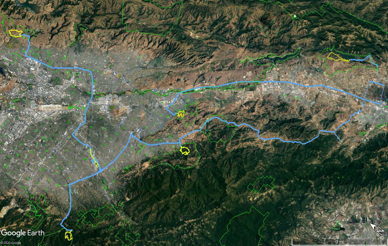
Finished an hour ahead of schedule: 27.6 miles of hiking and 138 miles of driving round trip from my house.
Was going to start at the most distant park--Coyote Lake--and work my way north. Unfortunately, Coyote Lake didn't open until 8am and I've had bad experiences with showing up a parks right at entrance time, only to find the gates are still closed. . .so, decided to get an earlier start and begin in Santa Teresa, whose trailhead would have required a detour either way. That also added a little buffer for the last park, where I definitely wanted to be in well before sunset.
Got to Santa Teresa fifteen minutes late. It had the smallest parking lot of all the locations, but fortunately got the last spot.
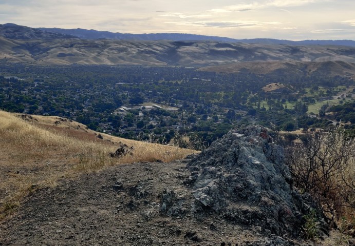
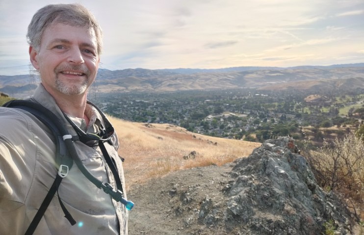
Generally consider this park "easy" and "small", so rarely go with my hiking group. Definitely could never start from this entrance, which has a small historical area (Bernal-Gulnac Joice Ranch Historic Area). Very much enjoyed the steep route up, where I picked up two geocaches along the way. Even at 7:30am, there were lots of people out and about. Got to the picture point quickly, which is at about the highest point on the prescribed loop.
Took a picture of the farther rock instead of the nearer rock (to the summit), as I couldn't differentiate on the black-and-white picture embedded in the map. Good enough!
The trip down the backside and around to the parking lot went quickly. Great to hike on new-to-me trail after 20+ years of regularly hiking in the area.
Back at the parking lot, headed off on a 45 minute drive to the farthest entrance into Harvey Bear/Coyote Lake. Was still fifteen minutes behind schedule, meaning the hike had taken almost exactly an hour.
This would be the second new parking lot of the day, as I've never driven *into* Harvey Bear since there are closer entrances for hiking. Was happy to see the ranger waving cars through--no fees today. A good sign! I had all the coordinates of the trailheads in my GPS, so rolled right into the closest spot, which is across the street from the parking lot.
Was surprised to see a large group of hikers in their 60s assembling nearby. Someone was disobeying the "group assembly" rules. Oh well, got out just before they started.
When it's not too hot, Harvey Bear is a great place to hike. This particular route was about as gentle as it gets. I took the lower trail to make it a counter-clockwise loop and delay the gratification of the picture.
Passed a few families along the way, where I donned a mask to make the passing safer. Upon reaching a gate at the far (northern) end of the loop, caught up to a couple. One of them noticed the map I was carrying and said "Are you doing the PixInParks Challenge? We'll see you up there!". That was a fun encounter, although at the pace I was going, there was zero chance we'd see each other.
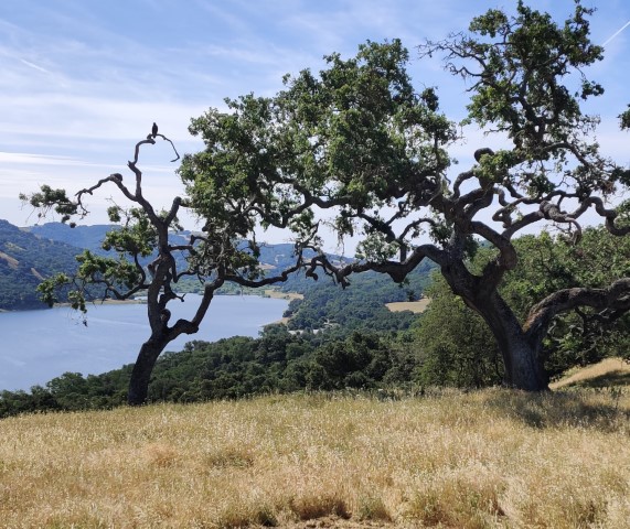
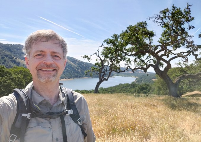
Headed up the Harvey Bear Trail and then headed up Coyote Ridge Trail to the picture location. Found the spot with the two trees framing Coyote Lake and snapped the requisite pictures.
It's a short downhill jaunt back to the parking lot from the picture location. There are two well established use trails I'd noticed at the start of the hike so took them back down at the end to make it slightly more of a loop.
Hopped in the car, grabbed a cold drink from the cooler, and selected the next destination on the list: Chitactac--the smallest of the parks with the shortest (0.3 miles) hike. This entailed a relatively short drive along a few roads I'd otherwise never have a reason to drive.
I walked every trail in Chitactac--and got barked at by the caretaker's dog--clocking in 0.39 miles. Also read all the educational material along the way since I had budgeted 30 minutes for the hike. This was a nice park, and it was easy to imagine why it would be a good place for a settlement.
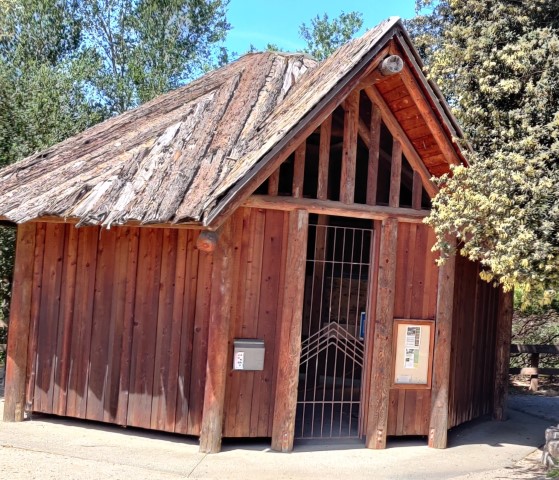
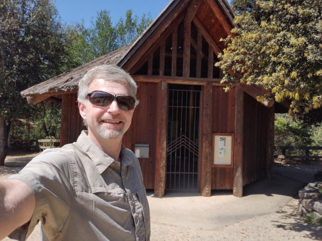
Back at the car, I walked over to take the necessary picture. Unfortunately the structure itself was closed.
Three down; four to go; 45 minutes ahead of schedule.
While driving into the Mockingbird entrance of Quicksilver, was surprised to see many cars parked along the road outside the park. When I arrived in the park, however, there was ample parking (although it might have been full earlier).
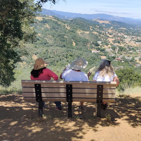
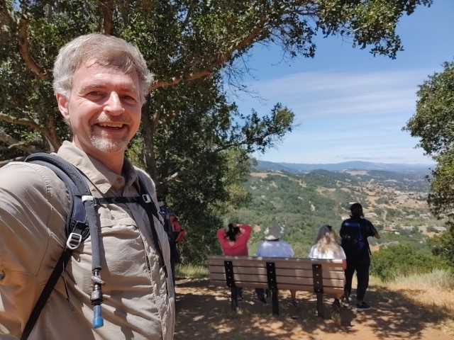
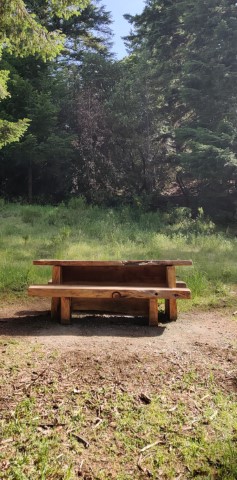
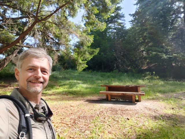
Planned to get the elevation out of the way early by taking the steeper part of the route first. The picture point was packed! The bench was occupied and there were two other groups of people waiting around in the shade. Could not believe how popular this random location was.
But this was only the start of the hike. I've been to this fine park many times and thought this was an peculiar route (much like Sanborn). While plotting it out ahead of time, noticed it went by the "Day Tunnel" junction, which would have been the logical connection to the Great Eastern Trail it eventually tied into. This stuck out mostly because I've never taken that short stretch of trail.
But I followed the route up to Mine Hill Road, picking up a geocache along the way. I overshot the Great Eastern Trail junction and headed down April Trail. Knew something was wrong pretty quickly as I was expecting a junction almost immediately. Pulled out the suggested Avenzo app, which confirmed I was on April Trail. Turned around and hiked back up, where I noticed the trail sign. Hadn't realized it is almost a three-way junction.
The Great Eastern Trail is a nice single-track trail, with the only drawback being there is no way to maintain a 6 foot distance with people coming the opposite direction. When I reached the other end of the Day Tunnel junction, I hiked 0.1 miles to the end (mentioned earlier) to close out the last trail in Quicksilver that I've never taken. Then turned around to continue the original route as planned. Soon I was at the Buena Vista Shaft and then on the final stretch along the shaded New Almaden Trail.
Between taking the wrong route and purposely adding an extra segment, I'd added more than a half mile to the hike. Back in the car, though, was still 40 minutes ahead of schedule. Whew.
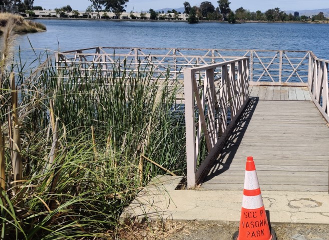
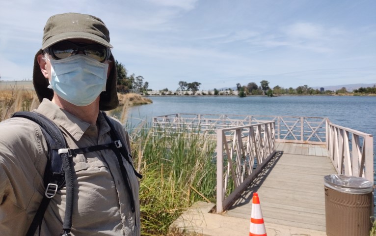
The next park was Los Gatos Creek. Parked near the unmanned entry kiosk and walked down the entrance driveway to reach the far perimeter of the ponds as highlighted on the map. Was surprised to find a big gate barried entry. Went around the gate on the well-established bypass. Shortly thereafter, realized I'd left my camera in the car. . .so headed back.
Starting again, I decided to do the long creek part of the trail first and then naturally come out back to the ponds. This park was hopping. I wore my mask almost the entire time, and was in the minority trying to establish social distance. It was hard to do with all the walkers and bikers. Since the parking lot was not remotely full, I'm guessing a lot of the crowd was local.
Walking on pavement is pretty boring, but it went quickly since the route is flat. The route turns back along the other side of the creek at Campbell Park, which was also well populated.
A mile and a half later, I was back walking along the pools. Went all the way to the far end of the park and came back down to take the picture. Also saw the other end of the trail is closed with a fence there as well. So the route marked on the map is illegal (not to mention not a loop). That's part of the adventure!
Back at the car, I'd put in an extra 0.4 miles relative to the suggested route, probably because the route did not actually mean to include the Dell Avenue side of the trails. Looking at the map later, it looks like one could bike over from Guadalupe River Trail to Los Gatos Creek Trail with only a few segments of intervening roads--a good idea for a summer bike ride. . .
Headed off to Sanborn County Park. There were lots of cars parked long Sanborn Road. Some were apparently going to Saratoga Springs (because they were very far from Sanborn Park). Was again happy to find there was no entrance fee today. Lots of people in the park, but the parking was still no problem. Lots of groups well spaced on the lawn.
I had downloaded the maps for this Challenge and planned everything out months ago. I re-downloaded the maps to see if anything had changed (as it often does). There was one change for this park. The route was *greatly* shortened (with much less elevation), although the stats on the map were not updated. I wasn't having that, and did the full original route (and then some).
It's clear why the route was changed. There are no signs indicating "Pick Lab Road", a key segment of the hike. I'd taken it before, back when it was "Todd Creek Trail". But either way, if you don't pay attention, it's easy to take the wrong trail, particularly because the rest of the trails have signs. Even knowing this, I walked up San Andreas Trail quite a way before realizing I'd missed the turn. Before that, I successfully navigated through some remote service buildings, which I was happy to do since I'd never hiked there because. . .they aren't really meant to be a trail (but that's what the map had). That was fun, too. The area around the Pick Lab Road is quite nice, and it was great to visit it again. It heads pretty steeply before eventually crossing the creek a few times and then heading up "San Andreas Road" to finally connect with the more trodden San Andreas Trail.
I was starting to feel a little "crampy" on the uphill here. Lack of long hikes over the last two months was showing. Fortunately it wasn't too hot, or it would have been a long(er) day. Was honestly relieved upon reaching the Sanborn Trail junction, because I knew it would be all downhill soon after that.
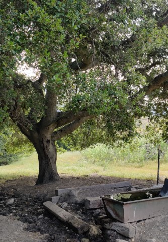
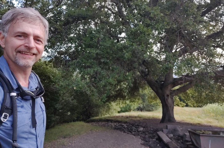
Soon reached the picture location. Had to walk around it a couple times to figure out where the picture was taken. Couldn't quite get the angle.
Alright, back to the car. I was really getting tired--the sort of feeling where I want to sit down and take a break. Decided to eat more and drink more. . .
When I reached the parking lot, I changed into my post-hike clothes. Mostly I wanted to change socks, but it felt good just to change everything and feel cleaner. The hike had been 0.5 miles longer than expected, and I was no longer tearing up the trail, so was now less than an hour ahead. But it didn't matter--I'd definitely be *in* the final park way before closing, so would complete the challenge no matter what--I had all night!
Drank the last cool beverage in the cooler (a V8 energy drink I'd gotten for free) along with a bottle of previously frozen water that was keeping other things cool. By the time I got to Ed Levin Park (45 minutes later), I was feeling better. The lack of entry fee perked me up as well. Decided to hike up in shoes instead of boots to make it easier.
Used to hike in this park a lot in the "old days", so felt a bit of nostalgia along the way. Headed up Tularcitos Trail to Agua Caliente. Lots of people on the trail. Because I knew I was done for the day, and probably more because I was wearing lighter shoes and had eaten more food, I made good time on the uphill. The picture location was definitely an odd one, but certainly different than the rest.
From here, it was a short cross trail over to Calera Creek Trail. I'd never taken the short piece between Agua Caliente and Monument Peak Road since the goal has always been Monument Peak, so got a tiny segment of new trail.
Coming down Calera, ran into a family including a grandmotherly-looking woman. A twenty-something in the group asked "Is this the way to the top?" I said "You can certainly get to Monument Peak this way". "Great--thanks--we're not going to do that!". I didn't understand the exchange, but maybe he could hear the "but you are starting too late" in my tone.
Coming back down, there is a paved road heading back to the parking lot. I knew this wasn't the route so took the correct trail all the way to the start of Tularcitos Trail. There were lots of people on that paved road--was glad to have the grassy trail to myself. Got back to the car at 6:53--good way to spend a day. Thanks for the challenge, Santa Clara County Parks!