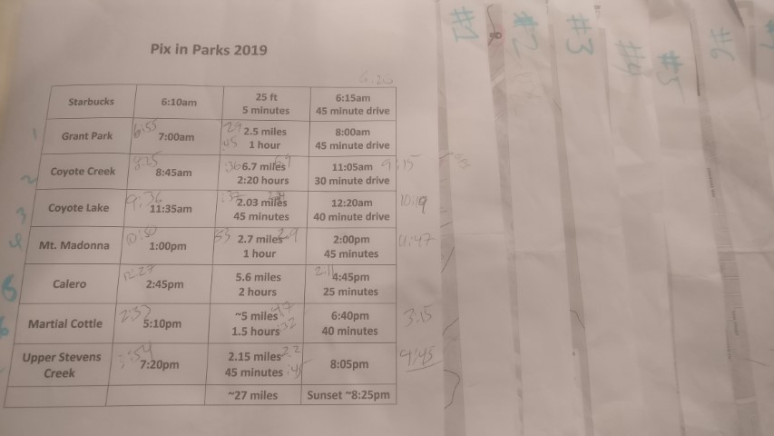
The Plan (post hike)
| Santa Clara County Parks: | 2017 | 2018 | 2019 | 2020 | 2021 | 2022 | 2023 | |||
| San Mateo County Parks: | 2020 | 2021 | 2022 | 2023 | 2024 | 2025 | 2026 |
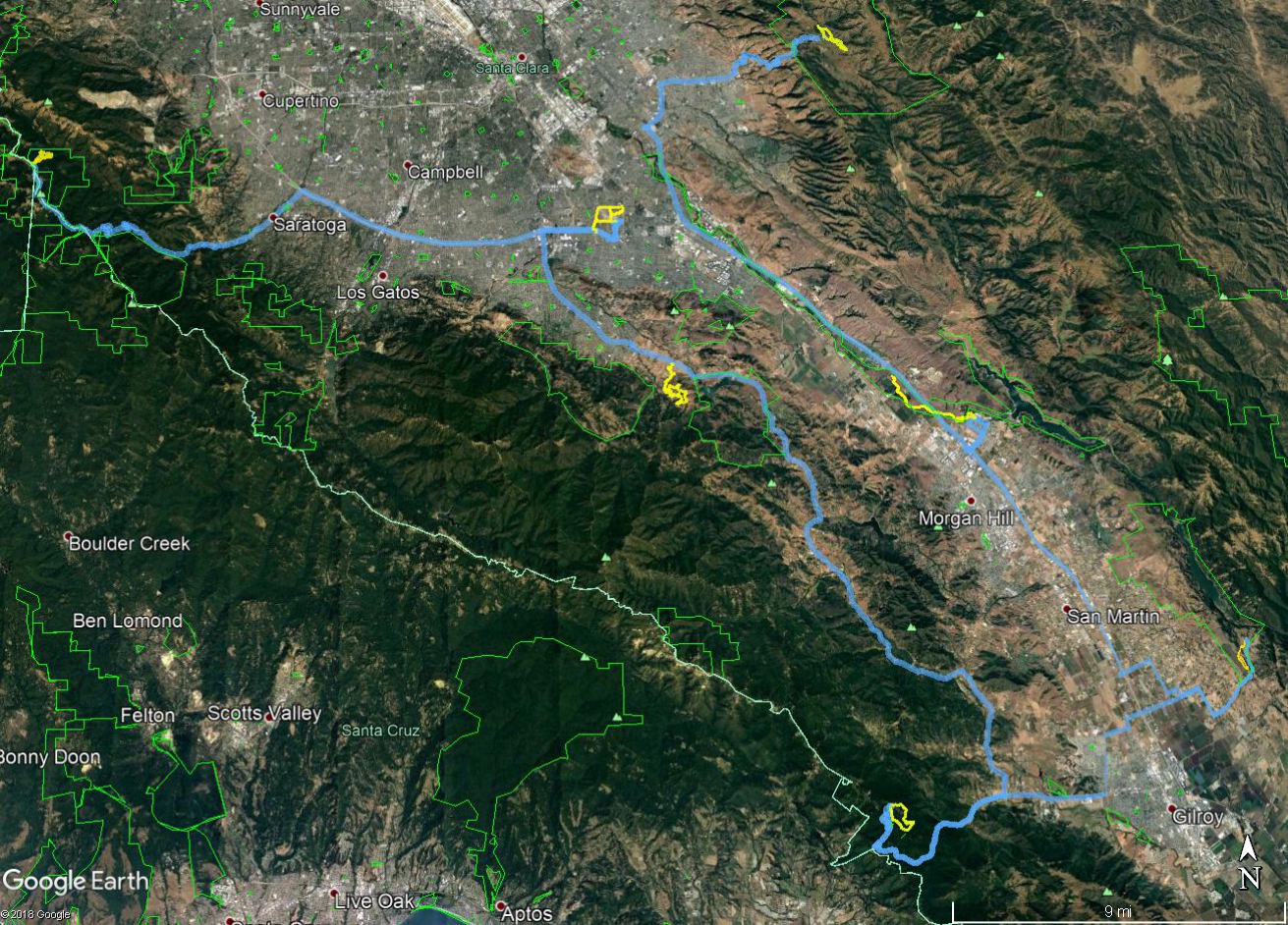
For the third year in a row, it was time to do the Santa Clara County Parks #PixInParks Challenge. The challenge is to visit seven parks and take a picture at a designated location along the recommended trail in each of those parks. And like prior years, the best I can do is make a web page since I don't use any of the suggested social media options.
None of the hikes is challenging--the challenge is finding and snapping the pictures. So to make it a logistical challenge, I again decided to do all seven parks in one day.
Since this year featured a sum distance that was longer than last year, I decided to go it alone. Last year I was able to complete it with a group of INCHers. And, to be sure, this is how it should be--no one should be able to complete the whole thing in a day. . .or maybe I'm just trying to get Santa Clara Parks to make that dream a reality! Whatever the case, this year had two parks with completely paved routes. At the last minute, I decided to bike them instead of hike them, which required cramming my bike into my smallish car. I figured, on net, it would save time--and it definitely did.
Finished over three hours ahead of schedule, largely because the schedule was based on hiking. And that was great, because it was a hot day. All said and done, it was 16 miles of hiking and 12 miles of biking. . .and 170 miles of driving round trip from my house. It was also the first time I spent more time driving than in the parks.
Since the days are long in June, I picked the opening time of the nearest Starbucks to decide when I'd start the drive to Grant park. Made sandwiches for the trip the night before and froze two bottles of Gatorade, as well as the water bottle for my bike, since it was going to be approaching 90°F on hike day.
Went to bed way too late, getting only 3.5 hours of sleep. But that's OK, because I'd get coffee and, later, had an espresso shot concoction I'd found in a geocache two years prior. It was way past its expiration date, but this was an excuse to get rid of it. Put everything into a cooler, picked up my Starbucks order, and headed for Grant Park.
Alas--upon arriving at Grant just before 7am, the Grant Lake parking lot was still closed. Drove up the road to where Loop Trail crosses Mt. Hamilton Road and (legally!) parked there. That would let me access the intended loop from a slightly different trailhead.
Hiked up Yerba Buena to get the elevation out early, and headed down Loop Trail. Despite the warnings on the Magnificent 7 page, I took the official route down McCreery Lake Trail. A month ago, the start of the trail was apparently underwater (according to the Magnificent 7 page). No problem today. I was jazzed about this trail because it was one of the only trails in this park I'd never taken.
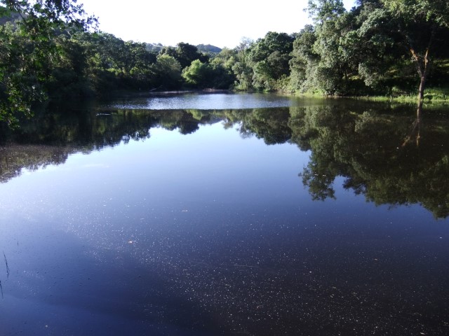
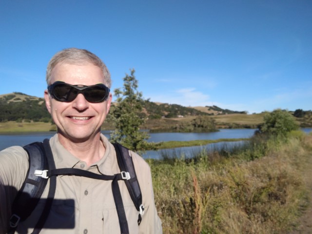
When I got to the Canal Trail, which is right at the picture location, I turned north to visit the short "Canal Trail" loop, since I'd never been there. Found the exact picture spot on the way back and snapped a few pictures, then headed to the car. Two fishermen were setting up along the lake as I returned and then ran into another group of hikers. The parking lot open when I passed through, so just missed it. . .
Next stop was Coyote Creek--ate a sandwich from the cooler en route.
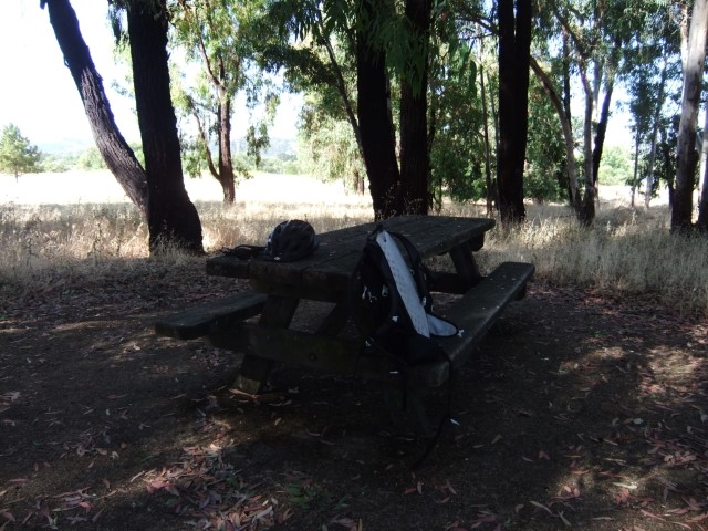
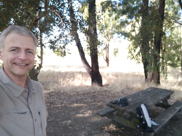
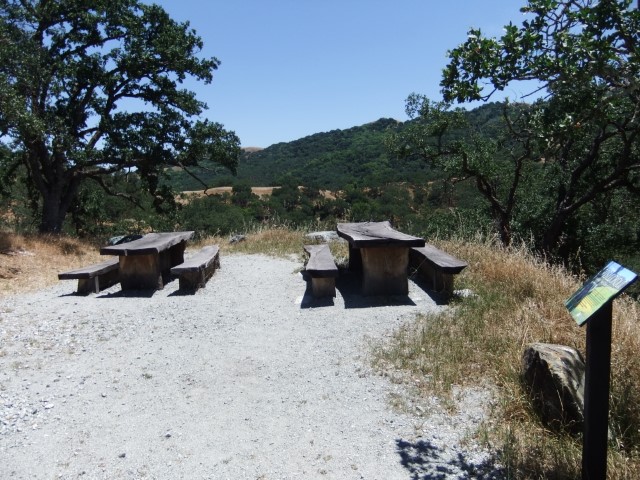
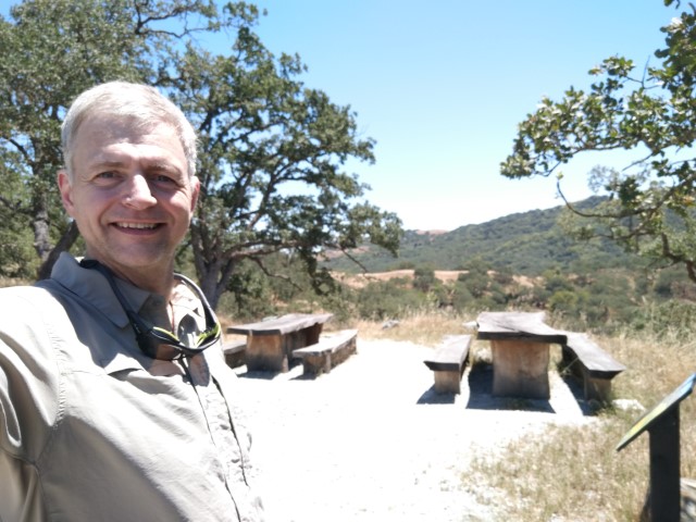
I've biked the entirety of this trail many times, which is part of the reason I decided to take my bike this time as well. Plenty of people walk along it, but it's paved almost as if begging for a bike ride. The picture location is a personal favorite of mine, and probably the only location I've stopped at multiple times among the Magnificent 7 locations (of all time). I remember putting air into a tire here once, enjoying the shade. It's a weird location for three picnic tables, but I always think "some day, I'll bring someone here for picnic because it's here!".
On the way back, I wanted to try the equestrian trail that starts under 101 to transform this linear route into a little bit of a loop. Unfortunately, there is no bridge there, and Coyote Creek was too high to try to cross carrying my bike. Suspect it can be done later in the year, so I'll try again next time. As a consolation, took the Nature Trail (which in retrospect is better for hiking than biking, but still fun) and the last bit of Equestrian Trail after the bridge to the parking lot. Total length was barely longer than the official route.
Back at the car, saw that I only took 36 minutes for something I had allotted 2:20 hours (hiking). Thus was ridiculously ahead of schedule now, which was great on this hot day, but probably should have slept in later when I decided to bring the bike.
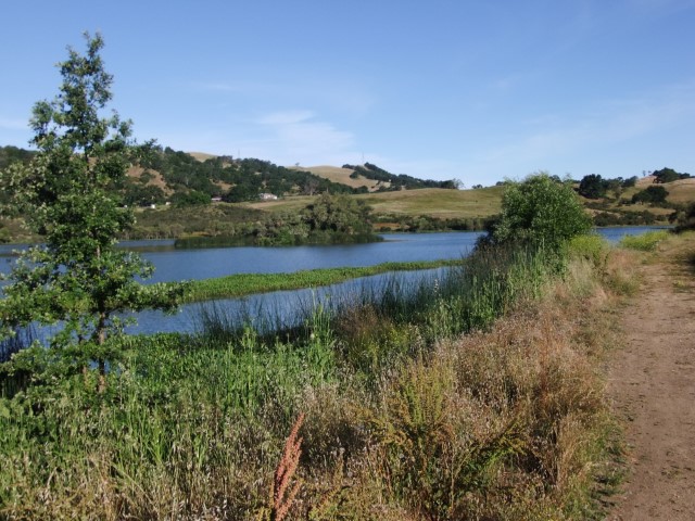
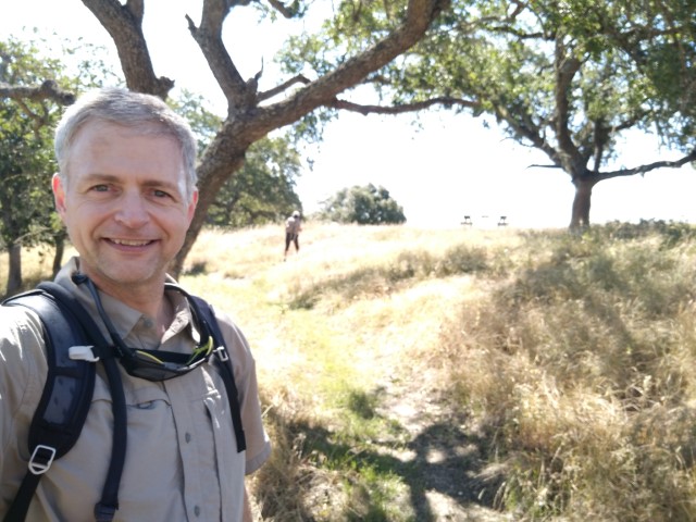
Next stop was Coyote Lake for a the shortest hike of the seven. The primary goal was the short-but-scenic La Polka Trail. Since most of Santa Clara County lives north of this park, I'm guessing they usually start at the more northern trailhead. Thus, this trailhead must be for for locals. Whatever the case, it was fairly busy at 9:30am.
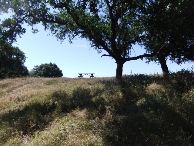
Saw a couple taking one direction of the La Polka loop as I was approaching. I took the the other direction (counter-clockwise), as the plan for the day was the reach the picture location as late as possible, and in this case, the location was just after the far point of the loop. Found the picture location and snapped a few pictures. The couple came soon after and photo-bombed my headshot. I have a suspicion they might have also been doing the "Challenge" since they went up to the picnic table. Fun!
On the way back, noticed the trail to Roop Pond. I've seen people at that pond many times on the way to Henry Coe. . .really wanted to take it today, but stupidly convinced myself to keep on schedule, even though that short detour (barely over half a mile round trip) would not make any difference. Oh well, next time!
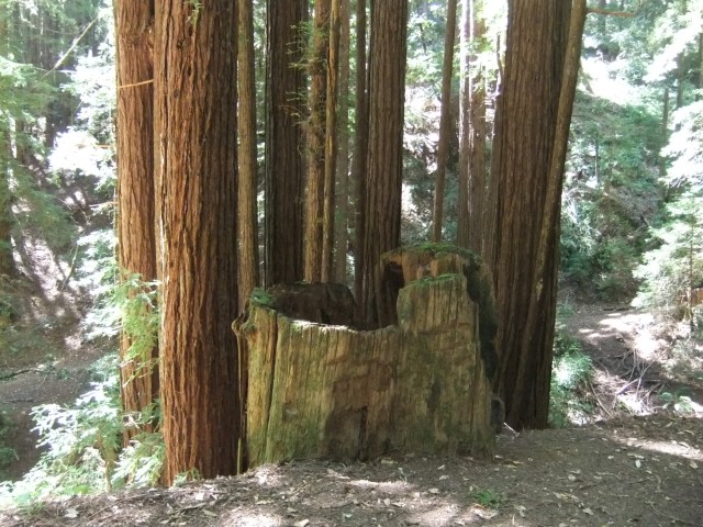
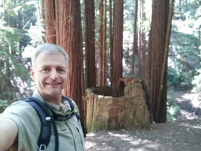
Onward to Mt. Madonna. Someone in the Santa Clara Park system really loves Mt. Madonna since it has shown up three years in a row despite, in my head, being relatively small. It also requires an entrance fee from the entrance chosen this year, so I feel like I paid for the "prize" since I was there less than an hour. :) Hard to complain, though, because it is among SC Parks' nicest locations and, for a hot day, nicely shaded.
The selected loop was great, covering trail I haven't been on since I started tracking over a decade ago. In particular, it drops down to the old Blackhawk Trail. We used to use that trail from near the Sprig Trailhead. Once it was closed (due to landslide long, long ago), we stopped visiting the park--true story.
Stopped to take a different picture before realizing I'd passed the official stump. Near this location, one can see what appears to be trailwork to re-open the entirety of Blackhawk. No time to investigate/confirm, though--gotta snap those pictures.
Next up: Calero County Park. Due to the general shape of Santa Clara County, I'm noticing that the order of parks visited is quite similar to 2017. So, just like then, went from Coyote Lake->Mt. Madonna->Calero. Enjoyed the first frozen Gatorade on the way to the park.
Calero is one of Santa Clara County's best Parks for hiking, but this particular trailhead favors bikers because of the gentler inclines of the recommended Lisa Killough Trail. Like Coyote Creek, I had already decided to make the "out-and-back" route into a loop. However, I wanted to make sure it was harder than the original route by all metrics. Thus, decided to hike up to Peak 1058 (the peak you can see from the parking area with a tower on it), then down to the picture location. This worked out well, and only added 0.2 miles of distance but over 300ft of elevation gain on this otherwise easy route.
The route back was flat and easy. Passed several people along the way--this trail is more popular than I would have expected. When I had started the hike, there had been some sort of bike event going on with two tents and plenty of people. There were still mountain bikes coming down when I headed up--but all was cleared up by the time I got back to my car. The lot was considerably less crowded, to say the least.
The next park was new: Martial Cottle. Note that Calero also has a Cottle Trail--both come from the same family. Arrived 2.5 hours ahead of schedule, so was in no rush. I had been warned by the Hayward Hiking Club that there was no reason to park within the park. Indeed, there is copious official parking along the southern edge of park. The weird route suggested on the map required visiting the perimeter of the park. I went out of my way to hit everything and then some, but was only a mile longer (4.7 versus 3.6) than the suggested length.
It was entertaining to bike down the spur trail under Hwy85 and turn back, just to hit the trails on the map, but gotta do what you gotta do. The map implies it is possible to make that southern-most spur into more of a loop, but the trail on the right-hand side of "Field C" is fenced off in both directions.
The center of the park was packed with large-scale celebrations/picnics. This whole area seemed very "modern" in contrast to the farming theme elsewhere in the park. Definitely a good location for a corporate picnic. In fact, I saw a fine, shaded, non-reservable area I'm considering for my team's next quarterly. . .
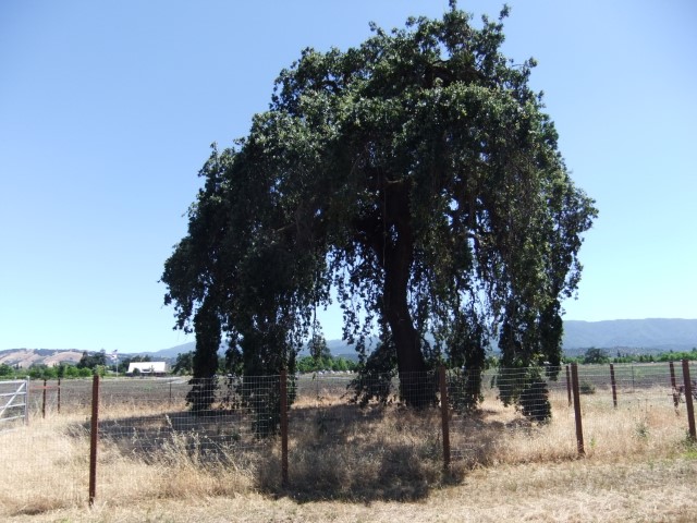
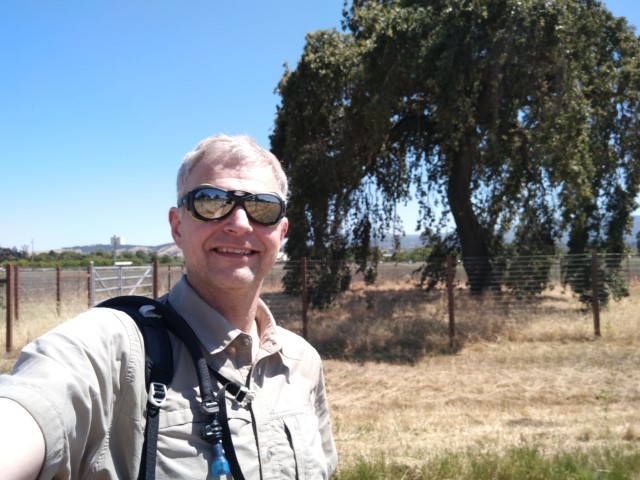
Found the tree in the picture and took the requisite shots on the last leg of the visit. What is a little surprising is that if you make a 180 turn from the tree, you're looking at a Safeway. This farm is truly a cool hold-out from development.
Well, after a second bike ride, I was now nearly 3.5 hours ahead of (hiking-based) schedule. Still, time to close it out! Drank the second of the now-slushy Gatorades and ate the second sandwich on the drive up to Upper Stevens Creek. The traffic wasn't exactly heavy, but there was a constant steam of cars. I was happy, upon reaching Skyline, to see everyone else going down the other side. When I got to the parking lot, there was plenty of space.
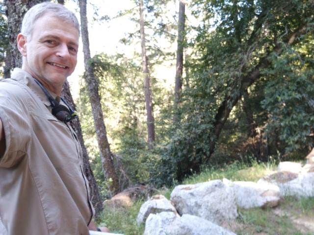
Pulled out the final map of the day. Only 2.15 miles! Ha. Cakewalk. I've been to this park many times, but most of those hikes started from Monte Bello and went through Table Mountain rather then Grizzly Flat. For sure, I've never done this piece as a loop--and it was a great finale.
First, above 2000ft, the air was much cooler than the prior park. Second, while short, the hike has almost 900ft of elevation gain. Third, there was a lot of nice scenery. Mt. Madonna was good for all the same reasons, but Upper Stevens Creek had no entrance fee and I never saw another person the whole time. If one can only take one of the Grizzly Flat trails, the South Trail is better.
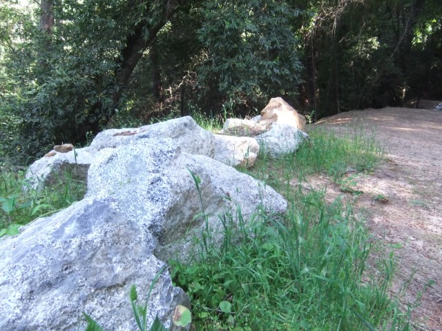
Found the rocks right where expected, but couldn't find an angle that reproduced the picture. I'm thinking they either moved the rocks a bit while grading the road or these rocks are from down the road which has been completely replaced. Mostly I couldn't find rocks with the same edges and, from what I have, the background trees don't look the same. Hmm! Wonder when the official picture was taken?
Was back to the car at 4:45pm, well ahead of the worst-case plan of 8:05pm. Since I have two fine shirts, was happy to see the new option of a bandanna this year. Plus I'd be less likely to wear a hot-pink shirt in the first place. Thanks, as always, to Santa Clara County Park for encouraging some outdoor adventure, no matter how one interprets it.
Looking forward to seven hikes that could not possibly be done in a day in 2020! #40 miles