Plans (and liquids)
| Santa Clara County Parks: | 2017 | 2018 | 2019 | 2020 | 2021 | 2022 | 2023 | |||
| San Mateo County Parks: | 2020 | 2021 | 2022 | 2023 | 2024 | 2025 | 2026 |
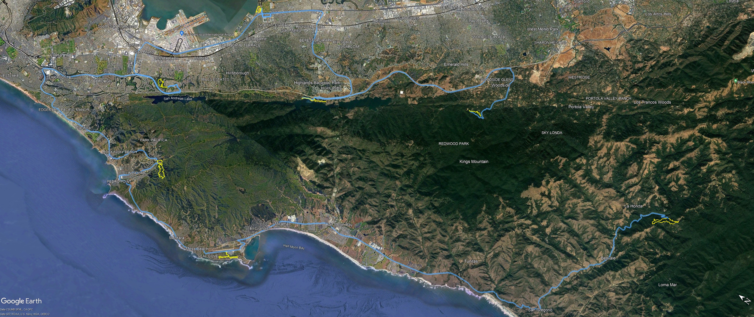
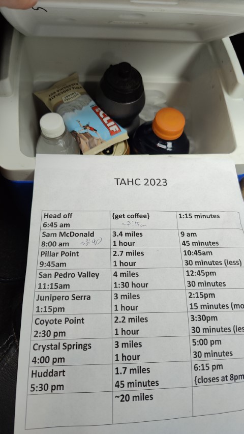
For the fourth consecutive year, attempted to complete San Mateo County's Take A Hike Challenge in a day. I was on a sabbatical from work so chose do the hikes on a weekday. Based on the lengths of the hikes, this year looked especially easy, and it was! Even made a TAHC summary PDF to make things easier/quicker.
The plan was to leave San Jose around 6:45am so I could get to Sam McDonald around the 8am opening time. But I stayed up too late, and the plans showed plenty of margin based on my predicted times, so started a bit later. A stop at Starbucks added another 10 minutes of delay, despite having ordered on-line earlier. Apparently someone had ordered a zillion drinks to take to work. Such was the unexpected downside of a work-day start.
Didn't get out of Starbucks until 7:15am and arrived at Sam McDonald (after another delay for HWY 9 going to one lane for construction) at 8:40am. 40 minutes behind the original plan. . .no problem!
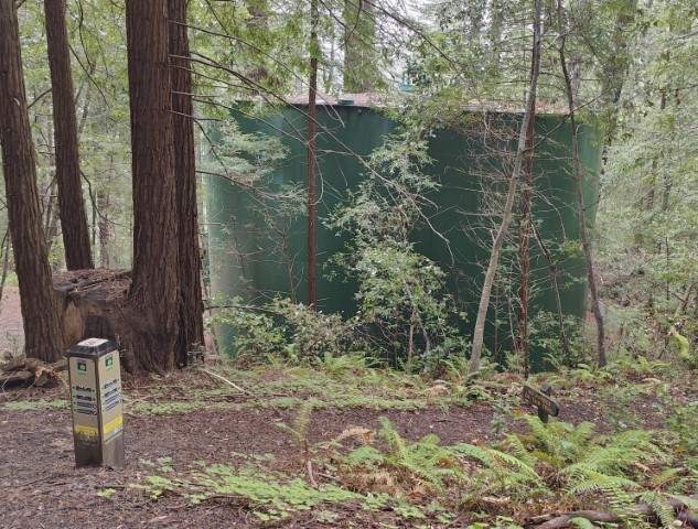
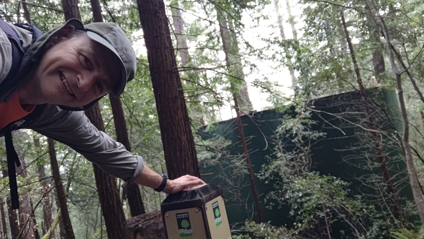
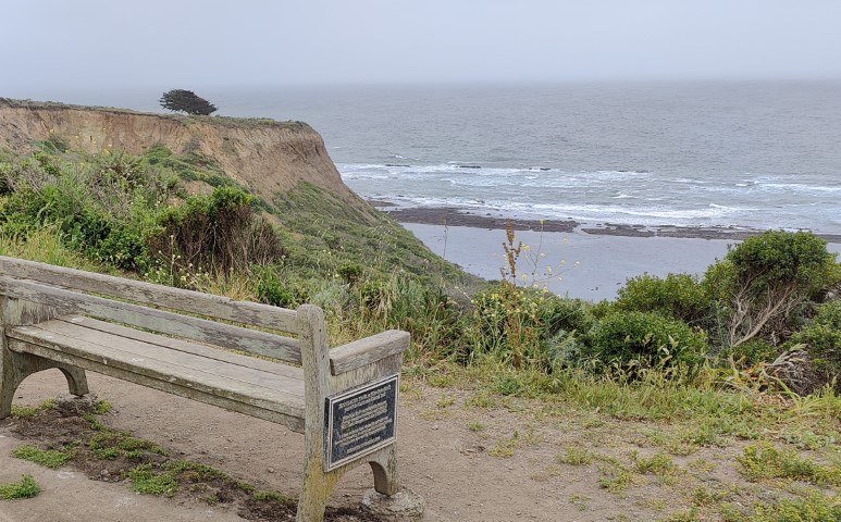
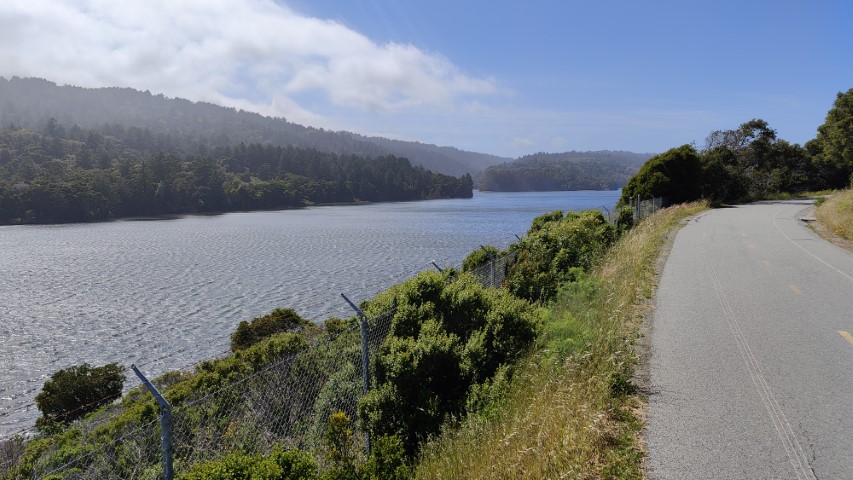
The trail was easy to follow--always love the numbered trail junctions. I'd never hiked this trail since it mostly goes to the camping area, so the new trail was welcomed. I passed the green water storage at the end of the loop. The position seemed a little more south compared to the map, but can't miss it. Lined up a picture that was almost identical.
The next stop is sort of interesting. I re-planned this trip three times during the prior week. It seemed natural to head to Huddart after this hike, but upon further inspection, it made more sense (time-wise and distance-wise) to continue down to HWY 1 and knock out Pillar Point and San Pedro Valley. And so that's what I did. . .
While I'd been to Pillar Point before, I'd never been to the parking lot. It's next to a trailer park, which has a long line of cars parked along the road. So don't be scared--that's not indicative of a lack of parking in the park! There were plenty of spots when I arrived, but then again, it was a weekday, so might still be full on the weekends (in which case you'd indeed have to park far down the road next to the local airport).
The suggested route was odd. For the same distance, you'd think it would take all of Ross's Cove Trail and Pillar Point Bluff Trail, but instead it doubles up on Jean Lauer Trail and the connector to the parking lot. But that's fine--there is probably a good reason. . .Easy picture spot to find and the distant tree on the bluff is a nice landmark.
The first two parks had been very close to the listed distance, so everything was going fine. The next park was San Pedro. The TAHC page warned that Brooks Creek Trail was closed and proposed an alternate out-and-back route via Montara Mountain. I had already decided to park outside the park (at trail junction #1), which adds 0.6 miles to the hike. . .but is free. When I got into the park, I decided to take Brooks Trail anyway since there was nothing gating the trail.
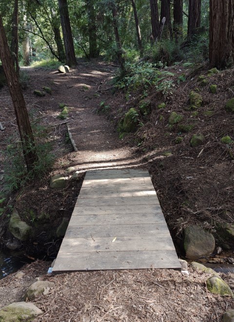
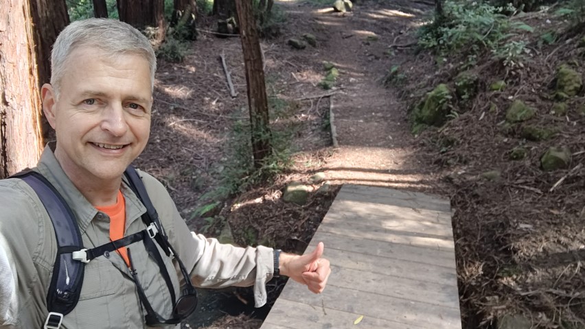
Much to my delight, not only was the trail open, but all the repairs were complete. There was no landslide and the trail was in fantastic condition. I could see where some new-looking wood retention support had been added, but otherwise it was just a well-maintained trail. Brooks Creek Falls were doing their thing in the distance, so it was a nice hike up the trail.
At the top of the trail is the junction with Montara Mountain Tail and the picture location. Unlike 2021, when this was also the picture point, there was no fog, so could see the beach.
Since I'd anticipated the trail being closed, and thus hiking the entirety of Montara Mountain Trail to the higher ridge, I'd allotted more time for the hike. By the time I arrived back at the car, I was 15 minutes ahead of the original schedule.
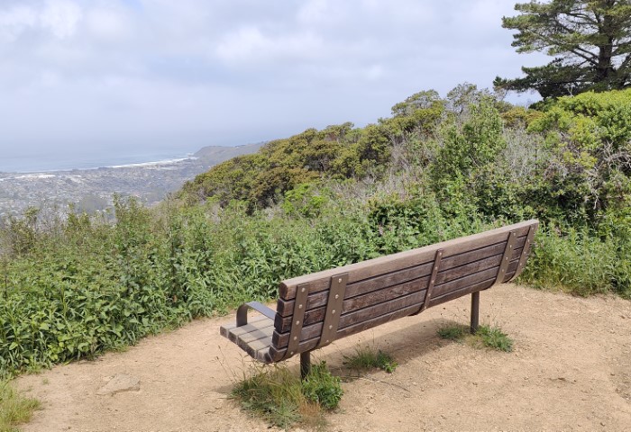
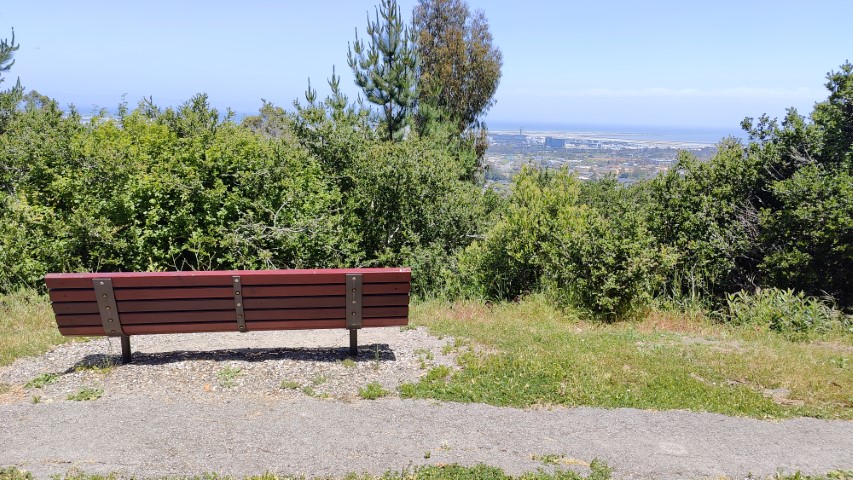
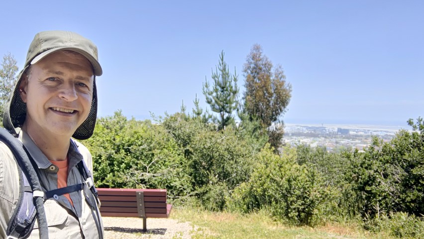
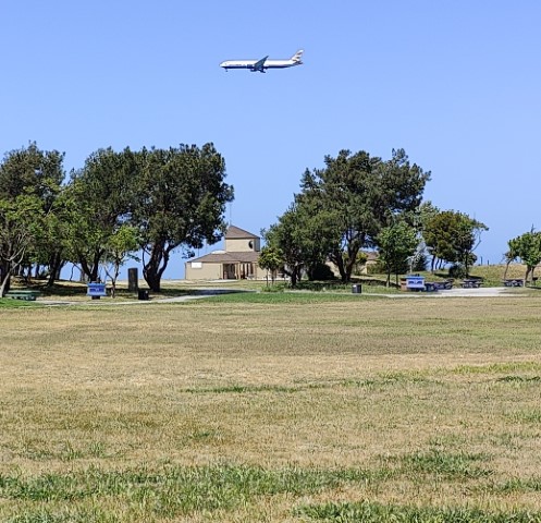
Next up was Junipero Serra, where I also planned to park outside the park and hike in. I'd biked through the park last year so knew the connection worked. This adds a little distance and elevation to the hike, and since this was a very short hike already, this was hardly a problem.
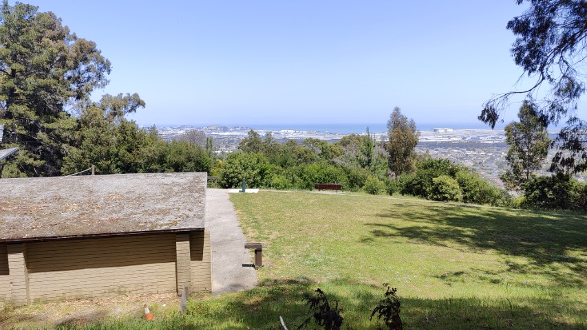
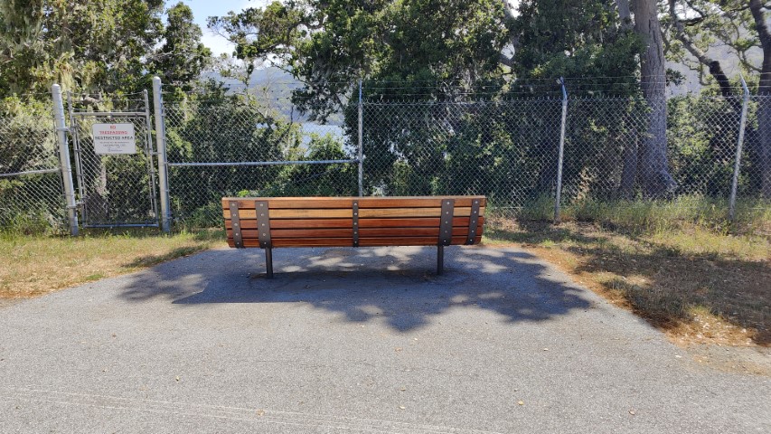
Went clockwise around the park so I'd reach the picture point later. Watched the planes landing as I want around the northern part of the trail. Upon arriving near the picture point, I didn't see any benches. Then I saw one that was, indeed, right outside the Bay View Picture Shelter. . .but it was a different bench than the picture. So the pictured bench must be elsewhere. Seems like the location is identical to 2020, where I have a picture of the same bench (but it matched that time!).
Next up was Coyote Point. Much to my surprise, there was a sign outside saying the park was closed! I'd already intended to park outside the park (it's a theme with this adventure) and pledged to have a beer at the golf course to "pay" for my parking. . .
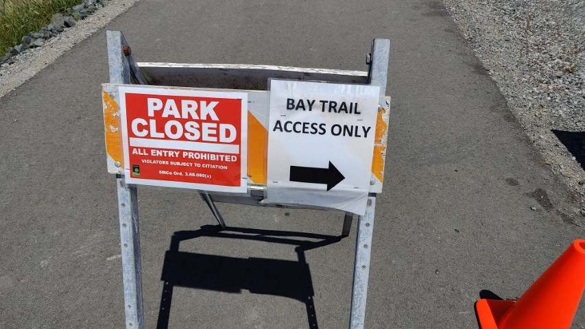
As I walked into the park, there were plenty of people there since the Bay Trail is still open. Didn't feel too guilty. Found the picture point, which was even nicer than the reference picture since some California poppies were in bloom. Took the requisite pictures and kept walking along the Bluff Trail. Could hear that the rifle range was open and doing good business. I guessed that the far northeast end of the park might "really" be closed and, since it's not anywhere near the Bay Trail, decided to instead loop back inward (back toward Magic Mountain Playground) to add some distance. In the end, the hike was 0.9 miles shorter than listed, but I'd already made up that distance doing longer hikes in San Pedro and Junipero Serra, so would still exceed the overall distance for the challenge.
Even after a quick beer at Par 3, I was 50 minutes ahead of schedule now, with two easy hikes left.
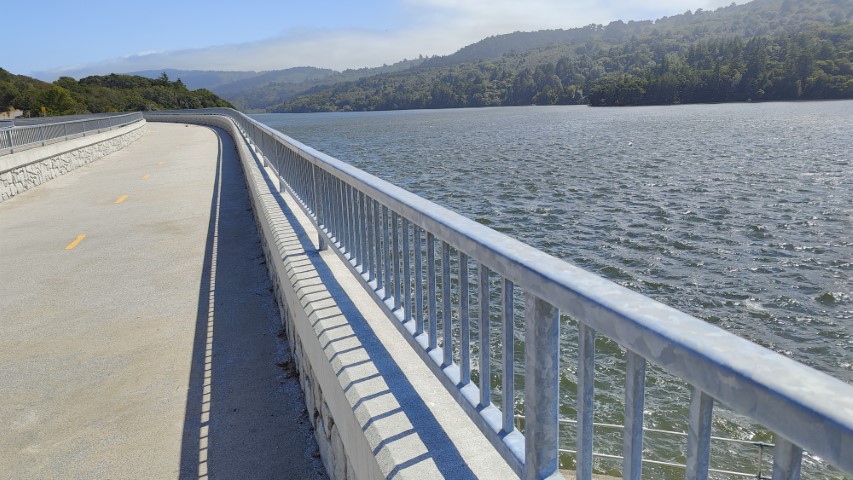
Crystal Springs was next. I'd generally bike this paved park, but the route was so short that the effort to pack a bike exceeded the time benefits of biking. So I parked at the north end of the dam and hiked to the end of the non-road trail, as indicated on the map.
It was windy, so the water was quite choppy. Turned around at the far end and took the needed pictures on the way back. Definitely not as busy on the weekdays as it is on the weekends.

Could not believe how easy this year was turning out. While I did run into some heavy traffic heading into Woodside, I would almost say that doing all seven parks in a day should be a requirement this year as it is so easy. . .at least on a long day in May like today. When all was said and done, it was only 8 hours and 20 minutes from starting in Sam McDonald to ending in Huddart. But I'm ahead of things here.
Huddart was the last stop. I'd hiked one side of the Redwood Natural Trail in the past as part of a bigger loop. Indeed, it would have made a lot more sense for this hike to do that same loop--it wouldn't be much longer and wouldn't require going "out-and-back" on Chickadee Trail. But I'm not complaining. Ran a hiking club for 26 years, so think about these things. Was happy to get a short section of new trail.
The big surprise for this final hike was that the picture point. It is is not remotely close to where it is marked on the map. It's on the lower right-hand side of the Redwood Nature Trail, not the upper left-hand side. Fortunately spotted the location on the way down.
Final stats confirmed that this was, indeed, easier than prior years: 16.9 miles of hiking with a meager 2.7k ft of elevation gain. From the Sam McDonald start to the Huddart finish it was 86 miles of driving. Door to door was 158 miles. Thanks San Mateo County Parks!