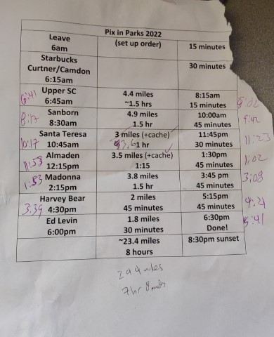
Picture of the planning sheet at the end of the circuit
| Santa Clara County Parks: | 2017 | 2018 | 2019 | 2020 | 2021 | 2022 | 2023 | |||
| San Mateo County Parks: | 2020 | 2021 | 2022 | 2023 | 2024 | 2025 | 2026 |
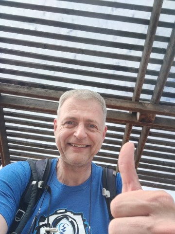
Time for the 2022 attempt to complete the PixInParks Challenge in a day. Once I put all the locations on Google Earth to optimize the route, it was clear that this would be an easy year. The net distance was in the low 20 miles and the overall distance among parks was not insane. New for this year, I relied entirely on the Avenza app rather than paper maps, which worked out perfectly. The main benefit of Avenza is not the maps themselves, but rather that Avenza uses the Santa Clara County PDF directly, which includes the critical color picture of the picture location. So by preloading them, everything you need is right there. Saves time in planning as well as execution.
Decided to make the attempt on the 4th of July since I had the day off. It was a Monday, but I was paranoid that the two parks with small parking areas would be full of other people with the day off. To combat this, I set an early start time (6:45am at Upper Stevens Creek) to make sure I could knock out the first two parks before July 4th crowds appeared. Based on that start time, I'd be done two hours before sunset--too easy. Left home around 6am and picked up Starbucks en route, reaching Upper SC four minutes early. There wasn't a single car in foggy lot. Quickly headed down the trail.
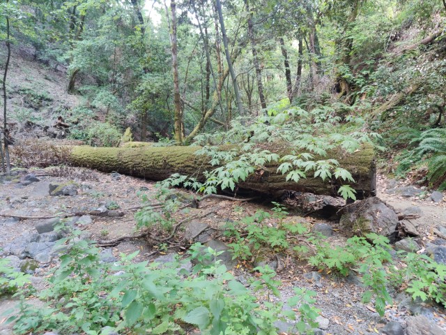
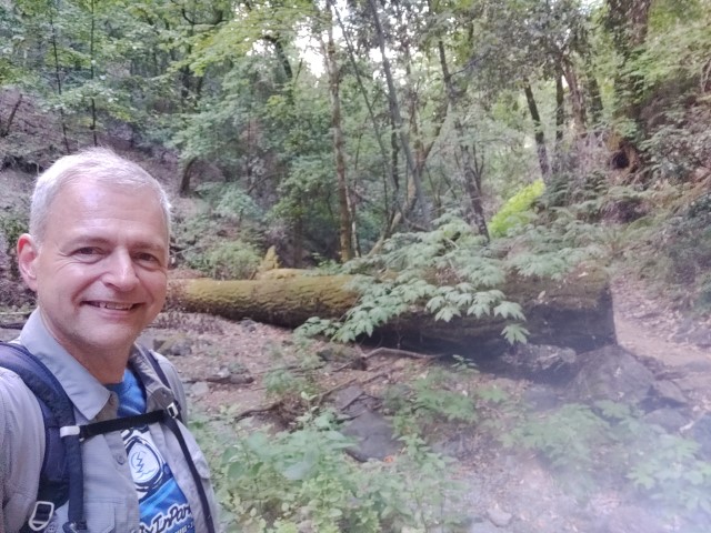
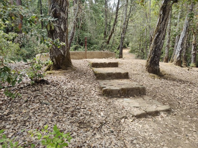
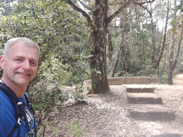
Reached the picture location (log), took some pictures, and continued along the official route. The route heads upward and over to Canyon Trail. For whatever reason, it then heads down to a non-existent stream crossing for the turn-around. I suspect the person who made the route didn't know the trail system, but I dutifully did to route just so I could make this comment. :) The gratuitous uphill section after the picture location does have a nice fern-filled valley that is different from the scenery along Grizzly Trail. A "better" picture location would have been at the intersection with Canyon Trail, as pictured below, which makes sure everyone checks out those ferns.
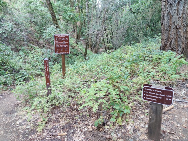
Came back up the northern side of the loop. While there was no new (to me) trail on this loop, it's the first time I've parked on Skyline Blvd and hiked this section as a loop. Normally do this area as a part of a larger loop starting at Los Trancos, so only take one or the other side of Grizzly Flat loop. When all was said and done, it was 4.4 miles with 1.2k of elevation gain. This would turn out to be the most elevation all day, so glad to knock it out while it was still cool.
When I got back to the top, there was a second car in the lot. My parking fears seemed to be overblown. Drove back down the mountain to Sanborn County Park for the second street parking segment. I was more worried about this lot because it's always been full when I drove by, but that's usually later in the day and on a Saturday. The park is also quite popular for picnicking, but these (free) lots are far from the picnic area. By the time I got there (~8:15am), the first lot was pretty full but the smaller secondary trailhead (on the suggested route) was entirely empty. This location has space for three cars parked end-to-end. I wanted to park here either way because it would add a short segment of new-to-me trail, so everything worked out.
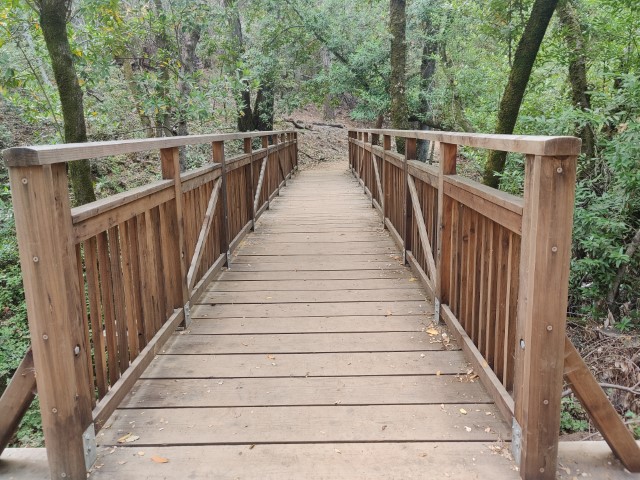
I've been along the primary designated trail twice since the new Saratoga-to-the-Sea Trail was opened. But these trails around Sanborn and Taylor Ridge have been there for a long time--just never had a reason to visit them until the Saratoga Trail made this into a longer route. The proposed route is mostly uphill and ends on one of the new bridges built for the Saratoga-to-the-Sea trail. By the time I was down and back, it was 4.9 miles with 922ft of elevation. Was feeling good because I'd already done 45% of the distance in 28% of the hikes! It's worth mentioning that when near the picture point you cross one relative new bridge before reaching the official new bridge. Oh, and when I was leaving, there was a long string of cars going into Sanborn for (I'm guessing) picnics.
Boring fact: because of the parking worries, I was visiting the parks in a counter-clockwise loop whereas the prior five years it was always clockwise. Why? Because to efficiently visit the parks, you need to start in the most remote park that can be entered earliest. . .and also make sure that by the time you are finishing, the last park will be open. That almost always means starting in Grant Park (which has been in most Challenges) and finishing in the Skyline area, but not this year.
Next up was Santa Teresa. Tried to get parking at the small free lot, but it was full. After parking, instead of heading to the official trail, I took the Mine Trail and looped counter-clockwise to hit Bernal Hill Trail (and the official route)--this made the route more of a loop and added 0.6 miles (20% longer!). This park was much more crowded than the prior parks, and I crossed paths with people the whole time. Enjoyed visiting the tiny spur trail just off the Vista Loop that was highlighted as part of the official route--this should have been the picture point. It was the only new trail for me in the park.
Despite the extension (and a geocache), was 15 minutes ahead of schedule back at the car, so unless there was some traffic catastrophe, it looked to be an easy day. The route here was 3.6 miles with 740ft of elevation gain.
Onward to Almaden Quicksilver. This was a noon hike and it was warming up. The parking lot was fairly full, which was a little surprising until I realized the overflow lot was closed. That lot has normally been open on the weekends. But they were right because when I came back an hour later, there was still plenty of space.
Have done all the trails in this park, so there was nothing new today. Still, I liked this short loop--almost 900ft of elevation gain in 3.5 miles RT. Zipped up the nicely shaded Deep Gulch Trail before encountering plenty of sun on the more exposed fireroads.
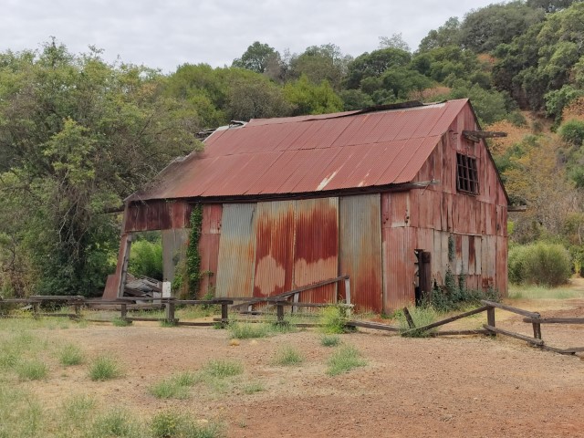
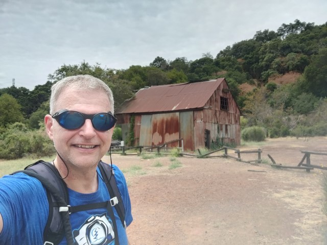
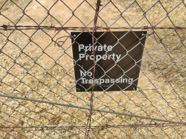
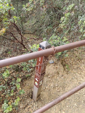
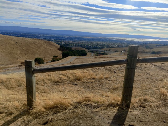
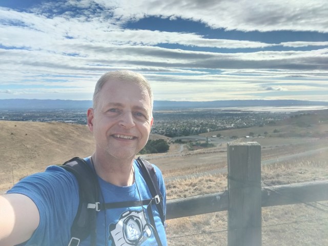
Next up was Mt. Madonna. This is a nice park and all, but it's my least favorite on these Challenges because it's always a long drive for a short hike. Was pleasantly surprised to find it wasn't a trivial hike this time. As per usual, did the hike such that the picture point occurred latest on the route. In this case, that's almost the entire hike. This sort of design always makes me imagine lazy people doing a 0.2 mile hike to the picture point and then driving off. Taking the official route results in 1k ft of elevation gain. If I'd designed this challenge, I would have made the trail sign at the lowest point of the trail the picture point. Oddly enough, that particular point had the gate chained to the trail sign (below).
Back at the car, was over 30 minutes ahead of schedule and heading into the final stretch. Enjoyed a chilled Gatorade on the drive back down Mt. Madonna and over to Harvey Bear. This was going to be almost 100% new trail for the day. The large parking lot was almost empty. Found this quite surprising on a holiday, but this is another place with no (sheltered) picnic area, so maybe it's just not a 4th of July hot spot.
I've hiked from the start location probably 15 times, but have never hiked the paved track, so glad to have a reason. The asphalt was hot, but there was some breeze. Only ran into one person along the way. On a Saturday, there are usually many people walking around there. Was almost an hour ahead by the time I was setting off. The route was 2.12 miles with 94 ft (!) of elevation.
And now to Ed Levin, where I'd get confirmation that a park entry could be used at multiple parks. Parked at an earlier lot than suggested so I could extend the hike around Sandy Wool Lake, thus hitting a small section of new trail. After looping into the upper parking lot, I did the rest of the hike as suggested. The picture location was an interesting point on a trail that, by virtue of hugging the edges of the park, had some enjoyable steep sections. The round trip was only 1.9 miles with 350 ft of elevation gain. Done!
Was back at the car at 5:41pm, making the whole day 11 hours from the start of the first hike until the end of the last. It was 24.4 miles of hiking with a respectable 5.2k ft of elevation gain over 7 hours and 8 minutes of hike time. 127 miles of driving from the first hike to the last; 160 miles door-to-door. As always, thanks for the fun Santa Clara County Parks!