#QuarryPark
| Santa Clara County Parks: | 2017 | 2018 | 2019 | 2020 | 2021 | 2022 | 2023 | |||
| San Mateo County Parks: | 2020 | 2021 | 2022 | 2023 | 2024 | 2025 | 2026 |
The Hayward Hiking Club tipped me off that San Mateo County was doing a 7-park Take A Hike Challenge, very similar to what Santa Clara County has been doing for the last few years. Why not make it even more challenging back doing all seven hikes a single day?
San Mateo County is smaller than Santa Clara County, so the amount of driving should be less. Adding up the hike lengths came to ~24 miles, so guessed it wouldn't be a problem. Only risk was the fewer daylight hours for this Halloween Day attempt.
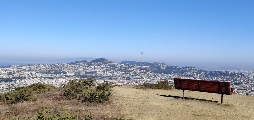
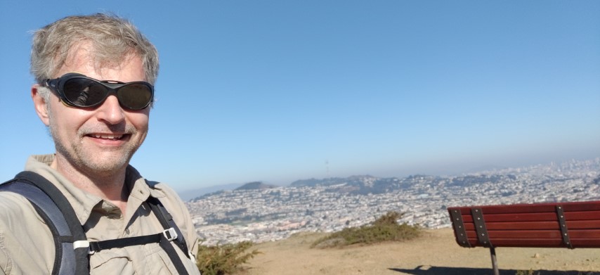
Looking at the seven parks, decided to first tackle the two hikes on the coast. That would help avoid weekend traffic. . .and it worked out great. Got to Quarry Park at 7:35am, three minutes after sunrise. Was a little worried that the park would be closed until 8am, but I wasn't even the first person there.
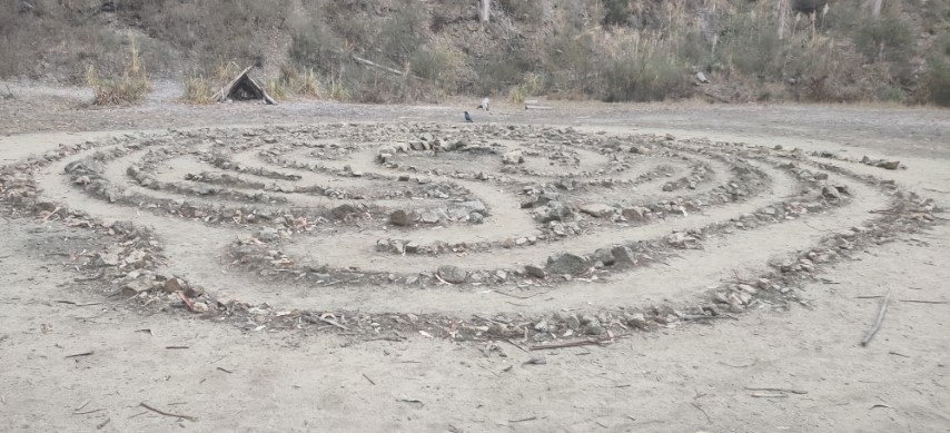
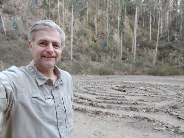
Walked up the trail to the picture spot, which was smaller than expected. Took some pictures and then started on the loop around the park. It was completely fogged in and chilly, which was good for the steep hike up. Will probably come back here next year to use this as a trailhead for a visit to Scarper Peak. . .
The surprise in this park was the almost complete lack of trail markers. I was prepared with a few waypoints and the map, but it is worth mentioning that this was the only park all day without awesome signage. San Mateo has the best *numbered* junction signs in the Bay Area, so it was a stark contrast.
#QuarryPark
Too early for puzzles!
The trip down the backside and around to the parking lot went quickly. Enjoyed the new-to-me trail after 20+ years of regularly hiking in the area. Extended the recommended route (barely) to make it more of a loop. 2.17 miles. One down.
Hopped in the car and drove to the north end of the Pillar Point, parking just outside the Fitzgerald Marine Reserve ranger station. The official parking lot was closed off, but there were six or seven slots outside and only a few cars @ 8:20am.
Since I like to get as much new trail as possible on a hike, after crossing the bridge, headed right on the Bluff Trail rather than taking the recommend out-and-back route. Once at the top, ran into a group of people taking wedding pictures. It was still socked in fog, so those would have been some interesting pictures.
Was here for the first time back in July, so looked for new routes. One of those was the closed road (the original Ocean Road) along the bluff. I passed a woman with two dogs coming the opposite way. One of the dogs started following me, excitedly jumping up at my calves. I figured if I kept going, it would eventually turn back, as dogs normally do. That didn't happen. I eventually stopped and "pointed" the dog back to the owner, who I hadn't realized was trying to keep up with me at the same time I was trying to create space. The dog wasn't interested. . .so the owner asked if I could grab the dog by the collar so she could leash him. I managed to do this--the first time I've ever done that, oddly enough. I learned a new trick on a young dog.
Took the longer Pillar Point Bluff Trail to make it a loop. The fog was still thick, so I knew I wasn't missing any ocean views. It is odd that the "Bluff Trail" is the farthest of three trails from the edge of the bluff, and mostly not on it. This is what you notice when creating hiking routes.
As I approached the picture spot, there was no reproducing the shot. It was completely fogged in. I kept going, eventually hiking up the fence around the "Northernmost extent of Vandenburg Airforce Base". Even there, could barely make out the outline of the big white ball. . .
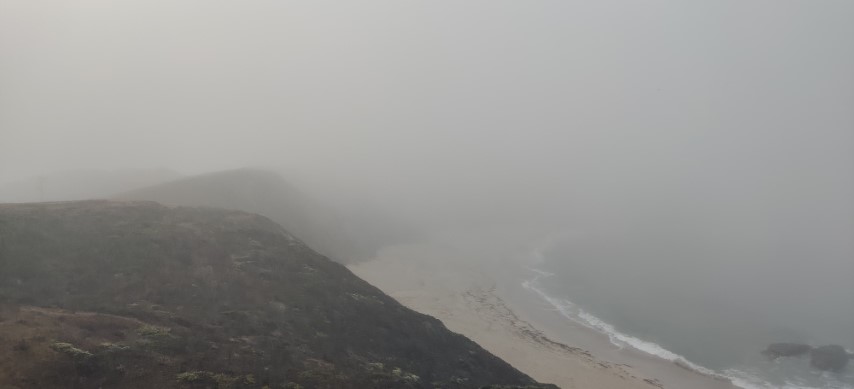
#PillarPointBluff (use your imagination)
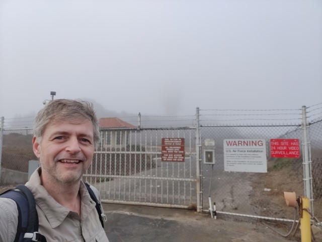
Can't get any closer--the iconic ball is just barely visible
Took a slightly different route back, including the streets through houses between the two sections of the park. Everything worked out. Despite actively extending the hike, it was still only 5.27 miles. Was nearly 45 minutes ahead of schedule as I drove off.
Next up was San Bruno Mountain. This was the longest drive of the day (except the drive to the first hike from San Jose). While I've hiked in this park many times, it has been at least 15 years since I've been to this not-summit area. Came in through the convenient connector trail off Crocker Ave, where I had no problem getting a great parking spot at 10:15am. The trail appeared quite popular.
A sign along the way showed that several trails had been converted to one-way routes due to CoViD. Fortunately (or maybe unfortunately), the suggested route was all two-way trails. Headed up to the picture spot. Great views of The City. Dense sprawl as far as the eyes can see.
#SanBrunoMountain
Ugly mug ain't helpin'
Completed the rest of the circuit, unmasking and remasking dozens of times. Back at the car, the distance was 3.03 miles--just about the same as listed. I was now an hour ahead of schedule, so no worries about the sun setting before completing the last hike.
The next park was Junipero Serra, which I'd never heard of before. It's tiny, and packed full of (closed) picnic areas. Parked near junction 16, which provided access up the Quail Loop trail. This was a one-way CoViD trail and mostly did not run into people going the wrong way. Got up to Iris Point and hiked to the "high point".
From there, continued down Quail Loop Trail. Never saw the picture spot, so once I got to Meadow Vista Trail, I turned back and re-visited the area around Iris Point, where I eventually found the picture spot off of the Bay View Picnic Shelter. That was fine--it's such a tiny park that the extra distance wasn't all that much.
Headed down Quail Loop again, then Pine, and final the lower Live Oak Nature Trail. It was here that, despite going the correct one-way direction, I encountered probably 20 people going the "wrong" way. I didn't care--had my mask--but the park is so small that taking the "correct" trails is easy to do without adding any additional distance.
Anyway, passed over the main parking lot, where volunteers were lining a ditch with white rocks. Very classy. Glad this Challenge brought me to this new (to me) park. All the extra searching extended the distance by 33%. . .but it was short in the first place, so clocked in 2.4 miles. Was now only 50 minutes ahead of schedule.
#JuniperoSerraPark
Hint--it's not along the trail marked on the map!
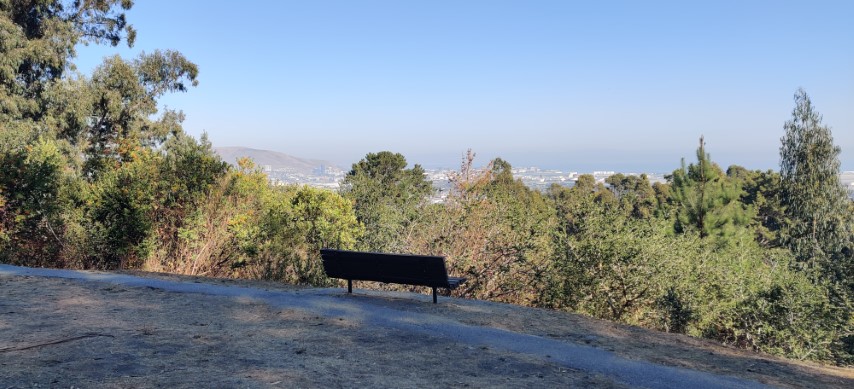
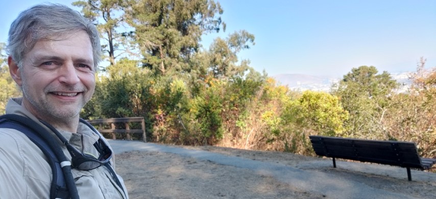
The fifth hike was Sawyer Camp Trail. I've always thought of biking San Andreas and Crystal Springs Lakes, but never have. The whole route is paved, and I probably should have brought my bike to knock this out quickly. But it was a surprisingly attractive hike, making a slow visit fine as well. I was disappointed by the out-and-back nature, though--there is no way to resolve that.
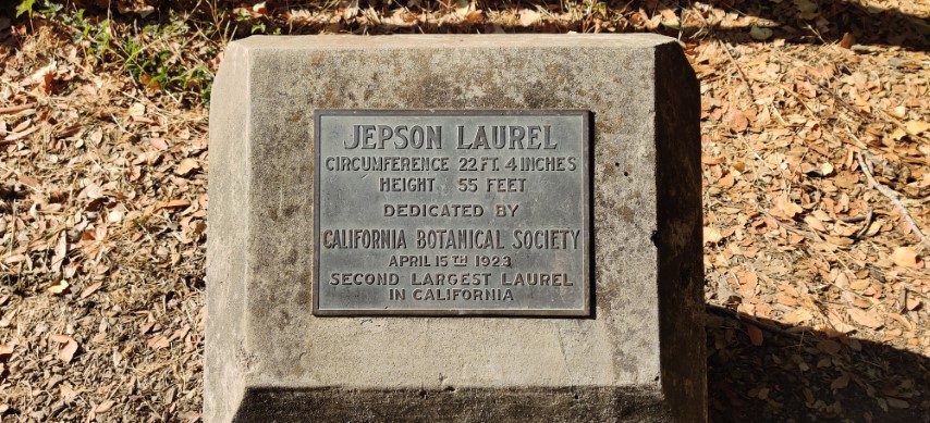
The famous Jepson Laurel looked pretty sad, which is probably why the plaque is the picture spot instead of the tree itself. Still, after looking to see where the largest Laurel in California was, learned that it has since been chopped down, making this tree the finest specimen in California. Hooray.
#SawyerCampTrail
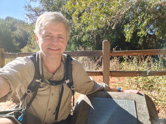
Would have smiled more if I had known the tree was now #1
The hike back was uphill, as expected, but still easy. Back at the car, it was 5.24 miles. I was an hour and a half ahead, mostly because I'd highballed the estimated time for this hike at 2 hours. It took less than 1.5.
While Quarry, San Bruno, Junipero Serra, and Crystal Springs were all new, the next two I'd been to several times. Still, they were different short routes that I wouldn't normally take, so still got a different "view" than normally.
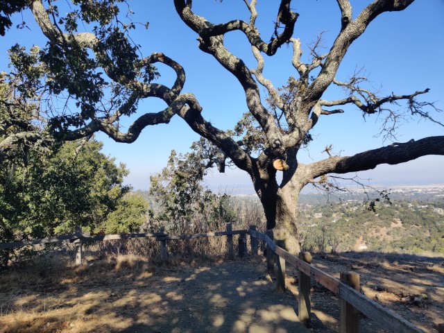
Edgewood is always packed, and today was no different. Managed to snag a parking space within the park at 2:12pm. Dutifully took the loop around the picnic area before setting off on Sylvan Trail. Sylvan Trail was, indeed, sylvan. The shade was welcome. This is what makes the Peninsula better than the (real) Silicon Valley on a hot day--dependable shade (and ocean breezes on the coastal side)!
I'd never been up the spur trail to where the picture spot was, so was happy to get some "new trail".
#EdgewoodPark
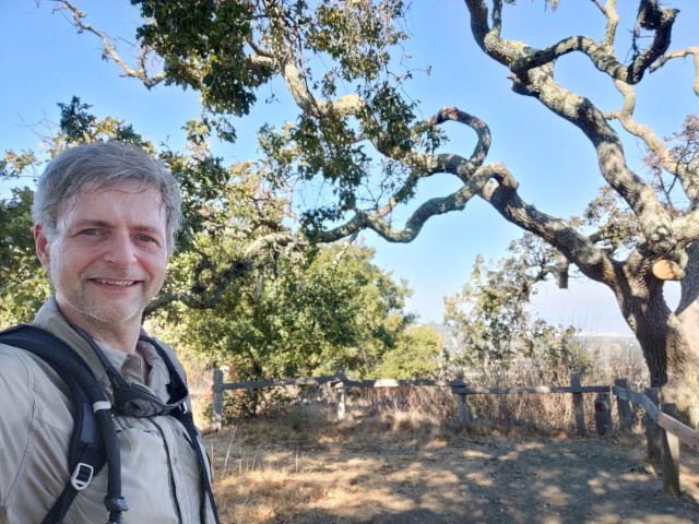
Looks like the tree had some recent surgery. . .or I picked the wrong tree?
From there, it was not all downhill, as the Live Oak Trail (formally part of the "Ridgeview Loop") goes higher than the picture spot. But after that ridge, it was Franciscan Trail and then a short span down the road and behind the visitor center. 3.63 miles--pretty much as advertised. I was starting to feel the length of the cumulative hikes, but was almost done!
When I reached Wunderlich, it was packed. I lucked out and got a narrow spot between two cars that were both much too close to mine. But that was the only spot in the place, and two more cars came in after me, circling fruitlessly.
Alambique was a little steep. Was surprised, when turning onto Meadow Trail, to experience a newly surfaced road. Lots of trees had been cut down on both sides and the understory had been bulldozed. Judging from all the little flags, new trees were planted.
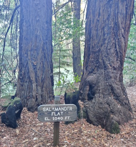
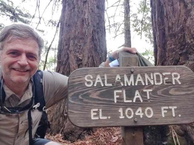
Upon reaching the intersection near Salamander Flat, I followed the sign to the location. This brought me to a bench and sign stating "Salamander Flat 1100 ft". This didn't match the picture! But I took pictures anyway, then headed back to the Redwood Trail to complete the recommended route. As I passed over the pond, there was another sign--the correct one--saying "Salamander Flat 1040 ft". This sign is higher than the 1100 ft one. Definitely wouldn't have discovered this discontinuity if not for this Challenge. Fix that, San Mateo County Park System! :)
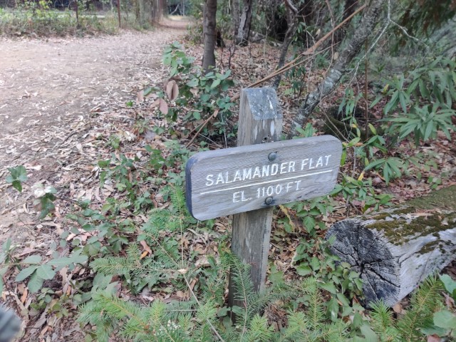
Bonus lower-altitude sign listing higher elevation
#WunderlichPark
Last park of the day!
There was still a bit of uphill from here, and was definitely feeling it this late in the tour. But I was still jazzed to have completed the challenge! Plus, this park is easily the most picturesque of the seven parks if you like redwoods.
Cleaned up back at the car. That was easy, because unlike Santa Clara County, San Mateo County doesn't lock down its water fountains and spigots. When all was said and done, it was still well before 5pm when I left the parking lot, meaning it only took 9.5 hours from starting the first hike to finishing the last.
Thanks to San Mateo County for this fun challenge. Hopefully when Pescadero is open, the Take A Hike Challenge will be too long to finish in a day.
Final stats: 25.25 miles of hiking, ~3.5k ft of elevation, and 125 miles of driving.
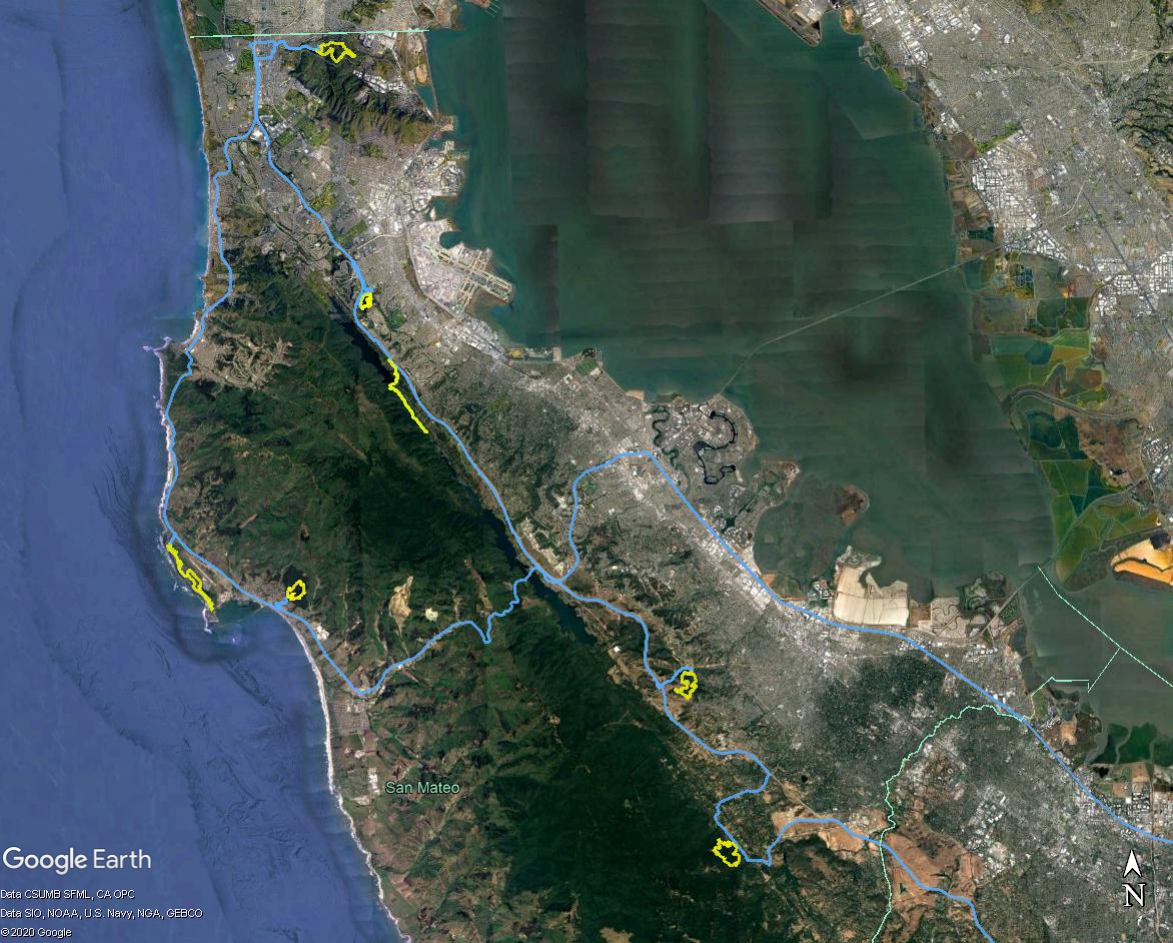
Full day of fun in San Mateo County--blue is car GPS; yellow is hiking GPS
Addendum: San Mateo did not scrimp on a fun package. Was surprised to find a USB to USB-C adaper, which worked as expected. But more broadly, looking forward to employing that fine picnic blanket.