Outside Starbucks--time to go
| Santa Clara County Parks: | 2017 | 2018 | 2019 | 2020 | 2021 | 2022 | 2023 | |||
| San Mateo County Parks: | 2020 | 2021 | 2022 | 2023 | 2024 | 2025 | 2026 |
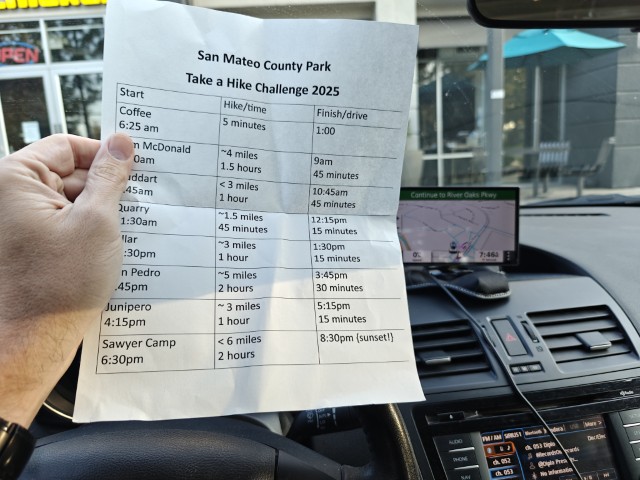
The tradition continues with a sixth consecutive completion of San Mateo County's Take A Hike Challenge in a day. This was an easier year with short hikes, but it was statistically harder than last year. As usual, I made a TAHC summary PDF to help with identifying the picture locations if there was no internet. This turned out to be particularly useful because two of the pictures were not quite where expected on the map and a third was not even on the official route.
The plan was to leave San Jose around 6:30am so I could finish at Crystal Springs (Sawyer Camp) before sunset. But since I'd packed my bike into my trunk the night before, I'd be able to finish Crystal Springs faster than my estimate. Since I was doing this on a Monday, I wasn't worried about parking, but wasn't too sure about traffic. Turned out to be fine.
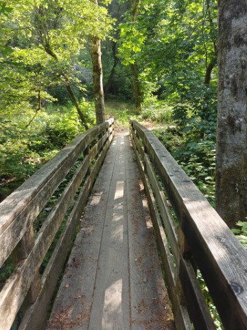
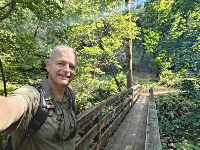
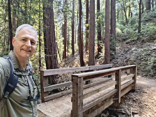
First up was Sam McDonald. Since I knew no one would be there, I drove to the free parking lot at Heritage Grove Trailhead which is the mid-point of the route. Started at 7:55am. After hiking the very nice official route to the other parking lot, I turned back up Towne Road and returned back down Big Tree Trail to add more elevation. Also took the short spur at the end (Lower Grove Trail) just to make sure I had gotten the right bridge. Such paranoia pays off (see later).
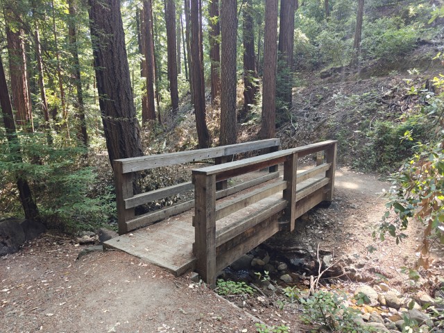
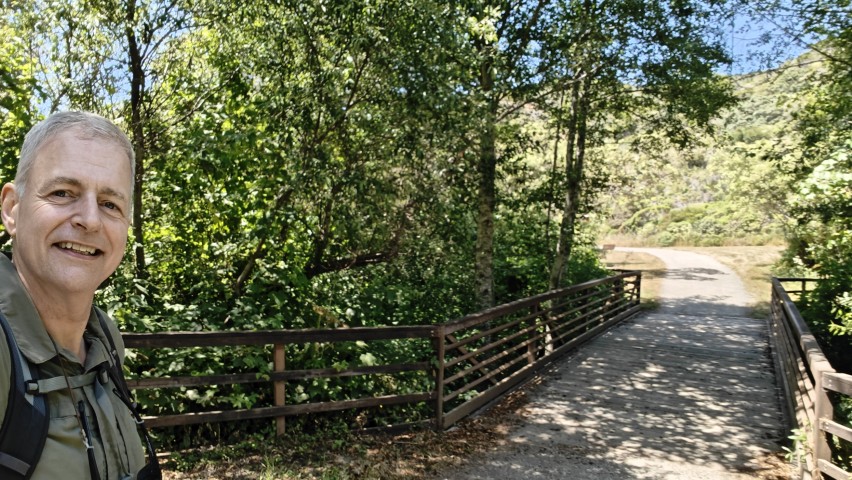
From here it's a 45 minute drive to Huddart Park. I've been there a million times, but it's an old favorite park. I did the route counter-clockwise. The "star" where the picture should be is on top of #12 on the map, but the actual bridge is closer to #13. Would have been in trouble if I'd done the loop in the other direction and realized this. There is a second shorter bridge just before this on as well.
It's another 45 minute drive from here to Quarry Park, but HWY 1 wasn't bad at all.
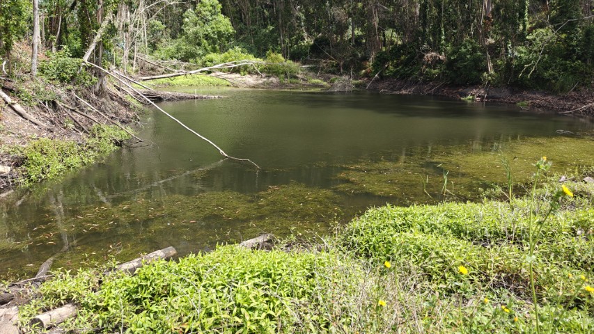
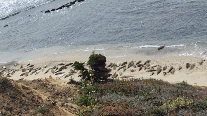
This park was surprisingly busy. Lots of little kids and parents in the vicinity of the parking lot. I'd parked here early in the year to hike up to Scarper Peak, so did almost all of the route but. . .gotta do them all on the same day. The route include a crucial spur to a small reservoir. That was the only place I'd never visited. Otherwise, it's a very quick and short hike.
Next up was Fitzgerald Marine Reserve and Pillar Point Bluff, right down the street. Parking was plentiful but there were still plenty of people out walking around. In addition to the official route, I also hiked a little farther to Whale Benchmark and also looped back through the housing area and Fitzgerald Reserve. Still a very short hike.
It was another short direct to get to San Pedro. As with Sam McDonald, I parked at a free edge of the park (#1 on the trail map) and hiked in to do the official loop. This adds 0.4 miles to the hike, which is nothing.
This was the only real "hike" of the series with almost, but not quite, 1k ft of elevation gain. I was wondering, on the way up, whether this car-width trail ever connected to the main ridge (Whiting Ridge) that leads ultimately to Montara (North Peak). But based on old topo maps and historical satellite maps, it never has. That's odd since it's a mere 0.2 miles from the highest point along the trail to the main road (on water district property). Did someone really design Hazelnut Trail as just a trail leading up and down a ridge? That's great!
Whatever the case, did this counter-clockwise, starting with the hard part (up and down). Upon reaching Weiler Ranch Trail, I took a right to visit the little loop at the end because I'd never been on that short section. Thus, by the time I was done, I'd clocked 5.3 miles for this 4.2 mile route.
Home stretch! At this point, I left the parking area around 2:50pm which was almost an hour ahead of schedule. I knew the next two were going to be easy, so felt like I was already done.
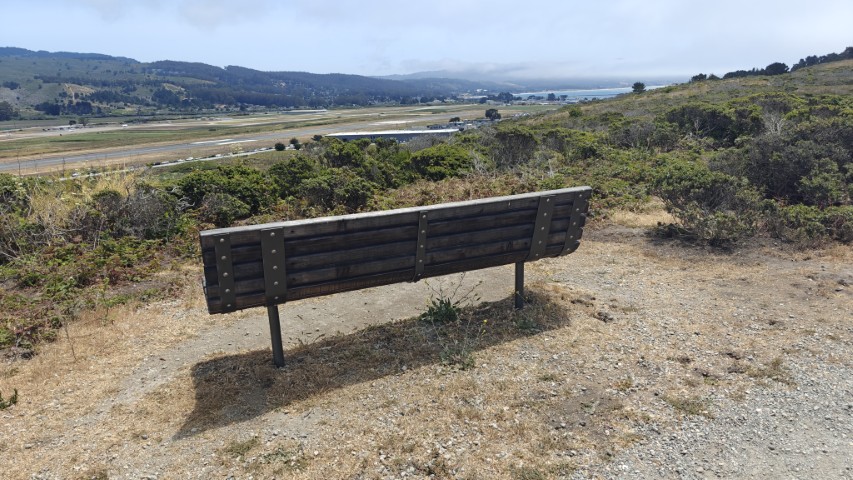
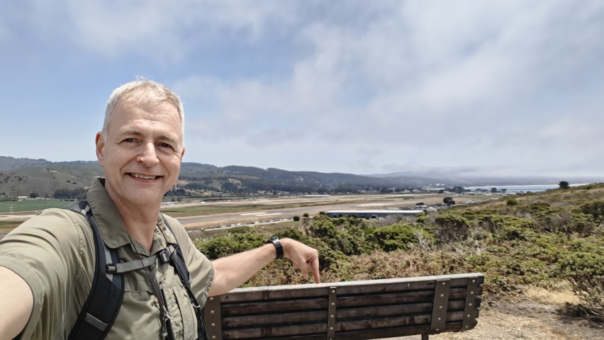
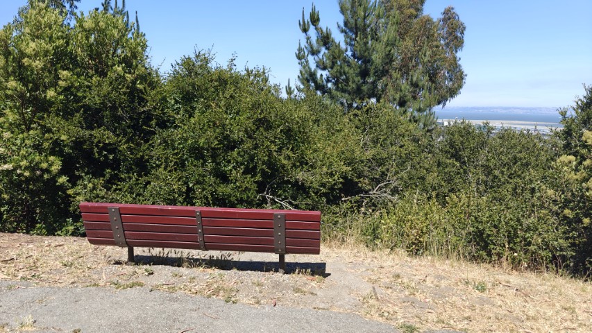
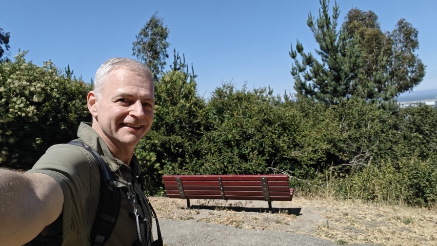
Junipero Serra is a funny park. I've only visited it on these Challenges and once while biking across it. It's too small to "hike", but a great place for picnics. As with my first visit in 2020, the map has the wrong location for the picture. And just like back then, I figured this out and had to loop back to the correctly location.
Why this don't get fixed is a mystery, but the bench in the picture is in front of the Bay View Picnic Shelter. That is to the left of (the highlighted) Quail Loop on a different trail. Indeed, I walked through a semi-formal wedding (?) gathering to take the picture!
Do the many others doing this challenge complain about this and/or take the wrong picture? Well, by gosh, I'm getting 100%!
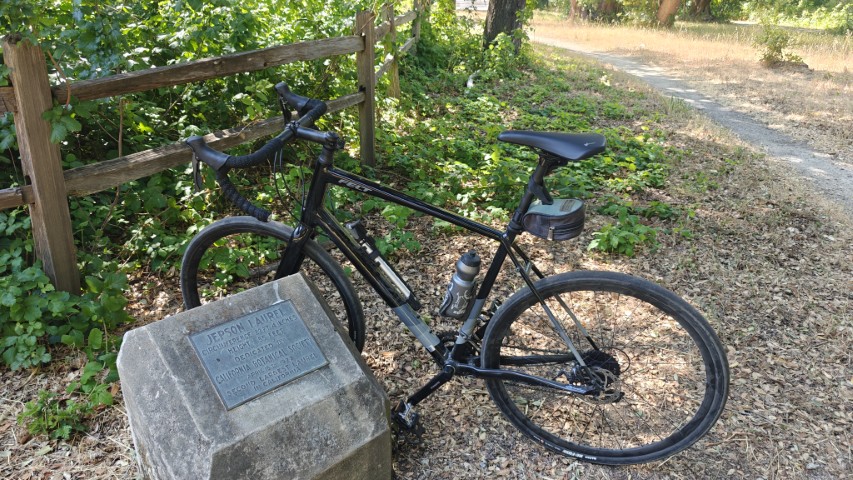
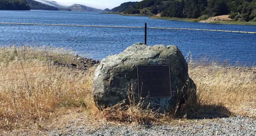
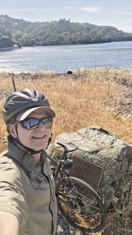
Final for the day was Crystal Springs, a short 15 minutes away. This area was still easy to park in, but filling up quickly. I had to pull out my bike in two pieces and reassemble it before setting off.
There was much more downhill that I remembered, allowing me to coast most of the way to the end of the route. Took a picture of the big Jepson Laurel marker, which was a more meaningful picture point back in 2020.
Back at the car, all the parking was taken and traffic was picking up. Glad to be done! Visited some breweries on the ride back to San Jose.
Final stats. 18.8 miles of hiking and 5 miles of biking with 3.4k ft of elevation gain. From the Sam McDonald start to the Crystal Springs (Sawyer Camp) finish it was an efficient 67.5 miles of driving. Door to door--with two brewery stops, was 150 miles. 7:55am start a Sam McDonald and 4:40pm ending at Crystal Springs made for 8 hours and 45 minutes of adventure. Thanks San Mateo County Parks!
P.S. Quite a haul this year. The prizes included a first aid kit, a coffee mug, a pair of sunglasses, a tick remover, and a fanny pack. Besides the first aid kit, I think the rest have been given in the past, but they're all useful. I use the big mug almost every morning and have removed more than one tick!
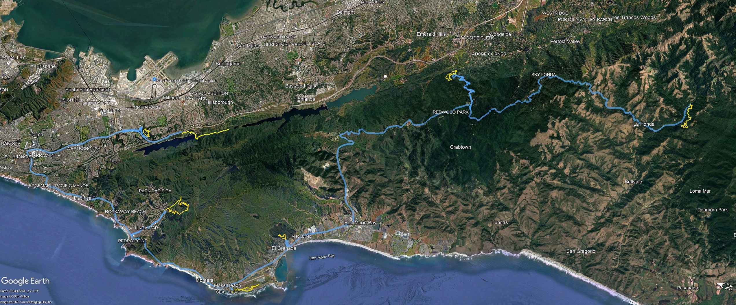
Driving (blue) and hiking/biking (yellow) tracks -- click for larger