Plans (after the fact)
| Santa Clara County Parks: | 2017 | 2018 | 2019 | 2020 | 2021 | 2022 | 2023 | |||
| San Mateo County Parks: | 2020 | 2021 | 2022 | 2023 | 2024 | 2025 | 2026 |
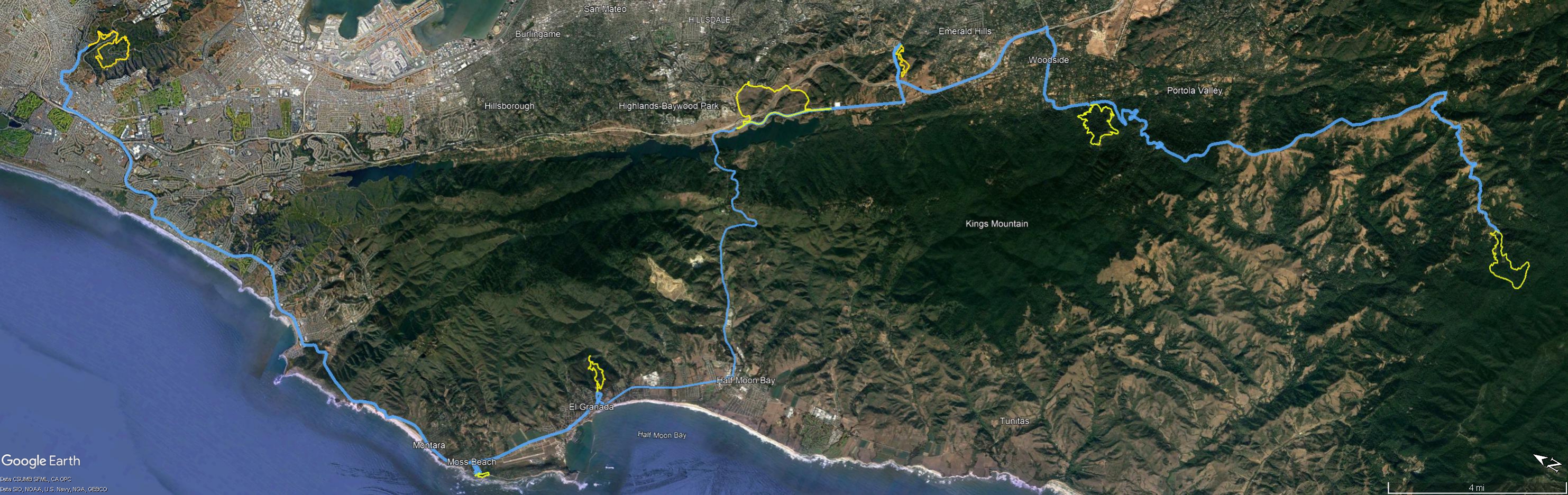
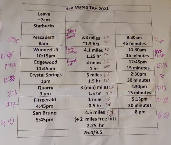
For the third year in a row, attempted to complete San Mateo County's Take A Hike Challenge in a day. Now that I no longer have a "required" hike every Saturday, it's much easier wait for an optimal weekend. With long summer days and not-too-hot temperatures, July 30th was the date.
The plan was leave around 7am so I could knock out the long drive to the most distant park in the series for me, which is Pescadero. As with last year, I stowed my bike in the back of the car the night before to make things smoother in the "early" morning. Still left a bit late and detoured to pick up coffee en-route. Slowly passed many bikers along Page Mill. The final stretch of Camp Pomponio Road is in dire need of repaving. Was surprised to see two cars, as well as a county park truck, already in the lot.
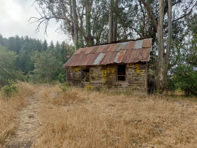
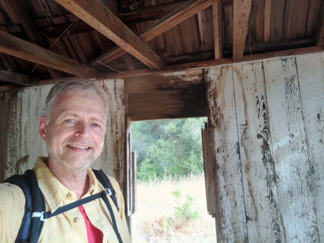
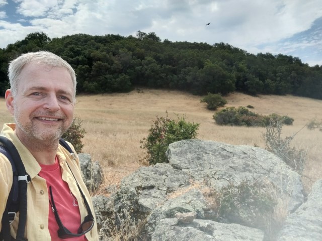
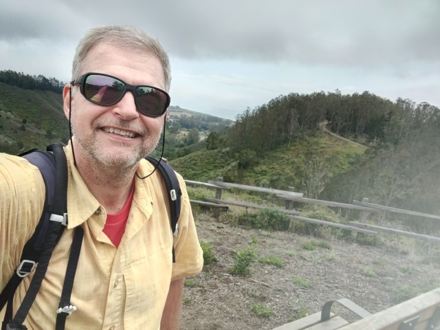
Immediately headed south to make a clock-wise loop, which would reach the picture point toward the end. Always like this park, and it did not disappoint. Have passed that old structure many times, but this was the first time I ever went inside. Snapped my pictures and continued back to the car. Map said 3.8 miles, but I clocked 4.7. And if you add up the distances on the map, it's 4.6, so makes sense! 760 ft of elevation gain was no problem as the temperature wasn't too warm.
From here was the longest drive of the day, heading north to Wunderlich. Lots of groups of sports cars were zipping in both directions along Skyline. Let a group of cars pass at one point which included a Ferrari and a Lambo, and, after getting back on the road, a Lotus came right up behind me. Too slow! That was OK, it was only a few miles to the next intersection.
The Wunderlich lot was completely packed. By some dumb luck, a car was backing out of a makeshift parking space just as I was completing my first loop of the tight parking lot. I drove right into the space, much to the disappointment of some other cars who had been waiting for open spaces in the official parking areas. Whew.
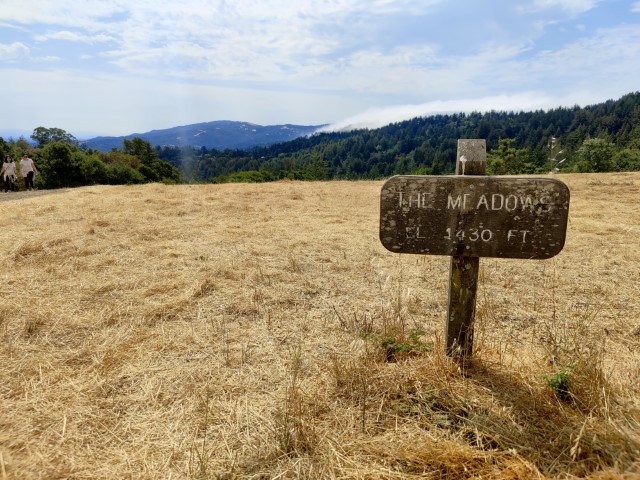
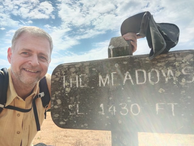
This is another park I've hiking numerous times, so nothing new under the sun. Made a clockwise loop up to the Meadow sign and snapped the requisite pictures. 4.5 miles with 966 ft of elevation gain--not too bad. Two down, five to go.
The next park was Edgewood. I had this big plan to bike both Edgewood and nearby Crystal Springs by parking along Canada Road. Later realized that one cannot bike in Edgewood. That was probably for the better, because I wouldn't have saved any time doing it that way.
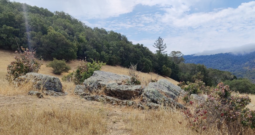
The Edgewood parking lot was almost as bad as Wunderlich, but got a space in the outside lot after trying for one on the inside. Hiked this like a figure 8, taking the steeper Old Stage Coach Road up and Edgewood Trail back. I'd never taken the top of Old Stage Road, so got some "new trail" on this visit. This did, technically, shorten the route by 0.8 miles, which I planned to "make up" later in San Bruno. It was pretty hot--a cool fog was rolling over the ridge to the west (Huddart Park, essentially) but no relief here. Snapped a picture with some rocks and headed back down.
All said and done, 2.2 miles with 440 ft of elevation gain.
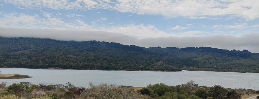
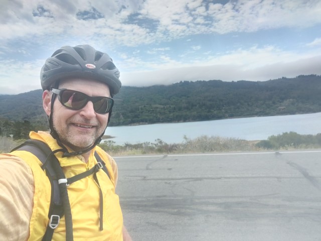
Back at the car, was now 15 minutes ahead of schedule. Drove a few minutes to the Crystal Springs parking area, assembled my bike, and set off. Since this was a one-way route, decided to make it a little more interesting by biking up the Ralston Bike Trail and back down Sheep Camp Trail. From there, biked down to the official turn-around point at the Water Temple. Sadly, it was closing for a wedding just as I arrived. Turned around and biked down the flattish road back to my car and the official starting/ending point.
After disassembling and repacking my bike, was nearly an hour ahead of schedule. This is because I'd based the time on hiking. In the end, it had been 6.5 miles of biking with 528 ft of elevation gain. That was 1.5 miles longer than the official route and nearly all the elevation gain was extra. I'd soon lose fifteen minutes of that buffer in bumper-to-bumper traffic on Hwy 35 to Quarry Park.
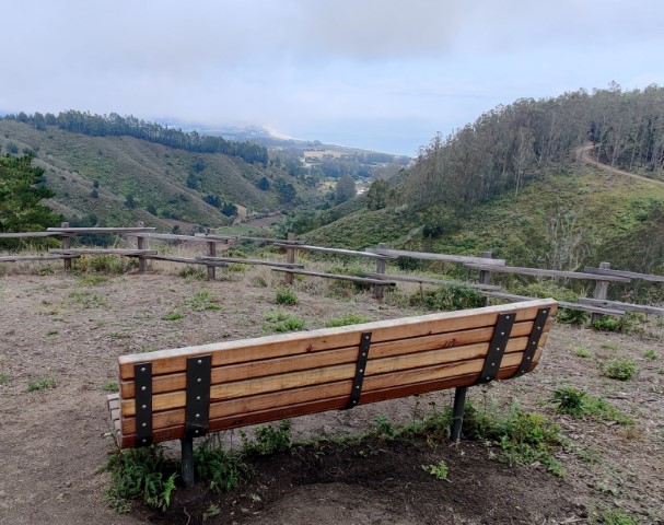
I've only been to Quarry Park once before, and it was the 2020 Take a Hike Challenge. Was happy to see a new spot and the opportunity to add some new trail. Parking here was a breeze at this time of the day. Headed up the official route to the lookout point.
It was nice and shady the most of the way up. The view from the picture point was exactly as advertised and not what I was expecting, based both on the weather and the fact that I imagined it facing a different direction. Took a different set of trails down to make a loop. This made the round trip a mere 2.6 miles with 717 ft of elevation gain. Thanks to the short hike, was an hour and fifteen minutes ahead of schedule.
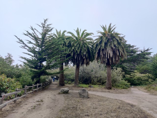
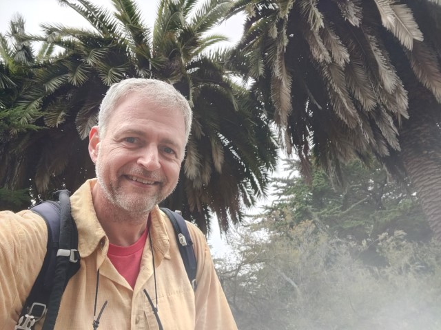
Next up was a tiny 1 mile hike. There was one tiny segment of trail that I'd never taken before. It shortened the already short hike a tiny bit, so I decided to lengthen it by first hiking down to the beach/view point before doing the loop. Lots of people at the beach area as well as along the Bluff Trail. And, as with every other time I've been there, someone was taking formal pictures under the trees. In fact, two groups were taking pictures. Speaking of which, I took a considerably less formal picture of the three palms. Liked that picture spot.
Back at the car it was almost exactly a mile with a mere 73 ft of elevation gain.
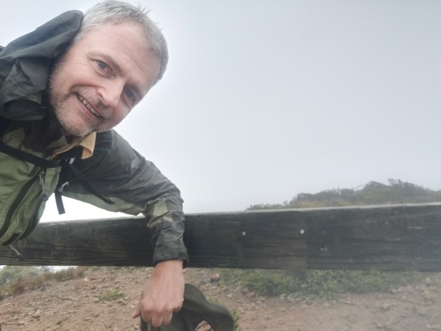
It was only 3:38pm when I drove off, so had plenty of time for the last hike in San Bruno Mountain Park. Decided to park on Crocker Avenue and hike in. It adds two miles and allowed adding a new-to-me trail--the Bog Trail. Took one section going out and the other coming back. And, of course, it saves on parking.
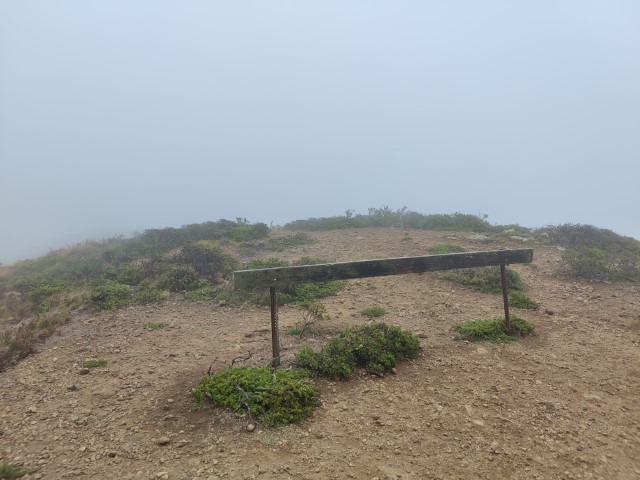
Unlike all the other parks, San Bruno was windy, socked in fog, and quite cold. Kept putting on and removing my windbreaker because it would get too hot from hiking and then too cold from the wind. Went up clockwise and overshot the picture point. Stopped at the highest point along the route (where it crosses the paved road) to get my bearings. Hiked back down to the fence point for the official, though viewless, picture.
Continued the Summit Trail loop back down, running into a few people along the way. While there were no views, hiking in the fog is also pretty fun. All in all, it was 6.4 miles with 1044 ft of elevation gain.
Final stats were pretty similar to last year: 21.4 miles of hiking, 6.5 miles of biking, with 4.5k ft of elevation gain. From the Pescadero Creek start to the San Bruno finish was an efficient 59 miles of driving. Door to door was 144 miles. Doing it in a day is good for the environment compared to seven trips, right? Thanks San Mateo County Parks!