Picture of "The Plans"
| Santa Clara County Parks: | 2017 | 2018 | 2019 | 2020 | 2021 | 2022 | 2023 | |||
| San Mateo County Parks: | 2020 | 2021 | 2022 | 2023 | 2024 | 2025 | 2026 |
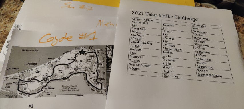
Was happy to hear San Mateo County was doing another Take A Hike Challenge. Just like 2020, wanted to see if I could do all 7 hikes of the Challenge in a single day. My hiking group canceled the hike at the last minute, so had the last (full) weekend in June free. That was perfect because the days are longer. Had originally planned to do it in early May, but discovered that Memorial Park didn't open until Memorial Day.
The plan was leave around 7:15am so I'd get to Coyote Point at the 8am opening. I had put my bike in the back of the car the day before and packed up everything else the night before. Got up early to make a few peanut butter sandwiches to eat while driving between parks. Also put a few energy drinks (and ice) in a cooler with the expectation it would be hot.
Picked up some coffee and a breakfast sandwich from Starbucks en-route to power up. While I got a slightly late start, still got to the park right at 8am. Lots of cars going in, but none going to the front lot where I parked under a crackling power line.
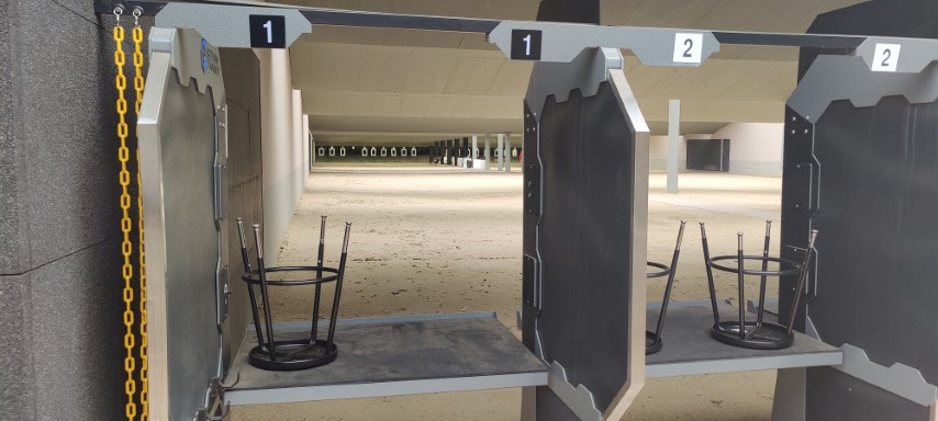
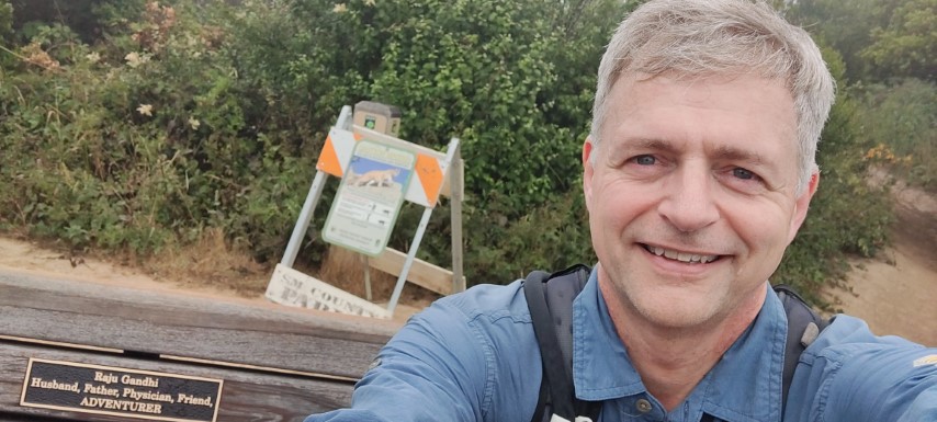
Made the loop to the west edge of the park and then headed east. The tide was out and was surprised to see several people already back from a swim--seems like the park must open before 8am. The Bluff Trail was closed, so ended up having to do the hike exactly as shown in the suggested route. Couldn't figure out why it had such an odd "shape" until encountering the fences and heavy equipment. Stopped by the Rifle Range to see what was going on while passing by.
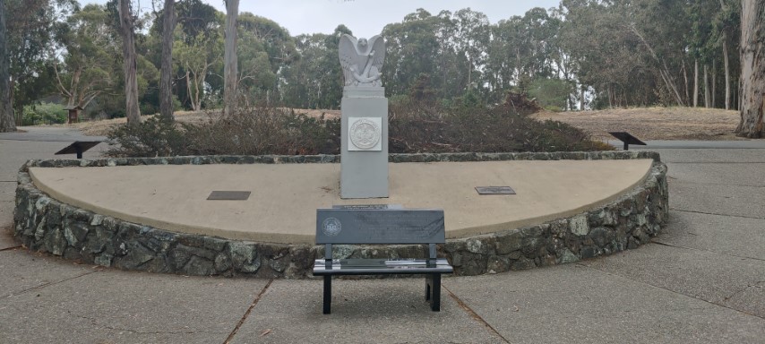
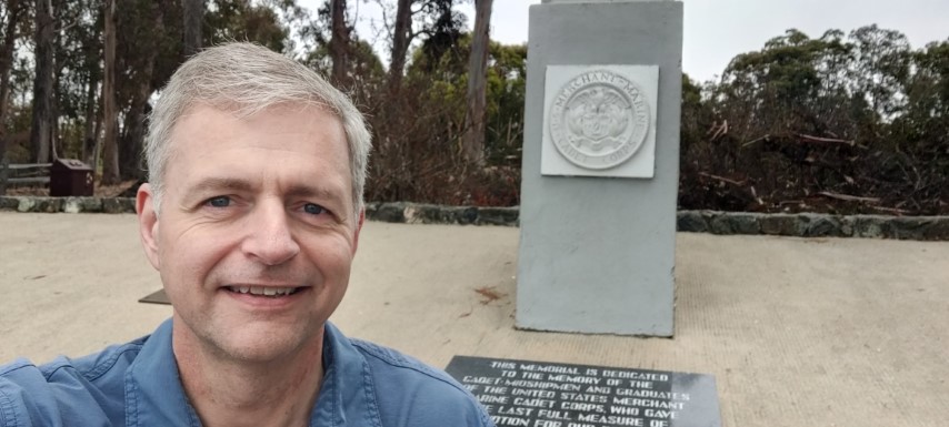
Was soon at the Merchant Marine Memorial. Continued the circuit and reached my car. 2.29 miles versus 2.0 listed. Pretty accurate.
Next up was Devil's Slide. I was so worried about parking that I went there before San Pedro Park, even though logically San Pedro should be first if minimum driving were the goal. Figured the parking would be easier earlier in the day. This proved to be correct, as there was plenty of parking.
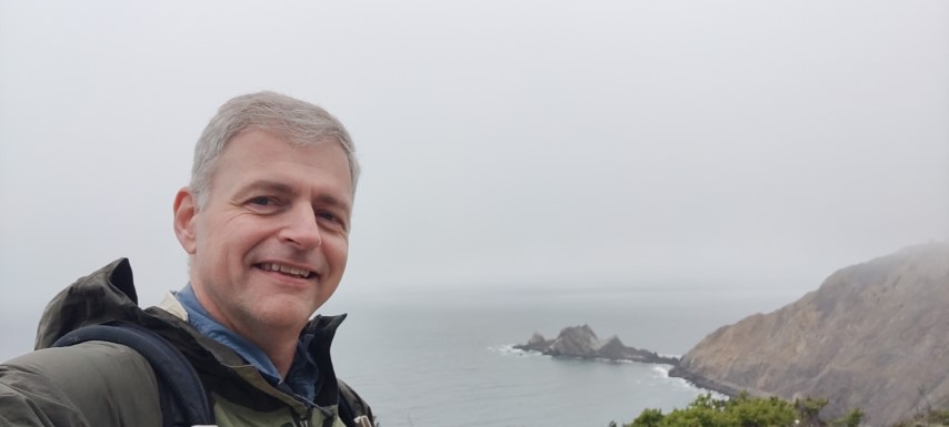
I'd never been to this park. It was interesting to read about the geology and why it is prone to landslides. You can see the folded sedimentary rock along the way from the north (as well as in the island in the picture).
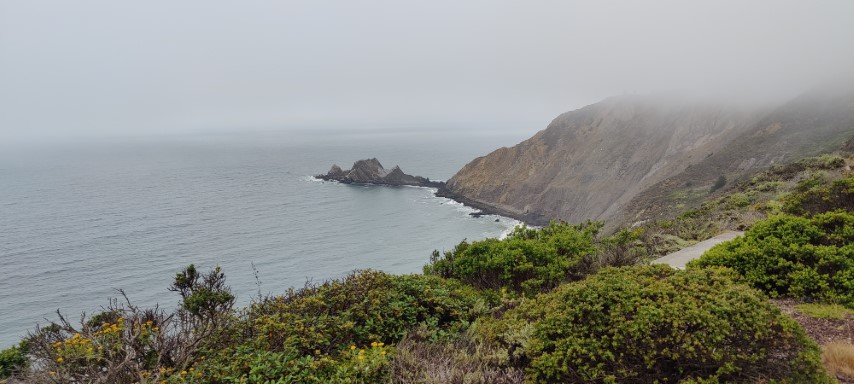
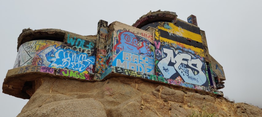
The picture point comes a mere 0.3 miles from the parking lot. Headed to the other side and kept going a little bit to visit the nearby bluff with a colorful building on top.
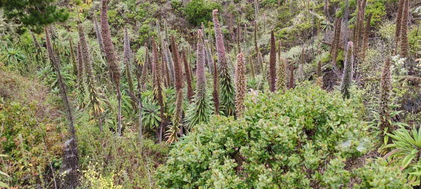
On the way back, was amazed at the density of Echium candicans, those purple plants that I just learned (thanks Rudi) are an invasive species. Since I went a little farther to the bluff, the RT hike was 3.3 miles versus 2.6 miles on the map.
From here, headed back to San Pedro Park. I've been to this park many, many times and thought I had hiked every trail there. While looking at the map, noticed an alternate entrance down the street, marked with sign post #1. Parked nearby and took that road into the park. Headed up Trout Farm and Brooks Creek to the overlook. It was completely fogged in. No complaints here--had been worried it was going to be hot all day, but so far, so good.
Love those Eucalyptus. I know they don't belong in California, but after so many years, the smell reminds me of coastal California. When I got back to the car, had clocked in 3.3 miles--apparently added 0.8 miles taking the new trail into the park. Was almost 45 minutes ahead of schedule, so knew things would work out even if the traffic was terrible.
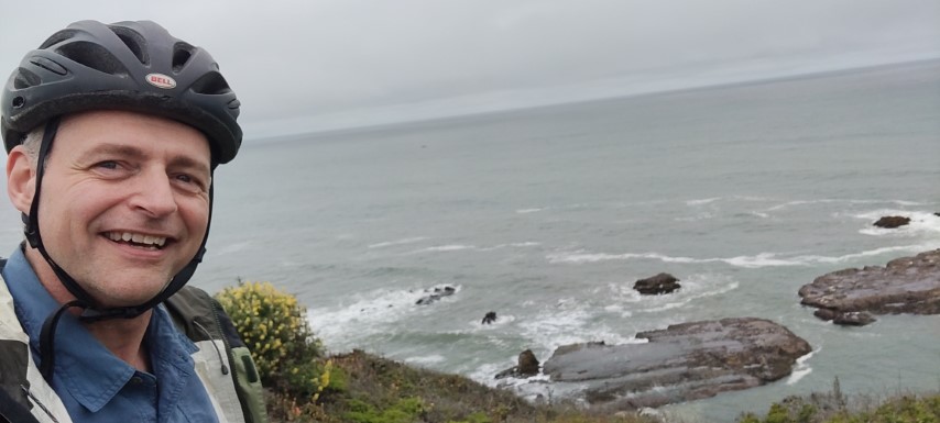
Next stop was Cowell-Purisima Trail. This was the other location where I was worried about parking. When I approached the first parking lot, there were many cars already parked along the road, so followed suit and parked along HWY 1. Pulled out my bike, added some air to the tires, and biked down HWY 1 to the south entrance, then biked the trail back. I wouldn't say the trail was crowded, but it was the most people I'd see that day.
Even at noon, it was still relatively cool on the coast. This is saying something, because there was a big heatwave going on Oregon and Washington. I was carrying extra-chilled water thinking it was going to be hot, but no problem. Stopped by both overlooks along the way, and finished with 6.3 miles. I had allotted 2 hours for hiking this, but only took 38 minutes by bike, so was just under two hours ahead of schedule. Was starting to think what I'd do with all the extra time I'd have left. . .like writing this up the same night.
Next stop was Huddart Park. I blindly followed the GPS, which went up Lobitos Creek Road to Tunitas Creek Road. This narrow-lane route is popular with bikes and works just fine, but was glad there wasn't much on-coming traffic.
Had thought I might be able to park along the road on the way to Huddart, but only saw one reasonable turn-out (which was occupied), so had to pay the fee going in. I don't mind paying, but when I'm going to be there less than 2 hours and leverage none of the amenities. . .I try to optimize.
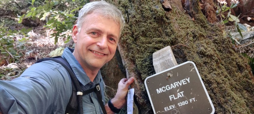
This is another park I've been to many times over the years. In fact, I'd been there twice in the last two months. But was happy upon reaching the picture location, as I've only taken that section of Dean Trail once before (as we usually go up to Skyline), and had never detoured to McGarvey Flat. The flat was much smaller than a normal (named) flat, incidentally. The sign is not in an obvious location, either, but there isn't much space to search.
I got 4.7 miles for this 4 mile route. Looking at the map, pretty sure the distance between signpost #16 and signpost #8 was omitted from the total. No big deal--this was the most elevation for the day, and still didn't crack 1k ft.
Was still at two hours ahead of schedule at the car. Headed to Memorial Park. Actually, I headed to Pescadero, which is next door. Figured I'd park at the lot there and walk in, which worked out perfectly.
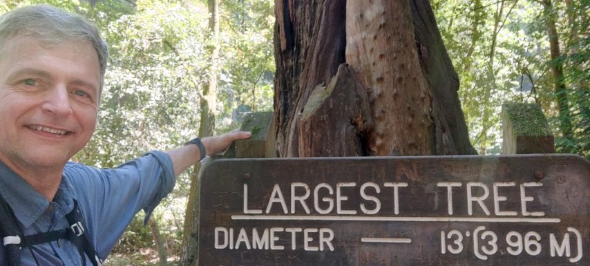
This was the oddest of the picture spots. While my estimated coordinates for the picture were pretty good, there is nothing indicating the "largest tree" on the trail junction signs. Finally found it!
And now--off to Mt. Ellen. This was the first time I'd taken the Trillium Nature Trail up to Mt. Ellen. Prior times I'd come up (or returned) on Pomponio Canyon Trail. Was glad for all the shade. Thought I remembered a marker/sign on Mt. Ellen, but only found a tree at the high point. Maybe that's why the summit wasn't the Challenge location? To be sure, Mt. Ellen is the only challenging thing, hike wise. Of course, there are so many roads and picnic areas that finding your way to cross the street is a challenge in of itself.
The 2.2 mile route was 3.4 miles, presumably due to my parking. Headed off to nearby Heritage Grove, where I planned to park at the free Memorial Grove lot on Alpine. Starting from there adds a little elevation, but this year's hikes had very little elevation anyway, so no problem!
The drawback to that parking area is the drive down narrow Alpine Road. Was happy to find one open space when I arrived. More vexing was the car GPS, which seemed to think I was driving off-road, so was not offering helpful directions. The track showed me driving through Heritage Grove!
Took a right on (upper) Heritage Grove trail. Instead of going to the (other) Sam McDonald parking lot, took Big Tree Trail. The signage suggested it was damaged, but I knew this area didn't get burned, so it was probably just a downed tree or, if something worse, I could just turn around, as there was hours until sunset. Well, there was a single downed tree. I stepped over it--no problem. Soon I was on Towne Fire Road, heading for the Hiker's Hut. A few spots along the road were exposed to the sun, but overall it was mostly shaded.
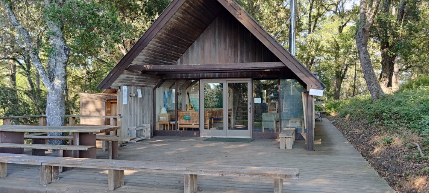
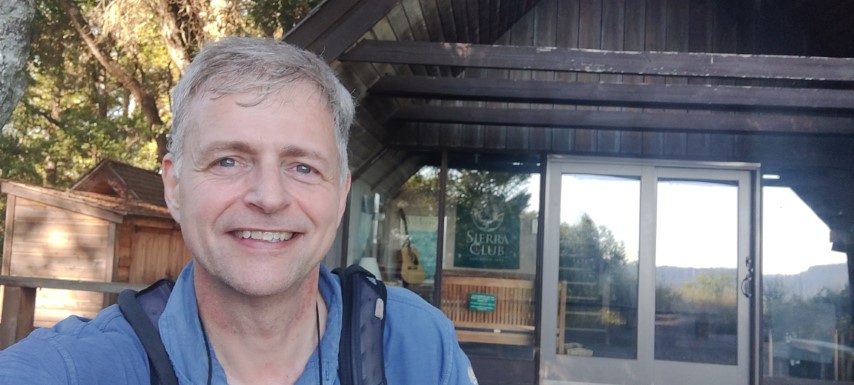
I'd been to the Hiker's Hut before, but it looked much bigger than I remembered, particularly from the side while coming up the trail.
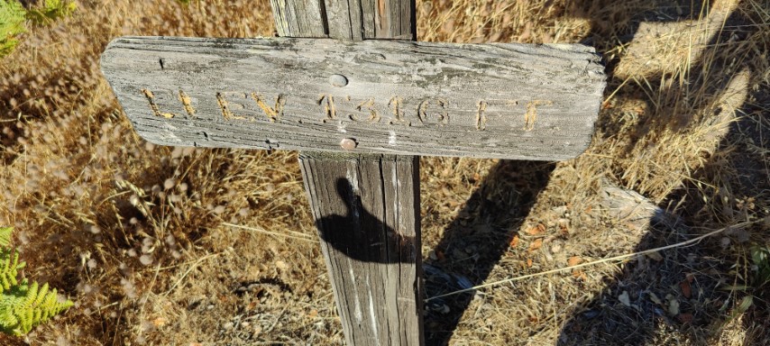
Hooray--done with the challenge. To make it more of a loop, I continued up the trail/road behind the hut to the microwave tower. Turned up the trail a little farther to the highpoint, where I was happy to find a sign.
Took Towne Road back down to Heritage Grove Trail. The parking lot had been full when I started the hike, but there was only one other car when I got back an hour and a half later. Round trip was 5 miles versus the expected 4, but that wasn't unexpected.
After all was said and done, it was 22 miles of hiking, 6 miles of biking, 3.9kft of elevation gain, and ~80 miles of driving from Coyote Point to Sam McDonald. Overall, it was 12 hours and 140 miles of driving miles, door-to-door. Thanks San Mateo County Parks!
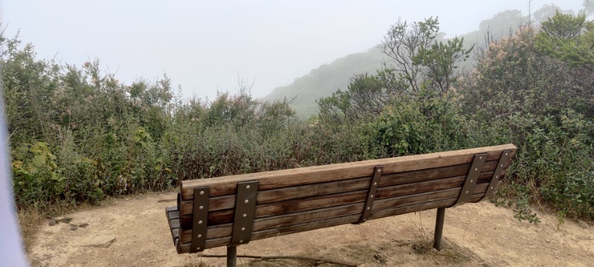
Have to use your imagination to see Linda Mar and the ocean #SanPedroValleyPark
Picture #3: 10:37am
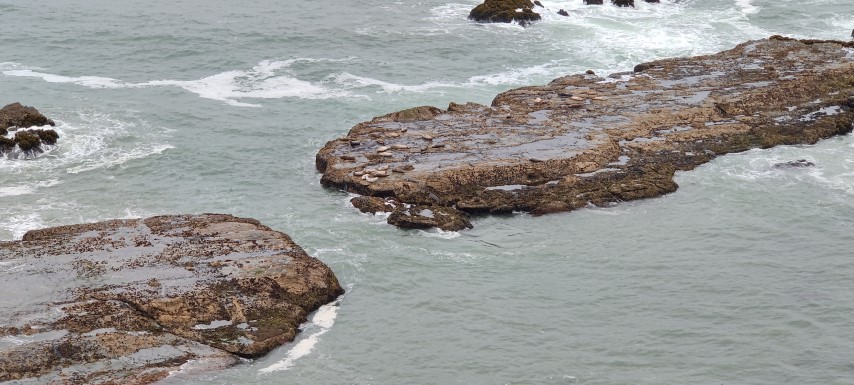
Lazy Harbor Seals #CowellPurisimaTrail
Picture #4: 12:06pm
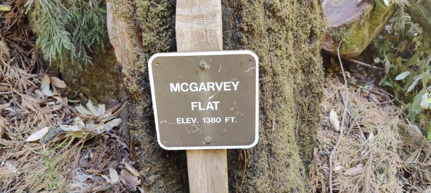
McGarvey Flat #HuddartPark
Picture #5: 1:36pm
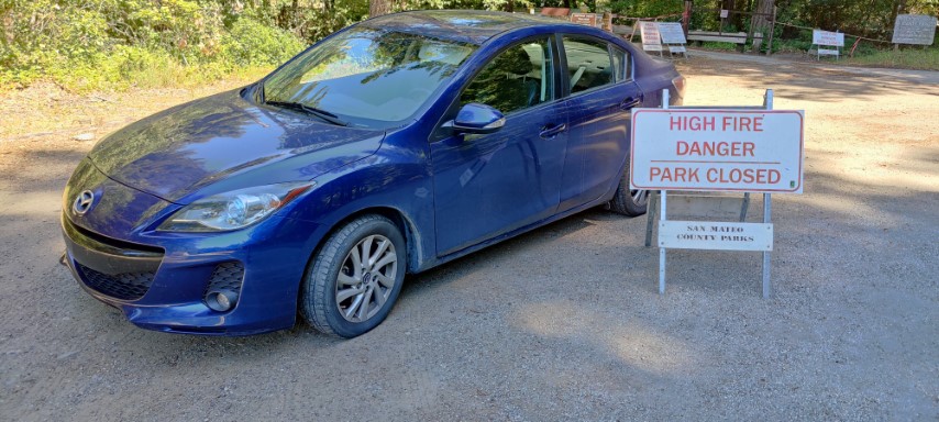
The park might be closed, but the parking lot is not
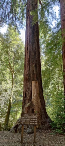
Largest Tree #MemorialPark
Picture #6: 3:37pm
Hiker's Hut #SamMcDonaldPark
Picture #7: 5:52pm
Highpoint behind the Hiker Hut
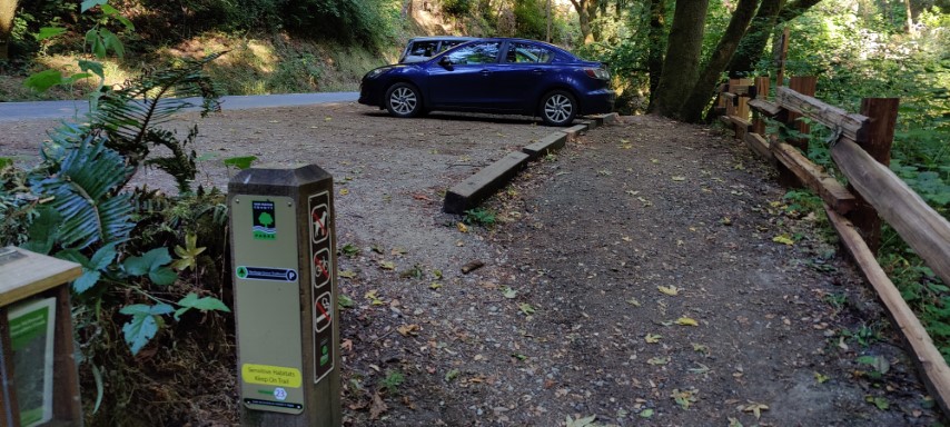
Plenty of parking @ 6:20pm
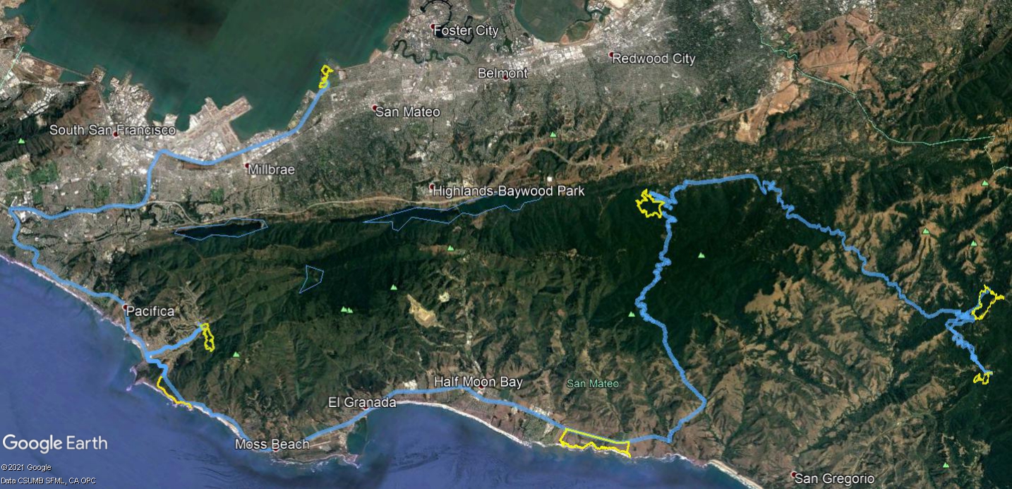
Driving (blue) and hiking/biking (yellow) -- click for larger