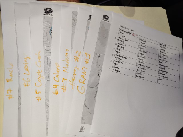
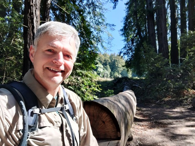
Picture of "The Plans" at 6:46am
| Santa Clara County Parks: | 2017 | 2018 | 2019 | 2020 | 2021 | 2022 | 2023 | |||
| San Mateo County Parks: | 2020 | 2021 | 2022 | 2023 | 2024 | 2025 | 2026 |
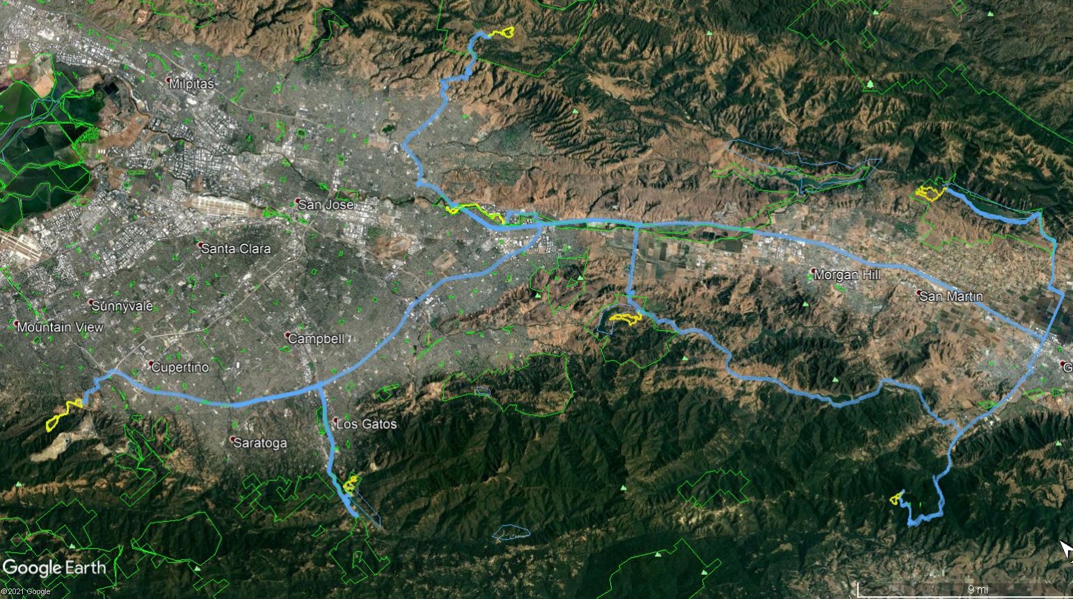
For the fifth year in a row, it was time to attempt the 2021 #PixInParks Challenge in a day. Later in the year it would be relatively easy based on the distances on the seven maps. Planned it out for earlier, but while counting up the driving times between all the parks, it was clear that this couldn't be attempted until at least March 15th, when the days would be a little longer and Daylight Savings Time kicked in (which critically pushes out the traditional sunset closing time by an hour).
April would or May would have been a great time, but a second constraint came up. Santa Clara County Parks declared they would resume collecting fees in the first week of April. So the last two weeks in March turned out to be the best time to complete this challenge for free. March 21st became the date.
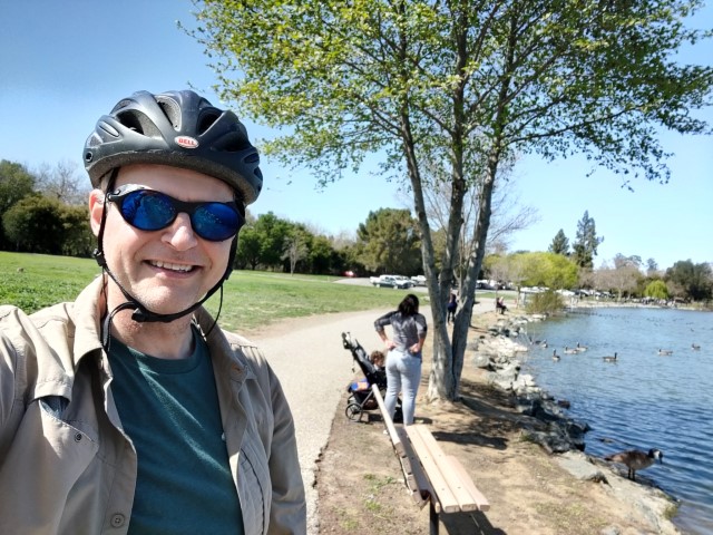
The plan was to start at 6:30am, when the nearest Starbucks opens. Was only a few minutes late, mostly due to the challenge of getting a bike into the back of my car.
First up was Grant Park. Had to slow down twice on Quimby Road. First for deer, then for turkeys. The turkeys were in no rush. Expected to park at one of the few legal roadside locations since the 7:15am arrival was before the park opens. That turned out to be unnecessary, and there were several cars in the lot when I arrived.
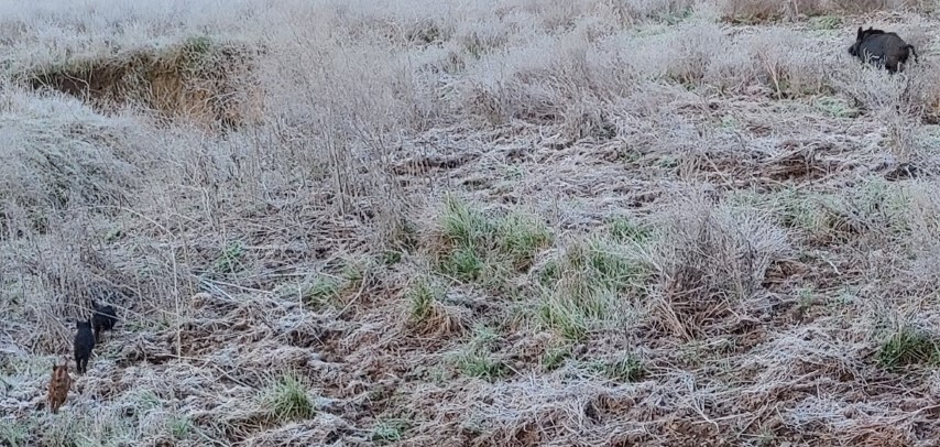
It was quite cold that early in the morning. I arrived after sunrise, but the sun never cleared Mt. Isabel the whole trip. I was wearing shorts, last year's PixInParks shirt, and a normal hiking shirt. It wasn't enough, so that motivated me to move quickly along the frosty trails.
Often see boar in Grant early in the morning. This time I came across a sow with piglets (or boarlets). They were cute, scrambling to get out of a trench to meet up with their mother. There were at least eight--so expect plenty of rooting next year.
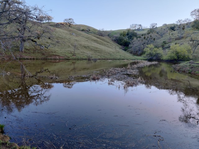
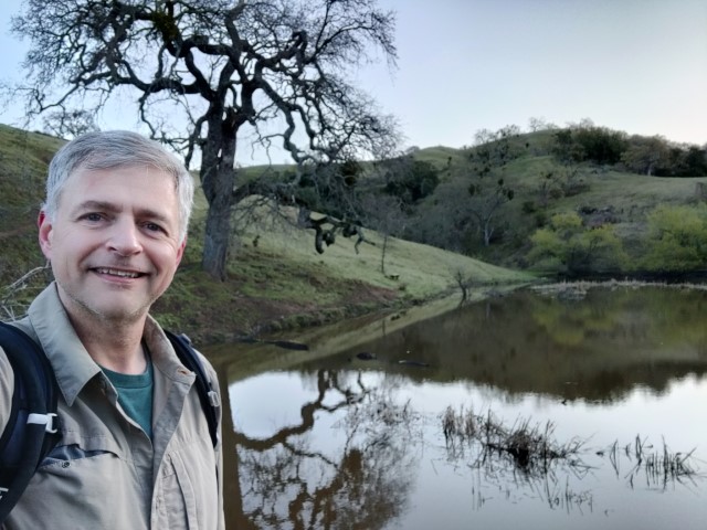
Took the longer leg of the suggested route to reach Bass Lake. Found a place on the shore that looked like the picture, snapped the money shot, and high-tailed it back to the car. The way back on Loop Trail was surprisingly mossy. Finished at the expected time, so was on pace.
The drive back on Quimby involved encountering two separate on-coming cars on the un-striped section. I've always worried about that happening--worked out fine. From there was the longest drive of the day down to Harvey Bear/Coyote Lake, after which I'd work my way back north. Turned out that Coyote Lake also involved a single-lane road to reach the trail head, which was at the Coyote Reservoir Dam. Encountered turkeys (quicker ones) and a group of California Quail en route.
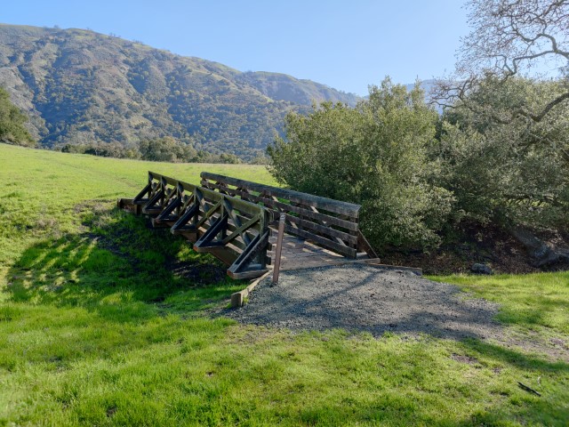
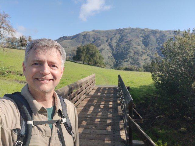
Took the longer leg of the route to heighten the anticipation. The top of the loop gives good views of Nesbit Ridge and lesser known Larios Peak. Took the requisite picture at the bridge and was back to the car in no time. When all was said and done, was 19 minutes ahead of schedule--the hike was half a mile longer than expected.
Except for a short stop for a train, the drive to Mt. Madonna was no problem. I had carefully prepared the driving segments, including numbered waypoints in my car GPS, to minimize the transitions. I hadn't routed the hikes at all, which would have saved just as much time. So on this hike, I walked around for a while before getting my bearings. There are a lot of real trails, use trails, and roads that compete for attention in the general vicinity.
Mt. Madonna is an oft-selected park for this Challenge, and it's almost always a very short hike for a fairly long drive. But unlike prior routes, this one didn't hit the "pretty" areas of the park. It did take some new trails, which was appreciated. The picture spot was fun, too.
I'd planned to do a slightly longer loop, but ended up not doing it since I puttered around at the start. Logged a paltry 1.7 miles (still longer than the 1.5 miles listed), so by the end of the hike was 45 minutes ahead of schedule. It wouldn't last, but was feeling good at the time. I returned to find a small hiking group in the parking lot. They were standing around and behind my car. They seemed oblivious to the high probability that a person getting into a car would soon result in that car backing into them. But like the earlier turkeys, they eventually moved.
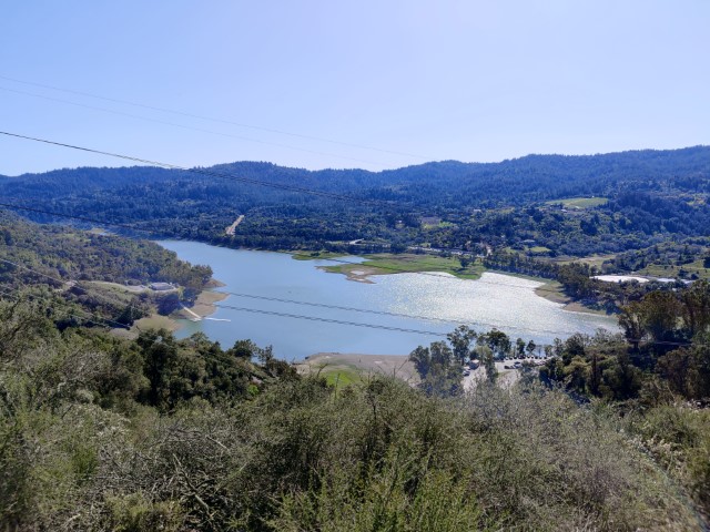
Another 45 minute drive to get to Calero, which was packed. The enormous parking lot was over 75% full. Plenty of places to park, but it was impressive.
One could get to the picture spot in under a mile, but took the longer leg first. There was some new trail (for me)--the Oak Cove Trail. This trail was routed higher than the old road, which is now closed off. Perhaps they plan to raise the water level a little higher after retrofitting the dam?
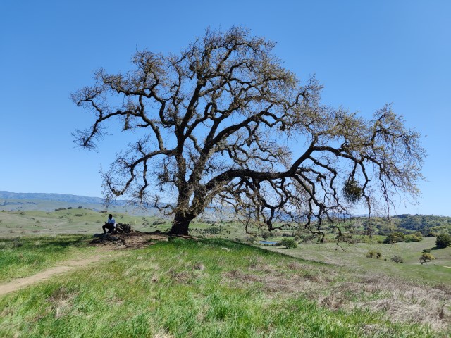
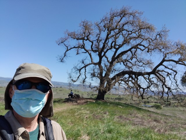
As I was coming down to the picture spot, I realized I'd put in the coordinates for the "pond" icon instead of the "picture" icon. Fortunately, I figured this out before passing the crucial tree! The tree was easy to spot, and the guy sitting under it must have been wondering why I was taking his picture.
It was down, then up, then down to the car. That's a nice feature of Calero--you have to work a little just at the end of your hike. Was about 40 minutes ahead of schedule at the end. The hike was .4 miles longer than advertised, although part of that could have been the distance to-and-from the rear of the parking lot.
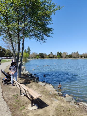
Next stop was Coyote Creek. I've biked this route from end-to-end several times, so remembered seeing this parking lot before. Had to pump up my tires and adjust my seat four times until finally setting off. There were lots of people on this route, with an even mix of walkers and people with rolling objects of all sorts. The far end of the route is sort of ambiguous on the map. I made a loop around the lake and field just to be safe. Quite a few large picnics/parties were going on. Felt like pre-CoViD.
Just as I was completing the loop around the lake, I realized I'd forgotten the picture and had to ride down the grassy slope from the Coyote Creek Trail to the lakeside trail. Was happy to spot the specific tree in the picture, as there are a few bench/tree combos in the vicinity.
Took a little detour into Shady Oaks Park near the end to make sure I'd get the 6 miles listed on the map (got 6.5). Back at the car, dissembled the bike and put the parts back into the trunk. As flat as the bike ride was, could feel some twitching in the calves. It has been a while since the last bike ride.
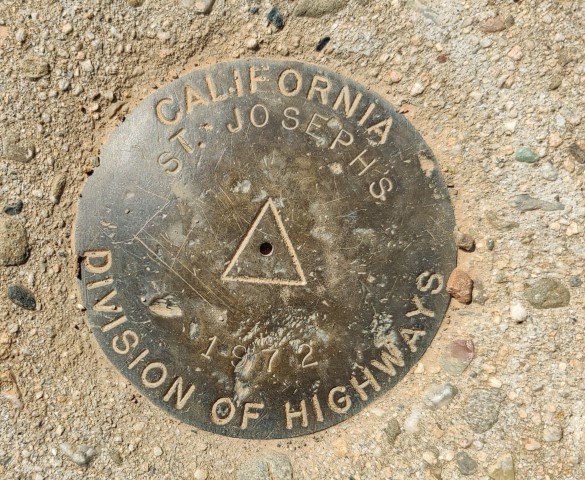
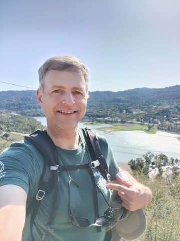
Almost done! Onward to Lexington. Haven't been to St. Joesph's Hill in a long time. The parking lot was crowded, but found an open spot. There aren't many miles of trails, so guess the parking-space turn-over rate is high.
Extended the suggested route to St. Joesph's summit--it's right there--but dutifully returned to the original junction to take Ridge Trail (new to me) over to Manzanita, rather than taking the expedient route straight down Manzanita from the summit. Took a few pictures from two spots that roughly matched the picture.
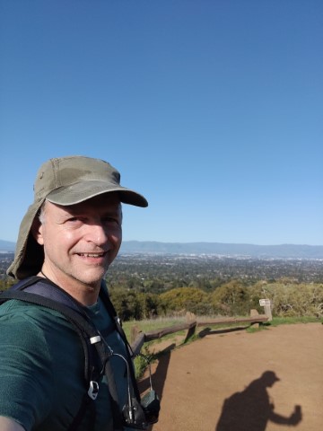
Was an hour ahead at this point, so no worries about sunset. Headed off to Rancho San Antonio. Haven't hiked from the suggested parking area in over a decade. It's just a terrible place. But was hoping the late start would be no problem. Headed directly to the Equestrian Lot where I got a spot. It was just dumb luck--there were three cars waiting as I set off.
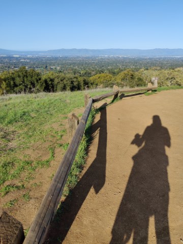
People were everywhere. Was happy (though surprised) that Wildcat Loop was a one-way route. That greatly reduced the traffic, although passed many people on the way to Vista Point. Realized later that I've never taken this trail (or at least had no track for it), as historically took longer routes, such as reaching Vista Point from nee PG&E via High Meadows.
Planned to take Coyote Trail back to the Equestrian Lot to make the route into a loop, but was thwarted by that trail also being one-way. Darn. Best I could do was take Permanente Trail near the end to reach the parking area. Surprisingly, this supposed 3.4 mile route clocked in at 5.8 miles. After cleaning up in the bathroom and changing, I was only 30 minutes ahead of schedule.
After all was said and done, it was 22.3 miles of hiking, 6.5 miles of biking, 3.7kft of elevation gain, and 142 miles of driving from Grant to Rancho (just over 12 hours and 178 driving miles, door-to-door). Thanks Santa Clara County Parks!