Plans (although started an hour later)
| Santa Clara County Parks: | 2017 | 2018 | 2019 | 2020 | 2021 | 2022 | 2023 | |||
| San Mateo County Parks: | 2020 | 2021 | 2022 | 2023 | 2024 | 2025 | 2026 |
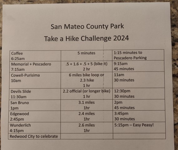
Completed San Mateo County's Take A Hike Challenge for the fifth consecutive year. Also completed it in one day for the fifth time. This year was slightly easier than last year, which set a record for "easy". Like last year, made a TAHC summary PDF to make things easier/quicker. Just saved it on the phone so I could pull up the information no matter what my connection was.
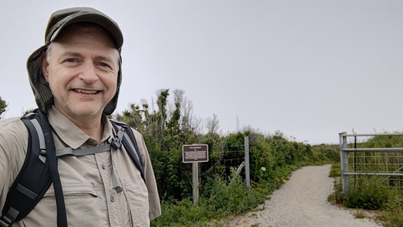
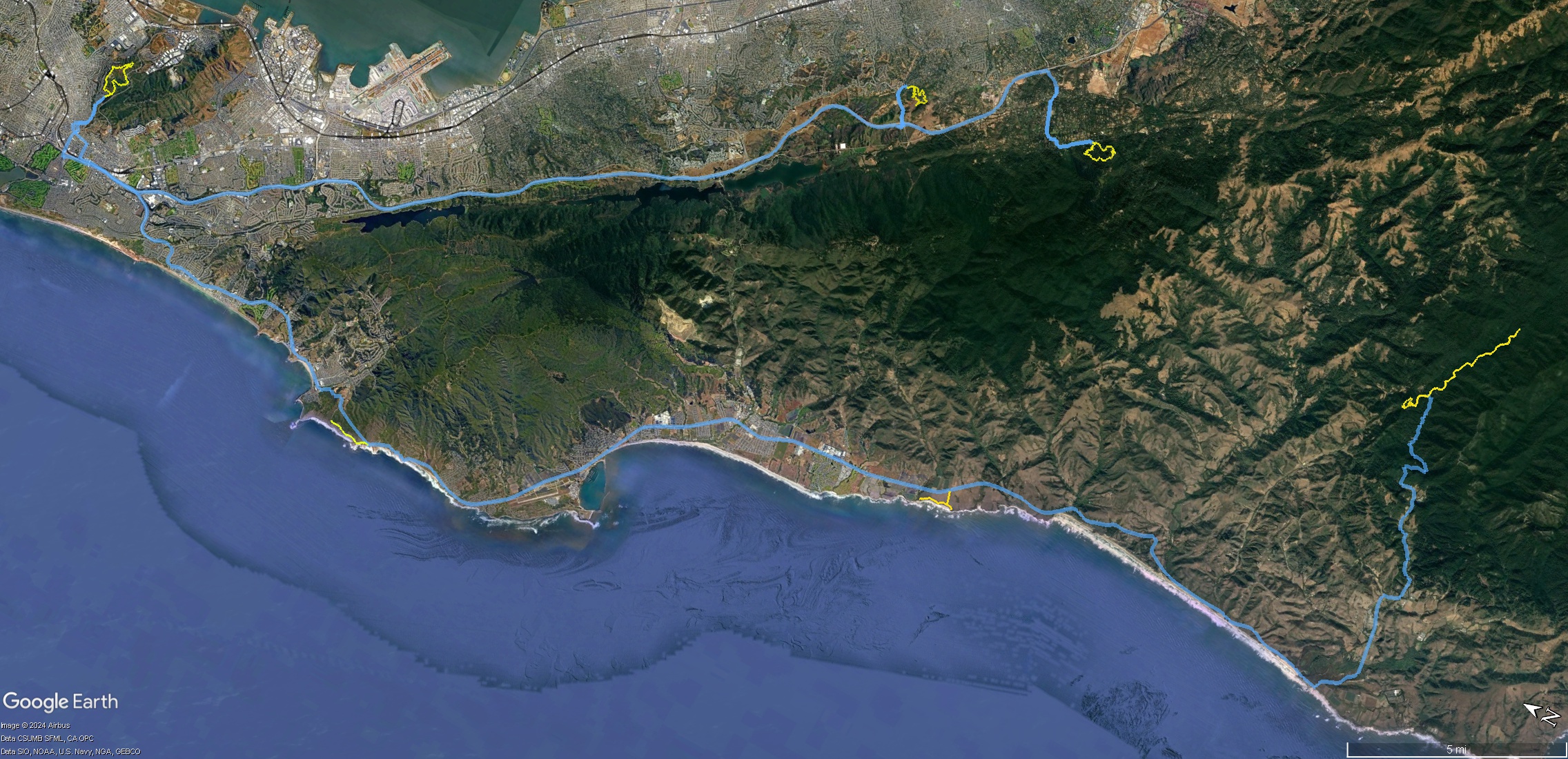
The plan was to leave San Jose around 6:30am so I could get to Pescadero around 7:15am. But since I "worst-cased" the schedule and was still projected to finish by 5:15pm, I didn't see much reason to get up so early. Long story short, got to Pescadero at 8:20am. The only concern with the late start was whether I'd have parking issues for the next two hikes (Cowell-Purisima and Devil's Slide) and/or crazy traffic around Half Moon Bay.
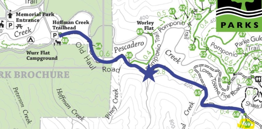
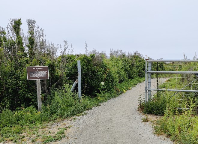
The traffic was relatively light on the way to Pescadero Creek. I'd preloaded the parking areas in my GPS. . .and also preloaded a bike in my car the night before. So when I got to the parking area, I re-assembled the bike and headed down Old Haul Road. I had originally planned to hike this as a loop, but Arlene from Hayward Hikers put the idea of biking it into my head. I figured this would let me sleep another 30 minutes. Plus, I've hiked all of Pescadero Creek over the last 27 years, but I've never biked there.
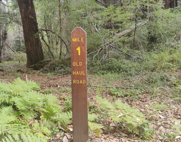
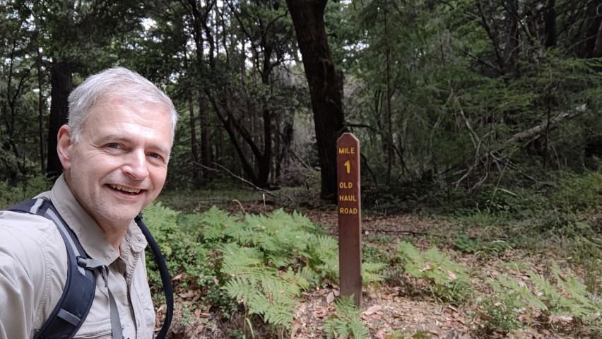
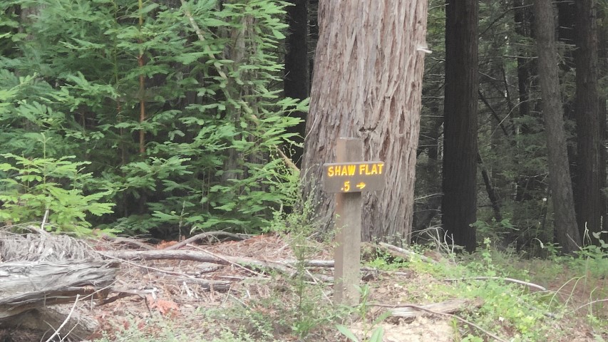
After taking my picture at the required location sign post, I kept going to the end of the designated route, which was around junction #68/#69. I looked forward to taking a picture gleefully pointing to #69. Looks like those signs were lost in the last fire and not yet replaced, despite showing them on the official map. So I ended up biking another mile uphill until I noticed "Mile 3 Old Haul Road", which was clearly much farther than I needed to be. On the way back, found the correct junctions. Ocean View Trail (junction 69) is closed with no sign and Shaw Flat (junction 68) just has an old-school sign. No big deal--that's what I get for trying to save time!
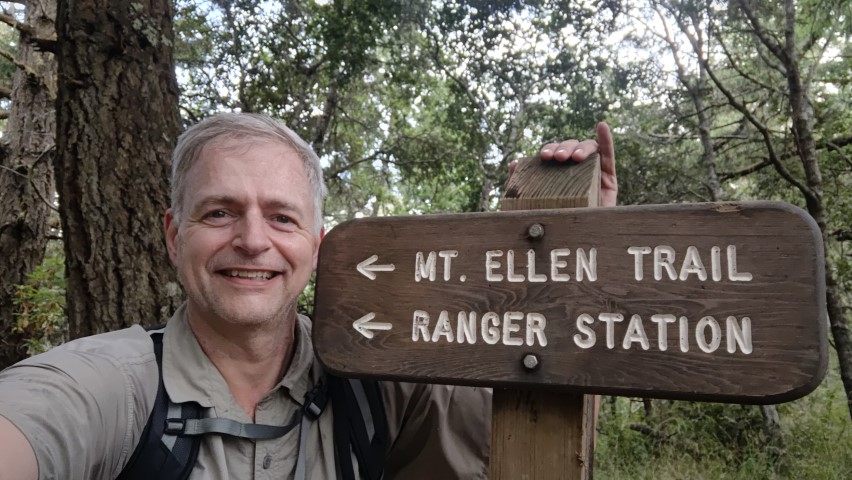
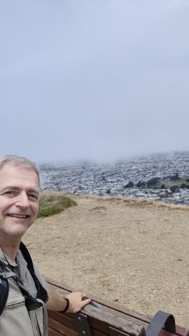
I kept biking past my car and down the street to the entrance to Memorial Park, where I locked up my bike and hiked the loop up/around Mt. Ellen. Found the picture location and snapped the requisite picture, then continued along the ridge to the summit of Mt. Ellen, which was the only real summit hike of the seven parks.
The late start had me worried about the parking at the next stop on Highway 1. While the traffic was definitely heavy, I was able to zip into the parking area and find a space with no problem at 10:36am.
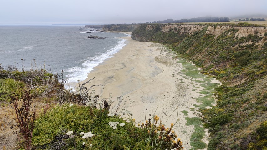
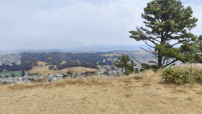
I had thought about biking a longer loop here, as I did in 2021 when the same park was on the TAHC list, but decided it would be faster to do the official short hike to help make up some additional lost time. After reaching the photo location (and waiting for a hiking group to pass from the opposite direction), I took my pictures. On the way back, it appeared the round trip was only going to be 2 miles, so extended the hike slightly to the overlook area. As it stands, I'd say it's ~2 miles RT to the picture location from the parking lot and 2.4 miles if one adds in the overlook.
I'd been to Half Moon Bay twice in the last two weeks because it's relatively cool during the latest extended heat wave. I'd even already covered Devil's Slide on a much longer hike. But since I needed to do them all in a day, I was back to repeat. Again, was surprised to find easy parking at 11:45am. I had thought about biking this area since it is paved but decided it was so short that assembling and disassembling my bike was more of a hassle.
A couple asked me why some of the rocks out to sea where white. I said "bird crap". The guy was so excited because he apparently won a bet with his girlfriend/wife, not that I know for sure why. But it was one of those funny situations when you wonder "Do I look like a scatoligist?"
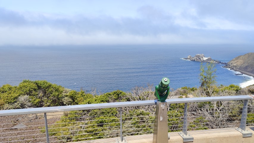
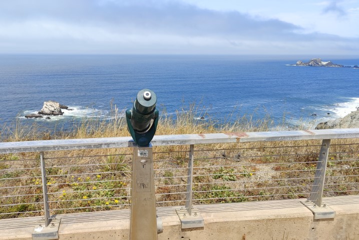
I'd made a rough waypoint--based on the map--to where the picture location was supposed to be. When I got there, it didn't look right and there was no telescope like in the picture. So I kept going to the Northern Viewpoint, which was required anyway. Well, it had a telescope, but the wrong view.
On the way back, eventually found the correct location, which is actually the Southern(most) Overlook, not the "Middle" Overlook that is marked on the map. It's weird that this hasn't come up by now and been corrected. On the other hand, maybe it keeps people honest.
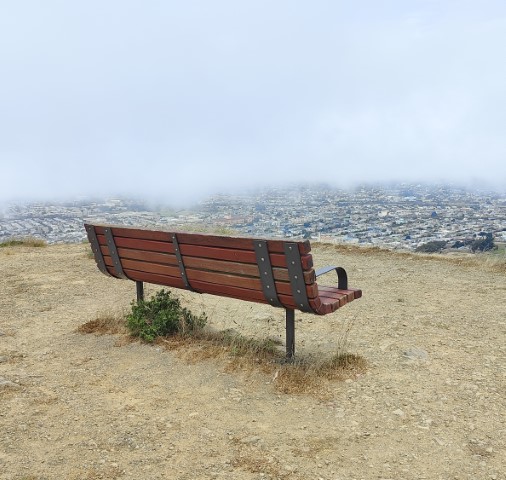
The official loop for San Bruno allows for free access from Crocker Avenue. I got parking immediately next to the trailhead, which was quite different than my 2020 experience for TAHC. There was no view in the "bench direction" this time. Last time I could easily see Sutro Tower. There was a view to the east, however. Took the requisite picture and completed the loop. I'd dressed expecting warm temperatures, but this hike (like all the prior ones today) was windy and pretty chilly, so that kept me moving.
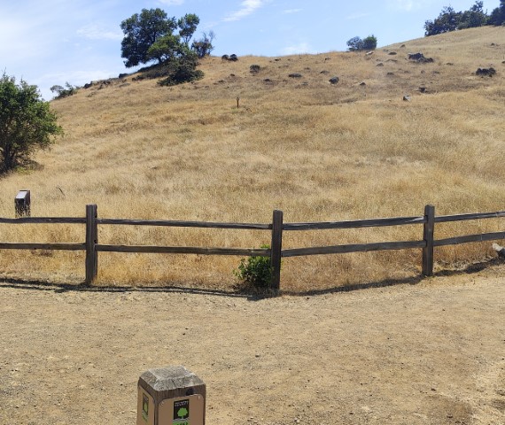
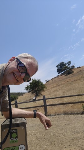
Next up was Edgewood Park. This is another place that can have tough parking. Saw some street parking as I came in but tried driving into the small inner lot. Surprise--two spaces. The San Mateo hiking gods were looking out of me. This was the first inland hike of the day and it was now quite hot, but at least half shaded. I took the steeper Sylvan Trail up to the picture point so I could take the gentler route down. Had fun trying to reproduce the original picture, which just captures the top of the sign-post.
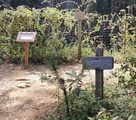
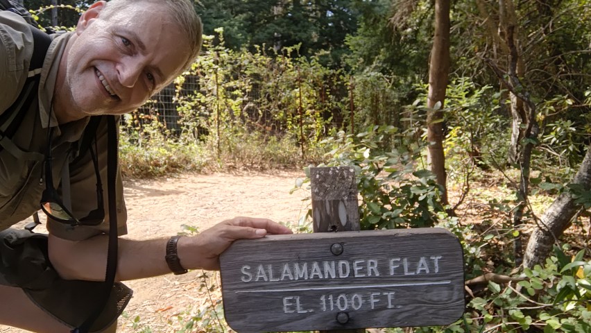
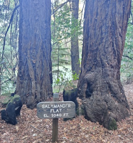
The last hike of the circuit was Wunderlich. The funny (to me) item was that a similar route was selected in 2020, but it went to the other Salamander sign on the opposite side of the pond. In the last two years or so, they put in a dirt road that connects from just outside the parking lot to Loop Trail. I accidentally took that route thinking the left (correct) route might go to the stables/barn below. The existing signage made no mention of this new obvious trail, which was what threw me off (I think). I knew it was wrong almost immediately because Alambique is pretty gentle, but I kept going as it looked like it would intersect with the Loop Trail, which would make it all work out. This was a good thing because it was the first--and only--new trail visited today despite being in seven parks.
Found the sign, lined up the identical picture, and then took a candid. From here it was down, down, down to the car. Was done by 4:17pm, which proves how incredibly easy these hikes are. I changed in one of the bathrooms and headed to Redwood City to celebrate another successful San Mateo Take-A-Hike Challenge.
Last year was 8 hours and 20 minutes between starting at the first park to ending the hike at the seventh park. This year is was 7 hours and 57 minutes. I didn't think it could get easier, but it did, probably because two of the parks were right next to each other.
Final stats suggest that this was about the same difficulty as last year. 15 miles of hiking and 7 miles of biking with 3.1k ft of elevation gain (some of which was outside the minimum required route). From the Pescadero start to the Wunderlich finish it was 81 miles of driving (not too bad). Door to door was 149 miles. Thanks San Mateo County Parks!