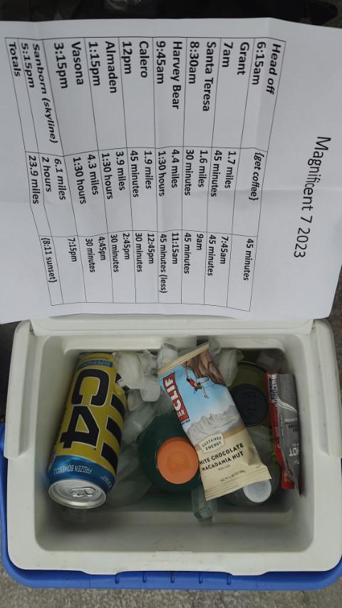
Picture of the rough schedule. . .which was 30 minutes behind at the get go
| Santa Clara County Parks: | 2017 | 2018 | 2019 | 2020 | 2021 | 2022 | 2023 | |||
| San Mateo County Parks: | 2020 | 2021 | 2022 | 2023 | 2024 | 2025 | 2026 |
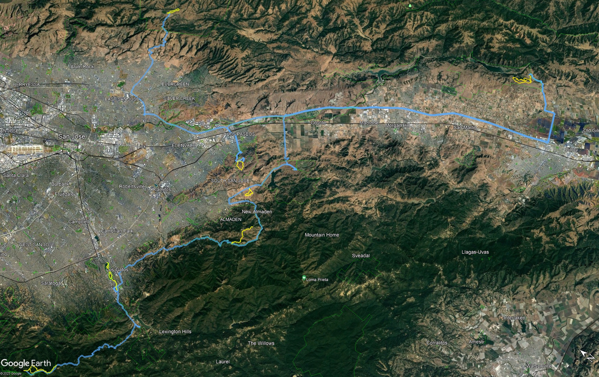
It's the end of an era. After seven years, Santa Clara is ending its annual PixInParks Challenge. It's been a fun ride. As with the prior six years, I set off to attempt all seven hikes in a single day. After putting all the trailheads into Google Earth and optimizing the order, was happy to see that this year would be easy with regard to driving among all the parks. Stayed up late planning the last details and was confident enough to sleep in. . .starting 30 minutes "late" with the expectation I could make up the time.
Had just started a 4-week sabbatical on Tuesday so had Wednesday (and the rest of the month!) free. For the first time, was doing this challenge on a non-holiday weekday. That, of course, comes with its own risks, so decided to start the hikes starting north and heading south (opposite of the expected commuter traffic). Had been thinking about this trip for a couple months so had stocked up on hydration/caffeine options, which I put into a cooler for the drives between parks. First stop, as usual, was Grant Park because it is relatively isolated, so a good place to start the day.
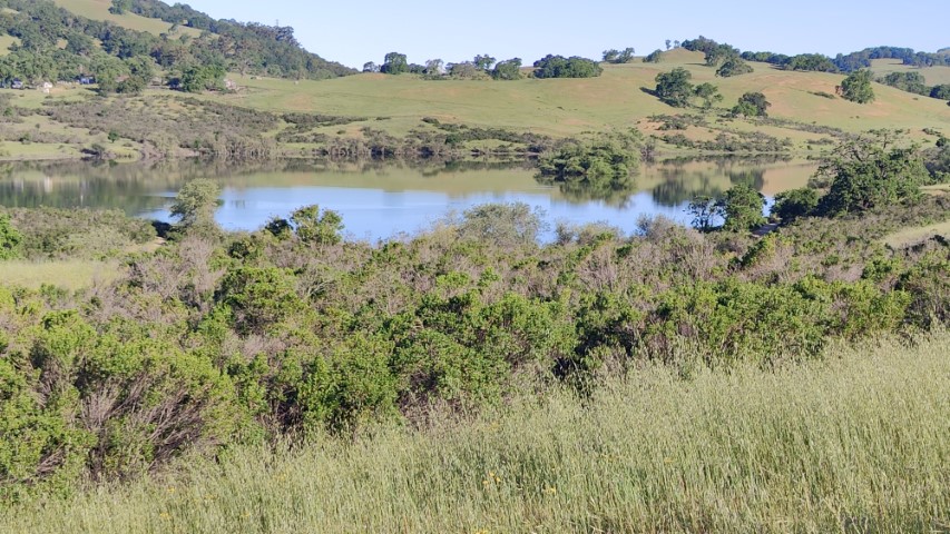
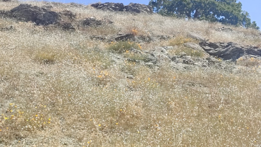
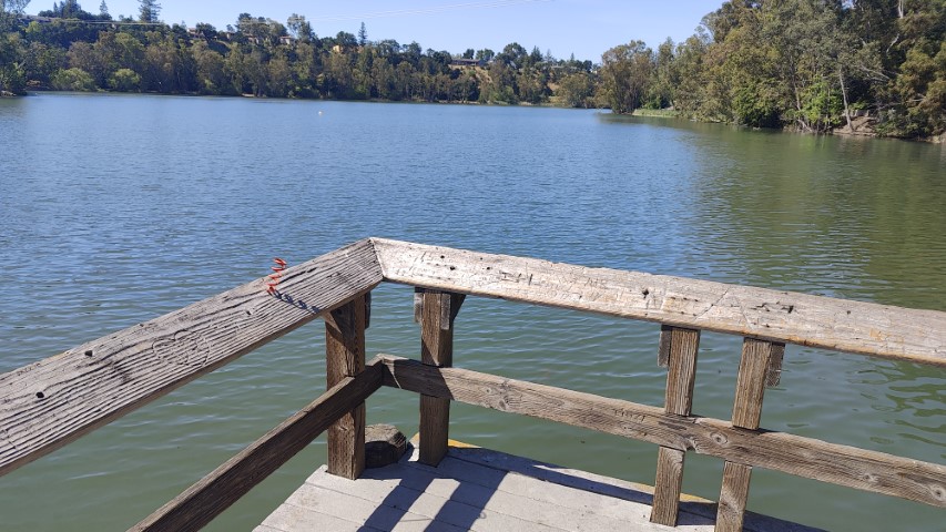
Silicon Valley was covered in low layer of fog, but eventually got above it while driving up Quimby. Halls Valley and everything else to the east was fog-free. Had the parking lot to myself. While I've hiked this park many, many times, was pleased that the official loop included a little section right by the parking lot that I'd never traversed since it's mostly for access to the lake (rather than hiking). In fact, that's where the picture spot was. So I hiked up the trail (parallel to the road) and came back on the interior trail (that goes by McCreery Lake) before doing that final tiny loop to take the picture.
As I came down the trail from McCreery, was surprised to see the small island in Grant was entirely submerged with just trees sticking out.
Took a while to figure out what angle the picture was taken, but finally noticed the trails on the opposite hill
Distance was 1.7 miles, exactly as advertised, with only 270ft of elevation gain. Headed back up, then down, Quimby Road. This route is generally the shortest and most scenic path, but has some narrow sections. . .
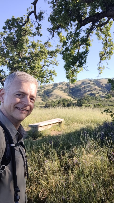
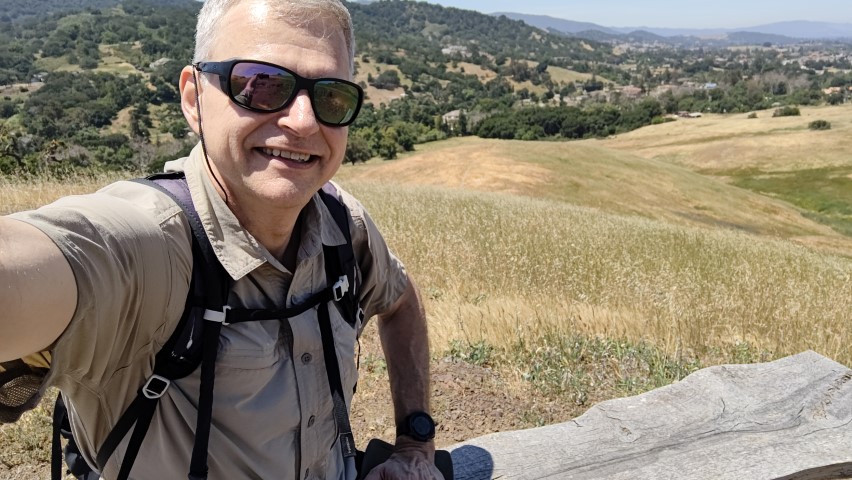
Instead of driving all the way to Coyote Lake to knock out the other "distant" park, the second stop was Santa Teresa, which I'd determined would shave a few minutes off the total time if visited as the second stop. In reality, this probably saved thirty minutes by simply avoiding the (later in the day) northbound commute. Dumb luck is great!
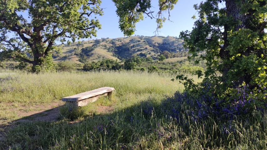
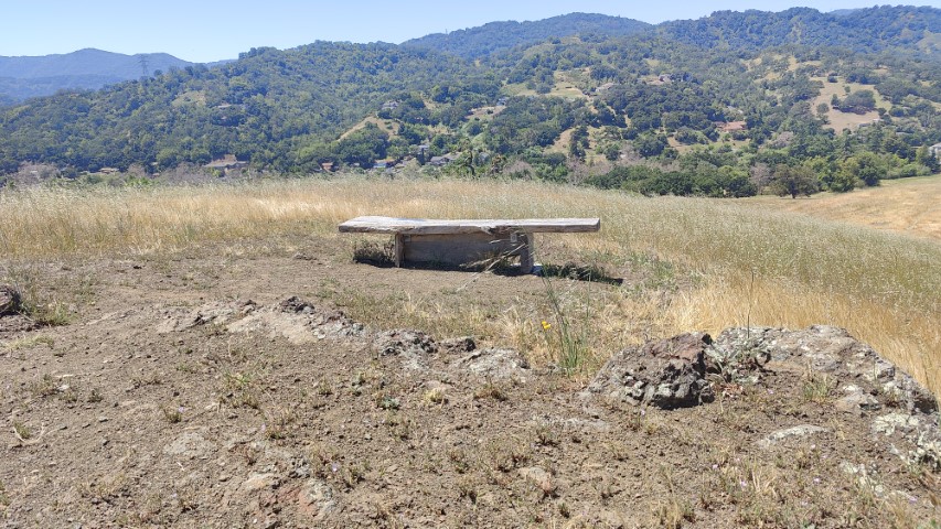
This is the only park this year with a parking fee, but that can be avoided by parking at the Stile Ranch lot if (and only if) there is a space (which is traditionally impossible on a weekend). Was surprised that the path to the picture point was unmarked/unsigned. Was pleased, for the same reason, since I'd never been there before.
The weeds/grass had grown pretty tall since the official picture was taken. When I got the angle roughly correct, the bench was barely visible. Took a second picture as a reference.
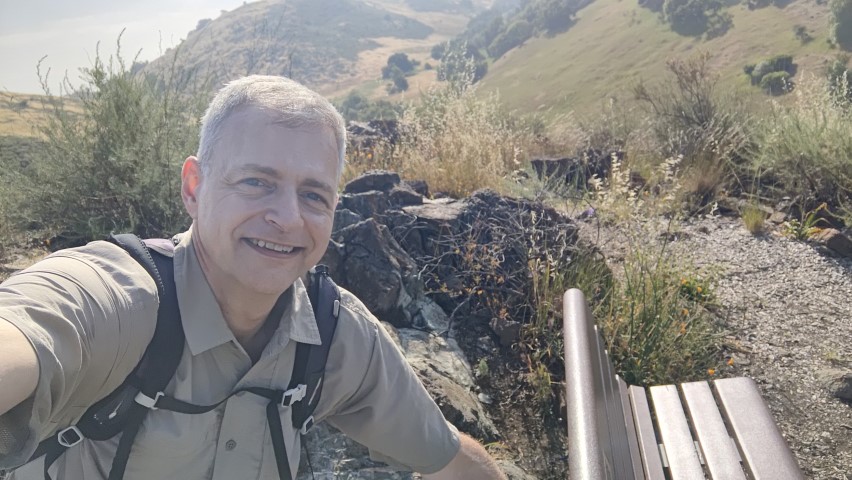
Route was 1.7 miles, which was within the noise of the advertised 1.6 miles. It had a mere 200ft of elevation gain. Was only 20 minutes behind the original plan, so things were looking fine. The drive south to Coyote Lake was a bit slow, but not nearly as bad as the northbound lane coming into San Jose. I was a little nervous about that for later, but figured/hoped it would be faster by the time I was heading back north. Unlike the first two parks, there were several people milling about in the parking lot as I set off. Makes sense--it was almost 10am, which is when sane people start hiking.
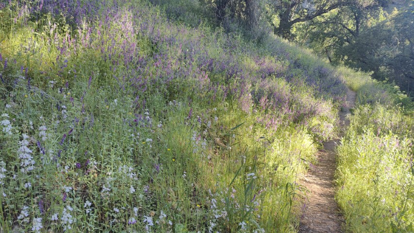
Liked that the picture point was at the man-made stairs, which are a cool part of the trail. I recall that this route was on a prior Magnificent 7 list and that time the picture was a different location. Great that someone is mixing it up! Could not quite find the correct steps from the picture and the weeds have grown since then. The location was a nice place to stop as it was one of the few shaded areas on the route (and the park for that matter). It was getting a little warm at this point. I remember the days before this trail was officially opened. . .
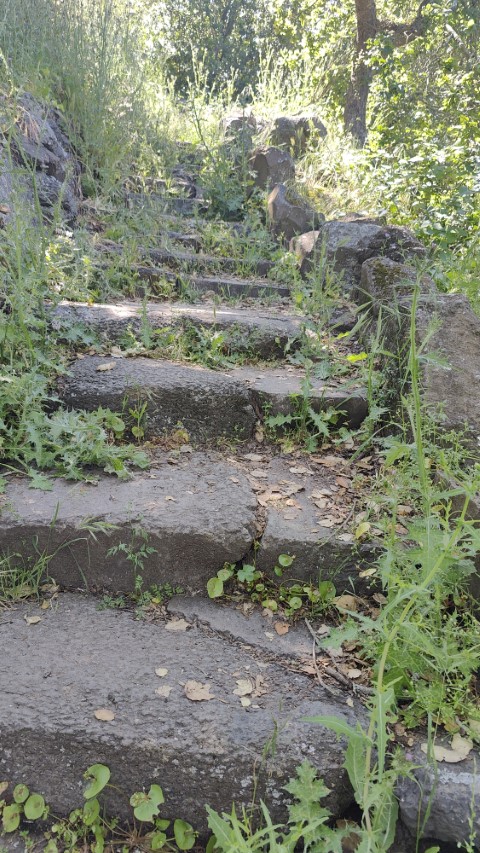
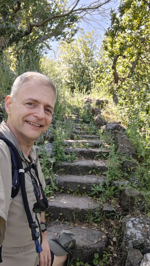
My post-hike data matched with the official 4.4 miles. It had 760ft of elevation gain, which made it the first legitimate hike for the day. Was only one minute behind the original schedule when I left. Even better, the traffic was no longer bad heading north (see dumb luck comment above. . .and just "dumb" below).
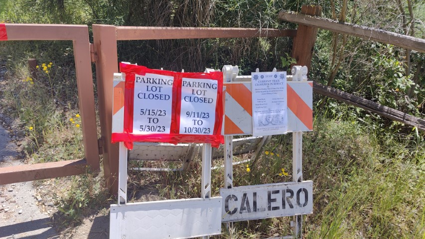
Was ahead of schedule as I parked at the next location: Calero. I know this park like the back of my hand, so hopped out of the car and headed up the trail. When I reached the first junction, I pulled out the Avenza app to see where the photo spot was so I could plan the loop. I eventually realized I couldn't find myself on the map because. . .I'd parked at the wrong trailhead and hiked up the wrong trail. D'oh! So much for experience! But it was easily resolved. . .
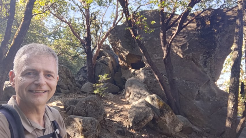
There correct parking area is San Vicente, which I hadn't realized was officially part of Calero. It used to be a separate Open Space Preserve, although that wasn't the reason I'd gone to the wrong coordinate for the trailhead. That being said, it is interesting to imagine if/when Rancho del Oro will merge with Calero, as it is vastly more connected with Calero than San Vicente ever was. . .But I digress. . .whatever the case, there was active construction happening in the hills where the route appeared to go. Once I set off, it was clear that the official trail was diverted. The diversion wasn't a problem, but the picture location seemed in jeapordy since it was around the "back" of the nearest hill and made a loop toward the closed area. So while it seemed like the goal would be accessible, the general "loop" looked like it would fail. Oh well, headed up the road (as opposed to trail).
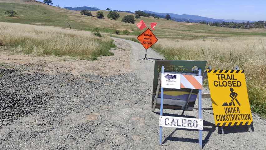
After the picture point, continued the loop around the back of the hill. I eventually ended up approaching a bulldozer coming in my direction, so took the trail downward to get out of its way. This was the trail that had been closed at the start, so got to complete the loop after all. Because of the initial bypass, the whole route was 1.7 miles, which was a tad shorter than the 1.9 advertised distance. It was also a mere 185 ft of elevation gain. After four hikes, it was feeling like this would be the easiest collection of hikes of the series.
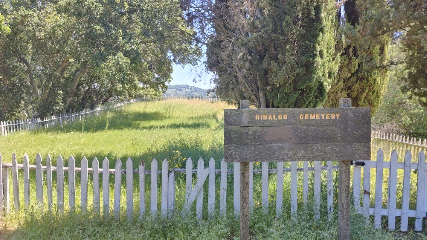
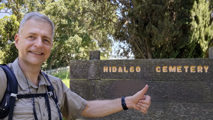
The next hike was an interesting choice. I'd been to Hidalgo Cemetery a long time ago. Most people would get there from the Hacienda entrance, but PixInParks chose a route from Hicks Road, which is a pretty far flung trailhead.
Upon arrival, the Almaden-side parking area gate appeared closed, so I instinctively parked at the nearby (and older) Sierra Azul lot. Didn't think much of it at the time, but as I hiked into the Almaden parking lot, I read a sign that it was closed from May 15-30. It implied (unambiguously) that Wood Road was closed, but since I was already there and many hours into this adventure, I figured I'd hike up and see if there was construction and/or some other reason that would logically prevent visitation. Turned out nothing was happening on this Thursday. Looking now at the website, I see that every trail (including Hidalgo) is closed on weekdays. Whoops! In my defense, there was no activity along any of those trails, so guessing whatever work they are going to do starts next week. . .
The route was 4.4 miles, a little longer than the 3.9 miles advertised. Some of that came from the more distant parking area. 730ft of elevation gain made it reasonable. Got back to the car at 2:30pm, which was 15 minutes ahead of the original schedule. The drive from this trailhead to Vasona was interesting. The GPS continued along Hicks and into Los Gatos without ever getting back on a "main" road. It was slow-going as schools letting out on this weekday hike.
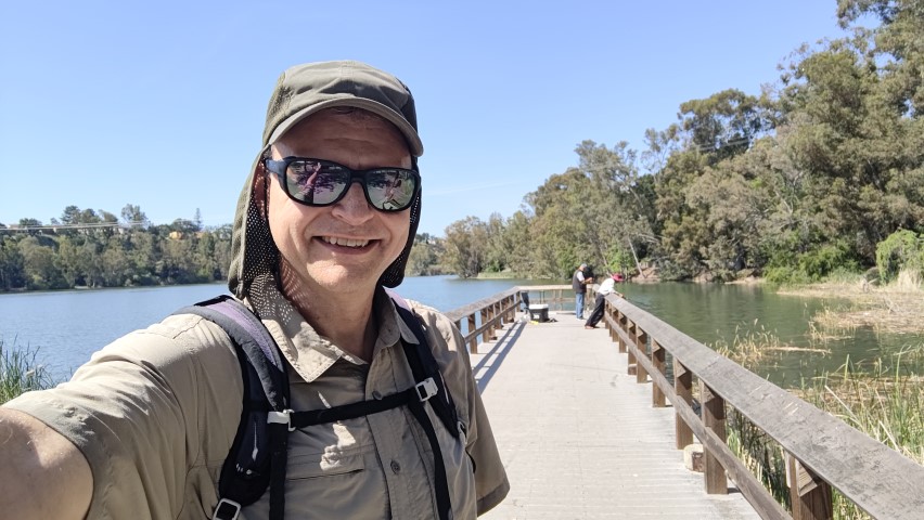
I'd never been to Vasona Lake, so this was an interesting stop. Every year one of the Magnificent 7 is a bikeable trail and this was certainly it for 2023. But I decided not to bring a bike since it was clear that time would not be an issue. To be sure, if you are in a rush, this is an entirely paved route and bit boring between the parking area and the lake itself. The parking area was ample, which I assume is why it was selected.
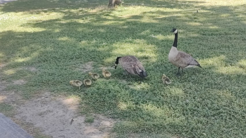
Came across a goose family with many goslings just before the picture point. Soon I'd discover that two guys were fishing at the picture point like they owned the place. After walking to the far end of the advertised route, took alternate trails back to make it into more of a loop--not sure why the official route didn't do this since most of those trails were within the park and on the map. All told, it was 4.5 miles (versus 4.3) with a minimal 135ft of elevation gain. It would have been even less elevation on the official route.
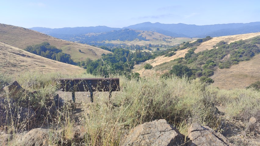
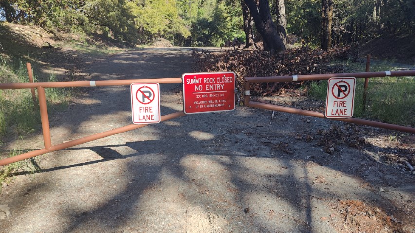
And now off to Sanborn on Skyline Blvd for the last hike of the day. Garmin chose Black Road as the driving route, which was a good choice coming out of Los Gatos. Heading back toward Saratoga would have incurred a lot of traffic. When I got to the parking area, it was closed. I think (but don't know for sure) that it has been closed for a long time since I can't remember the last time the "summit" itself was open. Whatever the case, there was space for cars beyond the gate and the intended route doesn't go to the summit. Arrived at 4:55pm and there were no other cars. The initial signage is vaguely worrisome.
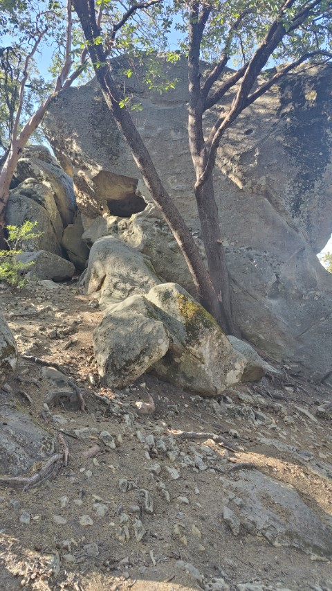
I've been through here many times, but never starting or ending at that parking area (much less outside it). Took the long part of the loop going out (which has some minor deadfall obstacles). Not kidding when I say I know the area well--took an unmarked use trail to the picture point to make it a loop. That trail is hard to find at the start (if you don't know it) when coming from the west as I did, but trivial to find if you pick it up behind the picture location (it's a natural continuation of the trail) for future PixInParkers.
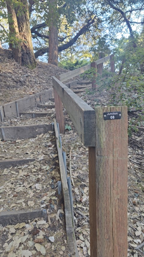
While I had snapped the picture, there was still plenty of hiking to the end of the trial and back. This was an odd route since the turn-around point seemed arbitrary. Still, took a picture at "Junction 8" for posterity/proof.
After looking at the Avenza map the night before, I had planned to cross over into Castle Rock for a segment to create a slightly bigger loop. Turned out that there was no connection between Skyline Trail and that particular Castle Rock route without climbing up the side of the hill to Skyline Blvd. No big deal. Got back to the car at 4:55pm, well ahead of schedule. The hike was 6.2 miles (versus 6.1) with a respectable 1.1k ft of elevation gain. Celebrated with a beer at Big Basin Burger soon after.
All told, the official adventure was a 12 hours and 15 minutes from start to finish, with 24.6 miles of hiking and only 3.4k ft of elevation gain (last year was 5.2k for contrast). There was 105 miles of driving from the first hike to the last--154 miles door-to-door. Thanks for the fun Santa Clara County Parks--sorry to see it end and proud to have kept up the 7-in-a-day streak for all seven years!