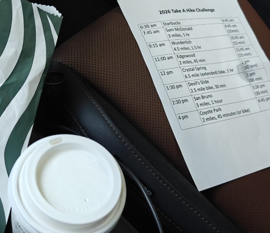
Outside Starbucks--already spilled on the itinerary, which was predicting a worst-case 4:45pm completion
| Santa Clara County Parks: | 2017 | 2018 | 2019 | 2020 | 2021 | 2022 | 2023 | |||
| San Mateo County Parks: | 2020 | 2021 | 2022 | 2023 | 2024 | 2025 | 2026 |
Another year, another fun San Mateo County Take A Hike Challenge. As usual, I was out to finish all seven parks in a day. A cursory look at the lengths suggested it would be easy. A follow-up look at the distance among all the parks also showed it wouldn't be too much driving.
I made a TAHC summary PDF to help with identifying the picture locations. However, mailed myself the original PowerPoint instead of the PDF. So when it came time to look up the picture, my phone couldn't read the file. So spent part of the first hike holding my phone high in the air, trying to get a better signal to download an app that would display PPT files. Whoops. Fortunately the rest of the preparations paid off.
Completed the Challenge on April 2nd. Whether that was ideal is debatable since gas prices were unusually high. On the other hand, it was still relatively cool outside, which makes the hiking easier. Choices!
Now that I've retired, I can hike any day of the week. Much like the "gas versus weather", there are conflicting priorities on weekday versus weekend hiking. Hiking in the middle of the week is easier for parking, while hiking on the weekend has better traffic most times of the day. Overarching this all, of course, is that one wants to finish before the sun sets. I decided to start from Starbucks at 6:45am on a weekday, which was expected to get me out of the valley and into the hills before the morning traffic.
The night before, there was an earthquake around 2am that woke me up. But I was soon asleep after logging it on the USGS website. Got to Starbucks right on time, mostly because I'd packed everything in the car the night before.
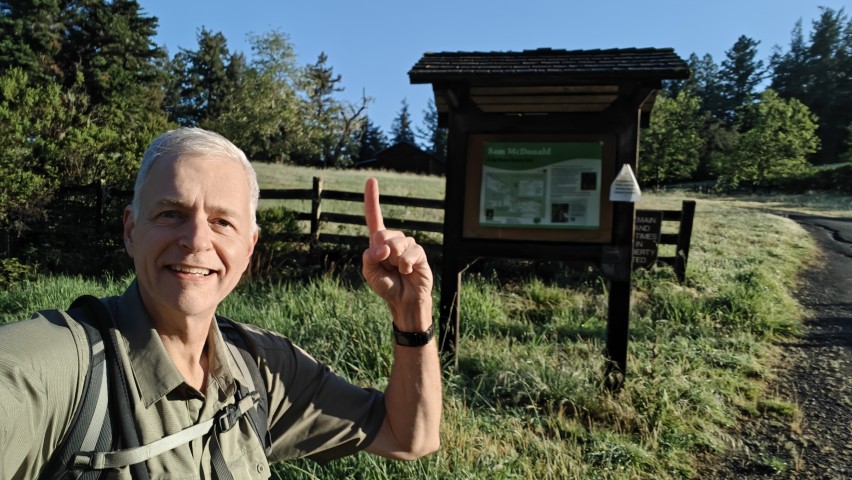
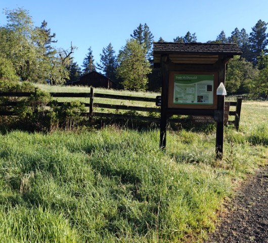
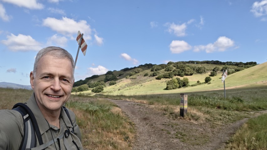
The drive to Sam McDonald--the longest of the day at an hour--wasn't too bad since most people are going the opposite direction. I made the hike a little longer by going up the Big Trees Trail at the beginning just to add more "loop" to the original route while making sure I hit every point of the suggested route.
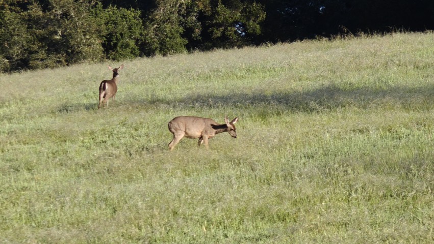
It was a chilly start from the empty parking lot. Once I reached the ridge, there was plenty of wildlife: turkeys, deer, and newts among others. I took the trails (East Brook) along the ridge and the road (Towne) back, getting a bit wet on the grassy connector trail crossing over to the Brooks Trail thanks to the rain the prior night. If I'd come later, it would have all burned off. Oh well, this is the park to start with (or end with) if you're doing them all in a day.
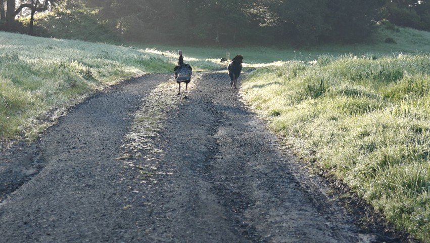
While I took the requisite pictures on the way up, I stopped and took a second set on the way back to try to frame it just right. Just before that point, I ran into the same flock of turkeys I'd encountered on the way up, along with some deer.
From there I headed to Wunderlich, just up and over the hill. Got there with no traffic issues from Sam McDonald. The lot was less than half full so I had my pick of parking. When I used to come here for weekend hikes, I often had to park outside on the road. The Alambique Trail seems easier every time I hike it, so it was smooth sailing to the Meadow Trail and finally the picture point.
There was a person standing nearby (having a smoke in the great outdoors) the whole time I snapped selfies like a teenager. Later, as we both continued on, I saw she'd driven to a nearby junction on Bear Gulch Road. I wondered fleetingly if she was completing this same challenge the easier way. Probably not.
Continued the loop back along Bear Gulch Trail. I kept encountering much older people coming up that trail. I would have thought they were all in the same group, but there was just enough spacing between sets of people that it appeared to just be a "thing" to hike up Bear Gulch on Thursdays. It's a fine trail any day of the week for sure. I think I was mostly surprised because I almost always hike this park clockwise. It feels like the trails out of the parking lot encourage that.
This was officially the longest hike of this year's Take a Hike Challenge series at a mere 4.4 miles (I got 4.7 miles). I also noticed, when looking at hikes on Google Earth, that the Stanford Linear Accelerator points directly at the Wunderlich trailhead.
The third park was Edgewood, starting from the unusual (to me) Clarkia trailhead. There was plenty of parking there, too, although not a proper "parking lot". Parking along Cañada is generally used by bikers. So despite the many cars parked there, I did not run into any hikers along the Clarkia spur trail into the park. As I made my way up, I wondered why a slightly longer loop involving Sunset and the Ridgeview weren't used instead of Sunset and Clarkia. I'm sure there's a reason. After snapping my pictures with the signs, I knocked out the short loop and headed back down to the car.
Just down the street was the start of the Crystal Spring segment. This is all paved, so I brought my bike. However, it was also so short that I wanted to make it into more of a challenge. So instead of doing the suggested "out-and-back", I took Ralston Trail up, up, up and Sheep Camp back down. That turned out to be more challenging than expected, resulting in some cramping on my part, but that is a testament to my lack of biking fitness, not the actual effort. It's an enjoyable coast almost the entire way back down Sheep Camp to Cañada Road.
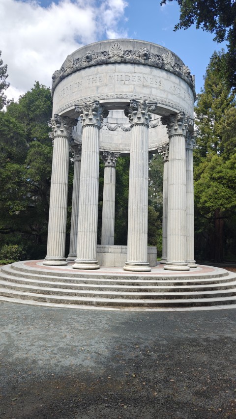
After that, took a left and reached the far end of the route: the Pulgas Water Temple. This was the fourth time I'd been to the entrance gate, but the first time it was open. I think it's normally open, I had just been unlucky in the past. Anyway, took this opportunity to bike in and explore the small park.
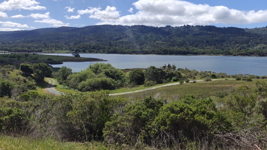
On the way back, I looked for locations similar to the picture. I never found the right photo location. In fact, the top of the fence in the reference picture seems to face toward the reservoir as if preventing wildlife from getting out, unlike the fencing I encountered. I'm wondering if it's an optical illusion after looking at my own picture. Then again, the location marked on the map is on the other side of the reservoir, so who knows.
I was so fixated on the fence that I followed a side dirt trail back to the car, never finding the correct fence orientation (it must be closer to "The Temple"?). I did, however, have my front tire slip off the axle because I hadn't tightened it enough (apparently) and all that bumpy dirt track loosened the bolt. I had the right Allen wrench on me to resolve that problem. Weird.
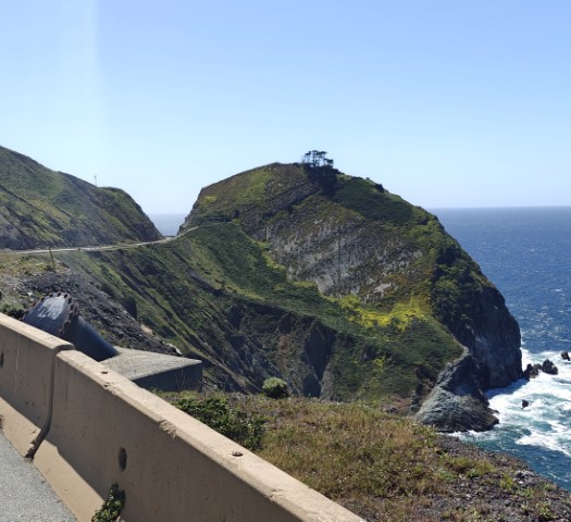
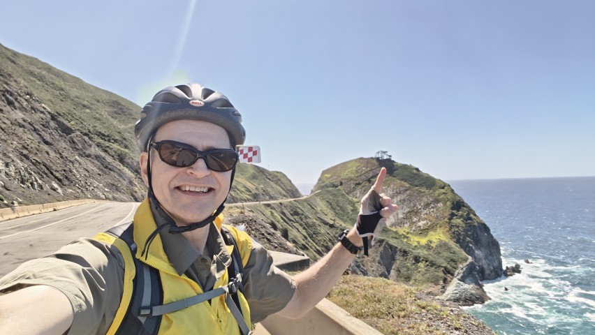
I knew I'd bike the next park as well, so didn't change out of my clipless shoes, saving a minute or two during my "transition" time at the car. Jumping out of the car and hiking is pretty fast. Jumping out of the car and biking is a longer process. Whatever the case, I headed to Devil's Slide. It made more sense to start from the northern lot, but my reward for that was having to park in the lower lot because the upper lot was full. They are no more than 30 yards apart, so it was funny to watch people come later and wait for an opening instead of just parking slightly farther away.
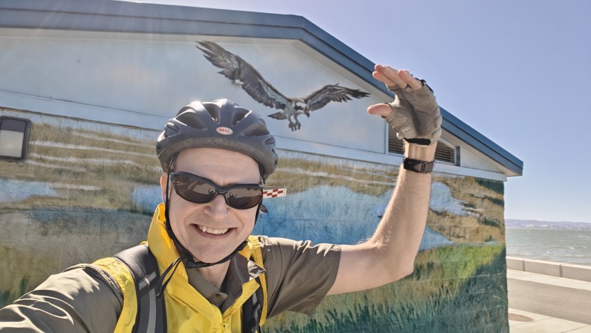
I had forgotten that this short route does have some elevation, but was still fairly easy. I went all the way to the other parking lot just to make sure I covered every inch of the suggested route. Incidentally, that lot is larger, so makes before a better start if you aren't in a rush. Like prior visits, it was quite windy in the gap shown in the picture. I was pretty jazzed when I noticed the pipe in the picture, which allowed me to align my photo closer to the reference.
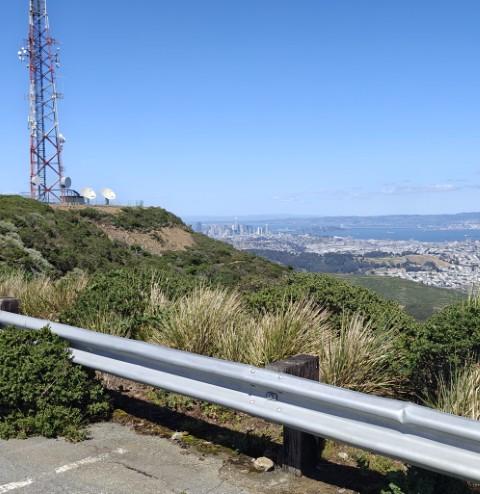
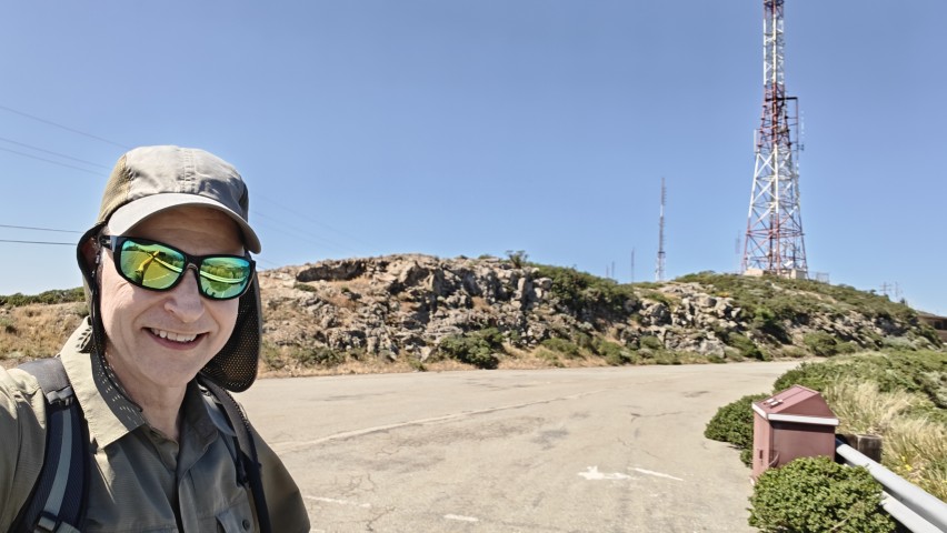
At this point, I was back at the car almost 30 minutes ahead of schedule, so knew that no matter how bad the traffic might get, I'd easily be done before 5pm. The drive to San Bruno was interesting in the sense that I don't think I've ever been on those roads before. The suggested parking lot was closed so had to park closer to the entrance/fee area. Turns out there was no reason for the lot to be closed, as I would discover after walking up that road to get to the start of the hike. Five or six parking spaces sat there sadly vacant at the end of the smooth road.
I've hiked this area many times in the past, but never started from this trailhead, so it was new in a way. The hike up and back seemed gentle compared to the normal routes I've taken from the South San Francisco side to the summit. This was another case where I spent time trying to get the same angle on the picture.
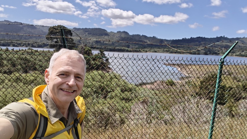
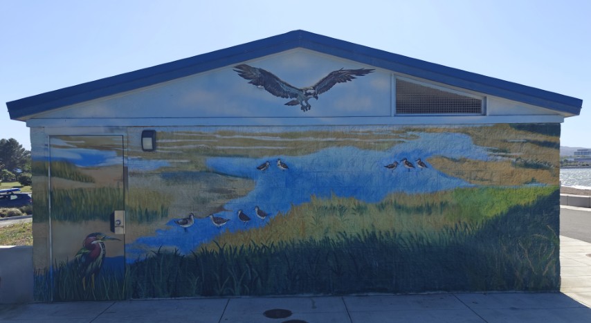
The final location for this whirlwind tour of San Mateo parks was Coyote Point. I remembered from my last visit (for this challenge series) that it was on the Bay Trail and, indeed, you can bike in from either end. So I parked at the Anza Fisherman's Park and came in from that direction, following the full suggested route afterwards. Last time I visited this park, the northern edge was closed. This time everything was open, so visited some new-to-me trails. It was not all paved as I had expected, but ~90% or so was, so it made for a quick ride. It was also the most crowded park of the day, but that might just be because it was later in the day.
Final stats: 12.7 miles of hiking and 12.8 miles of biking with 3.8k ft of elevation gain, which was quite similar to the prior year. From the Sam McDonald start at 7:50am to the Coyote Park conclusion at 4:05pm it was 8 hours and 15 minutes and only 63.5 miles of driving. San Jose door-to-door was 133 miles. Thanks for a fun day, San Mateo County Parks!
This was the seventh time I've completed this challenge. Santa Clara County ran a similar challenge for seven years, will San Mateo take the crown for longest picture-based series next year?
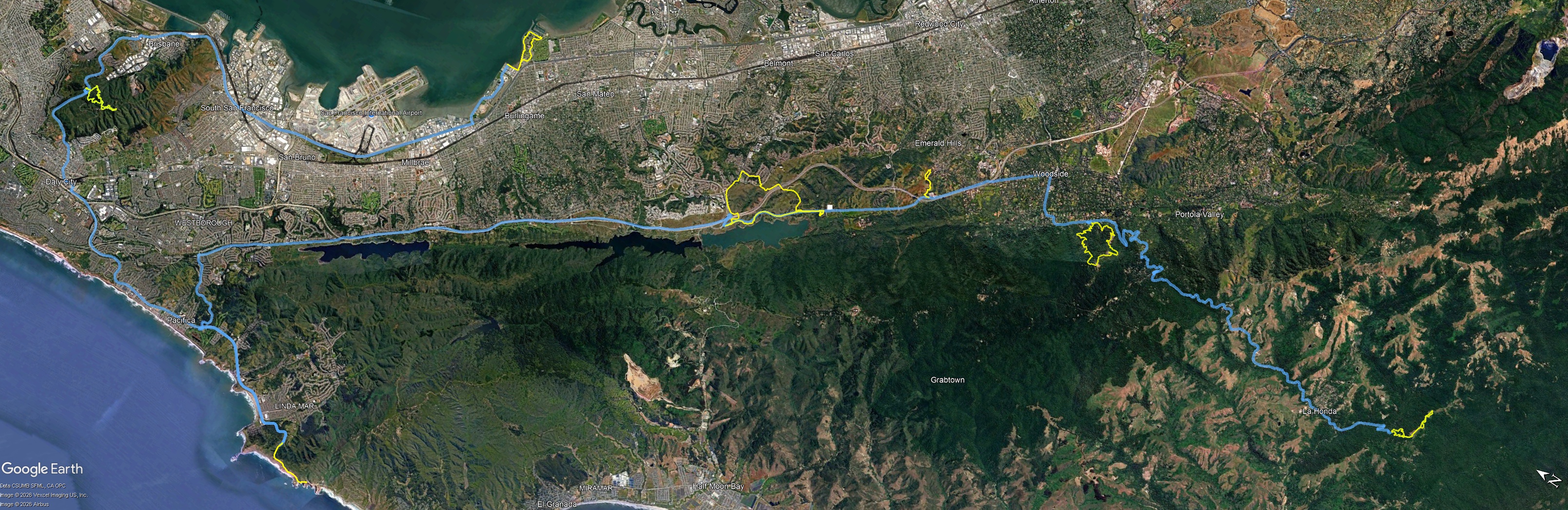
Driving (blue) and hiking/biking (yellow) tracks -- click for larger